
Each river (every single one) has its beauty, character, and unique story. These fantastic bodies of water provide food, security, and transportation to humanity.
In the United States, there are many rivers, including the famous Mississippi River, which may confuse one as to which is the fastest. For this reason, we will examine ten of the fastest rivers in the United States. But then let’s talk about river discharge.
The Concept Of River Discharge
In its simplest form, river discharge refers to the total volume of water flowing through a river channel at any given time, measured in cubic meters per second (cumecs). In a situation whereby a river experiences high river discharge, flooding could be a major aftereffect. On the other hand, low river discharge can significantly impact various species that rely on the ecosystem. In the advent of the worst possible scenario, too low river discharge can result in drought.
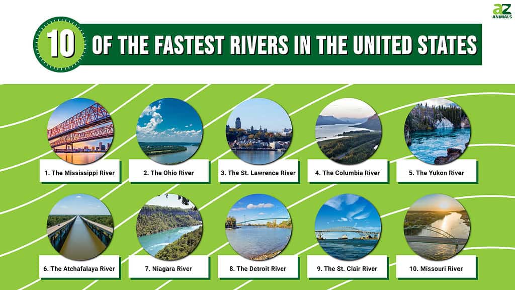
10 Fastest Rivers In The United States By Discharge
Below you’ll find the list of the top 10 fastest rivers in the continental United States by average discharge (streamflow) measured in cubic feet per second. This list contains only the top 10 rivers with an average discharge greater than 15,000 cubic feet per second. Since these data are variable with measurement time and period, the below estimates are approximate. Nevertheless, it is imperative to note that measuring river velocities is somewhat difficult and, at times, tricky because it is extremely variable. Furthermore, some rivers lack gauging stations near their outflow points.
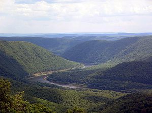
10. Missouri River
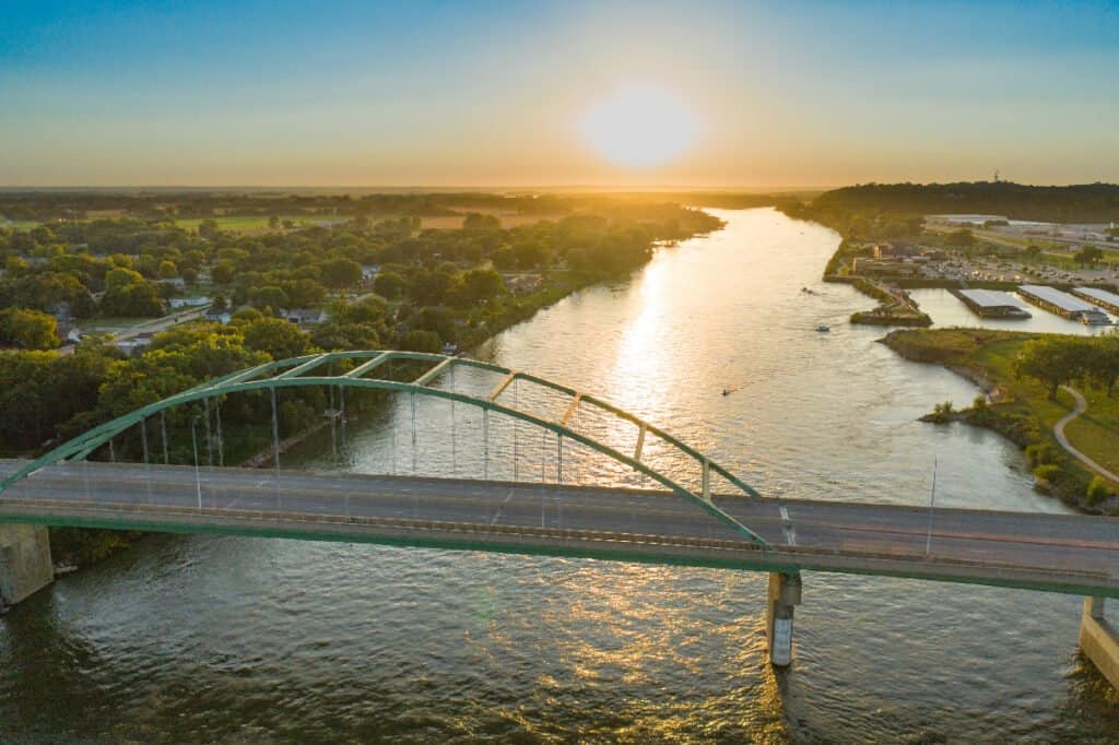
The Missouri River drains a lowly populated, semi-arid watershed with over 500,000 square miles.
©iStock.com/Matthew Howieson
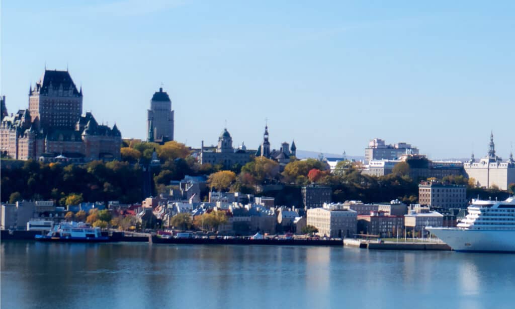
This river drains a lowly populated, semi-arid watershed with over 500,000 square miles, including parts of ten U.S. states and two Canadian provinces. Holding its record as the longest river in the United States, the Missouri River shoots off in the Eastern Centennial Mountains, Southwestern Montana. It flows 2,341 miles (3,767 km) east and south before dashing into the great Mississippi River north of St. Louis, Missouri. This river is nominally regarded as Mississippi’s tributary. The Missouri River ranks number ten on this list with an average discharge rate of 86,300 cfs. This river flows out into the Mississippi River.
9. The St. Clair River
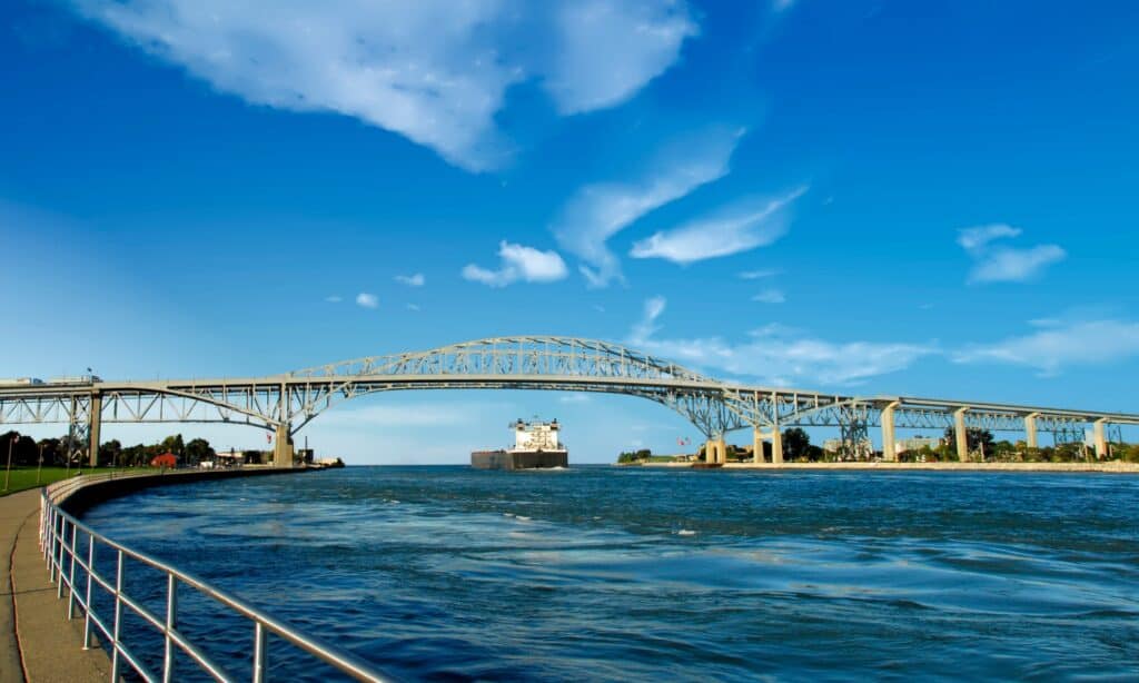
St. Clair River has an average discharge rate of 183,000 cubic feet per second.
©iStock.com/William Reagan
Known in French as Rivière Sainte-Claire, this major North American river flows from Lake Huron into Lake St. Clair. It forms part of the international boundary between the Canadian province of Ontario and the United States at Michigan. This river’s shipping channels allow cargo vessels to travel between the upper and lower Great Lakes, making it a significant component of the Great Lakes Waterway. It measures 39 miles (63km) in length and has an average discharge rate of 183,000 cfs.
8. The Detroit River
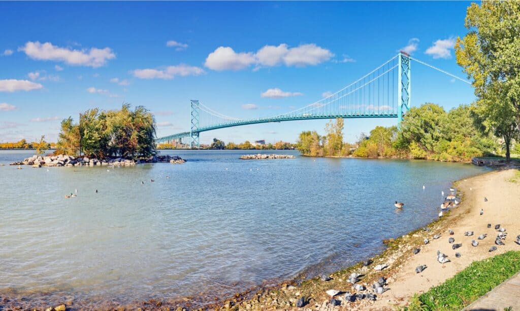
Detroit River runs 32 miles (51km) in length.
©iStock.com/Simplyphotos
The Detroit River divides Detroit–Windsor, a metropolitan area of Detroit, and Windsor, Ontario, while making up some portion of the United States and Canada‘s borders. This river features a unique two-way flow, 24 nautical miles south and west, from Lake Erie to Lake St. Clair. It runs 32 miles (51km) in length with an average discharge rate of 188,000 cubic feet per second and flows out into Lake Erie.
7. Niagara River
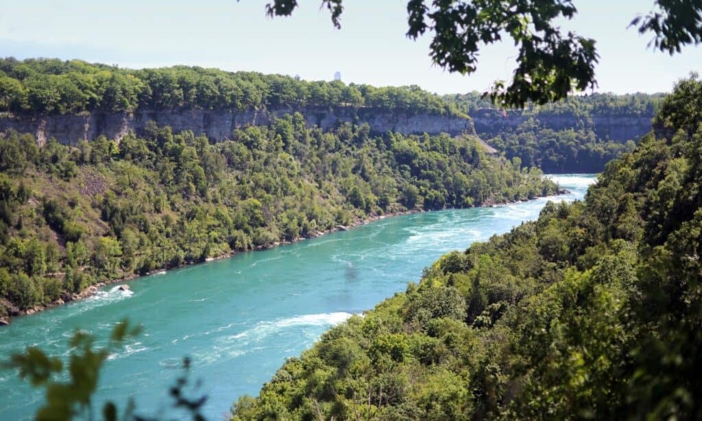
The Niagara River runs for a length of 36 miles (58km) with an average discharge rate of 204,700 cubic feet per second.
©iStock.com/bukharova
Flowing all the way north to Lake Ontario is the Niagara River, making part of the border between Ontario Province, Canada, and New York, United States. The fame of the Niagara River and Falls dates back to the 17th century, even outside of North America. A French explorer, Father Louis Hennepin, was one of the earliest discoverers. In addition, it served as the site for the earliest recorded railway in America. The Niagara River runs for a length of 36 miles (58km) with an average discharge rate of 204,700 cubic feet per second.
6. The Atchafalaya River
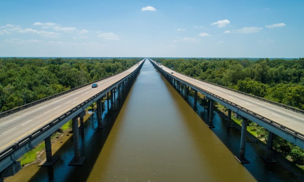
The Atchafalaya River is a distributary of the Mississippi River and Red River in south-central Louisiana.
©iStock.com/felixmizioznikov
Located in Morgan City, Louisiana, United States, the Atchafalaya River is a distributary of the Mississippi River and Red River in south-central Louisiana, United States, spanning 137 miles (220 km) with an average discharge rate of 225,000 cubic feet per second.
5. The Yukon River
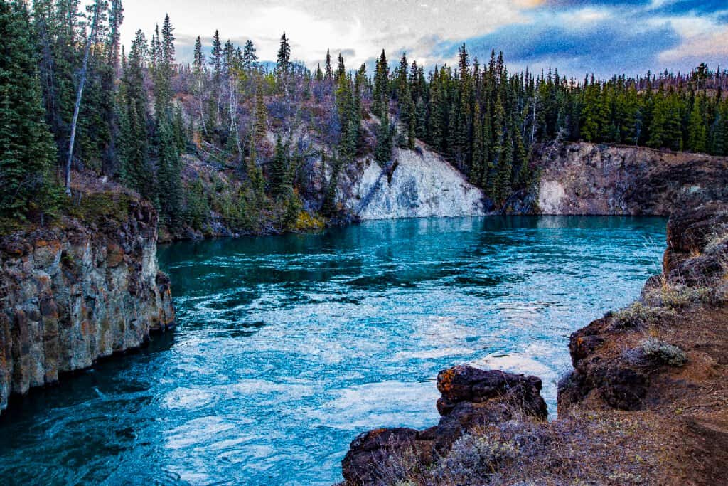
The Yukon River is a major watercourse flowing through Canada’s territory of Yukon from British Columbia.
©iStock.com/HeatherECampbell
The Yukon River is located in northwestern North America and is a major watercourse flowing through Canada’s territory of Yukon from British Columbia, its source. At the same time, the lower half continues westward through the U.S. state of Alaska. The river empties into the Bering Sea at the Yukon while spanning a distance of 1,980 miles (3,185 km) with an average discharge rate of 227,000 cfs and flowing out the Gulf of Mexico.
4. The Columbia River
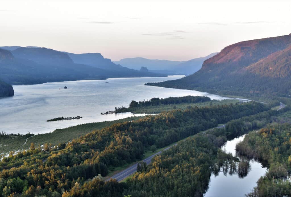
The Columbia River is the fourth-largest river in the United States by volume.
©iStock.com/Chaitra Kukanur
This river is the largest in the Pacific region of North America. The Columbia River rises in the Rocky Mountains of British Columbia, Canada. It flows northwest and, afterward, south into the U.S. state of Washington, then it makes a turn to the west to form most of the border between the states of Oregon and Washington before emptying into the Pacific Ocean. It spans 1,243 miles (2,000 km), with the Snake River as its largest tributary. Columbia River is the fourth-largest river in the United States by volume, and its drainage basin extensively cuts into seven U.S. states and a Canadian province. Its average discharge rate is 273,000 cfs.
3. The St. Lawrence River
St. Lawrence River is located in the middle latitudes of North America.
©bulbspark/Shutterstock.com
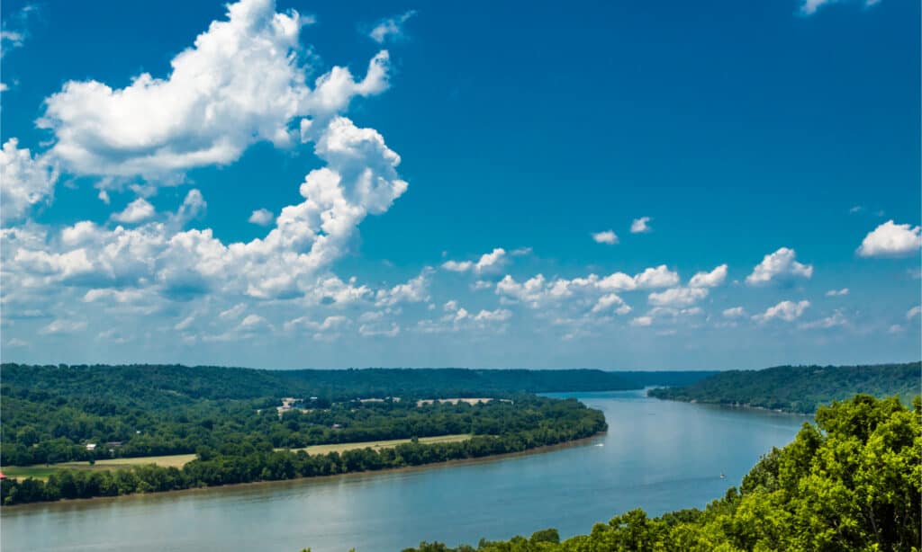
This large river is located in the middle latitudes of North America. It flows from Lake Ontario into the Gulf of St. Lawrence and serves as a connection between the Great Lakes and the North Atlantic Ocean while forming the Great Lakes Basin’s primary drainage outflow. This river is part of the international boundary between Canada and the United States. It traverses the Canadian provinces of Ontario, Quebec, and the U.S. state of New York. This river remains a primary thoroughfare for many people as it flows through and adjacent to numerous Indigenous homelands. It has a length of 600 miles (965km), an average discharge of 348,000 (cfs), and 275,000 on the U.S.-Canada boundary.
2. The Ohio River
The Ohio River flows along the borders of six states.
©Corey B Stevens/Shutterstock.com
The Ohio River, located at the Midwestern and Southern United States boundary, is a 981-mile (1,579 km) long river. It flows southwesterly from far-western Pennsylvania to its mouth on the Mississippi River (south of Illinois). This river is the second largest river by discharge volume of 281,500 cfs in the United States and the 6th oldest river on the North American continent. It flows along the borders of six states; its drainage basin includes parts of 14 states and is the drinking water source for three million people.
1. The Mississippi River
The average discharge rate of the Mississippi River is 593,000 cubic feet per second.
©Sean Pavone/Shutterstock.com
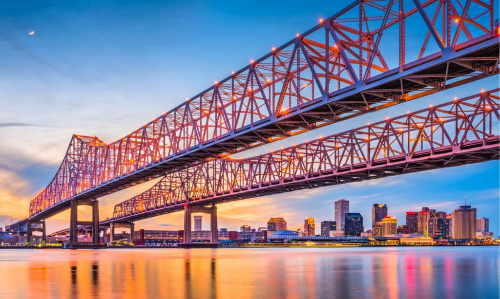
The Mississippi River is the second-longest river on the North American continent. It flows south from its traditional source at Lake Itasca in northern Minnesota for 2,350 miles to the Mississippi River Delta in the Gulf of Mexico. This river ranks as the thirteenth-largest river by discharge in the world, passing through several states, including Minnesota, Wisconsin, Iowa, Illinois, Missouri, Kentucky, Tennessee, Arkansas, Mississippi, and Louisiana. Its average discharge rate is 593,000 cubic feet per second.
Fun Facts About the Mississippi River
The Mississippi River is famous for much more than being the second-longest river in North America. The river is connected to American culture through literature and song and provides hydroelectric energy and drinking water to millions of people. Here are more fun facts about the Mississippi:
- The Mississippi River is the third-largest river basin in the world. Only the Amazon and Congo rivers outrank it. The Mississippi watershed covers over 40% of the continental United States.
- The river’s widest point is over 11 miles across Lake Winnibigoshish.
- People have swum the entire length of the river. Slovenian, Martin Strel did it in 68 days in 2002. He went on to swim the length of the Amazon and Yangtze rivers. American, Chris Ring swam the length of the river in 2015 in 181 days.
- You can drive alongside most of the Mississippi on a scenic roadway known as the Great River Road. The entire trip, which covers 3,000 miles, takes 36 hours to complete.
- It takes 3 months for the water to travel the entire river. The Mississippi River releases 4 million gallons of water into the Gulf of Mexico every second. It takes three months for the water to flow from Lake Itasca to reach the Gulf of Mexico.
What is the Gulf Stream, and Where is it Located?
The Gulf Stream is an intense, warm, and swift Atlantic Ocean current originating at the tip of Florida, following the eastern coastline of the U.S. and Canada, and crossing the Atlantic Ocean towards Europe. This Gulf Stream is significant because it ensures that Western Europe’s climate is much warmer than it would have been. The North Atlantic Equatorial Current brings tropical water from the east, while the Florida Current brings warm water from Mexico’s Gulf. They converge to form the Gulf Stream. The Gulf Stream flows at an average speed of four miles per hour (6.4 km/hr). However, as the stream widens to the north, its current drops to a speed of one mile per hour (1.6 km/hr).
Summary Of 10 Of The Fastest Rivers In The United States
| Rank | River | Miles of Flow | Average Discharge Rate |
|---|---|---|---|
| 1 | Mississippi River | 2350 miles | 593,000 cubic feet per second |
| 2 | Ohio River | 981 miles | 281,500 cubic feet per second |
| 3 | St. Lawrence River | 600 miles | 348,000 cubic feet per second |
| 4 | Columbia River | 1243 miles | 273,000 cubic feet per second |
| 5 | Yukon River | 1980 miles | 227,000 cubic feet per second |
| 6 | Atchafalaya River | 137 miles | 225,000 cubic feet per second |
| 7 | Niagara River | 136 miles | 204,700 cubic feet per second |
| 8 | Detroit River | 32 miles | 188,000 cubic feet per second |
| 9 | St. Clair River | 39 miles | 183,000 cubic feet per second |
| 10 | Missouri River | 2,341 miles | 86,300 cubic feet per second |
What River Is the Deepest in the U.S.?
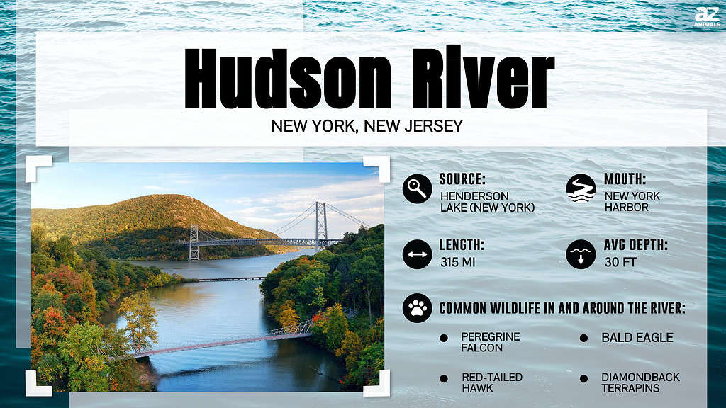
The speed of a river is influenced the its slope as well as the roughness of the terrain it flows across. The slope of the stream or parking lot, and the roughness of the ground over which the water flows, are important. But typically, more shallow rivers tend to move slower than deeper rivers. Presented with this general rule, you may wonder if the deepest river in the United States lies within the top 10 fastest rivers in the country. Actually, it does not. The deepest river in the U.S. is not very comparable in speed–it moves about 3 mph on average, or 21,900 cbs. So what river is the deepest in the United States?
The deepest river in the United States is the Hudson River, with a maximum depth of 216 feet. Its headwaters are located in New York’s Adirondack Park in the Lake Tear of the Clouds. The river travels 315 miles to the Upper New York Bay. The Hudson River is a “ria” or “drowned river,” meaning, it contains both freshwater and saltwater up to the point of the George Washington Bridge, which sits approximately 17 miles from the bay.
The photo featured at the top of this post is © iStock.com/bukharova
How to Add Us to Google News


Thank you for reading! Have some feedback for us? Contact the AZ Animals editorial team.