
When learning about the United States as a child, one of the first states recognized is Florida. This is due to its unique shape as a peninsula surrounded by water on three sides. Additionally, the state borders were drawn in an interesting way. Florida’s long panhandle on the coast of the Gulf of Mexico looks like it should be part of Alabama. What happened there? Let’s explore how Florida got its shape, and how that shape might change in the future.
Geologically, Florida formed over millions of years. Politically, its borders were defined in 1821.
©Alexander Lukatskiy/Shutterstock.com
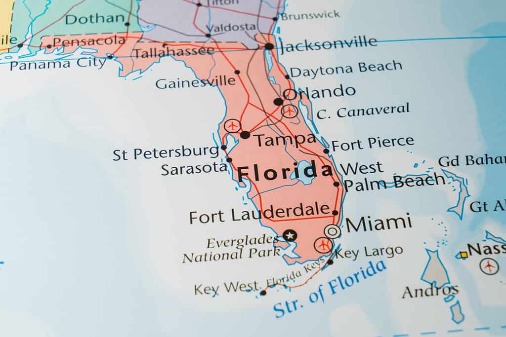
The Shape of Florida Today
Florida is a peninsula about 447 miles long and 361 miles wide. It’s extremely flat, with much of the state at or near sea level. It has an average elevation overall of only 100 feet above sea level. With 1,350 miles of coastline on both the Gulf of Mexico and the Atlantic Ocean, it also has the longest seashore of any of the lower 48 states. The other main distinction is the Florida Panhandle, which is also known as West Florida or Northwest Florida. This part of the state’s territory is about 200 miles long. It borders Alabama and Georgia to the north. The panhandle has more in common with its neighbors than it does with the rest of the state. It has a similar pine woods ecosystem, rural character, and social conservatism. The state capital, Tallahassee, is located in that region.
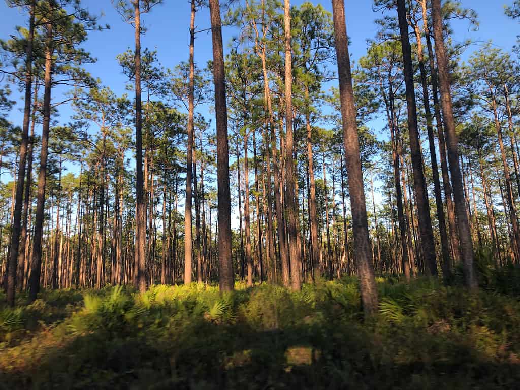
Piney woods like these are typical of the Florida Panhandle.
©Boomer3195/Shutterstock.com
How Did the Florida Peninsula Form?
Geologists believe that Florida was part of a supercontinent named Gondwanaland that split up 300 million years ago into what is today North America, South America, and Africa. Florida became part of the undersea continental shelf of North America. The ocean that covered it was shallow and warm. Coral, shellfish, and boney fish lived there for millions of years and left behind their calcified skeletons. Over time, this built up a layer of limestone rock hundreds and even thousands of feet thick in some places. Because limestone is a porous rock that groundwater can flow through, it created numerous underground aquifers and rivers. As the water level drops during dry periods, sinkholes can form unexpectedly, sometimes swallowing houses and cars.
This isn’t the whole story of Florida’s geology, though. To the north, the Appalachian Mountains eroded and rivers deposited a thick layer of quartz sand over the limestone. As glaciers in the Northern Hemisphere built up and receded periodically throughout history, Florida was repeatedly flooded and dried out. At its lowest point, Florida was about 100 miles wider on its western side than it is today.
The Florida Keys are a chain of islands off the south coast of the peninsula. They were part of a large coral reef that was partially exposed at a period when sea level dropped.
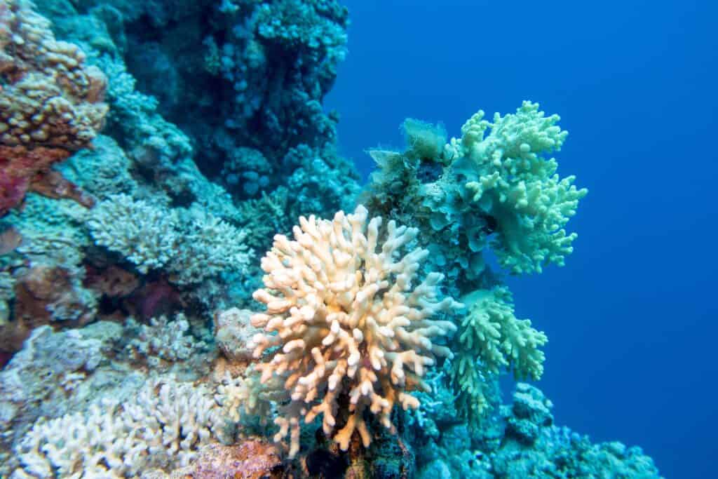
Coral reefs over millions of years built up the limestone layer that forms the foundation of Florida’s land.
©Jolanta Wojcicka/Shutterstock.com
How Did Florida Get Its Borders?
Spanish Colonization
Florida was inhabited for about 14,000 years by Native American people until Europeans arrived early in the 16th century. In fact, Florida was the first part of what is today the United States to be settled by Europeans. A conquistador named Ponce de León established Spain’s claim to the territory. He named it “La Florida” because it had so many flowers.
Rivalry with Britain
As Britain expanded its empire with 13 colonies on the Atlantic coast, it had an uneasy relationship with the Spanish. One motivation for founding Georgia and populating it with prisoners was to create a buffer between Florida and British South Carolina. The Spanish Christianized Native Americans and encouraged intermarriage to form a loyal population. They also offered refuge to escaped slaves from the British colonies.

Hibiscus is native to Florida. Early Spanish explorers named the state after its abundant flowers.
©Nikolay Kurzenko/Shutterstock.com
Florida Lost and Recovered
Spain sided with France during the 7-Years War and as a result, the British occupied Havana, Cuba, a Spanish possession. When the war ended in a British victory, Spain traded Florida for to Britain for Louisiana and Havana. British rule was short-lived, though, because Spain reclaimed Florida when Britain lost the Revolutionary War. How then did it become part of the United States?
The American Era
Spain was not able to control Florida’s border with the United States in the years following the American Revolution. While Spain was tied up in the Napoleonic Wars, its colonies began to revolt. The warring country did not have the money or troops to take full control of Florida. As a result, it had a porous border with the United States. Escaped slaves and white settlers crossed going south. Native Americans raided American settlements to the north and then ducked back across the international border. After the Louisiana Purchase, the United States government announced annexations of parts of the Panhandle. It was apparent that Spain would eventually lose the whole territory. As a result, the two sides signed a treaty in 1819 in which Spain ceded Florida to the United States. The U.S. agreed to pay the $5 million in legal claims its citizens had filed against Spain.
For about 300 years Florida was governed from Madrid, Spain.
©Eszter Szadeczky-Kardoss/Shutterstock.com
How Could the Shape of Florida Change?
So far, we have talked about how Florida got its natural, geological shape and how it got its political borders, first as a Spanish colony in rivalry with the British empire to the north, then as a part of the United States. But how could both of these shapes change in the future?
The Geography of Florida
Because Florida is so flat and lies so close to sea level, it is uniquely vulnerable to flooding and erosion. The state’s large population of 21 million people, many of them concentrated in large cities, use an enormous amount of groundwater. If this water usage outstrips nature’s ability to replenish the underground aquifers, the state will be vulnerable to more sinkholes and potential flooding if seawater makes it into those underground chambers.
Rising sea levels due to global warming are another potential threat. By 2100, coastal areas of Florida and as much as a third of the southern end of the state could be underwater. Rising sea levels are also a threat to inland cities located on rivers that could get a backwash of salty seawater far inland. Finally, Florida is vulnerable to natural disasters that would bring sea-borne devastation. Some of the areas affected by the 2004 Indian Ocean tsunami were hit with a mountain of water up to 100 feet high, which, as we said, is the average elevation of the state of Florida. If an earthquake or meteor strike in the Atlantic set off a similar tsunami, much of the state might be inundated. An extremely large event like this could create rapid severe erosion of areas of the coastline, changing the shape of the state.
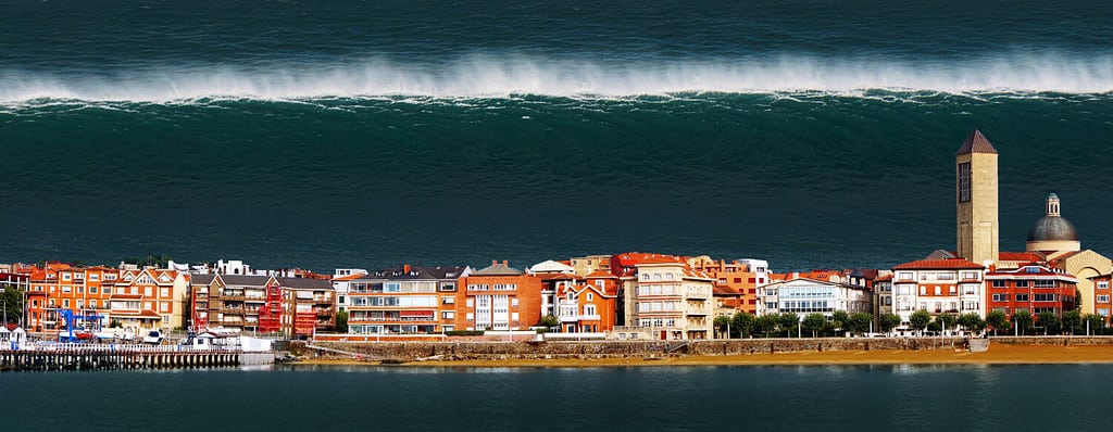
A tsunami of 100 feet could swamp Florida and make changes to its coastline through rapid erosion.
©Mimadeo/Shutterstock.com
Political Challenges to the Shape of Florida
The Panhandle is the area where a political change to the shape of Florida might be most likely. It has always been a lightly populated region of small agricultural towns. It was settled mainly by people from Alabama who to this day often feel more of a kinship to their neighbors to the north than the diverse urban populations of the southern parts of the state. Repeatedly in history, Alabama has proposed annexing the Florida counties west of the Apalachicola River.
After the Civil War, the idea was put to a referendum and received wide support in the affected counties, but because the proposal included paying Florida $1 million, the legislature of Alabama rejected it as too expensive. To take care of the funding issue, a creative and radical proposal was made in the Alabama Legislature to fund the purchase of the Florida Panhandle by selling Mississippi the city of Mobile and all the rest of Alabama’s territory west of the Tombigbee River, but nothing came of this proposal. The issue came up again in an annexation proposal by Alabama in 1901, but again to no avail.
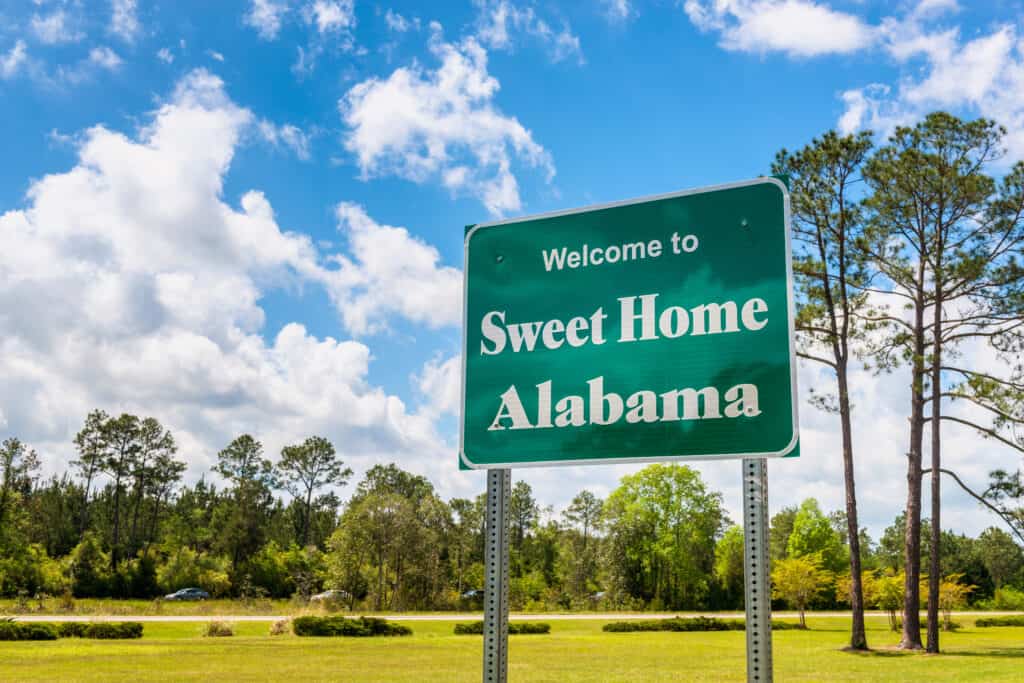
Will Alabama one day be home sweet home for residents of the Florida Panhandle?
©Allard One/Shutterstock.com
Annexation
From time to time, the issue of annexation still comes up but there have been no serious proposals in recent years. It may not be an entirely dead issue, though. Political divisions in the country have been severe in the past decade and there have been many proposals for changing state borders to align residents with neighboring states that share their political persuasions. For example, there has been talk of conservative Idaho annexing rural areas of Oregon and Washington State, of rural Western Nebraska combining with Eastern Colorado and Wyoming to make a new state. There is also talk of dividing California into up to three states, and of adjustments to the border of West Virginia to absorb neighboring conservative rural counties of Maryland and Virginia.
State and national boundaries have been the cause of more controversy and bloodshed than almost any other issue in modern times. When you think about it, though, these are imaginary lines on the globe that in the big scheme of things probably do not make that much difference to the future of the human race. Fortunately, Alabama and Florida are friendly parts of the same country. Wherever the border is drawn, residents can get along as neighbors and continue making contributions to the whole country.
The photo featured at the top of this post is © Alexander Lukatskiy/Shutterstock.com


How to Add Us to Google News


Thank you for reading! Have some feedback for us? Contact the AZ Animals editorial team.