
Nothing beats immersing yourself in nature, whether it’s a toasty summer afternoon or a crispy fall morning. Although the state of Georgia has a plethora of outdoor activities for everyone, we suggest taking a hike to Panther Creek Falls.
This series of waterfalls is one of the highlights of Northern Georgia. It’s located within the Chattahoochee-Oconee National Forest. If you’re looking for a fantastic place in Georgia to enjoy the great outdoors, consider visiting the Chattahoochee-Oconee National Forest.
These lands are rich in natural splendor, flora, fauna, and culture, with roughly 867,000 acres spread throughout over 25 counties. Here you will discover hundreds of miles of trickling streams and rivers, around 850 miles of dirt and paved paths, and endless campgrounds, dining areas, and other outdoor activity options.
Getting to Panther Creek Falls takes moderate work, but the views are well worth the hike! On the trails, you’ll see a collection of flowing falls located in stunning woodland framed by majestic trees and moss-covered stones.
Where is Panther Creek Falls?
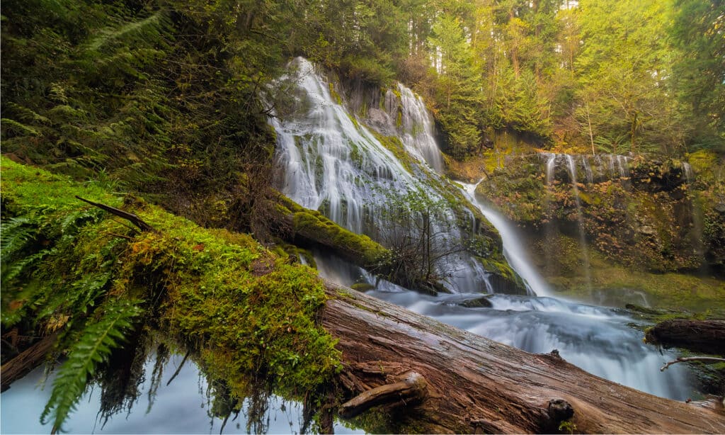
Georgia’s stunning Panther Creek Falls offers a great hiking experience.
©Thye-Wee Gn/Shutterstock.com
Located east of Turnerville in Clarksville, Georgia, Panther Creek awaits your visit. It’s about a two-hour drive from Atlanta, and visitors should be ready to strap on their hiking shoes to make their way to the falls!
If you want to see the falls, get there early. The expedition begins across from the Panther Creek picnic area on the side of Historic 441.
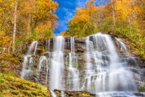
The First 3.5 Miles
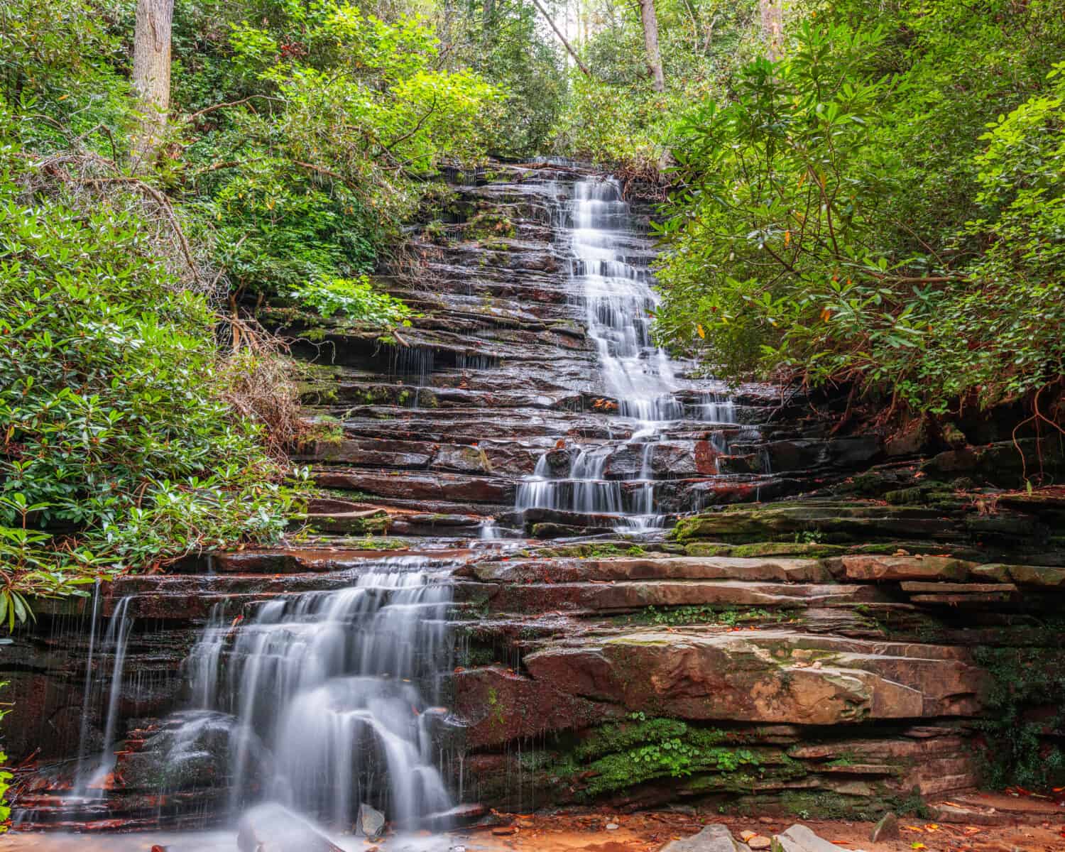
The majesty of Panther Creek Falls awaits you after a short hike.
©Sean Pavone/Shutterstock.com
The footpath on the east side of the road swiftly passes through a power line clearing before crossing under Highway 441. In the summer, you can discover delectable berries throughout these open areas.
The route stays atop the creek for the majority of the first portion of the trek as it curves around the hills. It gradually starts to descend toward the lake and the first footbridge. This represents around halfway through.
There are a number of campgrounds along this initial stretch, and there are many closer to the foot of the cascading waterfalls. As it traverses a clearing and provides views of the stream far below, the trail begins to ascend.
The sheer beauty of Panther Creek Falls draws in so many people that erosion started to affect some of the trails. New trails have been made to allow visitors to safely reach the gorgeous outdoor oasis.
One of the most scenic areas is around the mile-and-a-half mark. This is where the path begins to descend toward slow-moving streams that make you feel like you’re in some fairytale.
Near the streams are a wooden bridge, a few campsites, and plenty of flora and fauna, making it a great rest stop. Once you’re near the two-mile mark, the trail begins to ascend again, rising above the creek and over another bridge.
During the remainder of the hike, visitors can expect the trail to get quite narrow and swiftly change in elevation. That being said, take your time. Panther Creek Falls will be there waiting for you. There’s no reason to twist your ankle or scuff your knee along the journey!
How do you know you’re getting close to the falls? For one, you’ll begin to hear the rushing of water. It’s almost alluring as the water streams down the mossy cliffside. Near the enormous cascade below, the path runs over several large, chiseled granite outcrops and various other tributaries.
How Far Is the Hike to Panther Creek Falls?
After you’ve made the three-and-a-half-mile journey to the falls and enjoyed some time there, you’ll likely head back on the same trail. This will make the entire journey around seven miles in total.
You can take other trails, which make the entire hike around 12 miles long. Although the Western half of the trail is easier to traverse, some visitors have claimed the Eastern half has poorly-built stretches of trail.
Does It Cost Money to Visit Panther Creek Falls?
Visitors traveling by vehicle can expect to pay $4 for an all-day parking pass. This fee also covers the use of the picnic areas and restroom. We suggest investing in high-quality hiking boots and carrying reusable water bottles to stay hydrated during the Georgia summer heat!
Can You Swim in Panther Creek Falls?
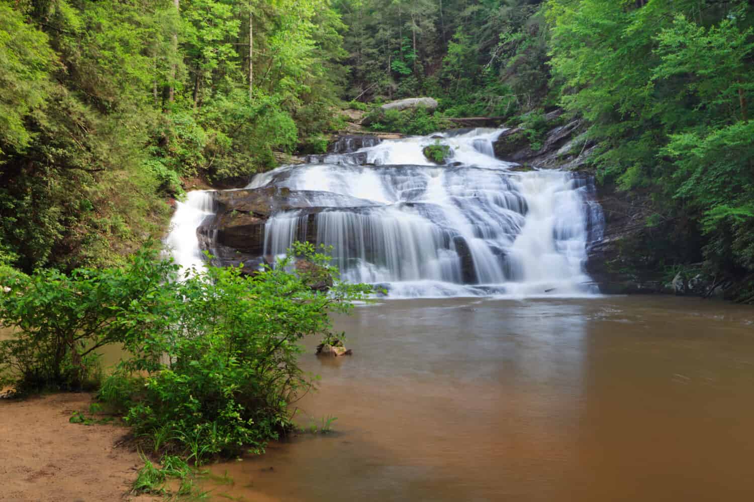
Panther Creek Falls is beautiful, but don’t dive, only wade.
©kurdistan/Shutterstock.com
You will definitely understand why this is one of the most well-liked waterfall treks in North Georgia once you see the waterfall swimming hole. Towering Panther Creek Falls cascades down over moss-covered stones into a large, swimmable pool below.
The main falls are vast and magnificent despite being only 40 feet high. Swimming is very enjoyable in the pool at the base, and the bottom of the falls can be explored. Few people venture past the falls on the route stretching into Yonah Dam Road and the South Carolina border.
If you have the bravery to dive in when you reach the cascades, it is the ideal hike for a steamy summer day. If you’re going swimming, keep in mind that there are submerged rocks protruding from the ledge close to the falls.
Something else to be aware of is the water is relatively shallow. This is a beautiful area to wade in, but you likely won’t be able to dive or swim very deep. Jumping from the different cascades is prohibited and wildly dangerous.
We hope you will have an incredible time if you choose to visit this mesmerizing piece of nature. The relatively short hike makes this a great option for beginners and younger hikers!
Where Is Panther Creek Falls Located on a Map?
With a two-hour drive from Atlanta, Panther Creek Falls is located east of Turnerville in Clarksville, Georgia. It is a three-and-a-half-mile hike to the falls. Start across from the Panther Creek picnic area on the side of Historic 441, find the footpath on the east side of the road, and pass through a power line clearing before crossing under Highway 441.
The photo featured at the top of this post is © Sean Pavone/Shutterstock.com
How to Add Us to Google News


Thank you for reading! Have some feedback for us? Contact the AZ Animals editorial team.