
There are many different natural sites to explore in Pennsylvania. For instance, this state is home to the majestic Pocono Mountains. On the other hand, several stunning lakes are spread across the state. In total, the state has more than 2,500 lakes. Although it is the largest lake in Pennsylvania by volume, Lake Erie is not located wholly within the state because it is a component of the Great Lakes.
50 of the state’s lakes were produced by glaciers. However, the majority are man-made. Among these magnificent lakes, which of them is the deepest? Below, we will uncover the deepest lake in Pennsylvania and other interesting facts.
What Is the Deepest Lake in Pennsylvania?
This question may have varied answers depending on what type of lake we are talking about. So, for the sake of this article, we will be discussing the two deepest lakes in the state by category. Technically speaking, the deepest lake that touches Pennsylvania is Lake Erie, one of the Great Lakes. However, since it touches other boundaries, encompassing Ontario, Canada, and the states of Ohio, Michigan, Pennsylvania, and New York, it won’t qualify as the state’s deepest inland lake. With that in mind, the deepest inland lake trophy goes to Conneaut Lake, which also happens to be the state’s largest natural lake. We will discuss each of them further below.
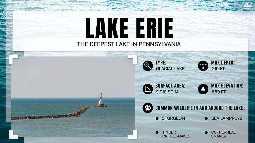
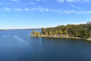
The Deepest Lake in Pennsylvania: Lake Erie
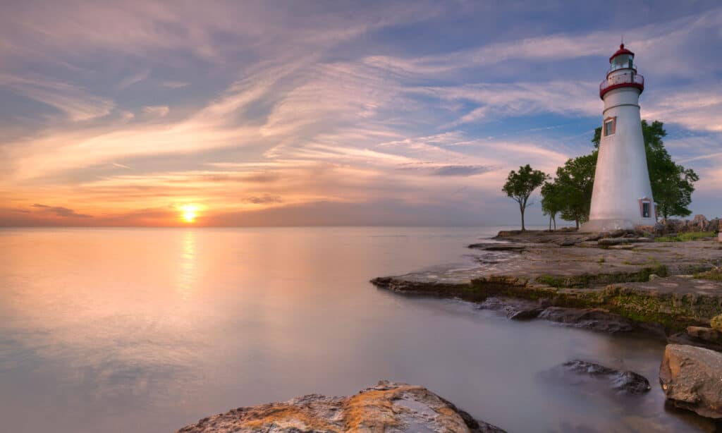
Lake Erie is the shallowest of the Great Lakes.
©iStock.com/sara_winter
Although Lake Erie is the shallowest among the five Great Lakes, it sure is the deepest lake in most of the states it touches. It is around 62 feet deep on average, 210 feet deep at its deepest point, and has a freshwater storage capacity of 116 cubic miles. As the border between Canada and the United States, Lake Erie is a prominent geographical landmark in North America. The lake’s surface is divided into several jurisdictions by water boundaries, and in Pennsylvania, there are about 45 miles of Lake Erie shoreline.
The largest island in the lake, Pelee Island in Ontario, is located at its western end. The lake’s water exits through the Niagara River at its eastern end. The Welland Canal links Lake Erie to Lake Ontario, the smallest Great Lake. If you went swimming in Lake Erie three years ago and returned this year, the water would be entirely different, because the lake’s water replenishes every 2.5 years. The lake is well drained because multiple minor rivers feed water into Lake Erie, which accounts for the minimal retention.
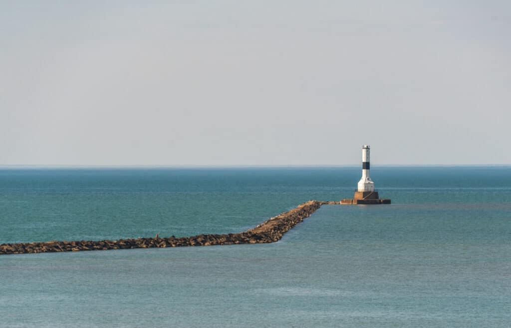
What Is at the Bottom of Lake Erie?
Lake Erie has the most shipwrecks of all the Great Lakes, so its bottom is filled with decades to centuries-old shipwrecks. Lake Erie is one of the busiest lakes in North America because of its convenient position. This lake is a favorite location for shipwreck tourism due to the number of wrecks to examine and the shallow depth of the water. Between 1,400 and 8,000 ships and boats are thought to have sunk to the bottom of this lake.
According to locals, the lake is also home to a sea monster. There have been several stories of sea monster sightings on Lake Erie since the 18th century. It is still unknown if Lake Erie is home to a real sea monster. Yet, we are aware of a real, enormous beast that swims in this lake. The sturgeon, a huge fish that can weigh as much as 300 pounds, lives at the bottom of Lake Erie. Numerous fishermen go to Lake Erie in search of a catch since the fish resides at the bottom of the lake.
What Does Lake Erie Look Like in Winter?
In the summer, Lake Erie is the warmest Great Lake, while the winters are the coldest. Erie experiences lake-effect snow, like the other Great Lakes, as the first winter winds blow over the warm waters. Lake-effect snow becomes visible when the relatively warm surface water and the cooler air have at least 18 to 23 degrees difference in temperature.
Heavy lake-effect snow may occur when cold air flows over a sizable unfrozen lake for at least 60 miles. According to information from the National Climatic Data Center, lake-effect snow makes Buffalo and Erie the twelfth and thirteenth snowiest cities in the United States, respectively.
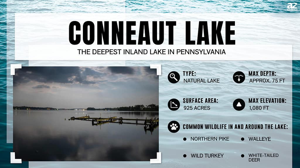
What Is the Deepest Inland Lake in Pennsylvania?
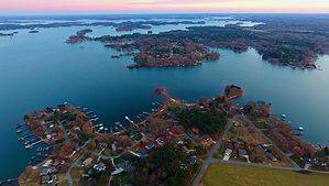
Conneaut Lake is the deepest inland lake in Pennsylvania.
©zrfphoto/Shutterstock.com
With a maximum depth of approximately 75 feet, Conneaut Lake, Pennsylvania’s largest natural lake, is its deepest inland lake. It is situated in western Crawford County, close to the same-named town, and covers around 925 acres. Besides the lake itself, the area’s main attraction has long been Conneaut Lake Park, a well-liked resort with an amusement park. The lake is about 20 to 25 feet deep in most spots, although it can reach depths of more than 50 feet in some. Its maximum depth of roughly 75 feet makes it the deepest lake entirely within the borders of Pennsylvania.
Where is Conneaut Lake Located on a Map?
Conneaut Lake is a borough in Crawford County, Pennsylvania. It is located approximately 25 miles southwest of Erie and sits at an elevation of 1,220 feet above sea level. The lake itself spans over 900 acres and is the largest natural glacier lake in Pennsylvania. To get to Conneaut Lake, you can take Interstate 79 or Route 322, depending on your starting location. If traveling from Pittsburgh or Cleveland, take I-79 North to exit 147A towards Meadville/Conneaut Lake Park. From there, follow signs to Conneaut Lake Road, which leads straight into the town center. If coming from the east, take Route 322 West through Meadville until reaching Conneaut Lake Road, where you will make a left turn onto it. On a map, Conneaut Lake can be found near the border between Pennsylvania and Ohio, with its coordinates being latitude: 41°37′44″N and longitude:80°18′22″W.
History of Conneaut Lake
Conneaut Lake was formed by glacial ice about 12,000 years ago, which geologists estimate to have been up to a mile deep. Abner Evans founded the town in 1793, and in 1796 it was given the name Evansburg. The town’s name was then changed to Conneaut Lake in 1892 to reflect the term most frequently used to refer to the town and the surrounding area.
Conneaut Lake is primarily a resort community today, offering year-round residents, seasonal residents, and visitors from near and far a wide variety of recreational opportunities, including swimming, fishing, skiing, golfing, sailing, boating, and biking in the summer and ice-fishing, snowmobiling, and 4-wheeling in the winter.
The photo featured at the top of this post is © Christopher Meder/Shutterstock.com
Sources
- Wikipedia, Available here: https://en.wikipedia.org/wiki/Conneaut_Lake#Depth
- Conneaut Lake Revitalization, Available here: http://newconneautlake.com/index.php/about-conneaut-lake
- Wikipedia, Available here: https://en.wikipedia.org/wiki/Lake_Erie#Lake_Erie_in_winter
How to Add Us to Google News


Thank you for reading! Have some feedback for us? Contact the AZ Animals editorial team.