
Alabama isn’t typically known for being very mountainous. Most of the state is relatively flat, with some low-rolling hills spread throughout. But the northeastern corner of Alabama marks the southernmost point of the Appalachian Mountains. And hidden within the Appalachian foothills, you’ll find Cheaha State Park—home to the highest point in Alabama.
Alabama’s Piedmont Ecoregion
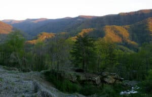
The highest spots in Alabama are located in the Talladega Mountains.
©Sharon Davies Photography/Shutterstock.com
The Piedmont is a plateau region stretching throughout the eastern United States. It’s a transition zone between the coastal plain and the Appalachian Mountains. “Piedmont” literally translates to “foot of the mountains,” signifying its location at the base of the Appalachians.
The Piedmont region of Alabama is located in the northeastern part of the state, where the Appalachian Mountains begin to rise from the flat landscape. Alabama’s top five highest points are all located here, in the Talladega Mountains of the Piedmont region.
Rolling hills and ridges, with some steep slopes in places, characterize this ecoregion. The soil is generally thin and rocky, supporting a mix of pine and hardwood forests.
How The Talladega Mountains Were Formed
The Talladega Mountains contain some of the highest points in Alabama.
©iStock.com/Jeremy Harbin
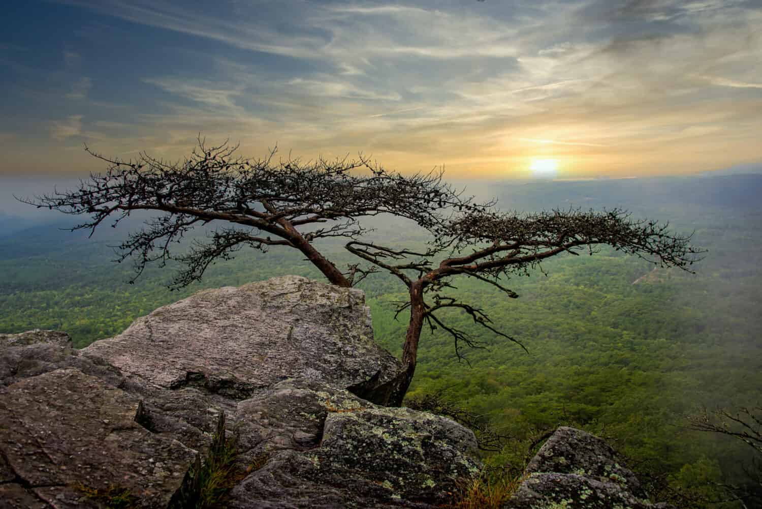
You’ll find the Talladega National Forest near the east-central side of Alabama. The Talladega Mountains in this area rose slowly over many millions of years through a series of orogenic (mountain-building) events.
The primary geological event that caused the Appalachian mountains (including the Talladega subrange) to form was the collision of two continents. About 300 million years ago, the North American and African landmasses collided. This slow squishing together of the continental tectonic plates caused the Earth’s crust to crumple and fold upward, creating the Appalachian Mountains.
Erosion has since weathered and eroded away much of the rock that once made up these high peaks. The Talladega Mountains today are a fraction of their original size and height, but they still tower high above the surrounding landscape.
Wildlife in the Talladega National Forest
Monarch butterflies pass through the area during their spring and fall migration.
©iStock.com/mzurawski
The Talladega National Forest is home to various animal species, including black bears, coyotes, and white-tailed deer. It’s not common to see foxes and turkeys as well. Birds, including the bobwhite quail and various waterfowl, also call it home.
The forest is also home to a few endangered and threatened species:
- Red-cockaded woodpecker
- Gopher tortoise
- Flattened Musk Turtle
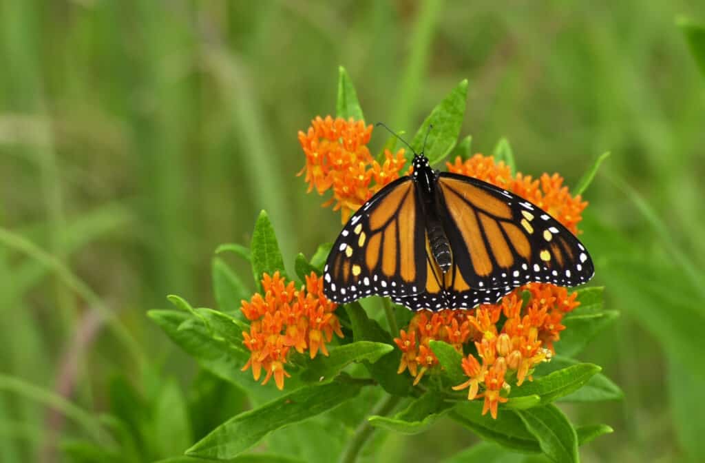
You will also likely see many butterflies depending on the time of year. Alabama hosts over 150 species of butterflies, including Cloudless Sulphurs, Eastern Tiger Swallowtails, and Common Buckeyes. Monarch butterflies are commonly seen in the spring and fall as they pass through the region during their annual migration.
The Talladega National Forest is great for hiking, camping, fishing, and picnicking. It’s also a great opportunity to see all of Alabama’s top five highest points (plus a few other scenic peaks).
The Top 5 Highest Points in Alabama
Alabama has various high points and peaks that don’t fail to dazzle.
©Gustavo Frazao/Shutterstock.com
5. Parker High Point – 2,188 feet
Parker High Point is the 5th highest point in Alabama, and it is one of the southernmost peaks of the Talladega Mountains.
You can take multiple trails to get to the summit, but the main one is the Nubbin Creek Trail. This well-maintained trail takes you past a beautiful series of cascades and waterfalls, then over the Little Caney Head peak (1,877 feet) just before reaching Parker High Point.
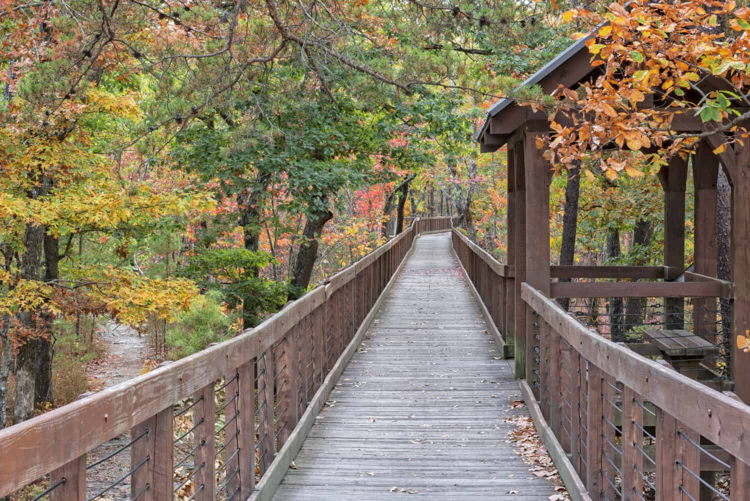
4. Bald Rock Mountain – 2,283 feet
Bald Rock Mountain is 2,283 feet and at the end of Cheaha State Park
©Liebra/Shutterstock.com
The 4th highest point in Alabama is the summit of Bald Rock Mountain on the northern end of the Cheaha State Park.
A short wooden boardwalk leads you to the top of a large rock outcropping, where you’ll be rewarded with sweeping views of the surrounding hills and valleys. This is the Doug Ghee Accessible Trail, and it’s one of the best wheelchair-accessible trails in the state.
You can also take one of the side trails off the boardwalk for a more challenging hike through the area.
There is a wheelchair-accessible walkway to Bald Rock on Mount Cheaha that offers beautiful views. Image: Jim Vallee, Shutterstock
©Jim Vallee/Shutterstock.com
3. Hernandez Peak – 2,306 feet
Hernandez Peak is the 3rd highest peak in Alabama. It is located on the southern end of Cheaha State Park.
The Pinhoti Trail to the summit is considered to be more challenging, with a rugged incline and lots of uneven terrain. This path will also take you to the nearby McDill Point (2,126 feet), just a short distance from Hernandez Peak.
2. Odum Point – 2,343 feet
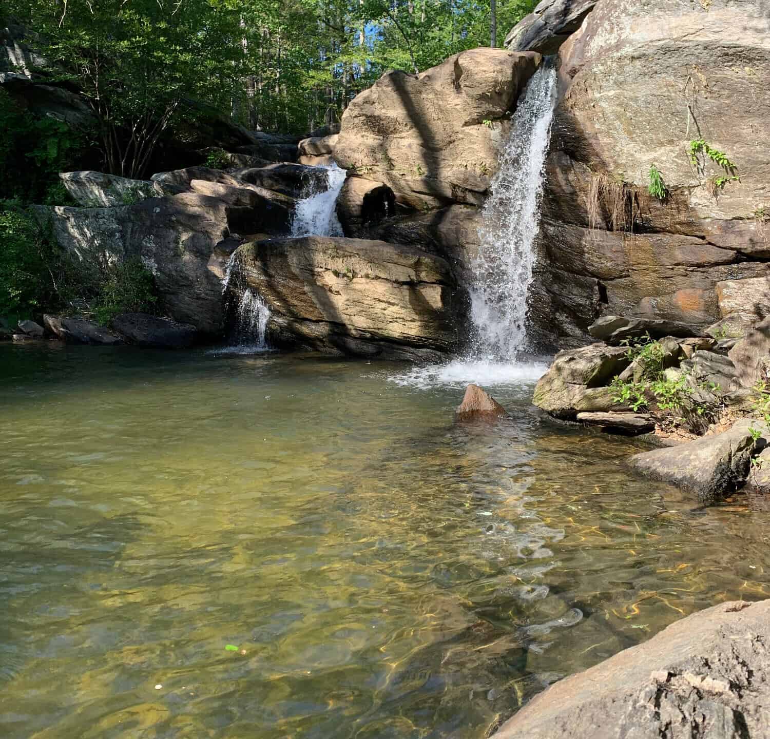
There are several amazing waterfalls on the way to Odum Point.
Image: Kristi McBurnett, Shutterstock
©Kristi McBurnett/Shutterstock.com
The 2nd highest point in Alabama is Odum Point. It is just west of Parker High Point.
You can reach Odum Point by taking the Pinhoti Trail south from Hernandez Peak and McDill Point. Or the Nubbin Creek Trail from Parker High Point also intersects with the Odum Trail, which leads to the summit.
You’ll see several amazing waterfalls, cascades, and rock formations on the way. You can also find campsites nearby if you want to stay a little while longer.
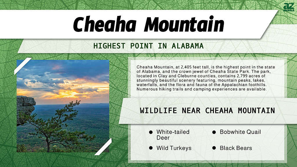
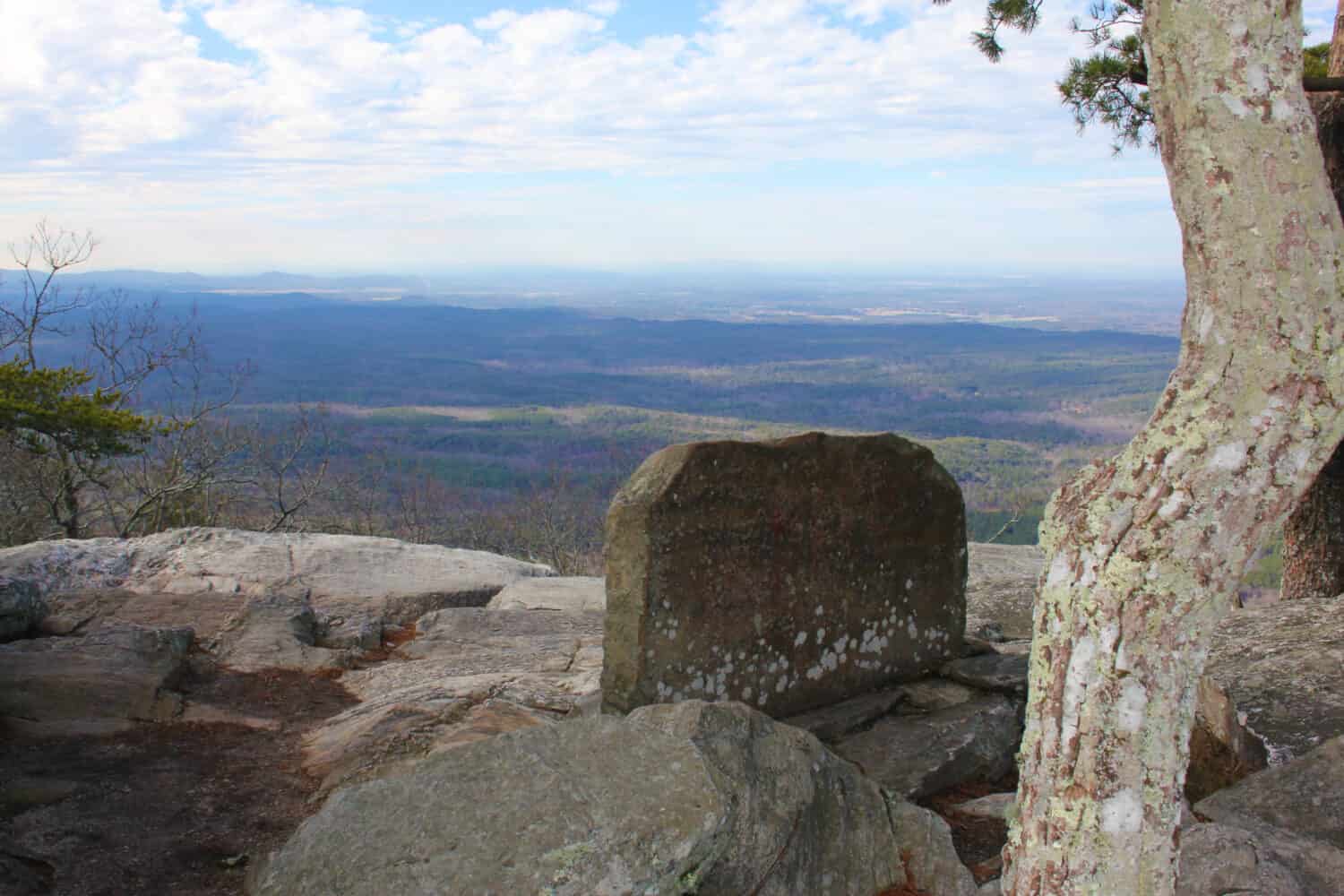
1. Cheaha Mountain – 2,405 feet
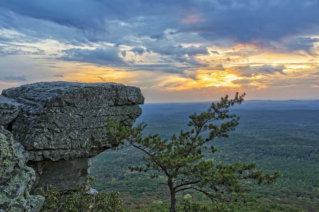
Cheaha Mountain is located in Alabama and is at the tip of the Appalachian Mountain chain.
©iStock.com/JimVallee
The highest point in Alabama is the peak of Cheaha Mountain. Cheaha is derived from the Choctaw word meaning “high.”
As the namesake of Cheaha State Park, Cheaha Mountain is a popular destination for hikers and campers. At the easily accessible summit is Bunker Tower, a stone observation tower built in the 1930s. You’ll also see radio towers and the transmitter tower for Alabama Public Television WCIQ.
The numerous trails in this area provide multiple lookout points and scenic vistas. You can also find many cabins and campsites throughout the state park so you can stay and enjoy all that Cheaha has to offer.
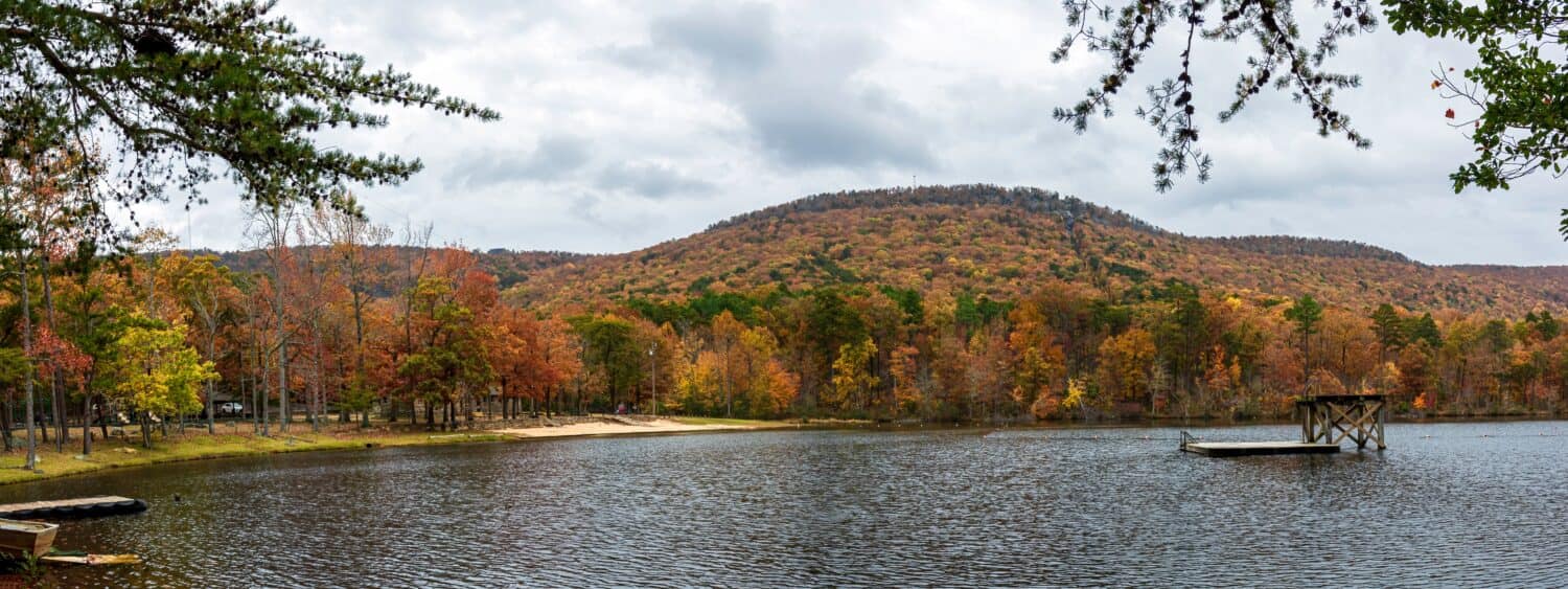
The beautiful lake at the base of Mount Cheaha is a popular swimming spot.
Image: JNix, Shutterstock
©JNix/Shutterstock.com
Where is Cheaha State Park Located on a Map?
Nestled in Clay and Cleburne counties of Alabama, USA, Cheaha State Park is a sprawling public recreation area that spans 2,799 acres. The park is renowned for its crown jewel, Cheaha Mountain, which proudly claims the title of the highest point in the state.
Cheaha State Park is a sprawling public recreation area that spans 2,799 acres. The park is renowned for its crown jewel, Cheaha Mountain, which proudly claims the title of the highest point in the state.
With its scenic beauty and proximity to the majestic Talladega National Forest, Cheaha State Park is a cherished destination for outdoor enthusiasts and is diligently maintained by the Alabama Department of Conservation and Natural Resources.
Here is Cheaha State Park on a map:
The photo featured at the top of this post is © iStock.com/JimVallee
How to Add Us to Google News


Thank you for reading! Have some feedback for us? Contact the AZ Animals editorial team.