
Maryland is a land of both beaches and forested mountains. Located on the East Coast of the United States, Maryland is the 9th smallest state in the country. Its capital is Annapolis, but Baltimore is actually its largest city. You might not think of mountains when thinking of Maryland, but even this small state is home to a state high point. So, just how tall is the highest point in Maryland? And how does it compare to the topography of the rest of the state?
We’ll discover the answers here, in our exploration of Maryland’s highest point. First, we’ll learn more about the high point itself, and what it looks like in comparison to the rest of the state. Then, we’ll find out how you can get there, and whether the peak is ADA accessible. Finally, we’ll explore what there is to do around Maryland’s highest spot, and find out where the other four state high points are located.
The Highest Point in Maryland
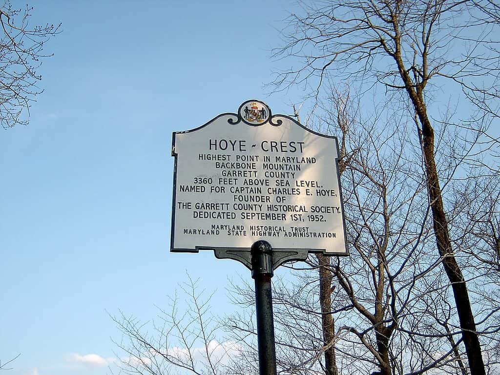
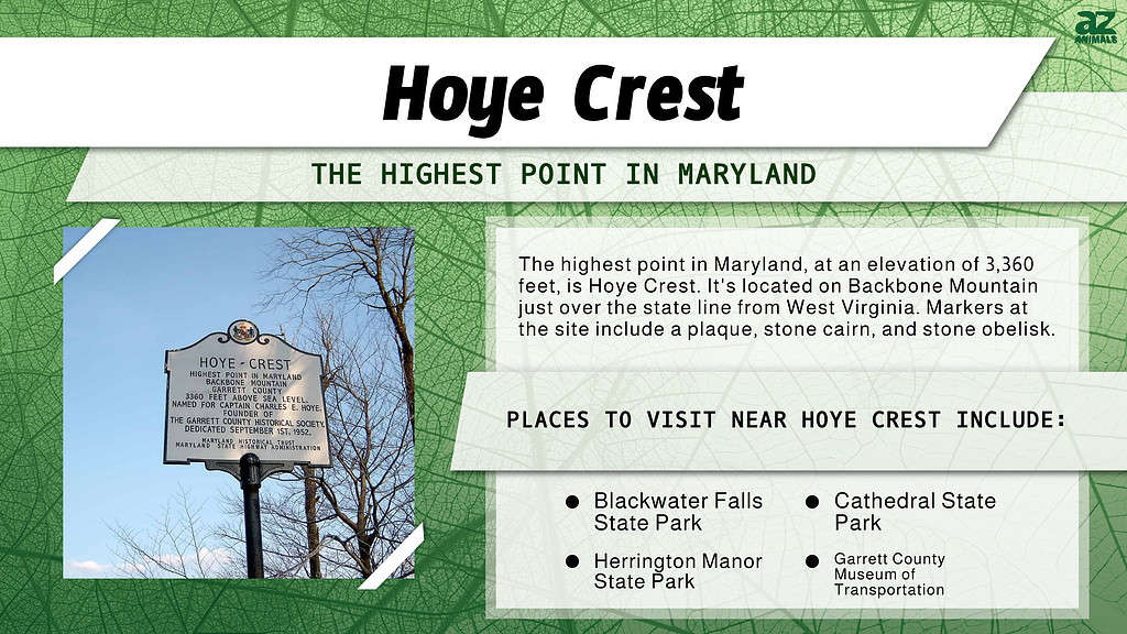
The highest point in Maryland is named Hoye Crest.
©Brian M. Powell (user Bitmapped on en.wikipedia) / CC BY-SA 3.0 – License
With an elevation of 3,360 feet, Hoye Crest is the highest point in Maryland. Hoye Crest is located on Backbone Mountain, in the state’s extreme southwestern corner. In fact, the site of the high point itself is just over the border from West Virginia. Named after Captain Charles E. Hoye, who founded the Garrett County Historical Society, the peak is well-marked. Visitors will find several benches, picnic tables, and markers.
Markers of the state high point include a large plaque, a stone cairn, and a stone obelisk. There’s even a mailbox register where people can sign their names to the visitor’s log. The Maryland state high point is technically on private property, though the owners permit access to visitors year-round.
Maryland’s Topographic Profile
Hoye Crest, the highest point in Maryland, is located in the highest elevation part of the state. The Appalachian Mountains cross Maryland’s western panhandle, creating a land of rolling hills and mountains. Further east, in the central part of the state, elevations vary between hills and valleys in the Piedmont Plateau formation.
The largest part of the state, which makes up everything from Baltimore to south and east, is low-lying. This part of Maryland is known as the Coastal Plain. Maryland has an exceptionally low state point, which can be found at the bottom of Chesapeake Bay. Known locally as Bloody Point Hole, the naturally occurring low spot measures 174 feet below sea level.
Can You Drive to the Maryland State High Point?
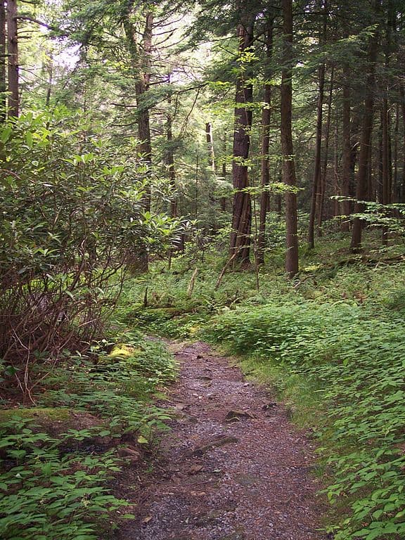
No, Hoye Crest is not one of the state high points that you can drive to. However, it’s not difficult to reach. Because the site is on private property, there is only one approved trail—the Maryland High Point Trail—leading to the top. Visitors can find the trailhead (known as the Backbone Mountain Trailhead) on Hwy 219 in neighboring West Virginia. From there, the hike to the top is just over a mile, much of it uphill, on a well-groomed trail.
Where Is Hoye Crest Located on a Map?
Hoye Crest is in Garrett County, Maryland. It’s about a three-hour drive south from Pittsburgh, and around a four-hour drive west from Baltimore.
Things to Do Near Hoye Crest
The Cathedral State Park is a place to visit, close to the Hoye Crest.
©Tim Kiser (w:User:Malepheasant) / CC BY-SA 2.5 – License
The highest point in Maryland is rural, to say the least. So, if you’re planning a day trip from any major city, be sure to get an early start. Because Hoye Crest lies on private property, there’s no possibility of camping or other exploring in the immediate area. However, there are several state parks in the surrounding region. These include Blackwater Falls State Park, Cathedral State Park, and Herrington Manor State Park. each offers camping and other recreation.
If you’re in the area, and you’ve already seen Hoye Crest, then you may want to check out some of the local attractions. Foremost among them are the Garrett County Museum of Transportation, the Deep Creek Lake Discovery Center, and the Oakland B and O Railroad Museum. If you’re looking for hotels, your closest bet is to drive north to Oakland (about 30 minutes from Hoye Crest). There, you’ll find places to eat and stay.
Five Highest Points in Maryland
At 3,360 feet elevation, Hoye Crest is the highest point in Maryland. But, what about the other highest points in the state? Though no official list exists, it is possible to discern which peaks make the grade, let’s check them out!
At 3,140 feet elevation, Roman Nose Mountain comes in second place. Coming in third is the place named Negro Mountain, with an elevation of 3,075 feet. In fourth place is Marsh Hill, with a height of 3,073 feet above sea level. Finally, the fifth highest point in the state is Snaggy Hill, at 3,040 feet elevation.
The photo featured at the top of this post is © Brian M. Powell (user Bitmapped on en.wikipedia) / CC BY-SA 3.0 – License / Original


Sources
- , Available here: http://www.mgs.md.gov/geology/highest_and_lowest_elevations.html#:~:text=The%20highest%20point%20in%20Maryland,on%20Backbone%20Mountain%2C%20Garrett%20County
- , Available here: https://www.britannica.com/place/Backbone-Mountain
How to Add Us to Google News


Thank you for reading! Have some feedback for us? Contact the AZ Animals editorial team.