
Key Points:
- Mount Arvon is the highest peak in Michigan, reaching an elevation of 1,979 feet.
- While Mount Arvon is the highest natural peak, a mining pile at Tilden Mine ranks higher.
- Since Mount Arvon is on private land, there aren’t hiking or camping options at the mountain. However, nearby landmarks Rock Cut and Quartzite Falls provide tourist opportunities.
Michigan is one of the largest states in the United States, both by population and by land covered. Lying along the Great Lakes, and sharing a border with Canada, Michigan is home to thousands of miles of coastline. This midwestern state is comprised of two distinct peninsulas, separated only by the Straits of Mackinac. The Lower Peninsula is by far the flatter and more low-lying of the two, while the Upper Peninsula is rather mountainous. But, just how high is the highest point in Michigan, and where is it?
Here, we’ll discover that Michigan’s Upper Peninsula is vastly different from its Lower Peninsula. We’ll find out just where Michigan’s mountains are, and how tall they grow. We’ll also explore the various activities visitors can partake in near the highest point in Michigan. Finally, we’ll go over the five highest points in the state, and where you can find them.
Michigan’s Highest Point
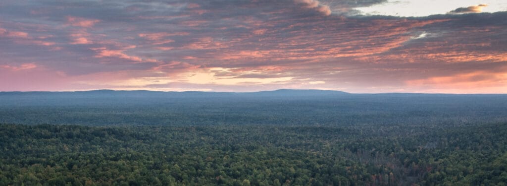
Mount Arvon in in Michigan’s Upper Peninsula is the highest point in the state.
©RomanKahler / CC BY-SA 4.0, via Wikimedia Commons – License
The highest point in Michigan is Mount Arvon, at 1,979 feet elevation. The peak is located in Michigan’s Upper Peninsula, in the middle of a heavily forested, ancient landscape. As the highest peak both in the state and in the Huron Mountains, Mount Arvon is a point of prominence for Baraga County. It is situated just a few miles to the east of L’Anse, a charming town that sits on the L’Anse Bay of Lake Superior. In fact, much of the western Upper Peninsula can be considered mountainous and rugged.
Mount Arvon isn’t located in a national forest, or even in a national park. In fact, this noteworthy destination in Michigan is actually privately owned. Luckily, this doesn’t interfere with visitors’ ability to get to the peak and take in the views.
Is Mount Arvon Really the Highest Point?
While a tailings pile at the Tilden Mine is higher, Mount Arvon is regarded as the state high point only including natural features.
©Yinan Chen / Public Domain – License
Interestingly, the highest point in Michigan hasn’t always been considered the highest point in Michigan. Sound strange? Well, the story might not be as entertaining as you might hope. It starts with neighboring Mount Curwood, which, when first surveyed, measured just one foot taller than Mount Arvon. But, a new survey, conducted in 1982, revealed that the first survey was inaccurate. It is, in fact, Mount Arvon which is one foot taller than Mount Curwood. So, since 1982, Mount Arvon has been the highest point in the state, or has it?
According to the National Oceanic and Atmospheric Administration (NOAA), as of 2019, Mount Arvon is no longer the highest point in Michigan. That honor instead belongs to none other than a tailings (byproducts of the mining process) pile at the Tilden Mine. The mine lies just to the east of Mount Arvon, where it can easily be seen for miles around. But, for purposes of state high points only including natural features, Mount Arvon maintains its title as the highest point in Michigan.
Where Is Mount Arvon Located on a Map?
Mount Arvon is situated in the upper peninsula of Michigan, United States. To get there by car, you can take County Road 510 from the town of L’Anse and turn onto Skanee Road. From there, follow the signs to Mount Arvon. The mountain is located within Baraga County, and its GPS coordinates are approximately 46°44′38″N 88°08′35″W.
On a map, Mount Arvon can be found in the northern part of Michigan’s Upper Peninsula near Lake Superior. It is surrounded by dense forests and offers scenic views of the surrounding landscapes. Visitors looking to explore this remote location should plan ahead and ensure they have adequate supplies for their trip, as services may be limited in this area.
Can You Drive to Mount Arvon?
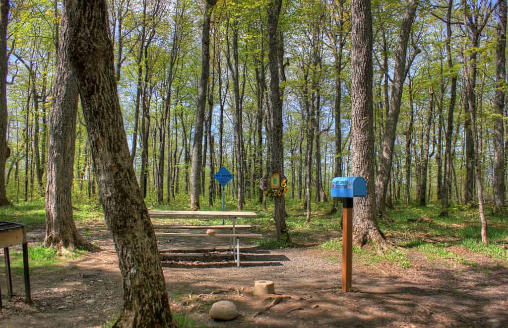
Mount Arvon isn’t the most well-known of state monuments, so the driving route there has little to no markings. If you’re planning on checking out the highest point in Michigan, be sure to do your research on the best ways to get there — and back again. But, if you follow the directions correctly, your driving journey will end at the Mount Arvon visitors’ parking lot. The parking lot comes equipped with a mailbox register, as well as several picnic tables.
From the parking lot, the summit itself is just a short walk away. Don’t blink, you might miss it. Despite the heavily forested area, however, you should get some pretty spectacular views from the top. The best time of year to visit Mount Arvon is definitely in the summer, as winter makes the roads impassible at times.
What Is There to Do at Mount Arvon?
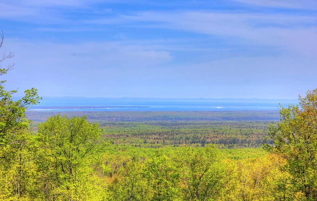
You can stop to take pictures in places around Mount Arvon.
©Yinan Chen / Public Domain – License
Given Mount Arvon’s super scenic, back-country location, you won’t be surprised to learn that the area doesn’t feature many activities. Since it’s on private land, there aren’t really any hiking or camping opportunities in the area. However, the nearby landmarks of Rock Cut and Quartzite Falls do present a couple of other noteworthy places to stop and take pictures. If you’re more of an in-town kind of tourist, be sure to check out neighboring L’Anse as it’s well worth the visit.
Michigan’s Five Highest Points
The highest point in Michigan is Mount Arvon, at 1,979 feet in elevation. But what about the other mountain summits of this low-lying state? They might not be much compared to peaks in the Rocky Mountains, but Michigan does in fact have a few more high points.
Mount Curwood is officially the second-highest peak in Michigan at 1,978 feet. The third highest is Summit Mountain, which rises 1,873 feet above sea level. The fourth highest mountain in Michigan is Underwood Hill at 1,870 feet. Finally, Sheridan Hill comes in fifth with an elevation of 1,837 feet.
The photo featured at the top of this post is © Yinan Chen / Public Domain – License / Original


Sources
- , Available here: https://www.michigan.org/property/mount-arvon
- , Available here: https://www.baragacounty.org/convention-visitors-bureau/things-to-do/mt-arvon/#:~:text=Arvon-,Mt.,in%20beautiful%20Baraga%20County%2C%20approx
- , Available here: https://k1025.com/mount-arvon-is-no-longer-michigans-highest-point-this-pile-of-mining-waste-is/
How to Add Us to Google News


Thank you for reading! Have some feedback for us? Contact the AZ Animals editorial team.