
Squarely in the Great Plains region of the United States, South Dakota has a population of under one million people. Despite the fact that it’s the seventeenth biggest state, South Dakota is one of the five least populated states in the country. It’s home to both Mount Rushmore and the Black Hills region, and is considered a part of the Midwest. South Dakota is divided roughly into eastern and western halves by the Missouri River, with the Black Hills in the extreme western part of the state. But, just where is the highest point in South Dakota?
Read on to learn more about South Dakota’s state high point and much more. We’ll go in-depth on the highest spot in the state, including where it is, how tall it is, and how to get there. Then, we’ll learn whether or not you need advanced climbing skills, or simply a car, to reach the summit. We’ll also explore a few things to do in the vicinity. Finally, we’ll discover the other four highest points South Dakota has to offer.
Where Is South Dakota’s Highest Point?
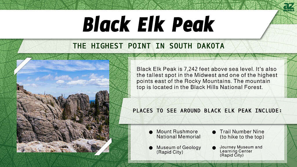
Black Elk Peak is South Dakota’s highest point at 7,242 feet.
©Tami Freed/Shutterstock.com
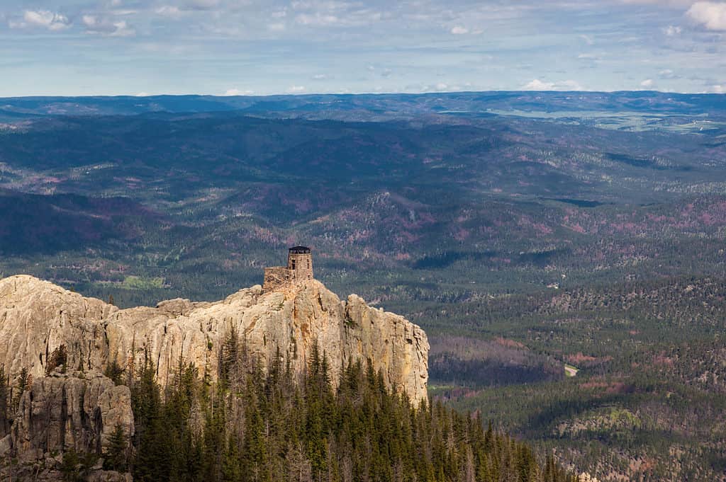
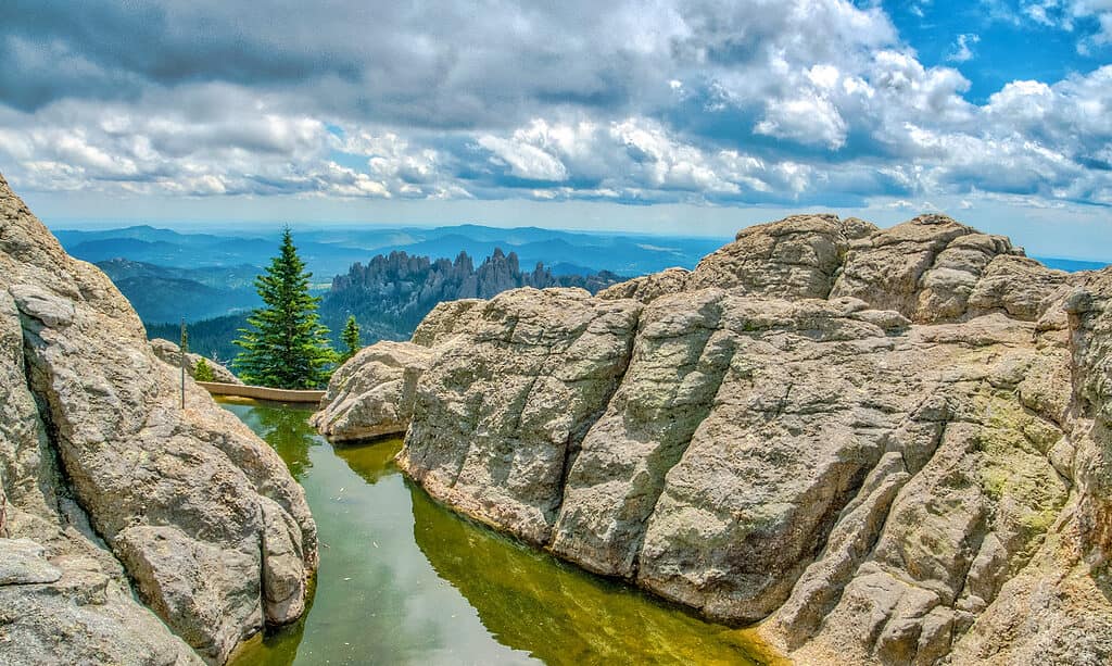
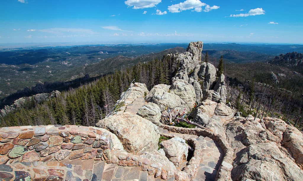
The highest point in South Dakota is Black Elk Peak, which rises to 7,242 feet in elevation. It’s also one of the highest of all state high points east of the Rocky Mountains and the tallest spot in the Midwest. Located in the Black Elk Wilderness area in the state’s southwest corner, Black Elk Peak is a part of the Black Hills National Forest.
Prior to 2016, the state high point was known as Harney Peak. Officials changed the name to better celebrate a famous Lakota Sioux man named Black Elk, an honored medicine man. Visitors to the peak enjoy astounding views, which extend all the way to Nebraska, Wyoming, and Montana on clear days.
Where Is Black Elk Peak Located on a Map?
Black Elk Peak is situated in the Black Elk Wilderness area in southern Pennington County. It is around 30 minutes drive from Mount Rushmore.
South Dakota’s Topography
Like much of the Midwest, South Dakota follows a general upward trend from east to west. The lowest elevations in the state can be found in its eastern half, as well as along the course of the Missouri River. The Missouri River bisects South Dakota from north to south, almost exactly down the state’s center line. The lowest point in the state can be found at Big Stone Lake, at 966 feet in elevation.
Roughly the western quarter of South Dakota is marked by higher elevations. These range from about 3,000 feet, all the way to 7,244 feet at the highest point in South Dakota. Black Elk Peak is widely considered to be the highest point between the Rocky Mountains in the west, and the Pyrenees Mountains of France in the East.
Can You Drive to Black Elk Peak?
It is not possible to drive to Black Elk Peak.
©Exploring and Living/Shutterstock.com
No, you cannot drive to Black Elk Peak. However, the most popular route to the top, known as Trail Number Nine, is considered easy enough for even youngsters. This route is seven miles long (roundtrip) and usually takes between 2-4 hours, with 1,100 feet of elevation gain. There are also several other trails to the top, many of them less crowded, though moderately more difficult. Visitors usually start their hike from the Black Elk Peak Trailhead in Custer State Park. Unfortunately, Black Elk Peak is not generally considered ADA-accessible.
Things to Do Near Black Elk Peak
For outdoor enthusiasts, there’s practically no end to things you can do and see in the area surrounding Black Elk Peak. Mount Rushmore National Memorial, one of the most heavily visited memorials in the country, lies just to the east. There are plenty of campgrounds and miles of hiking trails dispersed throughout the area. Though, be sure to get proper permitting and/or pay entrance fees to any State Parks you enter.
If you’re not much of a camper, there’s also nearby Rapid City. Rapid City has plenty to offer in terms of places to stay and eat. It also has several museums, including the Journey Museum and Learning Center and the Museum of Geology. The surrounding area is also chock full of “glamping” opportunities, inns, and cabins for rent.
Five Highest Spots in South Dakota
The Black Elk Peak stands at 7,242 feet.
©iStock.com/htrnr
We’ve learned that, at 7,242 feet above sea level, Black Elk Peak is the highest point in South Dakota. But, what about the top five highest spots in the state? Let’s explore those peaks as well.
Coming in at a close second, nearby Odakota Mountain measures in at 7,197 feet elevation. In third place is Bear Mountain, at an elevation of 7,166 feet. Green Mountain is fourth, with an elevation of 7,164 feet above sea level. Finally, at fifth place is Crooks Tower, at 7,137 feet elevation. Interestingly, the top four highest points in the state are all in Pennington County, while Crooks Tower is in Lawrence county.
The photo featured at the top of this post is © outerbounding/Shutterstock.com


Sources
- , Available here: https://www.britannica.com/place/Black-Elk-Peak
- , Available here: https://www.travelsouthdakota.com/trip-ideas/photo-essay/black-elk-peak#:~:text=At%207%2C242%20feet%2C%20Black%20Elk,the%20Pyrenees%20Mountains%20in%20France
How to Add Us to Google News


Thank you for reading! Have some feedback for us? Contact the AZ Animals editorial team.