
From vast prairies to towering mountains, Montana is a beautiful state to visit, rich with history and adventure. Situated in the northernmost part of the United States, the Big Sky Country calls to adventurers, offering a wide variety of activities. From climbing to soaring heights at its tallest point (Granite Peak, elevation 12,807 feet) to following rushing rivers to its lowest, there is no end to the beauty this great state has to offer. Now, let’s take a look at the lowest point in Montana and what makes it so special.
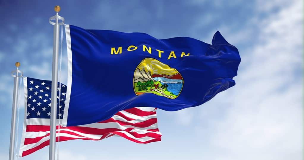
Even the state flag honors the rugged beauty of Montana.
©rarrarorro/Shutterstock.com
Troy: Montana’s Lowest Point
Nestled deep in the mountain valleys of northwestern Montana, a small town named Troy is the lowest point in Montana. With an elevation of only 1,820 feet, this gem of the Kootenai River is home to around 925 residents. Situated in Lincoln County, this town was originally a fishing village, where Kootenai (Kutenai), Salish, and Piegan Blackfoot tribes would meet. Now, it holds its place in history for other reasons, and you can read on to learn more about the town and its attractions!
History of Troy
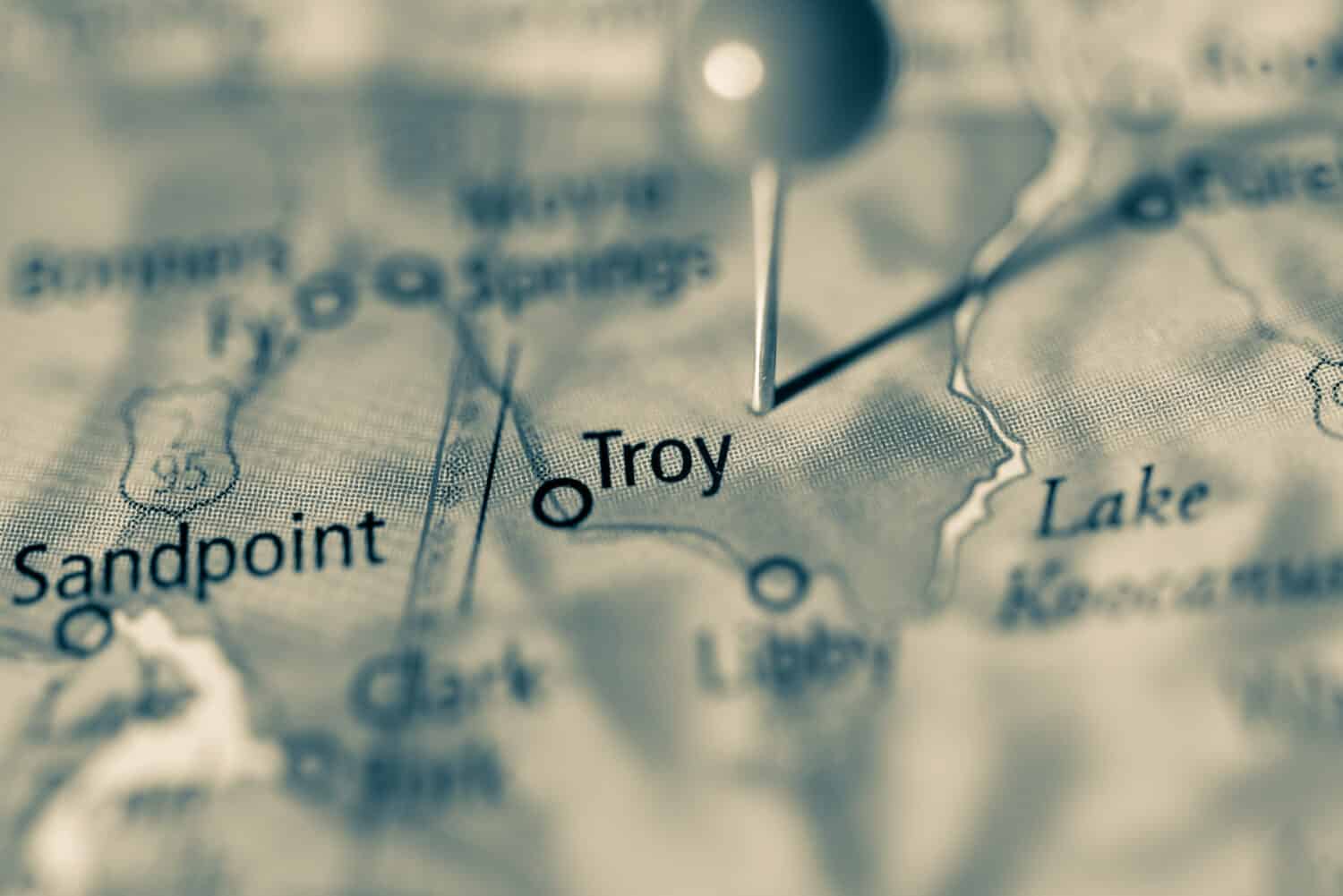
Troy sits very close to the Idaho border.
©Tudoran Andrei/Shutterstock.com
In the 1880s, miners settled along the banks of the Kootenai River near the border of Montana and Idaho. By 1892, Troy was a registered town, and its population grew as work opportunities appeared with the construction of the Great Northern Railway. Miners and their families flocked to the area, excited about the prospect of a new life in a perfect place. Unfortunately, life in this town would not be as stunning as the rich, wild nature that surrounded it. In the 1920s, asbestos contamination from a local vermiculite mine would pose a decades-long local health issue. The mine, owned by W.R. Grace, would remain active until the 1990’s, polluting the entire around surrounding it.
The town faced many more problems than contamination. A series of wildfires plagued Troy from 1906 to the end of the 1920s, burning many important buildings and large portions of the Kootenai National Forest. Despite this, the population of this town continued to grow until 1926. Unfortunately, Great Northern Railway relocated its local freight terminal, removing several jobs from the area. In the late 1920s, as the Great Depression hit, more people moved away. This resulted in a record-low population at the cusp of the 30s. After this, the town struggled to recover but slowly grew to its current numbers (925, 2021 census).
Environmental Protection Agency Intervenes
In 1999, the United States Environmental Protection Agency stepped in to investigate the contamination that had spread from the vermiculite mine. Findings from this investigation spurred the EPA into drastic action in 2002. They listed Troy as a matter of national priority and, in 2009, declared the very first EPA Public Health Emergency. Cleanup efforts began in 2000 and continued for 18 years. During this time, the EPA funded the cleanup of 2,600 homes and the removal of over one million cubic feet of contaminated soil. As 2018 came to an end, the EPA declared most of Troy safe from exposure risk. However, parts of the forest and areas near the mines still contain potentially high levels of contamination. In 2020, the EPA transferred oversight of the area to the Montana Department of Environmental Quality.
Geography and Climate of Troy
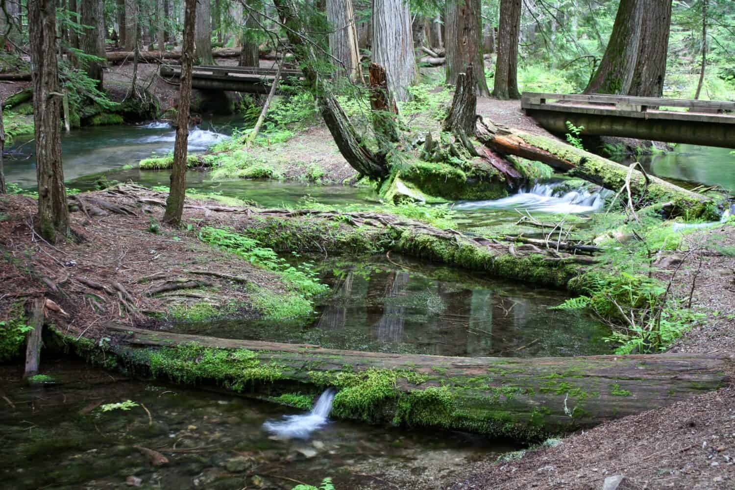
With breathtaking views and a friendly, small-town feel, it’s no wonder Troy has a steady stream of summer tourism. As mining and logging operations in the area dwindled, the town stayed on the map for its ideal location and pristine scenery. To the northeast, the Purcell Mountains stretch into British Columbia, Canada. This distinct part of the Rockies has a very high level of erosion and glacial activity. To the southwest, the Cabinet Mountains span over 2,000 square miles with peaks reaching heights of over 8,000 feet. Resting cozily on the banks of the Kootenai River between these two great ranges, Troy is home to Roosevelt Park, the Kootenay River Gorge, Ross Creek Cedar Trail, and many other delightful outdoor attractions.
Summers in Troy are hot and humid, with highs in the 80s, while winters are mild and temperate, with lows in the 20s. Due to its low elevation and its proximity to the Gorge, flooding is a common issue in Troy.
Troy’s Lowest Point
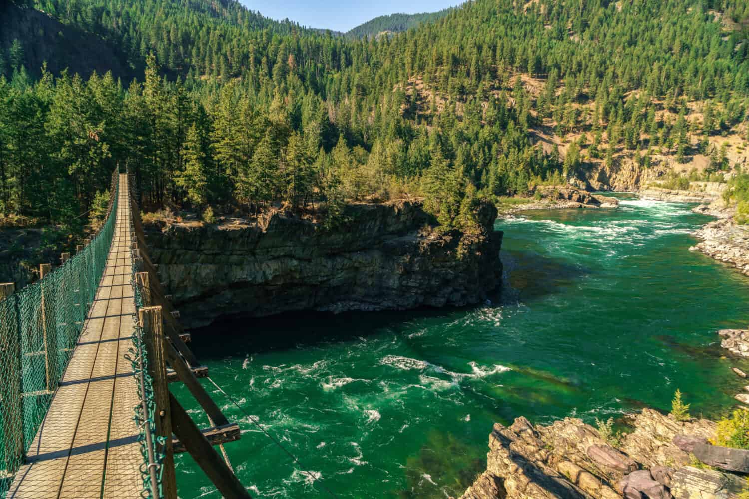
The swinging bridge that looks over Kootenai Falls.
©MarksPursuit/Shutterstock.com
While Troy is the lowest-elevation town in Montana, the lowest point of Montana is at Kootenai Falls – an eight-mile trek southeast of Troy’s city center on U.S. Route 2. At mile 21, there is access to the state’s largest undammed waterfall from a highway parking lot. A trail through the forest leads hikers to stunning views of the river and falls. It isn’t just the waterfall that attracts tourists to this trail – a beautiful swinging bridge over the river grants hikers views of the falls’ largest drop – 30 feet of plunging water.
The Kootenay River
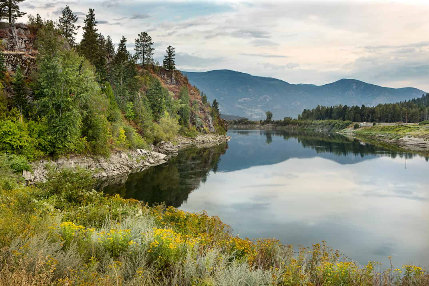
A rare view of placid waters on the river Kootenay.
©Gregory Johnston/Shutterstock.com
The Kootenay River (also known as the Kootenai River) is the third largest tributary of the Columbia River. It flows 485 miles from Kootenay National Park in British Columbia, Canada, down into Idaho and Montana, and back up into Canada, where it meets Kootenay Lake and drains into the Columbia River. The water from the Kootenai will make its way to the Columbia Bar and join the Pacific Ocean.
Ross Creek Cedars: Worth a Stop
Ross Creek flows through many acres of old-growth forest.
©JStarPhotog/Shutterstock.com
Lincoln County, the northwesternmost county in Montana and home of Troy, is also the home of the Ross Creek Cedars Scenic Area, which boasts 100 acres of pristine red cedar forests. Some of these trees are over 400 years old, and boast trunk diameters of 8 feet or more! A 0.9-mile accessible loop trail that runs through this area makes a visit worthwhile and fun for everyone. There is also a small picnic area and vault toilets.
Wildlife at Montana’s Lowest Point
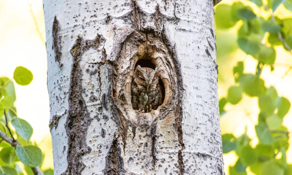
The flammulated owl is just one rare animal you can see in northwestern Montana.
©iStock.com/Devonyu
Lincoln County is teeming with wildlife, so you won’t miss out on your visit. With a diverse system of rivers, mountains, old-growth forests, and rainforests, there is seemingly no end to the amount of wildlife you can encounter. This area is part of “Kootenai Country”, and houses rare animals, including wolverines, western painted turtles, flammulated owls, golden trout, and woodland caribou.
You can check out a full list of wildlife in this area on the Kootenai Country website.
Recreation in Troy
In addition to hiking and wildlife viewing, there are several other activities visitors can participate in around Troy and Lincoln County!
First off, the area is a popular destination for all sorts of fishing! Alvord Lake is a locally-cherished family fishing area for bass and perch. South of Troy, Bull Lake is one of the largest lakes in the county and is great for boat fishing. Geiger Lake offers trout fishing – if you’re willing to make the strenuous trek to its rocky shores. For river and stream fishing in the area, check out this USDA list of recreational fishing opportunities in the area.
Next, you can find abundant camping spots in the county. Kootenai River Campground is only a five-minute drive from downtown Troy, or you can continue on to Yaak River Campground, where the Yaak River meets the Kootenai. Both of these campgrounds are RV-friendly, affordable, and near water.
Hikers and climbers find no shortage of destinations in the county. From fairly simple hikes such as Callahan Creek to complex climbs like Williams Creek Trail, there’s a place for everyone to explore.
Other local activities include snowmobiling, geocaching, and swimming.
Fun Facts About Montana’s Lowest Point
- Scenes from the 2015 Leonardo DiCaprio film “The Revenant” take place at Kootenai Falls.
- Troy, MT is a safe zone in the book “World War Z” by Max Brooks.
- The Theodore Roosevelt Memorial Bridge in Troy is on the National Register of Historic Places.
Where Is Kootenai Falls Located on a Map?
The lowest point in Montana is Kootenai Falls – the state’s largest undammed waterfall. It is an eight-mile trek southeast of Troy’s city center on U.S. Route 2 and then a trail through the forest leads hikers to stunning views of the river and falls. Troy is a small town nestled deep in the mountain valleys of northwestern Montana. Situated in Lincoln County, this town was originally a fishing village, where Kootenai (Kutenai), Salish, and Piegan Blackfoot tribes would meet.
The photo featured at the top of this post is © MarksPursuit/Shutterstock.com


How to Add Us to Google News


Thank you for reading! Have some feedback for us? Contact the AZ Animals editorial team.