
Long before the first Europeans came to the United States, native people lived across North America in a variety of cultures and configurations. Compared to these cultures, and many cities elsewhere in the world, the oldest towns are relatively new – at only a few hundred years old. In fact, the oldest continuously-inhabited town established by European arrivals in what is now the United States is St. Augustine in Florida. St Augustine was founded by Spanish people exploring North America in 1565. The other oldest towns in the United States were all founded after 1565 – over the course of more than 300 years!
This article introduces you to the oldest towns in each of the 50 United States. We will learn about these 50 cities, the year they were founded, and some of their history. Let’s go!
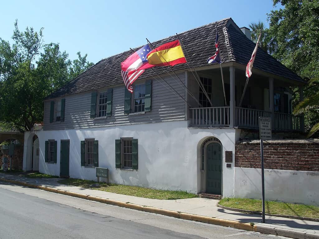
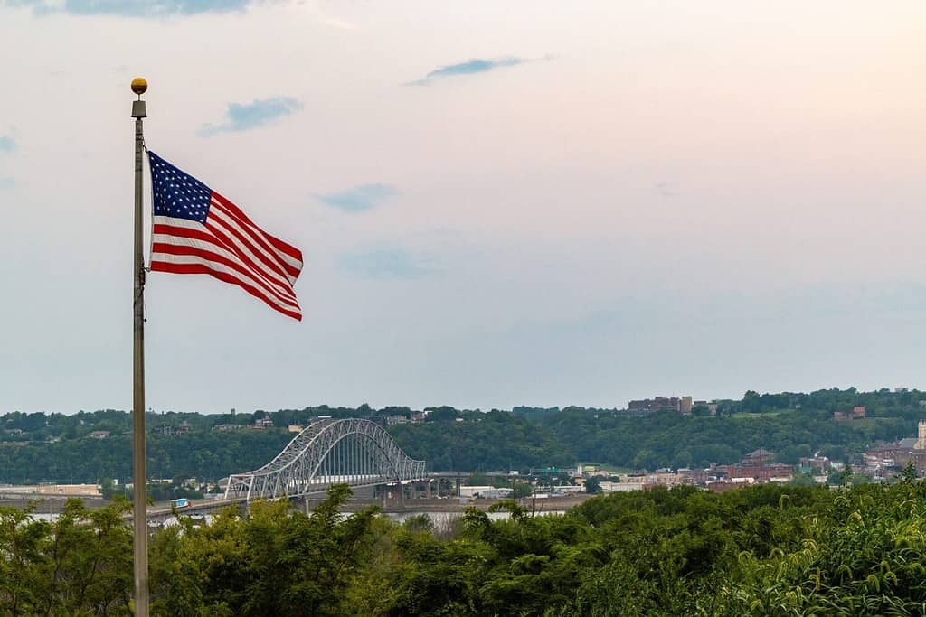
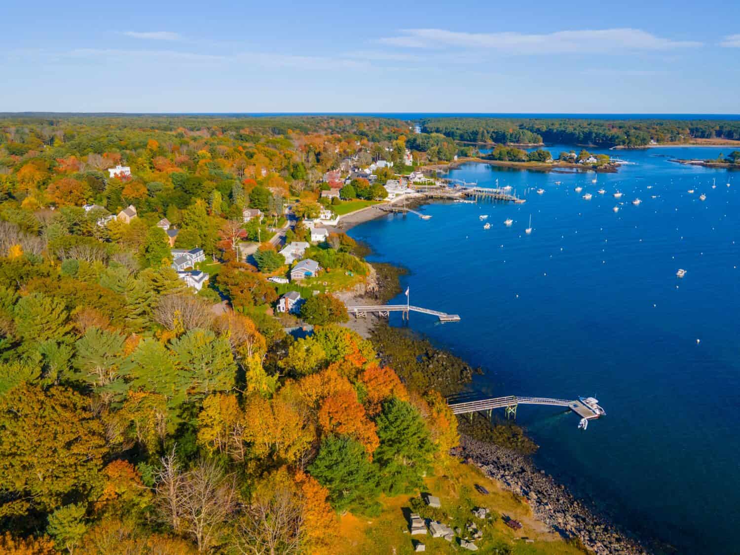
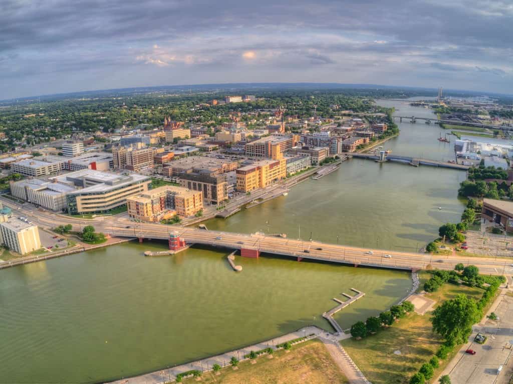
St. Augustine is the oldest town in the United States (that has been continuously inhabited).
©Ebyabe / CC BY-SA 3.0 – License
Mobile, Alabama
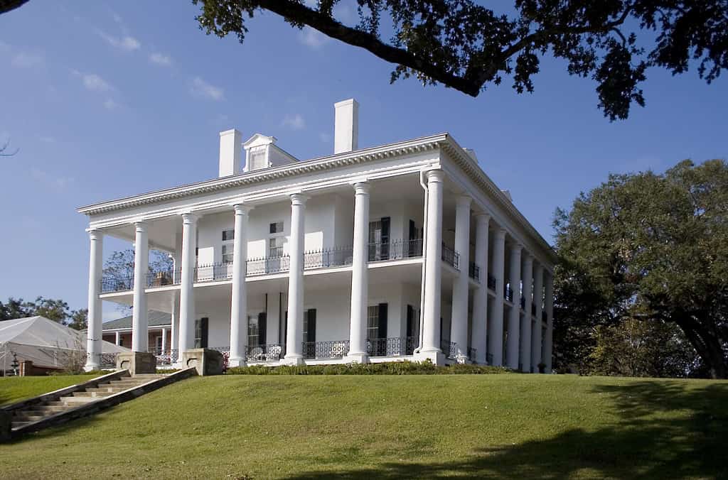
First on the list is Mobile, Alabama, which was founded in 1702 by French colonists. Originally, the French settlement was named Fort Louis de la Mobile. Back then, the city was a trading post and military site. Eventually, it became part of the United States in 1813. Today, Mobile is the fourth most populous city in Alabama, after Huntsville, Birmingham, and Montgomery. This city on Alabama’s Gulf Coast is home to an estimated 430,000 people who live throughout the metropolitan area.
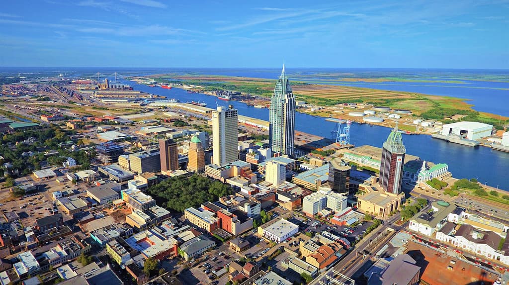
Mobile is the oldest town in Alabama.
©George Dodd III/Shutterstock.com
Where is Mobile, Alabama Located on a Map?
Mobile is located on the Gulf Coast in the extreme southwestern corner of Alabama. There is a 55-mile distance between Mobile and Pensacola, Florida, and a 35-mile distance between Moss Point, Mississippi, and Mobile.
Kodiak, Alaska
Kodiak, Alaska was founded by Russian settlers in 1792. At the time, this settlement was called “Three Saints Bay” and was a central hub for fur trading. Eventually, the settlement moved to where present-day Kodiak sits and was called Paul’s Harbor. Eventually, the town was renamed and gained its name after the native Kodiak people who lived in the region. Alaska joined the United States in 1959. Today, Kodiak is home to only about 5,500 people.
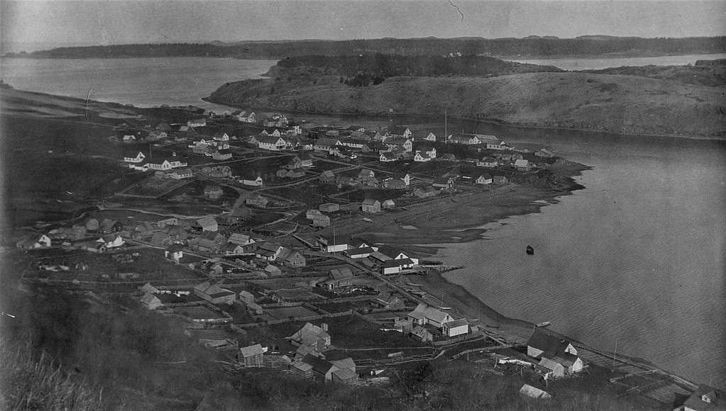
Kodiak is the oldest town in Alaska, photographed here in 1924.
©Btphelps, CC BY-SA 4.0 <https://creativecommons.org/licenses/by-sa/4.0>, via Wikimedia Commons – License
Where is Kodiak, Alaska Located on a Map?
Kodiak is located on the eastern shore of Kodiak Island, which is the second-largest island in the United States. It can be found in the Gulf of Alaska, about 30 miles off the Alaskan Coast.
Tucson, Arizona
Tucson, Arizona was founded by Spanish explorers in 1775. At the time, it was part of the Spanish colonial territory and named Presidio San Agustín del Tucsón. The settlement gained prominence as a rising trade outpost and military settlement since it sat on the Camino Real. The Camino Real was a major trading route that connected the south of Mexico with settlements to the north. Tucson was eventually transferred from Spanish control to Mexico and then became part of the U.S. in 1853. Today, Tucson is the second-largest city in Arizona, after Phoenix, and is home to more than half a million people.
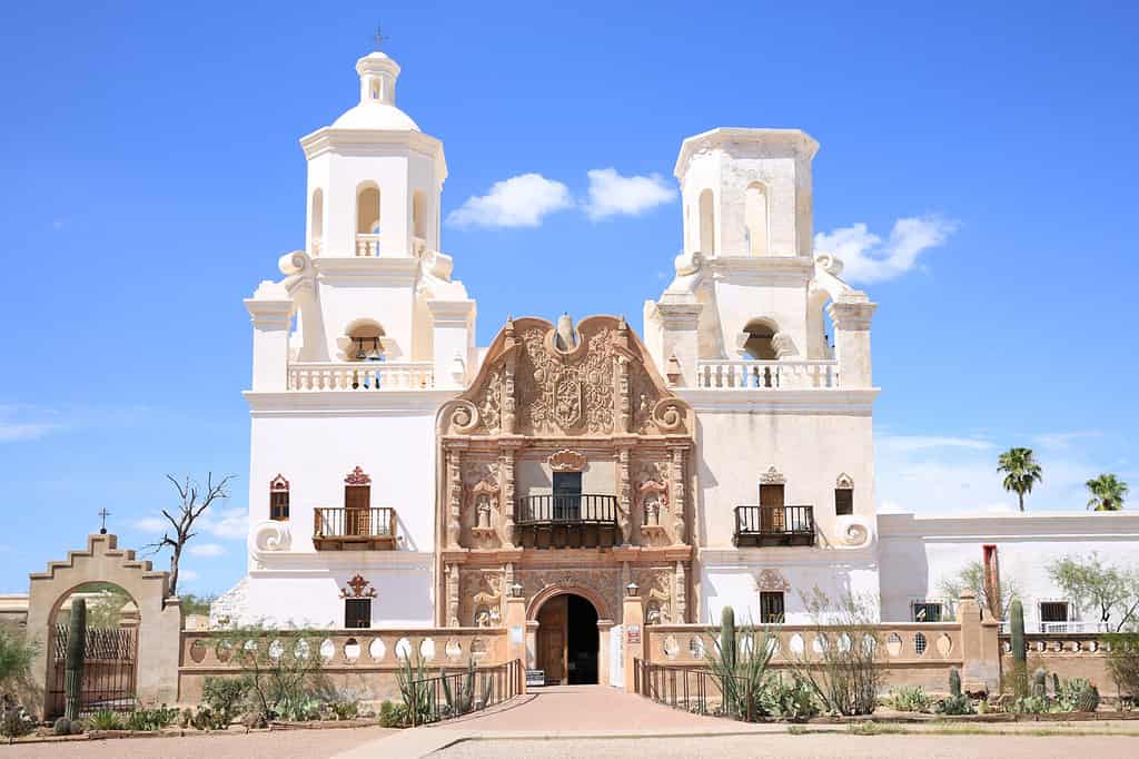
The San Xavier del Bac mission near Tucson is the oldest town in Arizona.
©Traveller70/Shutterstock.com
Where is Tucson, Arizona Located on a Map?
Tuscon is located in the southeastern region of Arizona, in Pima County. It is in the Sonoran Desert and is approximately 112 miles south of Phoenix, and is known for its Saguaro cacti.
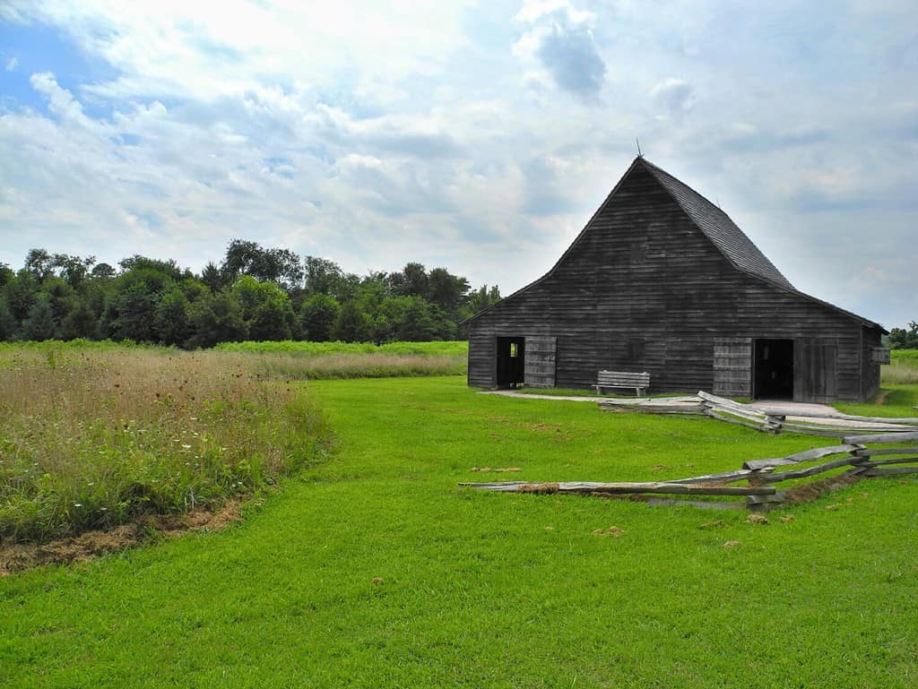
Arkansas Post, Arkansas
The oldest city in Arkansas is Arkansas Post or the Arkansas Post National Memorial. This site is considered the oldest European settlement in modern-day Arkansas and was established by the French in 1686. At the time, this location served an important function in trade, military strategy, and the development of the region. The site of Arkansas Post changed several times due to conflict with native peoples in the area and natural disasters. The current location was established in 1954 as a monument to the history of the area and is a national memorial.
Arkansas Post National Memorial in Arkansas Post is the oldest town in Arkansas.
©Jeffrey M. Frank/Shutterstock.com
Where is Arkansas Post, Arkansas Located on a Map?
Arkansas Post is located along the north side of the Arkansas River in Arkansas County in the southeastern part of the state. It is 117 miles southeast of Little Rock.
San Diego, California
San Diego, California was founded by Spanish settlers in 1769 on an expedition that established a Spanish mission and military presidio. Originally, San Diego was named San Diego de Alcalá. The mission was a religious site to convert native peoples and be a Spanish stronghold. Eventually, San Diego became part of the United States after the Mexican-American War in 1848. The city grew significantly during the California Gold Rush. Today, more than 1.3 million people live in San Diego and 3.28 live in San Diego County, making it the most populated city after Los Angeles.

San Diego is the oldest city in California.
©iStock.com/f11photo
Where is San Diego, California Located on a Map?
San Diego is on the southern coast of California and is located in the southwestern region of the state. Bordered by the Pacific Ocean to the west and the United States-Mexico border to the south, it is just two hours south of Los Angeles.
San Luis, Colorado
San Luis, Colorado, was founded in 1851. This city was established by settlers who came north from Mexico and founded the community in Colorado’s San Luis Valley along with several other towns in the region. As the first permanent settlement in Colorado, San Luis had an important role in the region’s development. Today, San Luis is the county seat of Costilla County and the most populous town in the county. However, that doesn’t mean much in this rural area! In 2020, the town had a population of 665. The area is largely agricultural and the residents are farmers.
San Luis, founded in 1851, is located in Luis Valley, Colorado.
©Fredlyfish4/Shutterstock.com
Where is San Luis, Colorado Located on a Map?
Windsor, Connecticut
Windsor, Connecticut was founded in 1633 by settlers who moved south from Plymouth Colony in Massachusetts. The town they founded was named Windsor in honor of another town of the same name in Berkshire, England. Windsor was the first English town established in Connecticut and was the colony’s capital until 1637. Today, about 30,000 people live in Windsor, which is on the northern border of the present-day Connecticut capital of Hartford.
Windson is the oldest town in Connecticut.
©SevenMaps/Shutterstock.com
Where is Windsor, Connecticut Located on a Map?
Lewes, Delaware
The oldest town in Delaware is Lewes, a historic settlement founded by Dutch colonists in 1631. Originally named Zwaanendael, the original location was created to be a trading post for the Dutch West India Company. Though the settlement was destroyed in conflict with local indigenous tribes who pre-dated the Dutch settlers, the area was rebuilt by the English in 1682. At that time, the English gave it the new name of Lewes, in honor of the town of Lewes in Sussex, England. Lewes played an important role in the development of Delaware and the overall growth of the United States. Today, this beach town is home to about 3,400 people who live in Delaware’s Cape Region.
Lewes, Delaware was founded by Dutch colonists in 1631.
©Jon Bilous/Shutterstock.com
Where is Lewes, Delaware Located on a Map?
St. Augustine, Florida
As mentioned before, St. Augustine, Florida is not only the oldest city in Florida but the oldest European-established city in the fifty United States. St. Augustine was established in 1565 by the Spanish, who initially called it “San Agustin” after St. Augustine, a notable Christian figure in history. This site was chosen to be a strategic military base and epicenter for Spanish development and control of the region. It was the capital of Spanish Florida and became a cultural and economic base during multiple periods of colonization. Today, this history is evident in the many historical landmarks and unique architecture throughout the city. Today, about 15,000 people inhabit St. Augustine.
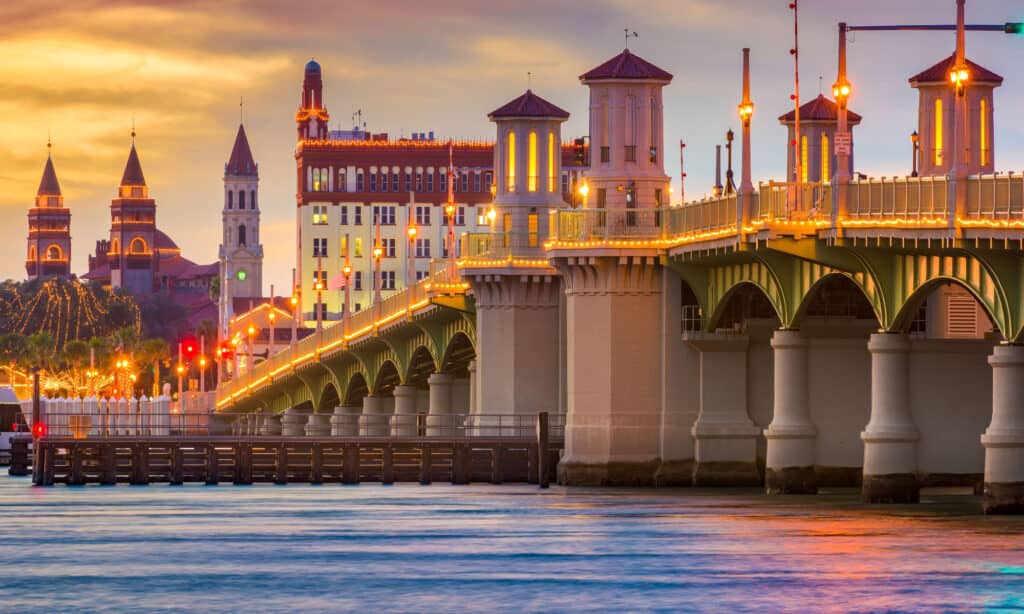
St. Augustine, Florida is not only the oldest city in Florida but also the oldest European-established city in the United States.
©Sean Pavone/Shutterstock.com
Where is St. Augustine, Florida Located on a Map?
Savannah, Georgia
Savannah, Georgia, was founded in 1733 by a group of colonists from England. Their arrival was part of the creation of the Georgia Colony, making it the thirteenth British colony in North America. Georgia was established in part by debtors and poor people from England, sent to the new world from debtors’ prisons. The city built alongside the Savannah River was a strategic trade location that became a vital commercial hub and site for transportation. Savannah had an important role during the Revolutionary War and served as the state capital of Georgia at various points. Today, about 147,000 people call Savannah home.

Savannah is the oldest town in Georgia.
©Sean Pavone/Shutterstock.com
Where is Savannah, Georgia Located on a Map?
Honolulu, Hawaii
Honolulu, Hawaii had a unique history among the other 49 oldest cities in the United States. It did not develop as a planned settlement like many of the other cities on this list. The area where modern-day Honolulu sits has long been inhabited by native Hawaiians. However, the start of what is now considered the city of Honolulu is often traced back to 1845. At the time, King Kamehameha III moved the Kingdom of Hawaii’s capital to Honolulu on the island of Oahu. This was part of Hawaii’s growth and become an emerging political, cultural, and economic center. Honolulu eventually became an important port and attraction for merchants and visitors. In 1959, Hawaii became a U.S. state. Today, over 345,000 people live in Honolulu.

In 1845, King Kamehameha III moved the Kingdom of Hawaii’s capital to Honolulu on the island of Oahu, now home to the world-famous Waikiki Beach.
©zabela23/Shutterstock.com
Where is Honolulu, Hawaii Located on a Map?
Franklin, Idaho
Franklin, Idaho, was started in 1860 by Mormon pioneers led by Brigham Young. The town they founded was named after a famous Mormon leader named Franklin D. Richards, who was an important figure in the Church of Jesus Christ of Latter-day Saints (also known as the “LDS Church” or “Mormon church”). Franklin developed as an agricultural community, where many of the residents worked as farmers or raised livestock. Today, about 1,000 people call Franklin home.
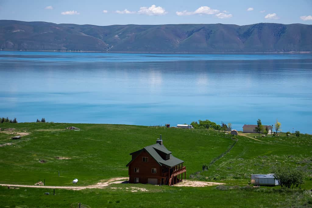
Bear Lake is about an hour away from Franklin, Idaho’s oldest town started in 1860 by Mormon pioneers.
©Chase-Karli Willden/Shutterstock.com
Where is Franklin, Idaho Located on a Map?
Kaskaskia, Illinois
Kaskaskia, Illinois, was founded in 1703 by French explorers and traders. At the time, it was part of a region called New France. Eventually, it became an important location for fur trading. Because Kaskaskia sits on the Mississippi River, it was an important location for transportation and trade between French settlements. At one point, Kaskaskia served as the capital of the French Illinois Territory, and later as the capital of the British Illinois County. Kaskaskia also previously served as Illinois’ state capital. The population of Kaskaskia peaked during the 18th century when there were about 7,000 residents. Today, very few people live in Kaskaskia. The most recent count showed about 17 residents in the area.
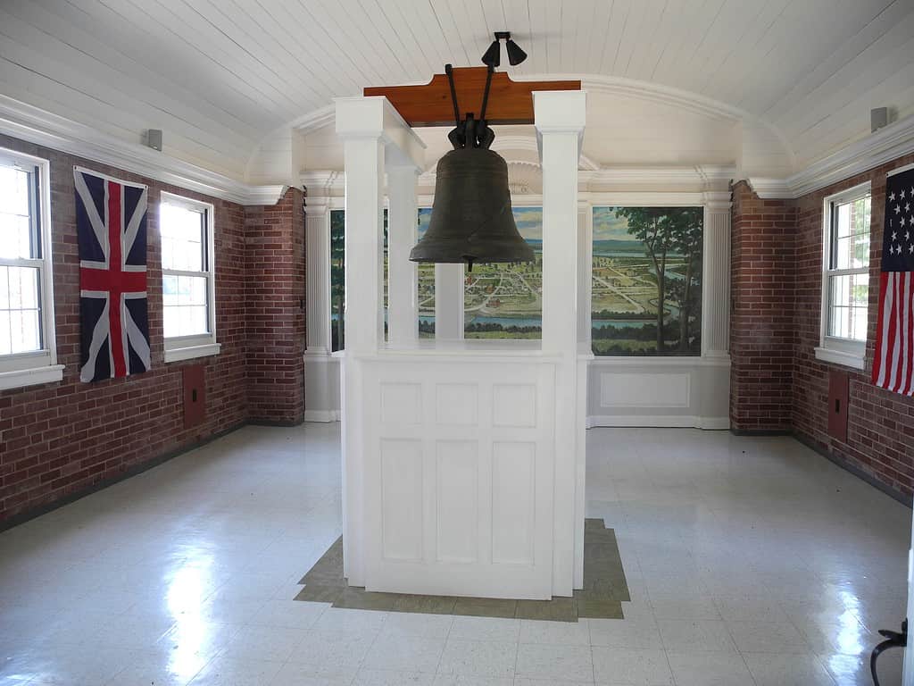
This bell, known as The Liberty Bell of the West, was rung in Kaskaskia to celebrate its liberation on July 4, 1778, from the British by American Colonel George Rogers Clark. It was cast in 1741 by Louis XV of France as a gift to the Catholic Church in Illinois.
©Kbh3rd / CC BY-SA – License
Where is Kaskaskia, Illinois Located on a Map?
Vincennes, Indiana
Vincennes, India, was founded by French fur traders and settlers who arrived in 1731. Originally, the town was named “Poste Vincennes” to honor a French military officer named Francois-Marie Bissot, Sieur de Vincennes, who helped establish the trading post. The town was the capital of the French territory and still has several important historic sites. Today, about 16,600 people live in Vincennes.
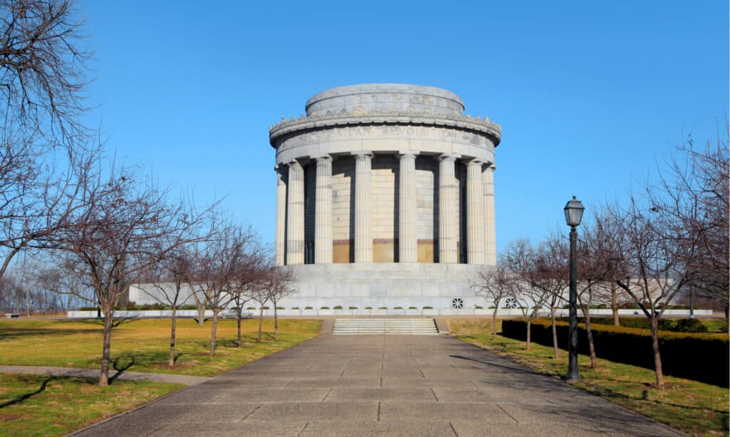
The George Rogers Clark National Historical Park is in Vincennes, Indiana.
©SNEHIT PHOTO/Shutterstock.com
Where is Vincennes, Indiana Located on a Map?
Dubuque, Iowa
Dubuque, Iowa, began in 1833 with the arrival of Julien Dubuque, a French-Canadian fur trader. At the time, Dubuque was established in order to support lead mining in the surrounding region. The opportunity to mine attracted settlers who came to work, and the area became an important trading hub due to its strategic location by the Mississippi River. Dubuque had an important role in the move of pioneers to the Midwest and further into the western parts of what is now called the United States. Today, about 60,000 inhabit Dubuque.
Julien Dubuque Bridge is in Dubuque, Iowa, named for a French-Canadian fur trader.
©Wirestock Creators/Shutterstock.com
Where is Dubuque, Iowa Located on a Map?
Fort Leavenworth, Kansas
Fort Leavenworth, in Kansas, was established as a United States Army post in 1827. This fort started to protect traders and settlers traveling to the western frontier and serve as a military operations hub. It developed to be an important logistics and military administration location to protect American interests. Today, Fort Leavenworth is still an active military fort and has many military institutions and museums preserving American history. About 82,184 call Fort Leavenworth County home.
Fort Leavenworth, Kansas was established in 1827.
©Ralph Eshelman/Shutterstock.com
Where is Fort Leavenworth, Kansas Located on a Map?
Harrodsburg, Kentucky
Settlers established Harrodsburg, Kentucky in 1744 as the first permanent settlement in the state. It was named after James Harrod, an explorer who led a group of people to the region in early 1744. They established Fort Harrod, and the nearby Harrodsburg, as a military outpost and center for the surrounding agricultural land. Today, about 9,000 people live in Harrodsburg.
Harrodsburg, Kentucky, was the state’s first permanent settlement.
©Danita Delimont/Shutterstock.com
Where is Harrodsburg, Kentucky Located on a Map?
Natchitoches, Louisiana
Natchitoches, Louisiana, is the oldest permanent settlement in the Louisiana Purchase territory. It was started in 1714 by French explorers, who built a trading post at a strategic location between the French colonies of Louisiana and New Spain, which is now present-day Mexico. Natchitoches eventually became a major agricultural center, where cotton and other agricultural products significantly shaped the local economy. Today, about 17,500 people live in Natchitoches.
Natchitoches, Louisiana is the oldest permanent settlement in the Louisiana Purchase territory.
©Rita Robinson/Shutterstock.com
Where is Natchitoches, Louisiana Located on a Map?
Kittery, Maine
Kittery, Maine, was established in the 1620s by English settlers. The town was formally incorporated in 1647. At the time, it was one of the first English settlements in the area. As a town situated on the Piscataqua River, Kittery became an important location for shipbuilding, trade, and fishing. The Portsmouth Naval Shipyard, which is located in Kittery, has had an important part in the United States Navy since it was started in 1800. This coastal community has a charming waterfront and a thriving cultural scene. Kittery is the most southern town in the state and attracts many tourists. Today, about 10,000 people inhabit Kittery.
Portsmouth Harbor is in Kittery, the oldest town in Maine.
©Wangkun Jia/Shutterstock.com
Where is Kittery, Maine Located on a Map?
St. Mary’s City, Maryland
St. Mary’s City, Maryland, was founded in 1634 by English settlers. In 1634, St. Mary’s City was started as the first colonial town in the Province of Maryland, and so had an important role in the religious, political, and economic development of the area. The settlement attracted many European settlers, including Catholics seeking safety from religious persecution. Though St. Mary’s City was initially the capital and seat of government for the Maryland colony, the capital eventually moved to the city of Annapolis in 1695. St. Mary’s City then declined in importance, eventually being abandoned. However, in the mid-20th century, efforts began to reveal the significance of the area. Visitors can see reconstructed buildings or visit the local St. Mary’s College of Maryland, which is located in the area. Not counting the residents of this liberal arts college, about 1,000 residents live in St. Mary’s City today.
Historic St. Mary’s City, the original capital of Maryland, attracted many European settlers, including Catholics seeking safety from religious persecution.
©tinakita/Shutterstock.com
Where is St. Mary’s City, Maryland Located on a Map?
Plymouth, Massachusetts
Plymouth, Massachusetts, was famously founded in 1620 by the English settlers commonly known as the Pilgrims, who came to the United States seeking religious freedom. They created the Plymouth Colony, which became one of the most successful English colonies. Today, about 60,000 inhabit this coastal town, though many visitors also come to commemorate the arrival of the Pilgrims over 400 years ago.
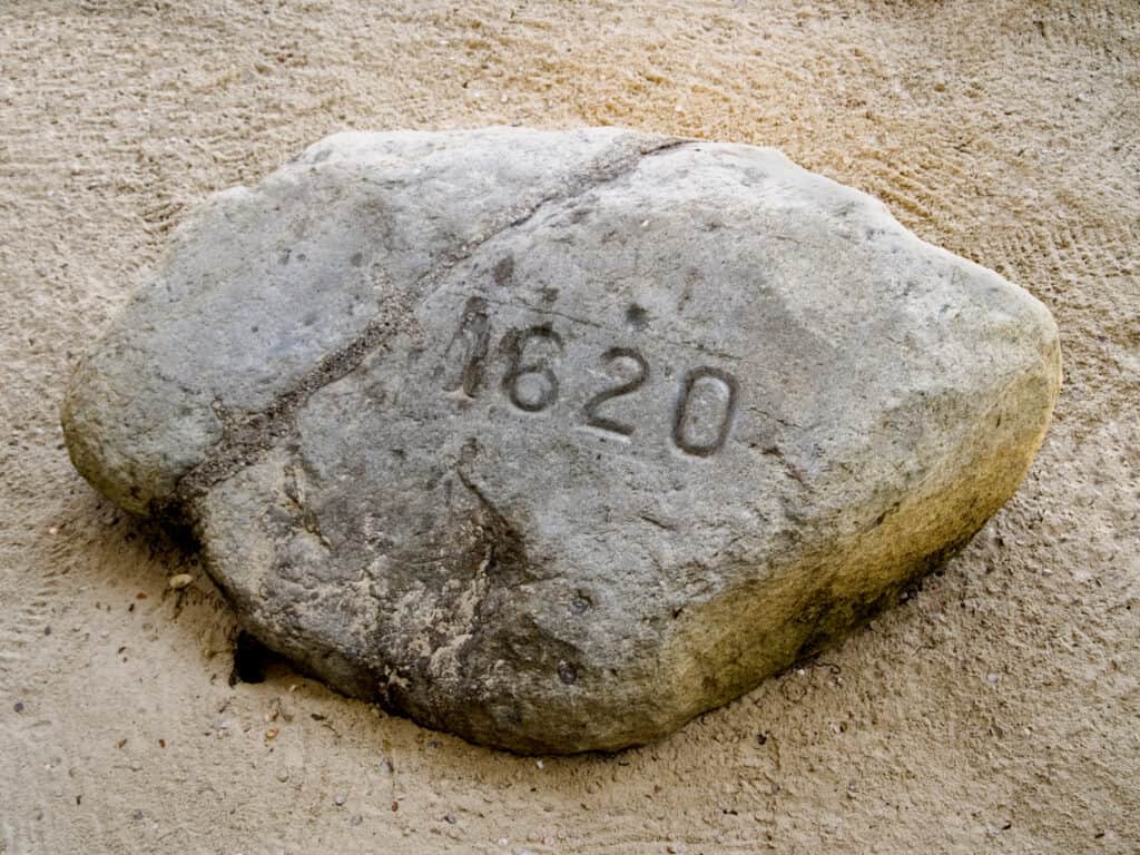
The famous Plymouth Rock, where the Mayflower supposedly landed in the New World, is in Plymouth, Massachusetts, the oldest town in the state.
©Suchan/Shutterstock.com
Where is Plymouth, Massachusetts Located on a Map?
Sault Ste. Marie, Michigan
Sault Ste. Marie, Michigan, was established by French traders and missionaries in 1668. The original settlement is located near St. Mary’s River, which connects Lake Superior and Lake Huron. Located near the rapids, explorers faced a significant obstacle to navigation in the area. The French settlers established “Sault de Sainte Marie” to make trade possible between the two Great Lakes. It became part of the U.S. with the establishment of the Northwest Territory in 1787. Today, about 13,000 people live in Sault Ste. Marie, making it the second most-populated city in Michigan’s Upper Peninsula, after Marquette.
International Bridge is in Sault Ste. Marie, Michigan’s oldest town established in 1668.
©John McCormick/Shutterstock.com
Where is Sault Ste. Marie, Michigan Located on a Map?
Mendota, Minnesota
Mendota, Minnesota was founded in 1852. The city sits at the confluence of the Mississippi and Minnesota Rivers, where the American Fur Company established it as a fur trading post. The settlement served an important role in fur trading and westward expansion, including the development of the state of Minnesota as a whole. Today, Mendota is a small community of only about 180 people.
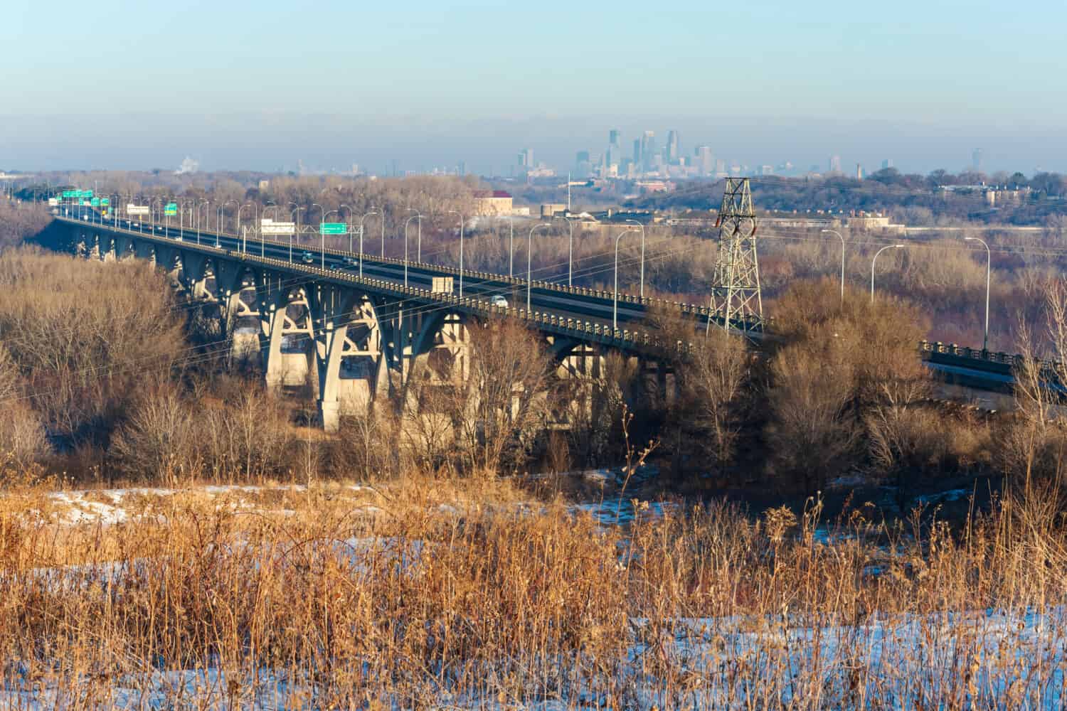
Mendota Bridge is in Mendota, Minnesota, the state’s oldest town founded in 1852.
©Joe Ferrer/Shutterstock.com
Where is Mendota, Minnesota Located on a Map?
Natchez, Mississippi
French settlers founded Natchez, Mississippi in 1716. This founding made it one of the oldest European-founded settlements situated along the Mississippi River. The area that is now Natchez was first inhabited by native peoples, including the Natchez. The French initially established Fort Rosalie in 1716 as a trading and military outpost. As the settlement grew, its residents eventually renamed it “Natchez,” after the local indigenous people. The city became a significant location along the Mississippi as a hub for shipping. Natchez became part of the United States with the Louisiana Purchase in 1803. Today, about 13,800 people inhabit Natchez.
Natchez was founded on the Mississippi River in 1716.
©HixnHix/Shutterstock.com
Where is Natchez, Mississippi Located on a Map?
Ste. Genevieve, Missouri
French colonists founded Ste. Genevieve, Missouri in 1737. The town they created sat on the west bank of the Mississippi River. The settlement became an important trading location and agricultural center, in close proximity to lead mining and farming. Today, about 4,500 people inhabit Ste. Genevieve.
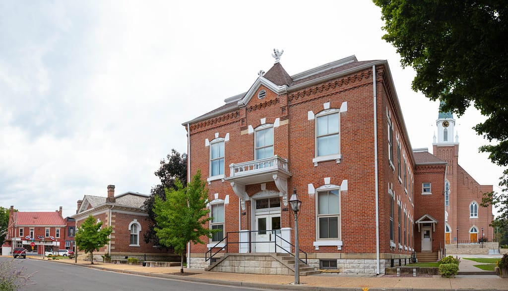
The County Clerk building is in Ste. Genevieve, Missouri.
©Roberto Galan/Shutterstock.com
Where is Ste. Genevieve, Missouri Located on a Map?
Fort Benton, Montana
The American Fur Company founded Fort Benton, Montana in 1846. This city sits on the banks of the Missouri River and was important to both transportation and trading. It gained the reputation of being the “birthplace of Montana,” as it inhabited an important role of helping to transport goods to pioneers who moved into the American West. Fort Benton is the oldest continuously occupied settlement in Montana. Today, only about 1,500 people live in this small rural town.
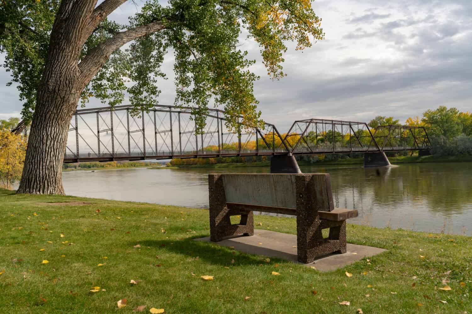
Fort Benton, Montana was founded in 1846.
©Urban Images/Shutterstock.com
Where is Fort Benton, Montana Located on a Map?
Bellevue, Nebraska
Bellevue, Nebraska, began as a fur trading post started by the Missouri Fur Company in 1822. This settlement is considered the oldest continuously-populated town in Nebraska. In the 1800s, many pioneers stopped in Bellevue. It served as a key location for both the Oregon Trail and Mormon Pioneer Trail. Many fur traders also came to Bellevue to trade and sell their goods down the Missouri River. Today, the city is a suburb of Omaha. About 64,000 people call Bellevue home.
Bellevue, Nebraska was a key location for both the Oregon Trail and Mormon Pioneer Trail.
©Jacob Boomsma/Shutterstock.com
Where is Bellevue, Nebraska Located on a Map?
Genoa, Nevada
Genoa, Nevada, began in 1851 as the first settlement in what is now Nevada. This town became a critical stop along the way to California for miners who moved west during the California Gold Rush. Genoa was the first capital of Nevada and had an important role in the early economic and cultural development of the state. Today, the settlement is an unincorporated town in the Carson River Valley, about 42 miles south of Reno. Fewer than 1,000 people live in Genoa.
Genoa, Nevada in the Carson Valley was the state’s first capital.
©Gchapel/Shutterstock.com
Where is Genoa, Nevada Located on a Map?
Dover, New Hampshire
Dover, New Hampshire, is the oldest city in the Granite State. English colonists settled Dover in 1623. They formed the settlement along the Cocheco River. Dover had an important part in fishing, trade, and the shipbuilding industry in colonial New England. Today, about 33,000 people call the picturesque city of Dover home.
Dover is the oldest town in New Hampshire.
©Loud Canvas/Shutterstock.com
Where is Dover, New Hampshire Located on a Map?
Bergen, New Jersey
Dutch colonists settled in what is now Bergen, New Jersey in 1660. When they founded Bergen, it became the first permanent European-established settlement in New Jersey. At the time, it was the capital of the colony of New Netherland. When the British took control in 1664, it became known as Bergen. The town played an important role in the trading and agriculture of New Jersey and is today part of modern Jersey City. Jersey City itself is home to about 284,000 people today.
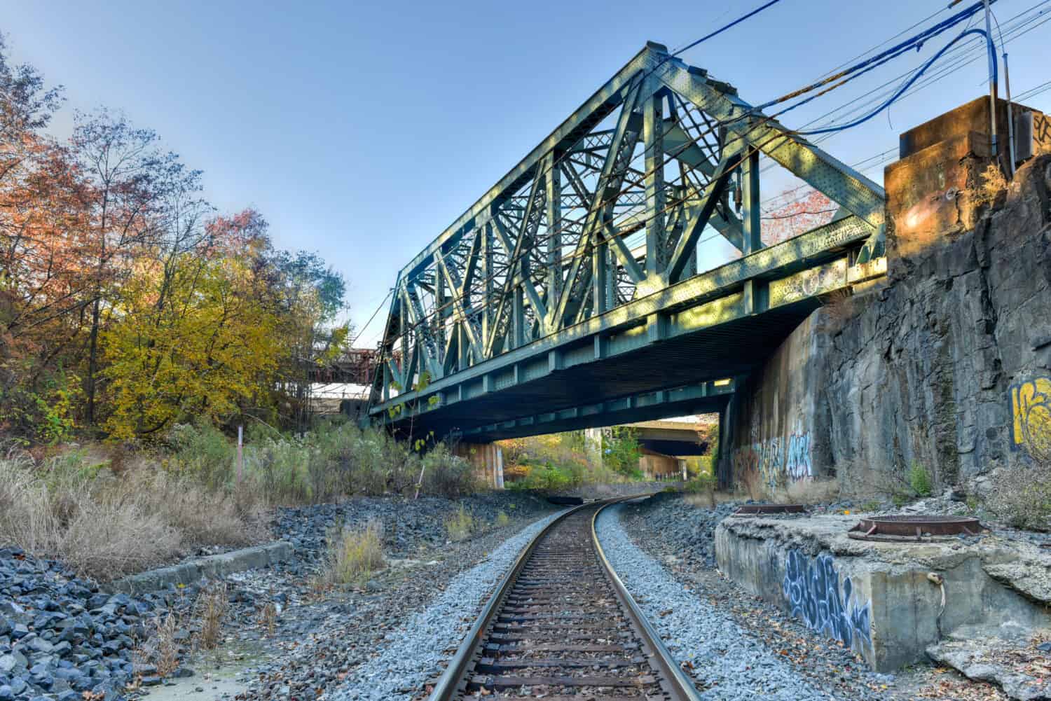
Train tracks run beneath the Bergen Arches of Jersey City in New Jersey.
©Felix Lipov/Shutterstock.com
Where is Bergen, New Jersey Located on a Map?
Santa Fe, New Mexico
Santa Fe, New Mexico, began in 1610 with the establishment of the Spanish colonists in the area. These origins make it not only the oldest city in New Mexico but the oldest existing state capital in the United States. First serving as the capital of the Spanish Santa Fe de Nuevo México, then of the Mexican province of Santa Fe, it is now the state capital of modern New Mexico and a rich center for culture and history. About 88,000 people live in Santa Fe today.
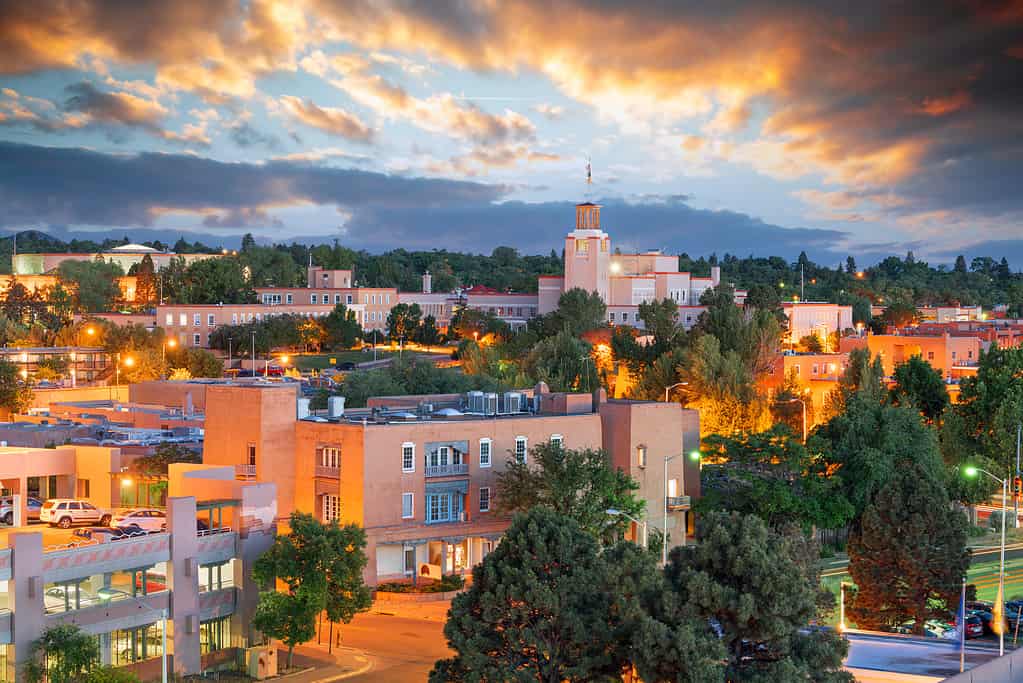
Santa Fe is the oldest town in New Mexico.
©iStock.com/Sean Pavone
Where is Santa Fe, New Mexico Located on a Map?
Albany, New York
Dutch colonists founded Albany, New York as Fort Nassau in 1614. This Hudson River trading post would eventually become an important center for the New York colony and serve as a key location in the Revolutionary War. Afterward, it became a key location for natural history, museums, and culture. Today, Albany is the capital of New York and is home to about 98,000 people.
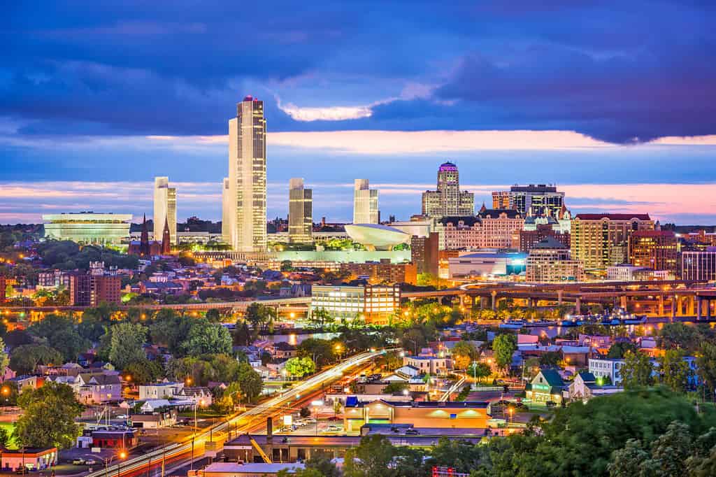
Albany, New York was founded as Fort Nassau in 1614.
©Sean Pavone/Shutterstock.com
Where is Albany, New York Located on a Map?
Bath, North Carolina
Bath, North Carolina, is the oldest town in North Carolina. Starting back in 1705, Bath began as an important port town on the Pamlico River. Eventually, Bath became the capital of the Province of North Carolina and was a center for trade and government. Many traders sold fur, tobacco, and other goods in this port of entry. Today, this tiny town is home to only about 245 people.
Bonner’s Point is in Bath, North Carolina, the state’s oldest town.
©David Byron Keener/Shutterstock.com
Where is Bath, North Carolina Located on a Map?
Pembina, North Dakota
Pembina, North Dakota, was founded in 1780 by French fur traders. At the time, it was an important trading post in the region and helped the Red River Valley area develop into a key agricultural area. Today, only about 500 people inhabit the rural town of Pembina.
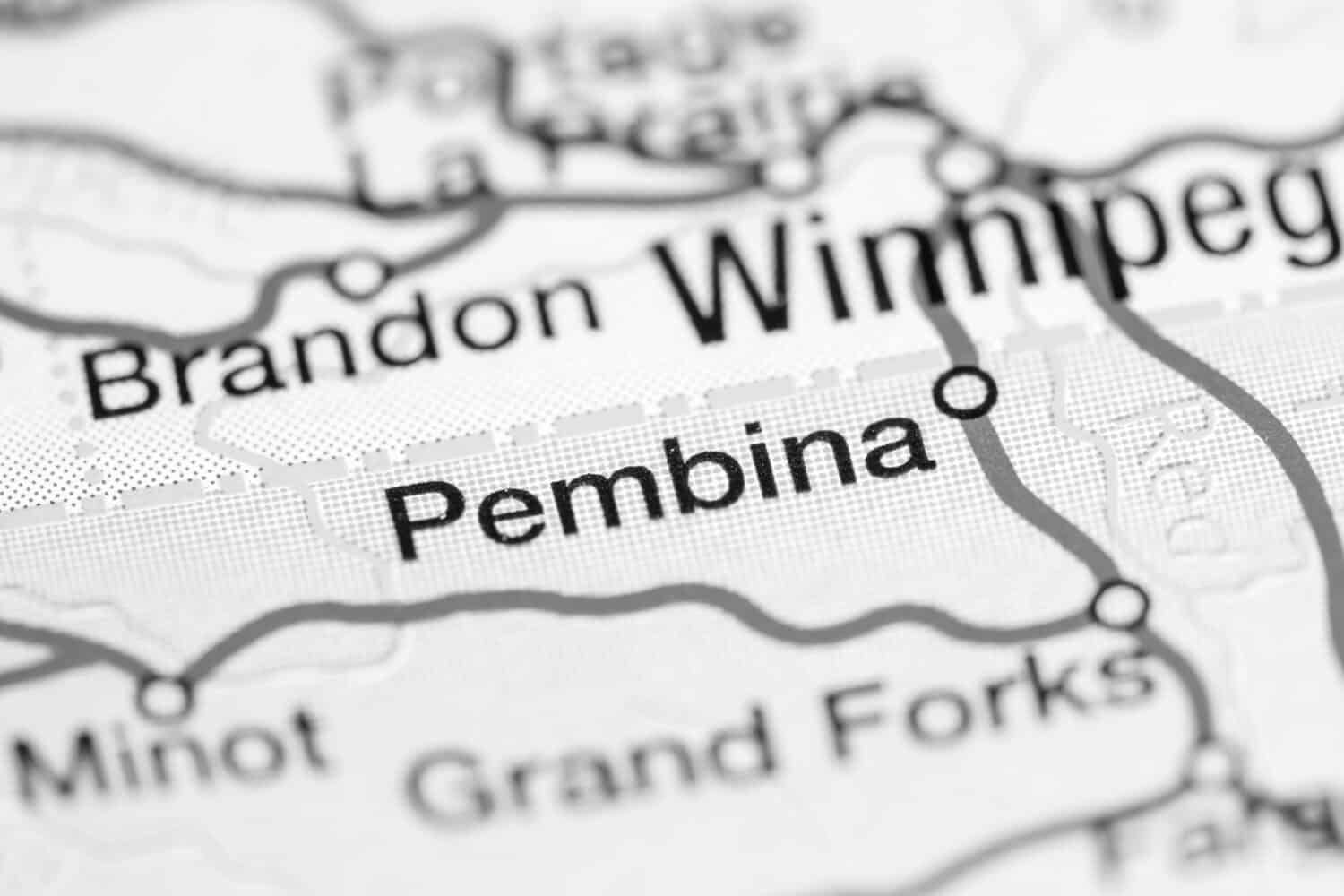
Pembina, North Dakota, sits on the border with Canada.
©SevenMaps/Shutterstock.com
Where is Pembina, North Dakota Located on a Map?
Marietta, Ohio
People founded Marietta, Ohio in 1788, giving the town a unique history. A group of American Revolutionary War veterans started the settlement, naming it “Marietta” after Marie Antoinette, the queen of France. Marietta became the first permanent settlement of the Northwest Territory, serving as an important stop in the westward expansion of the United States. Today, about 13,400 people live in this southeastern Ohio town.
Marietta, Ohio was named after Marie Antoinette, the former queen of France.
©iStock.com/Wendy Van
Where is Marietta, Ohio Located on a Map?
Guthrie, Oklahoma
Guthrie, Oklahoma began in 1887 during the Land Run of 1889. At the time, thousands of settlers were rushing west to claim land in the Oklahoma Territory. Guthrie grew quickly to become a center for business, government, and culture. It was the first state capital of the Oklahoma Territory, though it eventually lost its status when the state capital moved to Oklahoma City in 1910. Today, about 11,000 people live in Guthrie.

Guthrie, Oklahoma began in 1887.
©Kit Leong/Shutterstock.com
Where is Guthrie, Oklahoma Located on a Map?
Astoria, Oregon
In 1811, the Pacific Fur Company owned by John Jacob Astor founded the town of Astoria, Oregon. This makes Astoria the oldest American settlement to the west of the Rockies. Named after the company’s founder, Astoria was an important location for fur trading, fishing, and shipping. Today, about 10,000 people live in this riverside town, located on the Columbia River close to the Pacific Ocean.
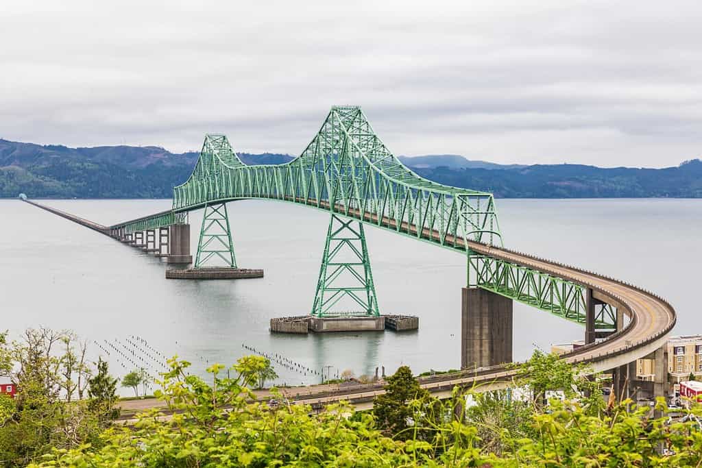
Astoria, Oregon is the oldest American settlement to the west of the Rockies.
©Danita Delimont/Shutterstock.com
Where is Astoria, Oregon Located on a Map?
Chester, Pennsylvania
Famous Quaker William Penn founded Chester, Pennsylvania in 1682. Chester served as an important port on the Delaware River, a center of commerce, and an important place in the colonial development of Pennsylvania. It became known for its shipbuilding, textiles, and manufacturing. This valley city sits between Philadelphia and Wilmington, Delaware, and has about 32,000 residents.

Chester County, Pennsylvania was started in 1682 by Quaker William Penn.
©Jeremy Tyree/Shutterstock.com
Where is Chester, Pennsylvania Located on a Map?
Providence, Rhode Island
A man named Roger Williams established Providence, Rhode Island in 1636. Williams began Rhode Island to be a place of religious freedom, where he, and others, could escape persecution for their faith. He named the town “Providence” to commemorate his belief that God had led him there. Providence eventually became an important colonial city and trading location. Providence is the capital of Rhode Island and the state’s largest city. Today, about 190,000 people live in Providence.
Providence is the oldest town in Rhode Island.
©Allan Wood Photography/Shutterstock.com
Where is Providence, Rhode Island Located on a Map?
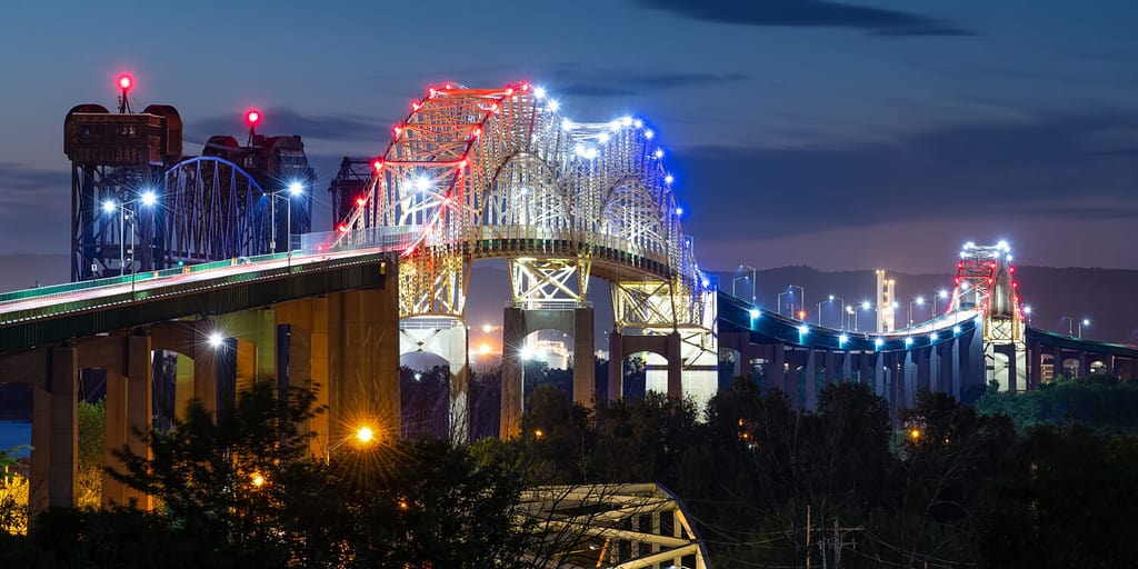
Charleston, South Carolina
English colonists founded Charleston, South Carolina, in 1670. It is one of the oldest cities in the U.S. and was a vital cultural center and port. It also served as an important military location during the American Revolutionary War and the Civil War. Today, about 151,000 people live in Charleston.
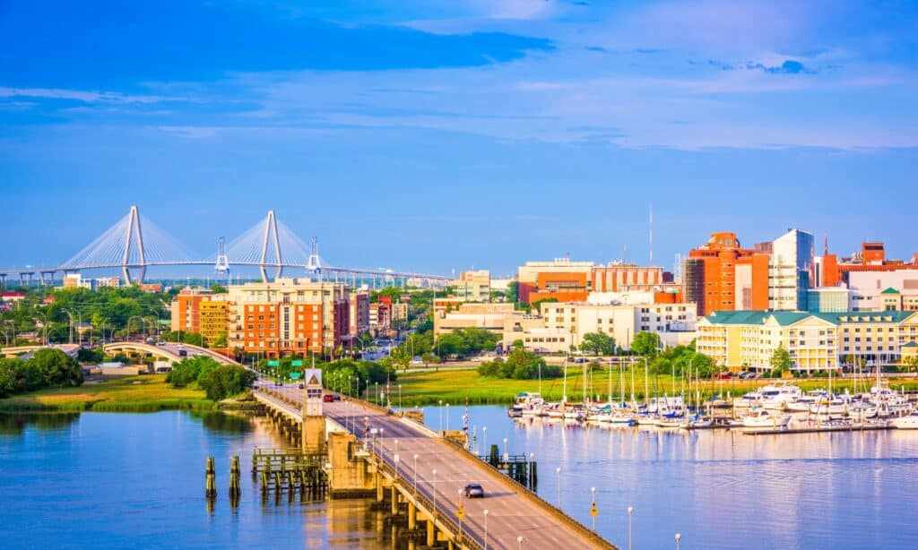
Charleston, South Carolina was founded in 1670.
©iStock.com/Sean Pavone
Where is Charleston, South Carolina Located on a Map?
Fort Pierre, South Dakota
Fort Pierre began as a fur trading post started by the American Fur Company in 1817. This site became an important hub for explorers, fur trappers, and settlers moving west. In fact, Fort Pierre had a key role in the expansion into the Great Plains region. Today, this small town has a population of about 2,100.
The Fort Pierre area of South Dakota was a hub for explorers, fur trappers, and settlers moving west.
©Jacob Boomsma/Shutterstock.com
Where is Fort Pierre, South Dakota Located on a Map?
Jonesborough, Tennessee
Jonesborough, Tennessee, is the oldest town in Tennessee. It was founded in 1779 as the county seat and center of government for Washington County, where Jonesborough helped develop the Southwest Territory at the end of the 1700s. It was also an important stop along the route for pioneers making the trek west. Today, about 6,000 people live in the southeastern Tennessee town of Jonesborough.
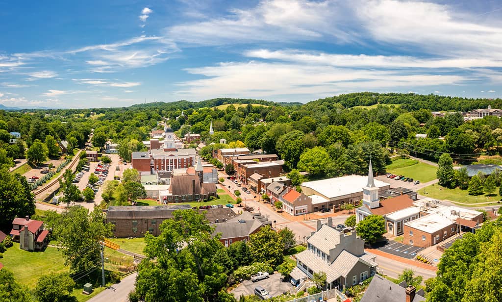
Tennessee’s oldest town is Jonesborough.
©Mihai_Andritoiu/Shutterstock.com
Where is Jonesborough, Tennessee Located on a Map?
Nacogdoches, Texas
Nacogdoches, Texas, was originally settled during the Spanish colonial period as a mission and fort in 1779. The town was originally founded as “Nuestra Señora de Guadalupe de los Nacogdoches.” This Spanish settlement was an important location for trade and government and has a long history that includes influences from Spanish, Mexican, white European, and native cultures. Today, about 32,000 people live in present-day Nacogdoches.
Nacogdoches is the oldest town in Texas.
©iStock.com/Roberto Galan
Where is Nacogdoches, Texas Located on a Map?
Fillmore, Utah
Settlers started Fillmore, Utah in 1851. At the time, it served as the territorial capital of Utah. Named after President Millard Fillmore, the town started as a planned agricultural community. Sadly, once the Utah state capital transferred to Salt Lake City, Fillmore’s growth declined. Today, this small town is home to only about 2,600 people.
Fillmore was started in 1851 as the territorial capital of Utah.
©Jeremy Christensen/Shutterstock.com
Where is Fillmore, Utah Located on a Map?
Bennington, Vermont
Bennington, Vermont, was chartered in 1749, but the start of the town began in the 1760s with the arrival of settlers seeking to build homes and farms in this part of New England. English settlers started farms and mills, using the area’s abundant water resources and fertile land. Over time, Bennington became a center for commerce in the area and played an important role in the Revolutionary War. Today, about 15,500 people live in this quaint New England town.
Bennington, Vermont was chartered in 1749.
©Bob Pool/Shutterstock.com
Where is Bennington, Vermont Located on a Map?
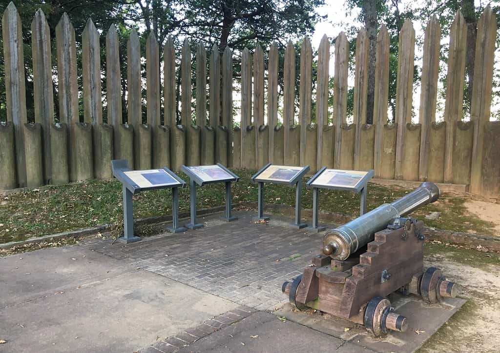
Jamestown, Virginia
The founding of Jamestown, Virginia, in 1607 played a crucial role in the colonial history of the United States. Jamestown is where English settlers established the first permanent settlement in North America. Initially, people from the Virginia Company founded Jamestown. It became the capital of the Virginia Colony. Many iconic and important events in American history took place in Jamestown, and this area is part of the Historic Triangle (along with Williamsburg and Yorktown). Today, Jamestown is home to about 15,000 people.
Jamestown, Virginia was founded in 1607.
©John Couture/Shutterstock.com
Where is Jamestown, Virginia Located on a Map?
Nisqually, Washington
Nisqually, Washington, was home to the Nisqually native people for thousands of years before European colonization. In 1833, the Hudson Bay Company established a trading post at Fort Nisqually. This began a key period of interaction between European settlers and the Nisqually tribe. However, Nisqually is a unique location in that the Nisqually people have a sovereign tribal government operating in the region. The Nisqually Reservation is a federally-recognized reservation in Thurston County, Washington. About 600 people live there.
Nisqually River in Mount Rainier National Park in Washington State. In 1833, the Hudson Bay Company established a trading post at Fort Nisqually.
©SchnepfDesign/Shutterstock.com
Where is Nisqually, Washington Located on a Map?
Shepherdstown, West Virginia
Shepherdstown, West Virginia, was founded in 1762. This makes it the oldest town in West Virginia. It was founded in 1762. Originally known as Mecklenburg, the town was eventually renamed to honor its founder, Thomas Shepherd. This town played a role in many historical events throughout American history and has long had a vibrant cultural scene thanks to Shepherd University, founded in 1871. Approximately 1,400 people live in Shepherdstown today.
This historic building is in Shepherdstown, West Virginia’s oldest city.
©Jon Bilous/Shutterstock.com
Where is Shepherdstown, West Virginia Located on a Map?
Green Bay, Wisconsin
Green Bay, Wisconsin, was settled by French explorers and traders. Many believe that the first French explorer arrived in the area in 1634. However, permanent settlement began in 1671 with a trading post known as La Baye or La Baie des Puants. After that, it became an important economic center. Green Bay came under American control as part of the Michigan territory, eventually separating into the separate territory of Wisconsin in 1836. Today, about 107,000 people live in Green Bay.
Green Bay, Wisconsin is on Lake Michigan.
©Jacob Boomsma/Shutterstock.com
Where is Green Bay, Wisconsin Located on a Map?
Fort Laramie, Wyoming
Fort Laramie, Wyoming, began as a fur trading post started by the American Fur Company in 1834. Over time, it became a vital military post that played a big role in westward expansion into the western parts of the United States. Fort Laramie had an important role in the development of the western U.S. and the movement of pioneers along the Oregon Trail, as well as in several official meetings between U.S. actors and native peoples. Only about 200 people live in this tiny town.
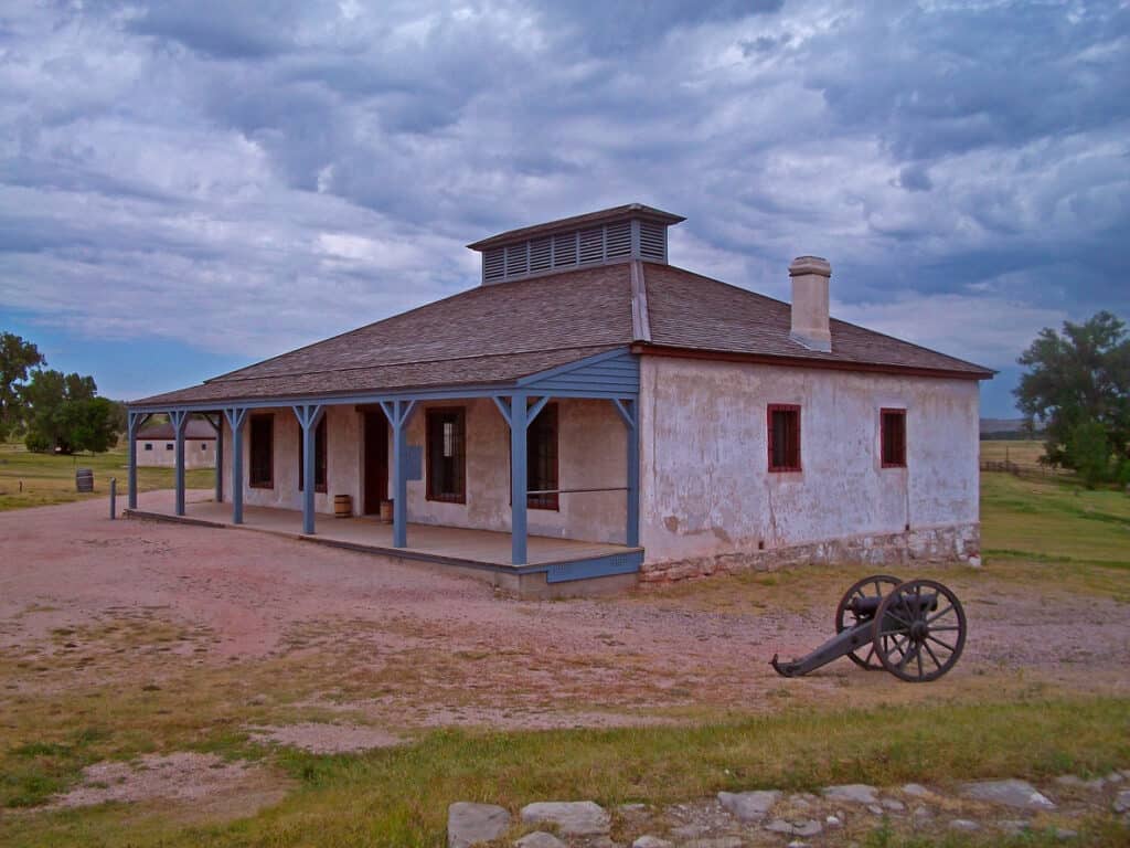
Fort Laramie National Historic Site is in Wyoming.
©iStock.com/rozdemir01
Where is Fort Laramie, Wyoming Located on a Map?
Oldest Town in Each of the U.S. States
| State | Oldest Town | Year Founded |
|---|---|---|
| Alabama | Mobile | 1702 |
| Alaska | Kodiak | 1792 |
| Arizona | Tucson | 1775 |
| Arkansas | Arkansas Post | 1686 |
| California | San Diego | 1769 |
| Colorado | San Luis | 1851 |
| Connecticut | Windsor | 1633 |
| Delaware | Lewes | 1631 |
| Florida | St. Augustine | 1565 |
| Georgia | Savannah | 1733 |
| Hawaii | Honolulu | 1795 |
| Idaho | Franklin | 1860 |
| Illinois | Kaskaskia | 1703 |
| Indiana | Vincennes | 1732 |
| Iowa | Dubuque | 1788 |
| Kansas | Fort Leavenworth | 1827 |
| Kentucky | Harrodsburg | 1774 |
| Louisiana | Natchitoches | 1714 |
| Maine | Kittery | 1647 |
| Maryland | St. Mary’s City | 1634 |
| Massachusetts | Plymouth | 1620 |
| Michigan | Sault Ste. Marie | 1668 |
| Minnesota | Mendota | 1824 |
| Mississippi | Natchez | 1716 |
| Missouri | St. Genevieve | 1735 |
| Montana | Fort Benton | 1846 |
| Nebraska | Bellevue | 1822 |
| Nevada | Genoa | 1851 |
| New Hampshire | Dover | 1623 |
| New Jersey | Bergen | 1660 |
| New Mexico | Santa Fe | 1607 |
| New York | Albany | 1614 |
| North Carolina | Bath | 1705 |
| North Dakota | Pembina | 1797 |
| Ohio | Marietta | 1788 |
| Oklahoma | Guthrie | 1887 |
| Oregon | Astoria | 1811 |
| Pennsylvania | Chester | 1648 |
| Rhode Island | Providence | 1636 |
| South Carolina | Charleston | 1670 |
| South Dakota | Fort Pierre | 1832 |
| Tennessee | Jonesborough | 1779 |
| Texas | Nacogdoches | 1779 |
| Utah | Fillmore | 1851 |
| Vermont | Bennington | 1761 |
| Virginia | Jamestown | 1607 |
| Washington | Nisqually | 1833 |
| West Virginia | Shepherdstown | 1762 |
| Wisconsin | Green Bay | 1634 |
| Wyoming | Fort Laramie | 1834 |
The photo featured at the top of this post is © Ebyabe / CC BY-SA 3.0 – License / Original


How to Add Us to Google News


Thank you for reading! Have some feedback for us? Contact the AZ Animals editorial team.