
The Mississippi River has been around for a really long time. It’s outlived dinosaurs, giant marine reptiles, and many other incredible creatures that have been lost to extinction. However, when one has lived for so long, it’s almost certain that some parts of one’s history would have been tampered with.
Since knowledge was mostly passed down verbally before humans got the hang of documentation, it’s quite possible that some details we know as facts are simply wrong. This article dives back in history, from the river’s formation, tens of millions of years ago, to our current year, 2022. Get ready to discover incredible details about the Mississippi River’s history.
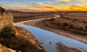
70 Million Years Ago
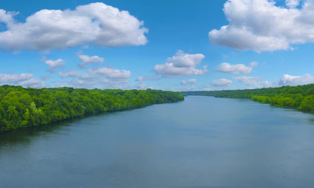
The Mississippi began to flow more than 70 million years ago.
©Milen Mkv/Shutterstock.com
Previously, most scientists believed that The Mississippi River was formed about 20 million years ago, but a discovery in 2018 proved otherwise. Sally Potter-McIntyre and her team studied zircon fragments found in the river in Illinois by team member Jeremy R. Breeden. Their studies garnered national attention and proved that the river is much older than that. They approximate that it started to flow more than 70 million years ago.
The 1500s
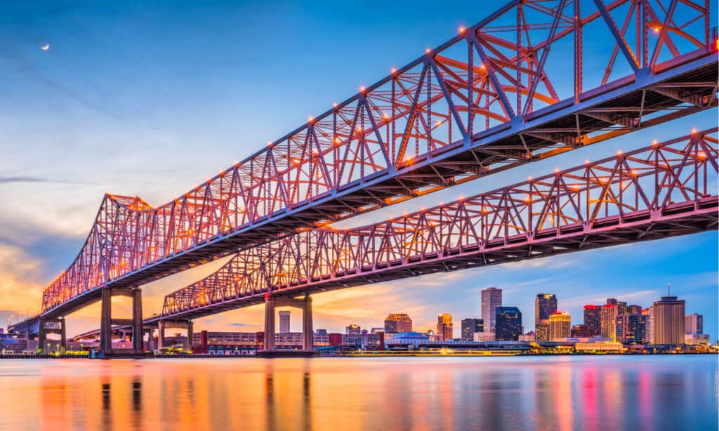
The first European to reach the Mississippi was Alonso
Álvarez.
©Sean Pavone/Shutterstock.com
In 1519, Alonso Álvarez de Piñeda, a Spanish cartographer and conquistador, became the first European on record to reach the Mississippi. Why is this relevant? Well, many other record books tell this tale a little differently. Twenty-two years later, another European, Hernando de Soto, arrived the Mississippi on the 8th of May. He named the river “Río del Espíritu Santo”, which translates to “River of the Holy Spirit”.
However, when a popular American artist decided to paint a picture of the discovery of the river, he painted Hernando de Soto and not Alonso Álvarez de Piñeda. Piñeda went on to be more significant in modern-day history by sailing around the coastline, which enabled him to draw a map of the Gulf Coast. This map is still being used today.
The 1600s
In the 1600s, more and more people decided to have a go at naming and owning the Mississippi. The first on record was an unnamed Sioux Indian, who named the river “Ne Tongo”, which meant “Big River” in the Sioux language. But as you can tell, that didn’t stick. In 1682, three Frenchmen; Henri de Tonti, René-Robert Cavelier, and Sieur de La Salle, decided to claim the river for France.
They named it the Colbert River in honor of the La Louisiane region and Jean-Baptiste Colbert. However, by 1699, the river was lost/ forgotten until another French soldier, Pierre Le Moyne d’Iberville, rediscovered the river’s mouth.
He named the River St. Louis River” in honor of King Louis XIV, the French king. But like others before him, he didn’t establish a settlement and solidify the claims. Not much later, two French explorers, Jacques Marquette and Louis Jolliet, began to explore different parts of the Mississippi and the Mississippi valley.
The 1700s
By the 1700s, humanity was feeling a little more daring, so the French decided to tap into the possibility of monetizing the river for transportation and founded the city of Nouvelle-Orléans on the Mississippi delta.
A delta is a wetland created by a river. When rivers flow at the speed they do, they carry along sediments such as sand and other solid matter. However, as the river approaches its mouth from which it pours into the sea or ocean, it starts to slow down. Due to the reduced speed of the currents, the sediments begin to drop to the river’s bottom.
This sediment mound slowly begins to grow until it piles and creates wetland. The river will continue to flow around the obstruction of the wetland it created for itself, thus continuing to feed the mound with sediments as it flows out of its mouth. If the river ceases to flow around the delta for any reason, the surrounding water will slowly but steadily cover the delta.
The city was founded on the delta, about 93 miles upstream from the river’s mouth. It was built on a ridge that ran along the current channel of the Mississippi. Since it was a wetland, the land wasn’t so steady, and floods often wreaked havoc on land and property. So, the colony’s commander began the construction of a levee. The levees were mounds of dirt barriers to keep the water from creeping into living space. And so, for the first time since its discovery, humans decided to tame the Mississippi.
In 1758, Antoine-Simon le Page du Pratz, a French historian, published an article explaining that the Native Americans had originally called the river “Mechasipi,” which meant “the ancient father of waters.” The French took to this idea, and the Mechasipi changed into Mississippi over time.
Finally, in the later parts of the 1700s, a group called the “The Maroons”, made up of runaway slaves, set up an armed camp on the delta, east of Nouvelle-Orléans. They picked a marshland that could only be accessed by wading through water up to chest level. They lived close to the Filipino immigrants who made a living selling shrimp.
The 1800s
Americans took ownership of the Mississippi in the 1800s.
©iStock.com/Willard
Work was still ongoing on building levees that stretched across the entire city. In 1803, America purchased the western half of the Mississippi River basin from France, and the agreed price was less than 3 cents per acre. The city of Nouvelle-Orléans would soon be known as New Orleans.
In 1812, America defeated Britain at war and secured ownership of the Mississippi River. Americans then established the state of Louisiana, which encompassed New Orleans. But by the end of this era, a National Geographic note informed that an old Spanish magazine that had been at the river’s mouth had slowly begun to sink over the past 20 years.
The 1900s
By the 1900s, more than 150,000 people in over 200 communities were spread across the delta’s marshlands. Engineers began to close the gaps in the levee to fully secure the delta from the water and flooding. However, in the 1920s, oil was discovered beneath the marshes. Corporations fell over themselves to get a piece of the Louisiana land to make profits.
Native residents who couldn’t read English signed away their ownership, thinking they were confirming it. By 1940, it was noted that plantations by the riverbank were slumping into the water, and by 1950, the Mississippi was pouring into the Atchafalaya River. Engineers feared that the Mississippi would begin to shrink, so they installed a barrier to stop this.
By then, the state of Louisiana was beginning to lose more land. Corporations had dredged more than 9,300 miles of pipelines and 10 major canals in the river, which worsened the situation.
The 2000s
In the past 80 years, the state of Louisiana has lost 5,000 square miles of wetland. Consequently, the Louisiana government is attempting to fix the problem by opening a gap in the levee so that the river can continue to deposit sediments into the delta.
However, this decision has been highly criticized for several reasons. One of the major reasons is that the levees were built to stop flooding, and many fear that opening a gap in it will cause just that. Secondly, given the history between local landowners and corporations, it is easy to see why there is little trust.
Final Thoughts
It’s interesting to see how humans have interacted with the river since its discovery. One major lesson to be taken from this walk down the memory lane is that natural resources are not infinite. Consequently, it is important to actively fight for better laws that manage our limited gifts of nature.
Up Next…
- Is the Mississippi River America’s Most Endangered River?
- 14,000 Years Ago, the Mississippi River started to Form. Here’s What Happened Next
- What Lives At The Bottom of The Mississippi River?
The photo featured at the top of this post is © iStock.com/Jon Rehg

How to Add Us to Google News


Thank you for reading! Have some feedback for us? Contact the AZ Animals editorial team.