Introduction
Snowfall is a staple of a New York winter. Upstate New York experiences large amounts of snow paired with cold and long winters, but Downstate New York’s winter is cold, wet, and mild by comparison. Upstate New York can even receive up to 200 inches of snow!
Understanding Snowfall in New York
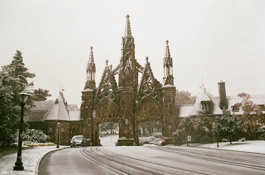
New York City averages a first inch of snowfall on December 24th.
©Connor Sullivan, CC BY-SA 3.0, via Wikimedia Commons – License
Snowfall is heavy in both mountainous regions of New York and areas of New York that border the Great Lakes. Regions that are further southwest or are close to the Atlantic Ocean do not receive as much snowfall. Two air masses affect climate in New York. Northwest air masses are cold and dry, while those from the southwest are warm and humid. Coastal nor’easters also come as a weather front to affect New York. In New York City, specifically, coastal nor’easters can increase average monthly snowfall, which typically ranges between three and 10 inches, to up to 20 inches.
The Great Lakes affect the amount of snowfall in New York. When cold air crosses over the lakes, it picks up warmth and moisture. When the air begins to rise, passing over higher elevations on land, precipitation is released. Most of the snow resulting from the Great Lakes falls on the Allegheny Plateau and Tug Hill and measures up to 24 inches per month. After the Great Lakes freeze over, snowfall decreases, as air masses do not pick up warmth and moisture from the ice. Lake Erie is susceptible to freezing earlier than Lake Ontario; snowfall near Lake Erie is likely to decrease during January, while snowfall near Lake Ontario continues into February.
Temperature in New York
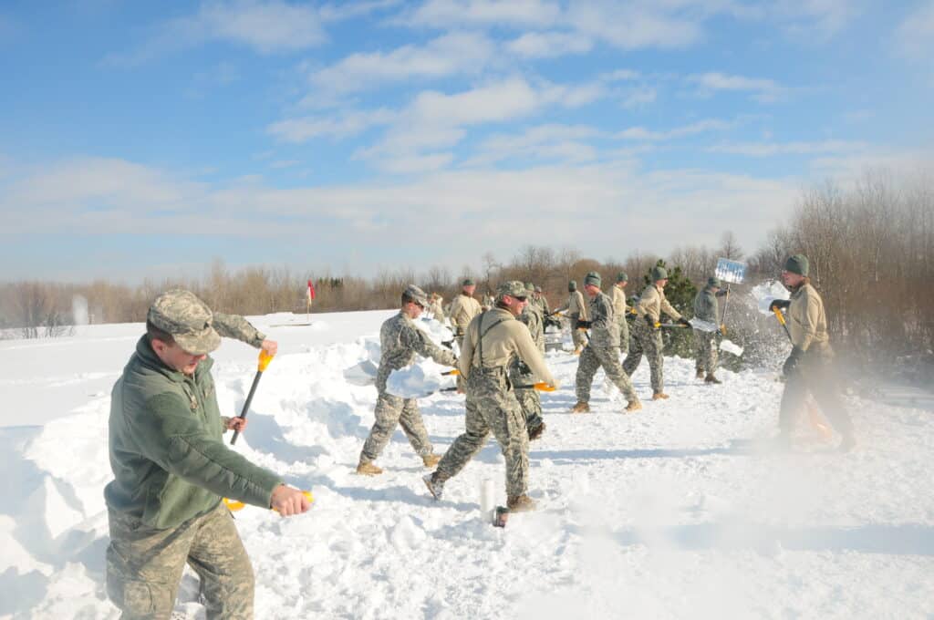
New York’s first snowfalls have proved to be as little as a flake or as massive as 15.2 inches!
©Senior Master Sgt. Raymond Lloyd, Public domain, via Wikimedia Commons – License
In Upstate New York, temperatures in the winter are often below freezing. Downstate temperatures are higher than Upstate temperatures in the winter because of a decrease in elevation and closer proximity to the Atlantic Ocean. In New York City, temperatures during the winter can measure approximately 5ºF to 7ºF warmer than other areas in New York due to urbanization, which has led to an urban heat island effect in Manhattan.
Heading into winter, November sees temperatures between 27ºF and 55ºF. On the other hand, December temperatures range from 15ºF to 45ºF when snow starts to fall more heavily. January is the coldest month in New York, and February places as a close second in frigid temperatures. In January, temperatures across the state can range between 3ºF and 31ºF, depending on the region. February temperatures exhibit lows of 5ºF and highs of 42ºF, also depending on the region. March is cold and wet, but its temperatures are warmer compared to January and February, as New York transitions into spring. March has temperature lows at 14ºF and highs up to 50ºF.
Earliest and Latest First Snows in New York
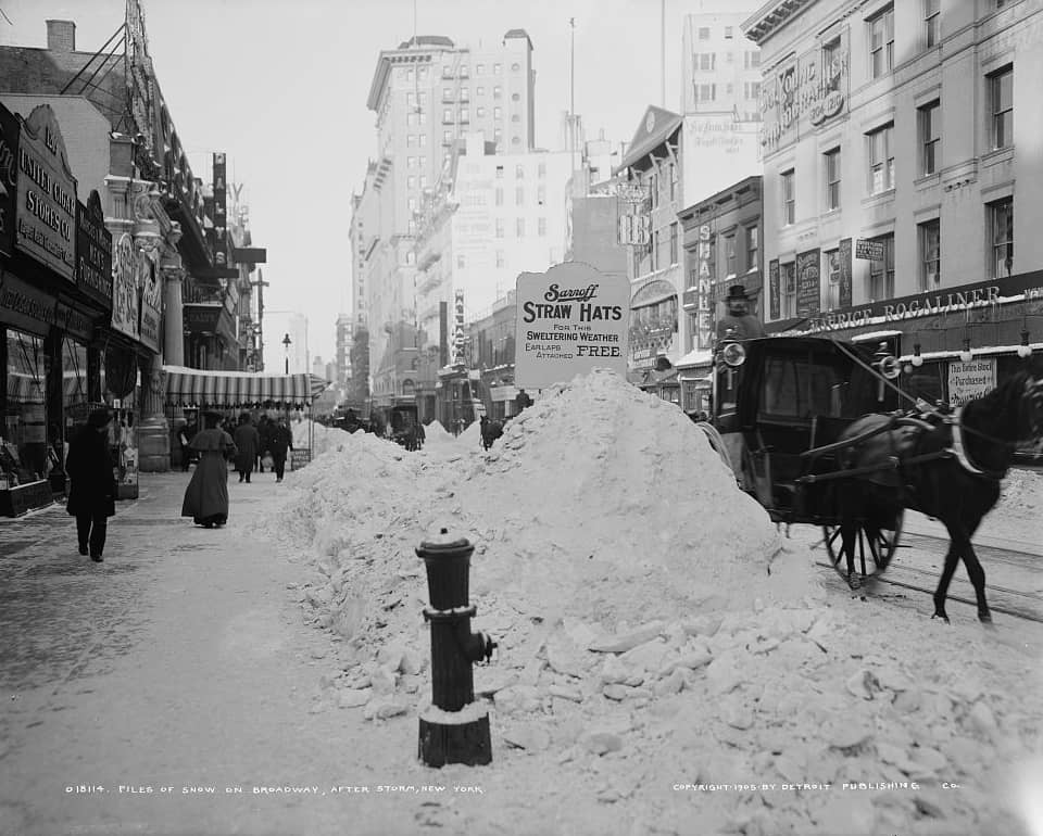
New York City averages a first inch of snowfall on December 24th.
©Detroit Publishing Co. , publisher, Public domain, via Wikimedia Commons – License
The earliest first snow in New York has been debated. Some consider the first flake to be negligible and believe only a measurable amount of snow should be considered a first snowfall. However, New York’s first snowfalls have proved to be as little as a flake or as massive as 15.2 inches!
Earliest First Snow
The average date for a first measurable snowfall in New York City is December 14th. However, in Buffalo and Rochester, the average time for a first snowflake to fall happens between October 23rd and October 24th. The earliest first snow in New York City was on October 29, 2011. A trace of snow fell in Buffalo and Rochester on September 20, 1956. The earliest first inch of snow fell in Buffalo on October 10, 1906, but in Rochester, it fell on October 11, 1906. By comparison, the earliest first inch of snowfall occurred in New York City on October 29, 2012.
Latest First Snow
The latest first snow recorded in New York City occurred on January 29, 1973, and the latest first inch to fall in New York City came down on March 22, 1998. New York City averages a first inch of snowfall on December 24th. In Buffalo, the latest first trace of snow happened on November 22 in 1946 and 1985, but the latest first inch to fall was on January 2, 1932. The latest first flake of snow fell in Rochester on November 20, 1918, and the latest first inch fell on December 28, 2015. The average first inch to fall in Buffalo and Rochester occur between November 18th and 20th, so for a first inch to accumulate as late as January is surprising!
Below summarizes the average, earliest, and latest first snows in New York City, Buffalo, and Rochester:
| Time and Amount | New York City | Buffalo | Rochester |
|---|---|---|---|
| Earliest Trace | October 29, 2011 | September 20, 1956 | September 20, 1956 |
| Earliest Inch | October 29, 2012 | October 10, 1906 | October 11, 1906 |
| Average Trace | December 14 | October 24 | October 23 |
| Average Inch | December 24 | November 18 | November 20 |
| Latest Trace | January 29, 1973 | November 22, 1946 and 1985 | November 20, 1918 |
| Latest Inch | March 22, 1998 | January 2, 1932 | December 28, 2015 |
Description of First Snowfalls in New York
Excluding the first flake or trace of snow, most first measurable snowfalls accumulate to approximately two inches. In New York’s mountainous regions, snow begins in November and lasts through April. In southwestern areas of New York, on the Southern Plateau, and in the Hudson Valley, snow falls halfway through December and end halfway into March, but the largest amount of snow in these areas accumulates in February. On the coast, snowfall and snow cover vary due to proximity to the Atlantic Ocean. From December to February (at the latest), coastal regions experience snowfall off-and-on.
Biggest Snowfall and Blizzards in New York
While blizzards typically affect Northeastern New York, three specific snowstorms stand out. These are The Great Blizzard of 1888, The Blizzard of 1966, and The Blizzard of 1996.
The Great Blizzard of 1888
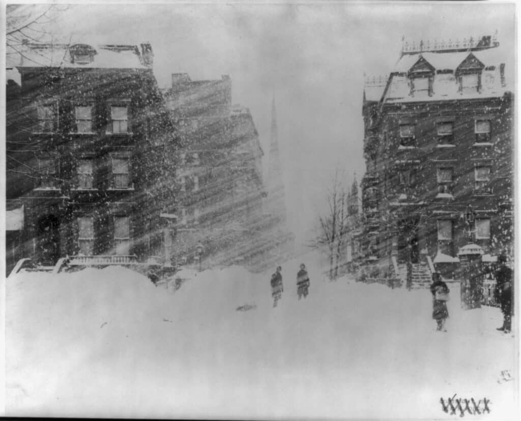
The Great Blizzard of 1888 influenced city planners to implement underground power lines and transportation.
©Miscellaneous Items in High Demand, PPOC, Library of Congress, Public domain, via Wikimedia Commons – License
Also called The Great White Hurricane, this blizzard killed approximately 400 people in New England and left $20 million in damages in New York City. On March 12th, 10 inches of snow covered New York City. Eventually, it accumulated to 22 inches. Winds in New York City blew at an average of 40 miles per hour, and some snowdrifts measured 50 feet. Businesses across the city shut down, and many New York residents searched for shelter from the disastrous storm. In the end, This storm influenced city planners to implement underground power lines and transportation.
The Blizzard of 1966
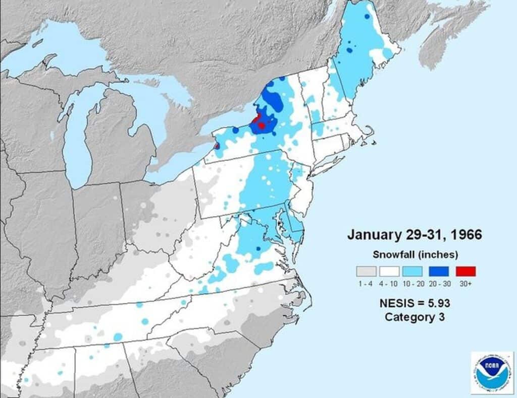
The greatest snowfall in
New York state
occurred during The Blizzard of 1966.
©US National Weather Service Office of NOAA, Public domain, via Wikimedia Commons – License
Creating The Blizzard of 1966, a coastal nor’easter brought copious amounts of snow to the Northeastern Unites States. Moisture from the Atlantic mixed with moisture from Lake Ontario, enhancing precipitation in Upstate New York. The greatest snowfall in New York state occurred during The Blizzard of 1966. On February 1st, the blizzard dropped 50 inches of snow in Oneida County. Businesses lost millions, people searched for shelter, and schools were closed for an entire week.
The Blizzard of 1996
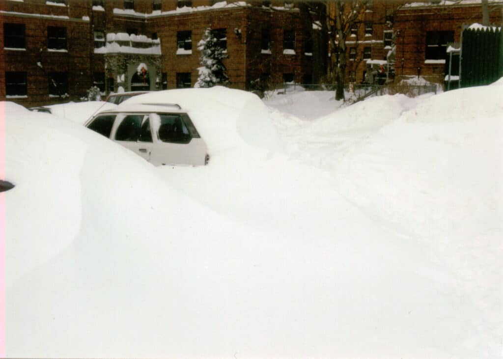
The Blizzard of 1996 left over $1 billion in damages in its wake and killed 154 people.
©Dennis Harper, CC BY 2.0, via Wikimedia Commons – License
Finally, The Blizzard of 1996 left over $1 billion in damages in its wake and killed 154 people. Warm air from the Gulf of Mexico met cold air from Canada, creating a front that brought snow and wind to the east coast. Car accidents during the blizzard resulted in many fatalities, and fallen trees plagued residents of New England. The Blizzard of 1996 caused a government shutdown and left many cities in a state of emergency.
The Best Places to Enjoy Snow in New York
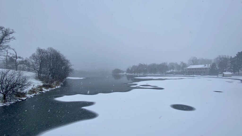
The average date for a first measurable snowfall in New York City is December 14th. However, in Buffalo and Rochester, the average time for a first snowflake to fall happens between October 23rd and October 24th.
©Andre Carrotflower / CC BY-SA 4.0 – License
One place that often receives more snowfall than the rest of New York state are the Adirondack Mountains. The Adirondacks are a fantastic destination for skiing or snowmobiling in the winter. This location has approximately 200 miles of trails, so there is plenty of room to explore. In addition, towns surrounding the Adirondacks throw lively winter festivals, which are a joy to attend.
The Catskills are another incredible mountain range to see in the winter. Complete with ski resorts and bed and breakfasts, the Catskill Mountains offer plenty of winter fun. Skiing, snowmobiling, and even snowshoeing are activities available to visitors of the Catskills. Furthermore, the Catskill Mountains have a plethora of farm stays, which allow lodging for visitors who help with daily chores on the farm.
Up Next
- The 11 Worst Blizzards in the United States
- Animals in New York State
- The 12 Best Dog Parks in New York City
The photo featured at the top of this post is © Connor Sullivan, CC BY-SA 3.0, via Wikimedia Commons – License / Original
Sources
- , Available here: https://spectrumlocalnews.com/nys/rochester/weather/2018/11/26/new-york-state-hightest-1-day-snowfall-totals-in-history-by-county
- , Available here: https://www.washingtonpost.com/news/capital-weather-gang/wp/2016/01/29/remembering-the-blizzard-of-1966-and-its-eye-popping-eight-feet-of-snow/
- , Available here: https://www.britannica.com/event/Great-Blizzard-of-1888
- , Available here: https://www.history.com/this-day-in-history/blizzard-of-1996-begins
- , Available here: https://www.weather-us.com/en/new-york-usa-climate#climate_text_1
- , Available here: https://thestarryeye.typepad.com/weather/2013/12/new-yorks-first-snowfall-of-the-winter-.html%20
- , Available here: https://www.weather.gov/buf/FirstSnow
FAQs (Frequently Asked Questions)
What is the coldest month in New York?
New York’s coldest month is January, which has temperature lows starting at 3ºF and reaching up to 31ºF.
Does it snow on Christmas in New York?
Depending on the region, snow on Christmas is a possibility in New York. In New York City, the average date for the first inch of snow to fall is on Christmas Eve!
Does Manhattan receive snow?
Manhattan can receive snowfall, but it occurs less frequently than in other areas of New York state. Manhattan’s urbanization causes the urban heat island effect, meaning average temperatures can be anywhere from 5ºF to 7ºF higher than other areas within the state.
Thank you for reading! Have some feedback for us? Contact the AZ Animals editorial team.


