
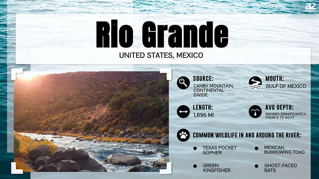
The Rio Grande River is ranked as the 5th longest river in North America and the 20th longest in the world. It is also referred to as the Rio Bravo del Norte or simply the Rio Bravo in Mexico. The river forms the border between Mexico and the U.S. state of Texas.
The Rio Grande was established as a wild and scenic river in 1978, giving it the protection it needs to flow freely through Big Bend National Park. In 1997, the river was declared an American Heritage River.
Here is everything you need to know about the “The Fierce River of the North.”
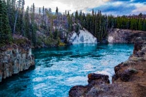
What Is The Actual Depth Of The Rio Grande River?
The Rio Grande River is 60 feet deep at its deepest points.
©CrackerClips Stock Media/Shutterstock.com
The Rio Grande is 60 feet at its deepest points and about 6 to 20 feet at its shallowest points. Depth varies throughout the river, depending on the time of the year (the river is more profound during the spring runoff than in late summer). As a result, the Rio Grande River cannot be navigated by cargo barges or passenger boats like it used to be in the 19th century. It’s only possible to navigate near the mouth of the river up to Laredo, Texas, in rare circumstances.
Where Does The Rio Grande River Start And End?
The Rio Grande River rises from Canby Mountain, which is part of the San Juan Mountains of the Colorado Rocky Mountains. Several streams join at the base of Canby Mountain to form the Rio Grande. From the Continental Drive, the Rio Grande flows southeastward through the San Luis Valley into New Mexico, where it picks up some of its water from the Rio Chama.
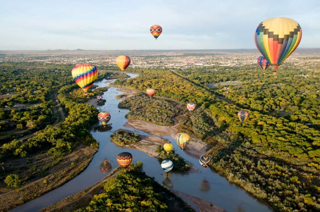
From Espaniola, the river continues southwards, irrigating the farmlands in the desert cities of Las Cruces and Albuquerque in New Mexico, all the way to El Paso, Texas. The Rio Grande then flows along the border between the United States and Mexico for about 889 to 1248 miles, separating Texas from four cities in Mexico, including Chihuahua, Nuevo Leon, Coahuila, and Tamaulipas.
In Ojinaga, Chihuahua, the Rio Grande is joined by Rio Concho, one of its largest tributaries by discharge, contributing about 24 cubic meters of water per second. Other rivers that drain into the Rio Grande from the right include the San Juan River, Rio Alamo, Rio Salado, Jemez River, and Conejos River. On the left, Rio Grande receives water from the Devil River, Alamito Creek, Pecos River, Embudo River, and Red River. The river then meanders through the Gulf Coastal Plain for the remainder of the journey into the Gulf of Mexico.
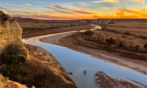
How Long Is The Rio Grande River?
The Rio Grande River is 1,900 miles (3,060 km) long.
©iStock.com/Greg Meland
The Rio Grande is 1,900 miles (3,060 km) long. The river flows to the southeast and south for 175 miles in Colorado, southerly for approximately 470 miles across New Mexico, and 1,240 miles towards Texas and Mexican states up to the Gulf of Mexico. Its drainage basin has an area of 182,000 square miles (472,000 square kilometers). However, the area within the entire watershed of the Rio Grande River is about 336,000 square miles (870,000 square kilometers).
Where Is The Rio Grande River Located On A Map?
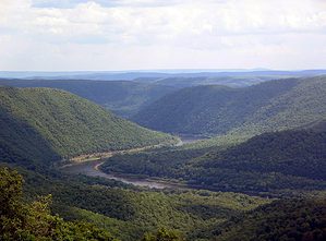
The Rio Grande River begins flowing in south-central Colorado, from the Rocky Mountains where its headwaters start in the San Juan Mountains and continues its way almost 1,900 miles to the Gulf of Mexico. It flows through Colorado, New Mexico, Texas and parts of Mexico before ending in the Gulf of Mexico.
What Are Some Of The Geological Features Of The Rio Grande River?
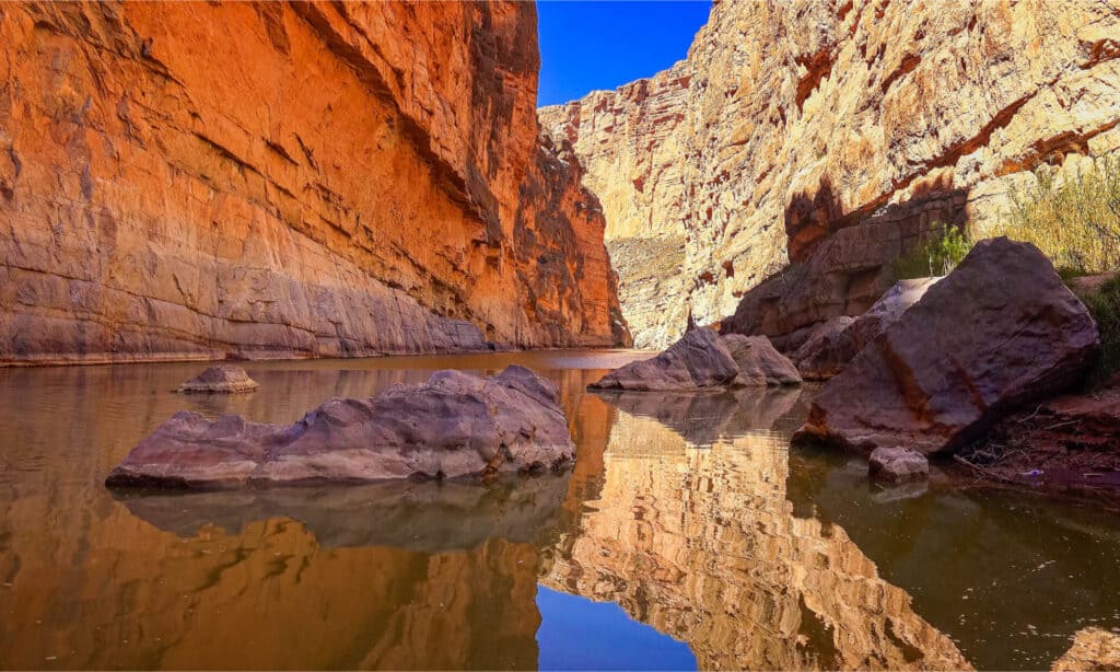
The Rio Grande winds its way across a few sheer-walled canyons carved from the volcanic rock of New Mexico’s Taos Pueblo. These canyons include the Rio Grande Gorge, Basin and Range, Mexican Plateau, and White Rock Canyon of northern New Mexico.
The river also flows through the Santa Elena Canyon in Big Bend National Park. The primitive character of the Rio Grande, combined with lots of canyons on the way, provides a stimulating environment for exploration.
What Kinds Of Animals Live In And Around The Rio Grande River?

The Rio Grande River is an important bird sanctuary.
©Jack Molan/Shutterstock.com
Many animals, including threatened and endangered species, depend on the Rio Grande’s rare riparian habitats. About 166 fish species inhabit the river. Approximately 70 of these fish species are only found in the Rio Grande. Numerous javelinas, jackrabbits, snakes, the Texas tortoise, ocelots, and horned lizards are often spotted in Rio Grande Valley. The Rio Grande is also an important bird sanctuary, so you can bring your binoculars and go bird watching while on the river.
10 Amazing Facts About The Rio Grande River
- Did you know that the slight change in the Rio Grande’s path almost caused the assassination of Mexican and U.S. presidents in the 19th century? In the 1920s and 1930s, Texas and New Mexico were involved in a skirmish, culminating in the 1938 Rio Grande Compact. The U.S. and Mexico negotiated and signed an agreement in 1944 on using the river. Until today, there is still some conflict regarding the agreement. The U.S. is still calling for the reexamination of the treaty due to frequent droughts in the Rio Grande.
- Only 20% of the water in the Rio Grande reaches the Gulf of Mexico because much of it is used to irrigate farmlands along the way, particularly in the Lower Rio Grande Valley.
- The Rio Bravo (Rio Grande) first appeared on a map of New Spain produced by a Spanish royal cartographer in 1536.
- The Rio Grande River is threatened by the diversion of too much water, invasive plants, and an altered flood plain. The river is now listed as one of the most endangered rivers in the world.
- Several dams have been constructed along the Rio Grande, including the Retamal Dam, Anzalduas Dam, Falcon Dam, Amistad Dam, Caballo Dam, Elephant Butte Dam, Cochiti Dam, and Rio Grande Dam.
- The Rio Grande River forms the Mexico-United States natural border between the U.S. state of Texas and the four Mexican states of Chihuahua, Nuevo Leon, Coahuila, and Tamaulipas.
- The river passes through some major cities, including McAllen, Laredo, Eagle Pass, Del Rio, Las Cruces in New Mexico, Mesilla, Socorro, and Brownsville in Texas.
- The Rio Grande River is mainly used for agriculture and domestic water supply.
- The Pecos River is the largest tributary in terms of drainage basin size, while the Rio Conchos is the largest by discharge.
- The Rio Grande was named “The Fierce River of the North” by Spanish explorers in the 1500s.
The photo featured at the top of this post is © CrackerClips Stock Media/Shutterstock.com
How to Add Us to Google News


Thank you for reading! Have some feedback for us? Contact the AZ Animals editorial team.