
Northern California has an abundance of natural beauty, from its rough and uneven coastline to its towering mountain ranges. But perhaps nowhere is this beauty more evident than in the many rivers that wind their way through the region’s valleys and canyons. These rivers are not only stunning to view, but they also play a vital role in the region’s ecology. They provide habitats for fish and wildlife, supporting agriculture and industry, and offering a wealth of recreational opportunities. From the extensive Sacramento River to the meandering Mad River, Northern California’s waterways are a testament to the power and majesty of nature. So, what are you waiting for? Climb aboard as we journey along the rivers in Northern California.
Rivers in Northern California: Commonalities
Although the rivers in Northern California are diverse in their size, topography, and ecology, there are several commonalities that unite them and make them an important part of the region’s identity.
All of the rivers in Northern California are incredibly beautiful, surrounded by steep canyons and lush vegetation. Whether you’re admiring the steep walls of the American River Gorge or gazing out at the misty redwoods along the Eel River, there’s no denying the natural splendor of these waterways.
Northern California’s rivers are a mecca for outdoor enthusiasts. A vast array of recreational opportunities abound, from casual hiking to adrenaline-pumping white water rafting excursions. Rafting down the rapids of the Trinity River, or casting a line into the Eel River, Northern California’s rivers offer something for everyone.
Rivers in Northern California: Ecological Significance
The rivers of Northern California are also incredibly important from an ecological perspective. They provide critical habitat for a variety of fish and wildlife species, including salmon, steelhead, otters, and eagles. They also support a range of plant communities, from riparian forests to wetlands, that are essential for maintaining healthy ecosystems.
However, the effects of climate change, habitat fragmentation, and pollution have had a significant impact on the health of the rivers and the species that depend on them. Climate change is causing changes in precipitation patterns and temperatures. This is affecting the timing and quantity of water flow in the rivers. Habitat fragmentation, often the result of human activity, reduces the availability of suitable habitats. Pollution is also a major concern for many of the rivers in Northern California. Agricultural runoff and wastewater discharge introduce harmful chemicals into the water, leading to compromised water quality. By working together we can help to ensure that these rivers remain healthy and vibrant in the future.
Sacramento River
The Sacramento River is the longest river in California, flowing 445 miles (718 km). It flows from its headwaters in the Klamath Mountains to its mouth in the San Francisco Bay. It is a significant waterway that has played a crucial role in shaping the landscape. The Sacramento River is crucial to California’s water supply infrastructure. It helps meet the water needs of millions of people throughout the state. The river serves as a vital water source for agriculture, industry, and residential use in the region. It provides irrigation for fertile agricultural lands, supporting a wide range of crops, including rice, almonds, and citrus fruits.
The Sacramento River is not only important for water supply and agriculture but also for its ecological significance. It supports a diverse array of plant and animal species. These include various fish species, such as Chinook salmon, steelhead trout, and sturgeon. These fish undertake remarkable migrations, traveling hundreds of miles from the Pacific Ocean to spawn in the river’s tributaries.
The river also offers numerous recreational opportunities. Fishing enthusiasts flock to the Sacramento River to pursue prized game fish. Boating, kayaking, and rafting are also popular activities on the river.
However, the Sacramento River faces challenges such as habitat degradation, water diversions, and pollution. These issues affect both the ecological health of the river and the livelihoods of the communities that depend on it.
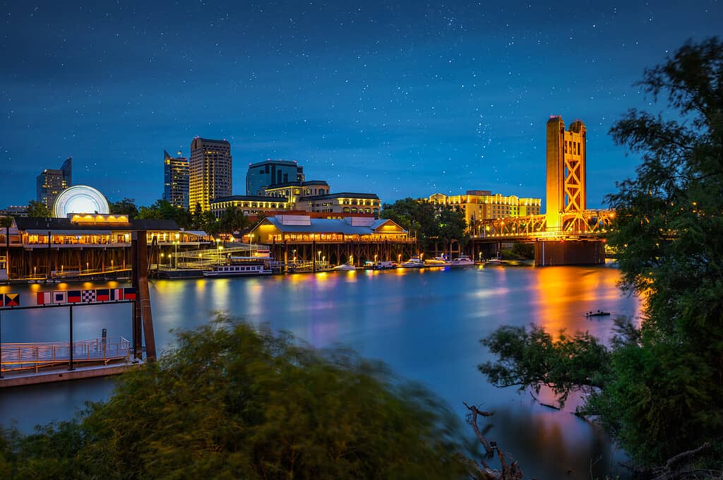
The Sacramento River flows through the heart of the Sacramento Valley, passing through cities such as Redding, Chico, and Sacramento (pictured).
©iStock.com/miroslav_1
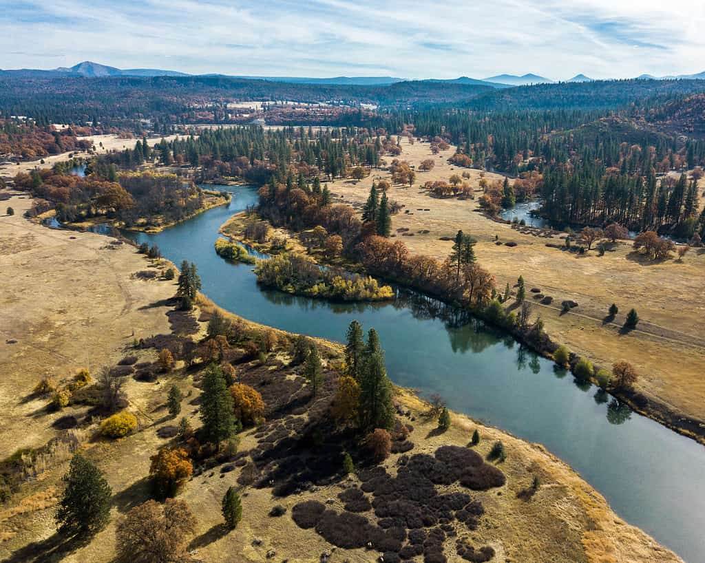
San Joaquin River
The San Joaquin River originates in the Sierra Nevada Mountains and flows approximately 366 miles (589 kilometers) before draining into the Sacramento-San Joaquin Delta and ultimately, San Francisco Bay. It is the second-longest river in California. The depth of the San Joaquin River fluctuates significantly. It depends on factors such as drought conditions or flooding, both of which are increasingly common in the region. In general, the river has an average depth of 10-20 feet (3-6 m).
The San Joaquin River is crucial as it provides water for irrigation and drinking for several million people. The river also supports a variety of ecosystems and wildlife, including several species of fish, birds, and mammals. However, the San Joaquin River has faced several challenges over the years. For decades, a large portion of the river’s water was diverted for irrigation purposes. This resulted in significant reductions in flow which negatively affected fish populations.
In response to these challenges, the San Joaquin River Restoration Program was established in 2006. The program’s objective is to restore and maintain fish populations in the San Joaquin River. It also hopes to improve the river’s ecosystem and water quality. In 2018, Chinook salmon spawned in the river for the first time in 65 years! Despite this success, the San Joaquin River still faces several ongoing challenges.
The San Joaquin River is crucial as it provides water for irrigation and drinking for several million people in the San Joaquin Valley.
©Lush Photography/Shutterstock.com
Eel River
The Eel River is one of the many rivers in Northern California. It meanders 196 miles (315 km) from its headwaters in Mendocino County to its mouth at the Pacific Ocean in Humboldt County. It is the third-largest watershed in California ( 3,684 square miles/ 9,540 km2). The depth of the Eel fluctuates wildly. The flow can be 100 times greater in the winter than in the summer.
The Eel River flows through a range of different ecosystems, including woodlands and chaparral at its headwaters. Ancient redwoods frame the Eel River’s lower reaches. It is home to a variety of fish species, including Chinook salmon, coho salmon, and steelhead trout. The river has a rich cultural history as well. It was an important resource for the Native American tribes who lived along its banks for thousands of years. In the mid-1800s, the river became the site of a major gold rush. Miners flocked to its banks in search of riches.
Today, the Eel River is a popular destination for outdoor enthusiasts, offering a range of recreational opportunities including fishing, swimming, and kayaking. However, the river faces numerous environmental threats, including pollution from agriculture and logging, water diversions, and the effects of climate change.
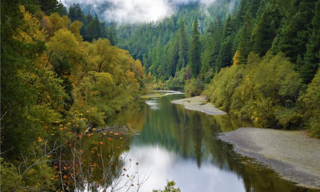
The Eel River meanders 196 miles (315 km) from its headwaters in Mendocino County to its mouth at the Pacific Ocean in Humboldt County.
©Anna Westman/Shutterstock.com
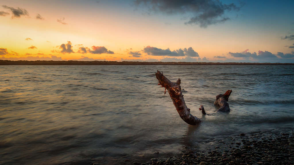
Klamath River
The Klamath River flows through Oregon and California. It is approximately 257 miles (414 kilometers) long and has a drainage basin of over 15,000 square miles (38,850 square kilometers). The river originates in Southeastern Oregon and flows southwest through the Klamath Mountains of Northern California before emptying into the Pacific Ocean near the city of Klamath in Del Norte County, California. The Klamath River has a maximum depth of 49 feet (15 m) and an average depth of approximately 18 feet (5.5 meters). The river flows through steep canyons, valleys, and dense forests along much of its length.
The Klamath River is an important source of water for agriculture, fisheries, and hydroelectric power in the region. The river supports various species of fish, including salmon and trout. However, the river has faced numerous environmental and ecological challenges, including water pollution, habitat destruction, and damming, which have had a negative impact on its ecosystem. In an effort to restore the Klamath to its former glory, four dams on the river will be removed by the end of 2024.
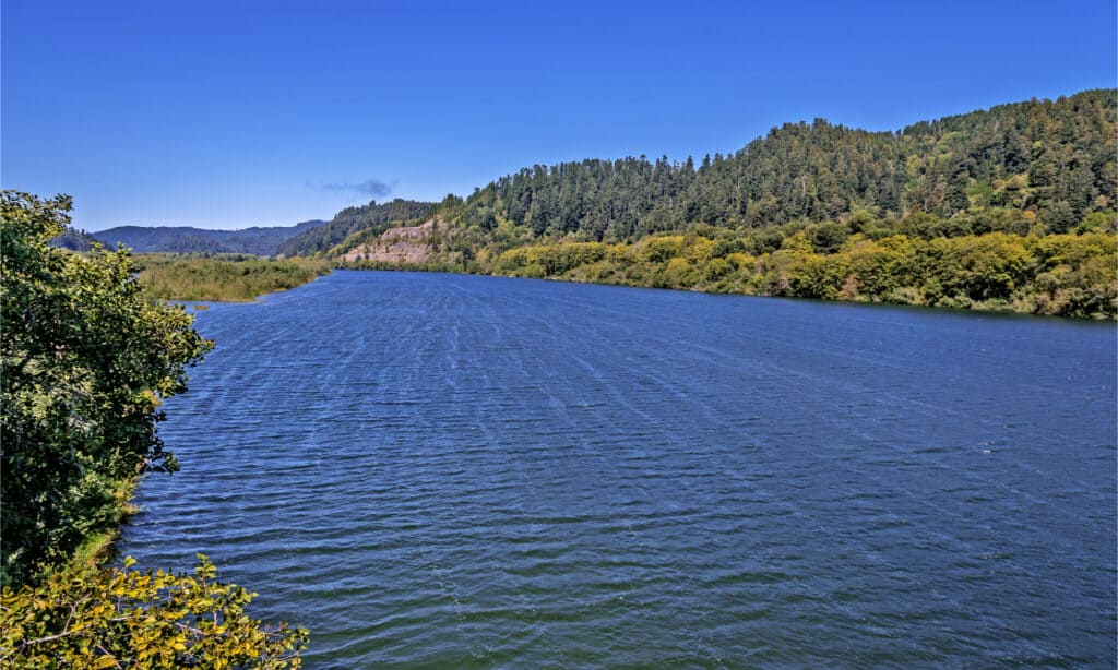
The Klamath River is an important source of water for agriculture, fisheries, and hydroelectric power in the region.
©randy andy/Shutterstock.com
American River
The American River flows for approximately 120 miles (193 kilometers) from its headwaters in the Sierra Nevada Mountains to its confluence with the Sacramento River near Sacramento, the state capital. Due to its location, the American River is one of the rivers in Northern California. It has an average depth of 10 feet (3 m). The river is characterized by deep pools, rapids, and riffles that provide excellent opportunities for fishing, swimming, rafting, kayaking, and other water sports.
The American River is divided into three forks: North, Middle, and South Forks. The North Fork is famous among whitewater enthusiasts for its Class IV and V rapids. The Middle Fork also has scenic beauty and challenging whitewater, with Class IV rapids and a popular 18-mile (29 kilometers) run from Oxbow Reservoir to the Ruck-a-Chucky campground. The South Fork, the longest and most accessible of the three forks, offers a mix of whitewater and gentle flows, making it a popular destination for families and casual rafters.
The American River is also home to several parks and recreational areas. The American River Parkway runs 23 miles (37 kilometers) along the river from Sacramento to Folsom. The parkway features numerous trails for hiking and biking, picnic areas, and camping facilities.
The American River is an important source of water for irrigation, hydroelectric power generation, and municipal uses. The river supports several species of fish, including salmon, steelhead, and rainbow trout. It is a popular destination for fishing enthusiasts.
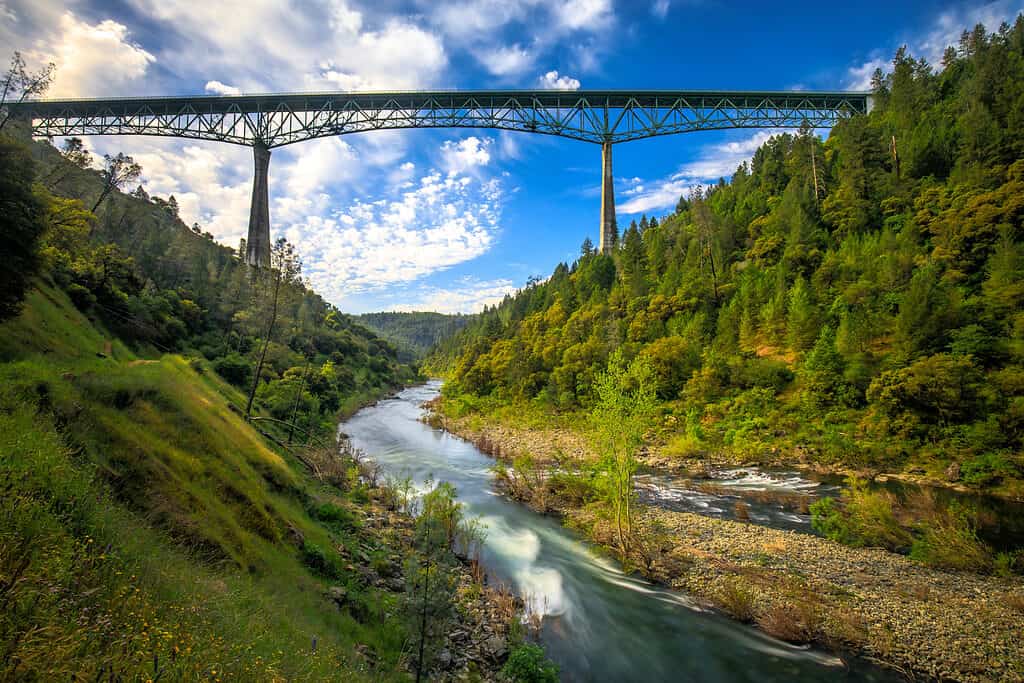
The river is characterized by deep pools, rapids, and riffles that provide excellent opportunities for fishing.
©James Sakaguchi/Shutterstock.com
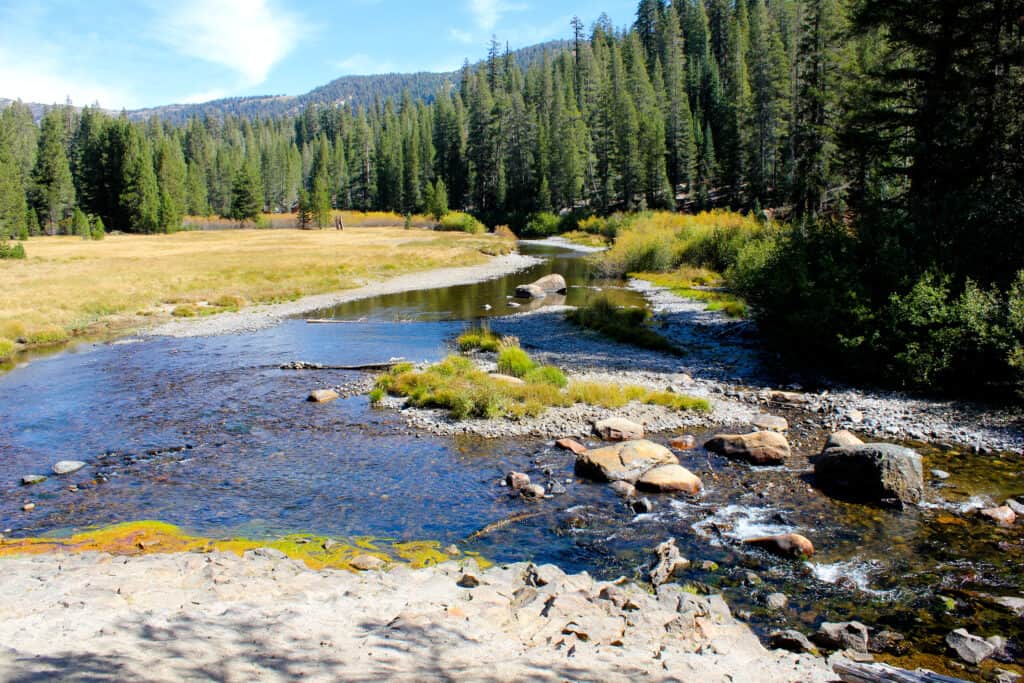
Upper Truckee River
The Upper Truckee River is a major river located in El Dorado County and Alpine County in California. The river originates in the high Sierra Nevada Mountains and flows approximately 23 miles (37 km) before draining into Lake Tahoe, a large freshwater lake in the Sierra Nevada. The river is shallow, with an average depth of 3-4 feet ( 1-1.2 m), punctuated with deeper pools. The Upper Truckee River is characterized by its scenic beauty, clear water, and abundant wildlife. The river provides habitat for a wide variety of plant and animal species, including several species of fish such as rainbow trout and brown trout, as well as various species of birds and mammals.
The Upper Truckee River is also a popular recreational resource for the surrounding communities. The river is surrounded by several parks and trails, including the Upper Truckee River Marsh, which is a popular destination for hiking, birdwatching, and nature observation. Despite its natural beauty, the Upper Truckee River has faced several environmental challenges, including pollution and habitat degradation. Human activities such as logging, mining, and urbanization have negatively affected the river’s ecosystem.
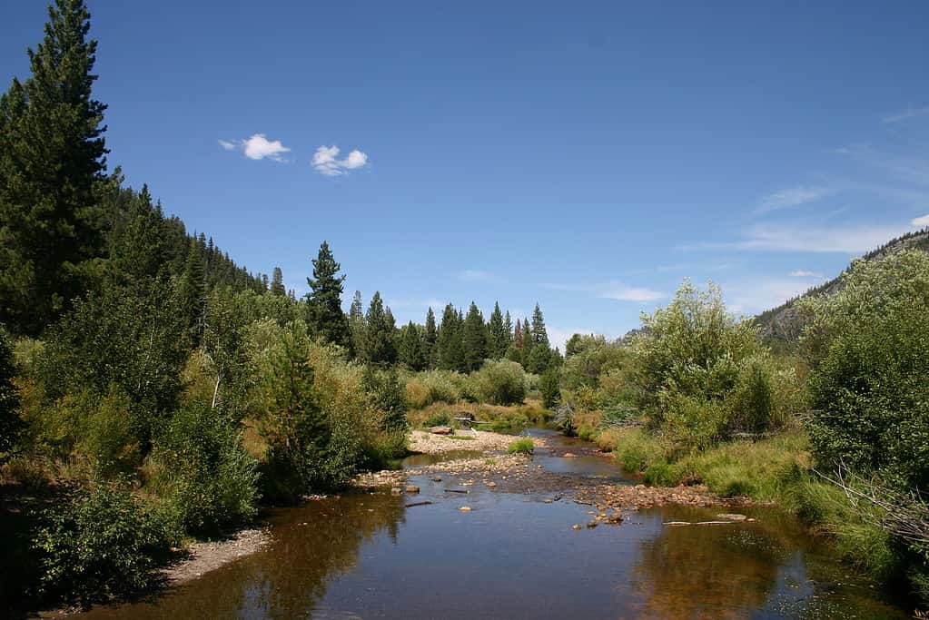
The Upper Truckee River is shallow, with an average depth of 3-4 feet ( 1-1.2 m).
©Steve Mollin/Shutterstock.com
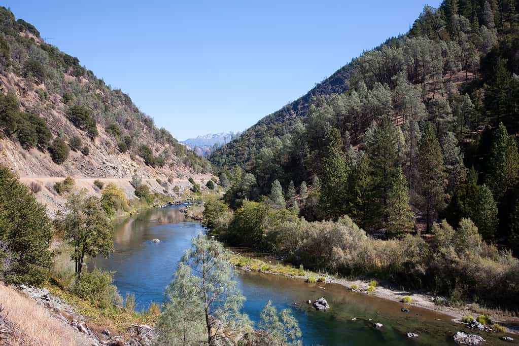
Pit River
The Pit River is approximately 315 miles (506 km) long. It is the largest tributary of the Sacramento River. The depth of the Pit River varies depending on the location and the season. The Pit River is an important source of water for irrigation and hydroelectric power generation. It is home to several dams and hydroelectric power plants. These facilities provide electricity to thousands of households in Northern California.
The Pit River is also a popular destination for recreational activities. It is home to several species of fish, including rainbow trout, brown trout, and Chinook salmon. These sport fish attract anglers from around the world.
The Pit River is approximately 315 miles (506 km) long. It is the largest tributary of the Sacramento River.
©Gibson Outdoor Photo/Shutterstock.com
Trinity River
The Trinity River is a major tributary of the Klamath River It is approximately 165 miles (265.5 km) long.
The river originates in the Trinity Alps and flows through a diverse landscape of forests, canyons, and open grasslands. It is a popular destination for outdoor enthusiasts, offering opportunities for fishing, kayaking, rafting, hiking, and camping. The Trinity River is renowned for its excellent fishing, particularly for salmon and steelhead. Chinook salmon are the most common species in the river, with fall-run Chinook being the most sought after by anglers. Steelheads are also abundant in the river, with the run typically peaking in the winter and early spring.
Like many rivers in the region, the Trinity River has faced significant challenges in recent decades. Dams, water diversions, and other human activities have affected the river’s flow and habitats. However, there are ongoing efforts to restore the health of the river.
The Trinity River is a major tributary of the Klamath River, located in Northern California.
©pmphoto/Shutterstock.com
Mad River
The Mad River is a river in Northern California, USA, that flows through Trinity and Humboldt counties. It is approximately 113 miles (182 kilometers) long and flows westward towards the Pacific Ocean, joining the ocean just south of the city of Arcata. The Mad River is a habitat for salmon and steelhead trout. The river’s watershed includes several protected areas, including the Six Rivers National Forest and portions of the Trinity Alps Wilderness and the Headwaters Forest Reserve. The Mad River is a popular destination for outdoor recreation, offering opportunities for fishing, kayaking, hiking, and other activities. The river is particularly well-known for its steelhead fishing, with anglers from around the world traveling to the area to fish for these prized game fish.
The Mad River is also a critical source of water for agriculture, industry, and residential use. However, like many rivers in California, it has faced significant environmental challenges, including water diversions, habitat degradation, and pollution from agricultural and industrial activities. Efforts have been made in recent years to restore and protect the river’s ecosystem and to promote sustainable water use in the region.
©Jeffrey Schwartz/Shutterstock.com
The photo featured at the top of this post is © randy andy/Shutterstock.com


How to Add Us to Google News


Thank you for reading! Have some feedback for us? Contact the AZ Animals editorial team.