
Utah boasts the third-most national parks among all U.S. states, behind only California (nine) and Alaska (eight). Arches National Park is one of Utah’s “Mighty Five” and consistently ranks among the most popular parks in the state.
There are 47 hiking trails within the park’s boundaries. Since it is rather unlikely that you’ll be able to hike every one of them, here are nine of the very best hikes to help you make the most of your visit to Arches National Park. The trails have been divided into three different categories based on the difficulty of the hike. If you prefer an easy stroll, Arches has you covered. If you’re looking for a strenuous adventure, Arches has that, too.
Dog owners should be aware that dogs are not permitted on any of the trails listed below. This ban does not include service dogs.
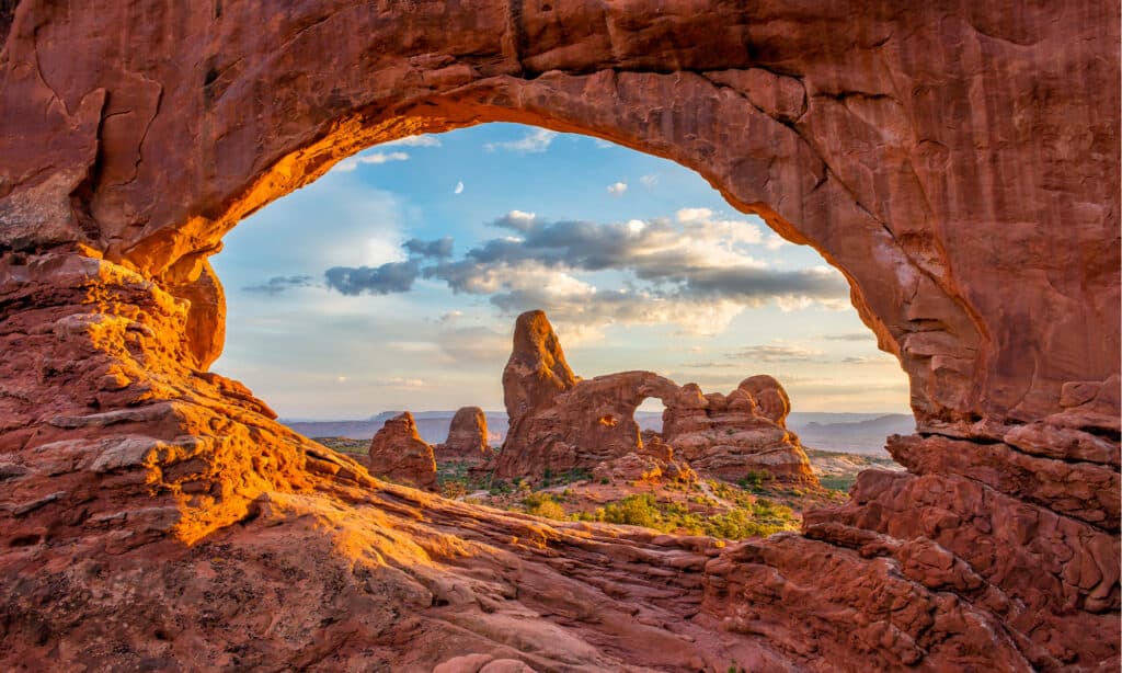
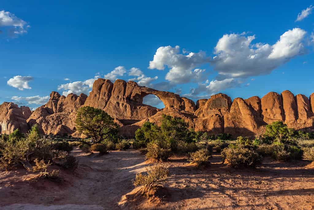
Arches National Park’s stunning scenery invites hikers from all over the world.
©anthony heflin/Shutterstock.com
Easy Trails
Balanced Rock Trail
- Roundtrip Distance: 0.3 mile
- Time: 15-30 minutes
- Elevation Change: 35 feet
- Trail Type: Loop
The trailhead is flat and paved. The trail around Balanced Rock is rocky, with steps and uneven terrain. There is an accessible picnic area and toilet on a gravel road near Balanced Rock.
This is one of the easiest trails in the park. Hikers with minimal or even no experience should navigate this trail with no problem.
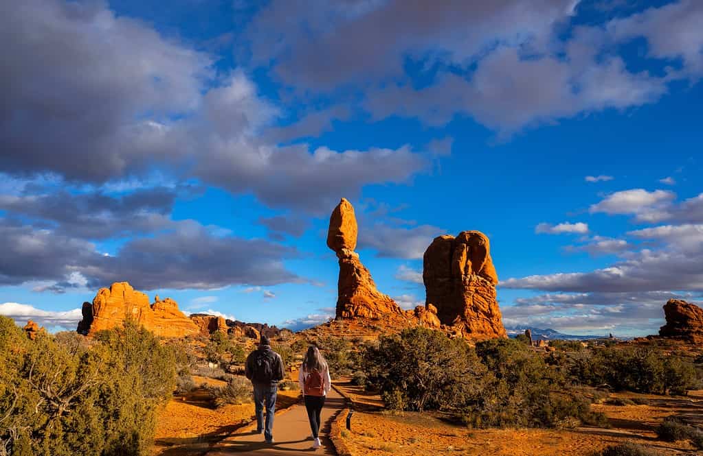
Balanced Rock Trail is among the easiest hikes in the park.
©Margaret.Wiktor/Shutterstock.com
About Balanced Rock
Balanced Rock is one of the most emblematic features of Arches National Park. The rock structure stands 128 feet tall. The top boulder weighs 3,600 tons, and it appears to balance precariously atop its pedestal. In reality, the rock is not balancing at all. It is attached to the pedestal of Dewey Bridge mudstone.
However, the pedestal is constantly eroding away, so it will not be able to support the immense weight of its boulder crown forever. At some point, that boulder will come crashing down. In the winter of 1975-1976, a similar formation known as Chip-Off-the-Ol’-Block collapsed. So, while there is no sign that Balanced Rock is going to fall soon, there are also no guarantees. Better make plans to take the easy hike to see it now!
Windows Loop Trail
- Roundtrip Distance: 1 mile
- Time: 30-60 minutes
- Elevation Change: 99 feet
- Trail Type: Loop
An easy walk up a gravel trail leads to the North Window, South Window, and Turret Arch. There are some rock stairs on the trail.
Some visitors choose to return to the parking lot on the same path, but there is also a primitive loop section to extend the hike a bit. Few visitors take this route, so it is a great way to get away from the crowds. This trail only adds about 0.2 mile to the hike and ends in the same parking lot as the main trail. There are fewer trail markers on the primitive section, so hikers need to pay close attention to remain on the trail.
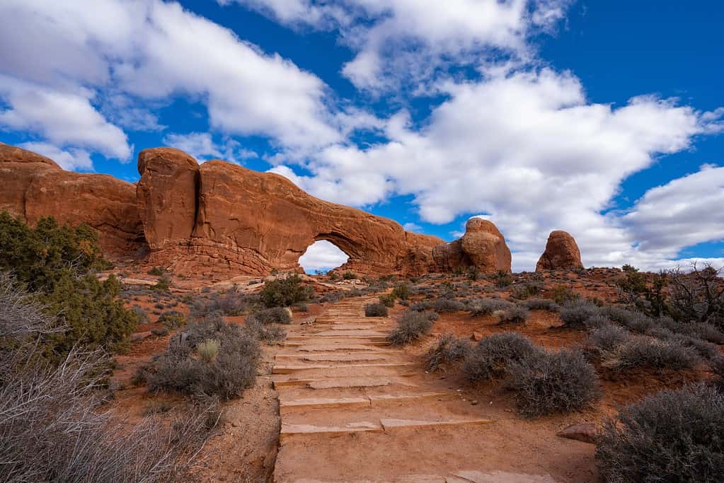
There are some rock stairs on the Windows Loop Trail.
©Margaret.Wiktor/Shutterstock.com
About The Windows Section
This area has the highest concentration of natural arches in the world, making it one of the park’s most popular destinations. If you’re a photographer who is seeking an iconic photo op in the park, you’ll want to check out The Windows.
Pro Tip: The parking lots for the Windows Loop and the Double Arch (detailed below) trailheads are connected by a set of stairs. Visitors can park in one lot and walk between the two parking areas to experience more arches.
Double Arch Trail
- Roundtrip Distance: 0.6 mile
- Time: 15-30 minutes
- Elevation Change: 30 feet
- Trail Type: Out and Back
This trail slopes gently to the base of Double Arch. The trail is hard-packed and is classified as barrier-free. It may be accessible to wheelchairs with some assistance.
Some hikers choose to scramble up the rock beneath the arches. Be aware that climbing up is easier than climbing down. Choose your path carefully, and watch your step!
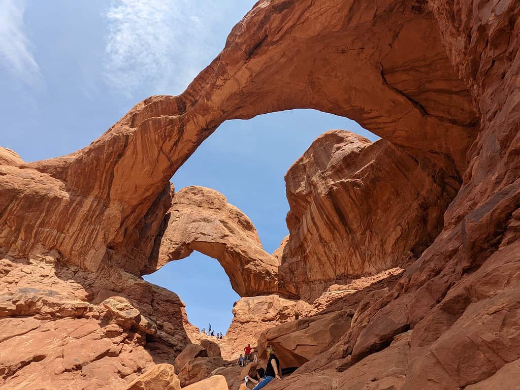
The easy trail makes Double Arch one of the most accessible features in the park.
©Lu Paniagua/Shutterstock.com
About Double Arch
Double Arch is a key feature in the Windows Section of the park. It is so named because two massive arches share the same stone as a foundation on one end. The red sandstone feature was formed by downward water erosion.
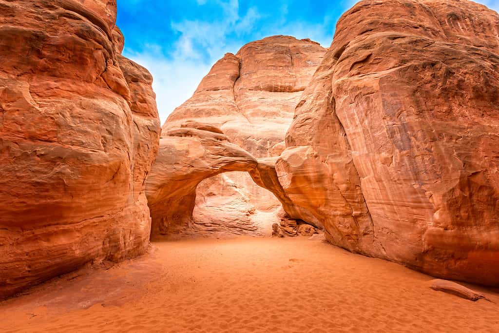
Sand Dune Arch Trail
- Roundtrip Distance: 0.4 mile
- Time: 15-30 minutes
- Elevation Change: 0 feet
- Trail Type: Out and Back
Follow a wide path to a sign-marked trail junction. The trail to Broken Arch (a more difficult 2.3-mile trail) goes straight at the junction, while Sand Dune Arch Trail bears to the right. The path is sandy and moves through a passage between rows of sandstone fins (narrow rock walls) which leads to Sand Dune Arch. The trail narrows significantly as it moves through a small slot canyon. The sand also becomes ankle-deep on the trail, so consider your accessibility needs before starting the trail.
The Sand Dune Arch Trail is an easy hike that is great for families.
©Martina Birnbaum/Shutterstock.com
About Sand Dune Arch
This secluded arch is squeezed in-between high canyon walls. Its name comes from the sand dune that lies beneath the arch. While it may be tempting, visitors must remember that climbing and/or jumping off the arch is not permitted. This hike is especially desirable for young families since the kids can play in the sand.
Landscape Arch Trail
- Roundtrip Distance: 1.8 miles
- Time: 30-60 minutes
- Elevation Change: 40 feet
- Trail Type: Out and Back
Landscape Arch is in the Devils Garden region in the park’s northern portion. There are toilets at the trailhead and drinking water is available from spring until fall. The Landscape Arch trail is hard-packed and barrier-free, though there are steep slopes on the trail. Consider your accessibility needs before embarking on the trail. The Double O Arch Trail that continues past Landscape Arch is a strenuous four-mile trail.
About Landscape Arch
Landscape Arch is the largest natural arch in the world, with a span of 290.1 feet. Kolob Arch in Zion National Park is a close second with a span of 287.4 feet. Its slender, delicate center makes the incredible expanse of Landscape Arch all the more impressive. The stone arch is only six feet wide at its narrowest point.
Some pieces broke off of Landscape Arch in the 1990s, so the short spur trail that used to run underneath the arch is now closed to ensure visitor safety.
It remains to be seen whether Landscape Arch’s falling rocks are a precursor to a complete collapse or if the arch was simply “rebalancing” itself, in which case it may stand for hundreds of years to come. However, it will eventually fall. No natural arch stands forever. Every arch in the park will eventually succumb to the power of gravity and erosion. Wall Arch came crashing down on August 4, 2008.
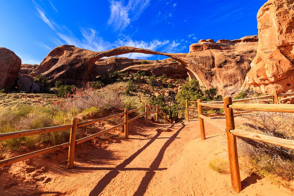
Landscape Arch is the largest natural arch in the world. The trail to view the feature is fairly easy to navigate.
©Fotoluminate LLC/Shutterstock.com
Moderate Trail
Park Avenue Trail
- Roundtrip Distance: 1.8 miles
- Time: 1 hour
- Elevation Change: 322 feet
- Trail Type: Out and Back
There is an accessible paved walkway to a viewpoint. From there, a long flight of stairs takes hikers down to the trail. The trail itself is sandy and uneven as it descends steeply into a canyon.
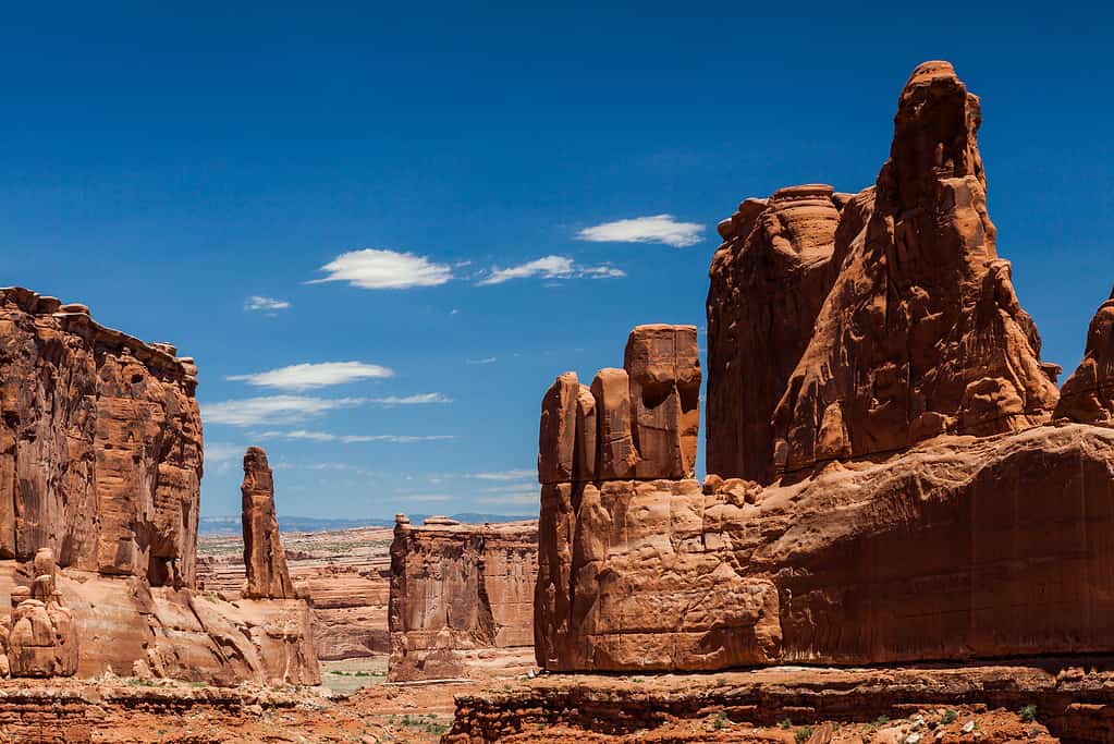
The monoliths of Park Avenue can be experienced on a moderately difficult trail.
©Oscity/Shutterstock.com
About Park Avenue
This trail is just over three and a half miles from the park’s visitor center, so it is often a popular first stop for park guests. Park Avenue features gigantic monolith towers that have been called “nature’s skyscrapers,” hence the area’s name.
Strenuous Trails
Delicate Arch Trail
- Roundtrip Distance: 3 miles
- Time: 2-3 hours
- Elevation Change: 538 feet
- Trail Type: Out and Back
This trail ascends a steep slick rock slope that exposes hikers to open heights. The trail is also in full sun, so proper clothing and hydration are essential to avoid heat exhaustion. The narrow rock ledge near Delicate Arch is about 200 yards long and often becomes icy in the winter. This trail has a reputation for lost hikers, so pay careful attention to the trail markers. Delicate Arch is not visible until the end of the trail.
If you want to view Delicate Arch without undertaking a strenuous hike, there are two viewpoint trails. While these trails won’t take you to Delicate Arch, they will provide great views of the feature.
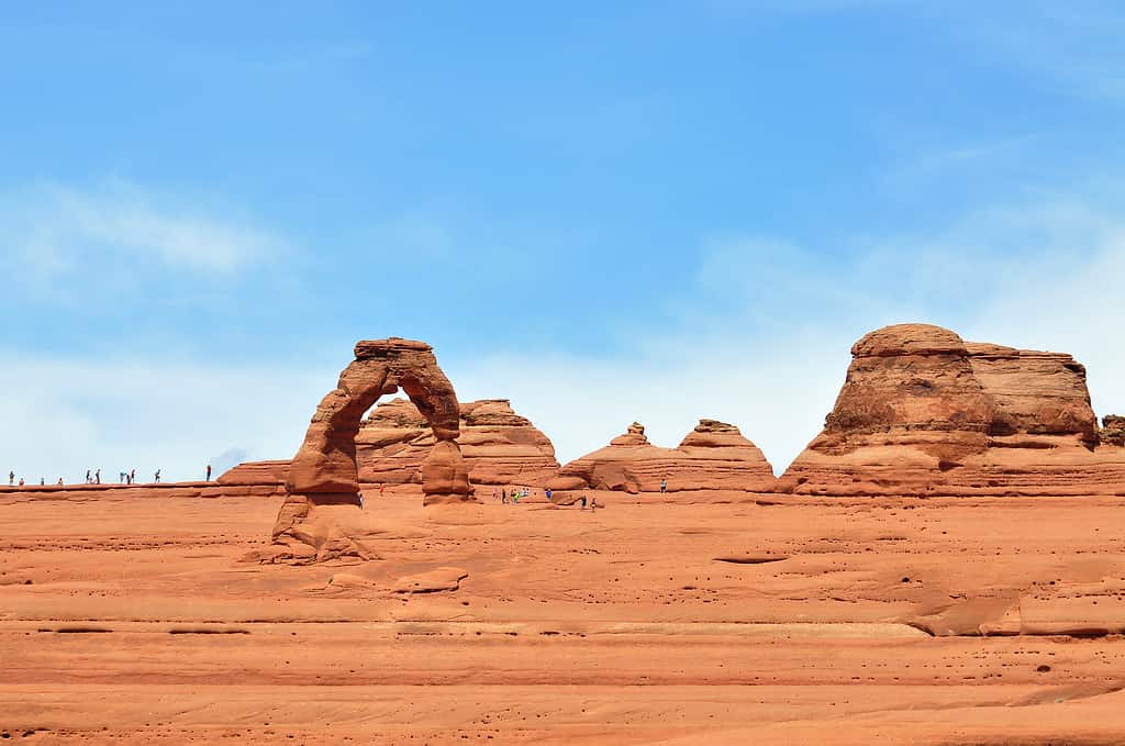
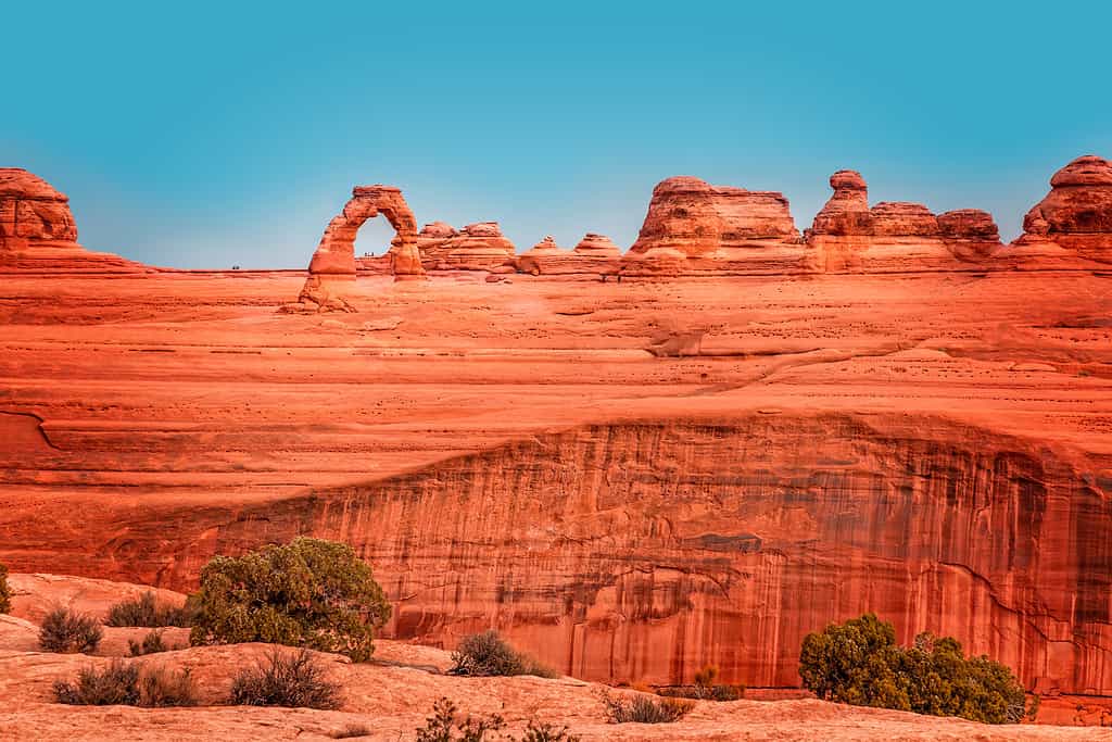
There are multiple options to view Delicate Arch, including a strenuous trail to the famous feature.
©OLOS/Shutterstock.com
Lower Delicate Arch Viewpoint is an easy trail.
- Roundtrip Distance: 200 feet
- Time: 5-15 minutes
- Elevation Change: 0 ft
- Trail Type: Out and Back
This trail is hard-packed and is accessible to wheelchairs.
Upper Delicate Arch Viewpoint is a moderate trail.
- Roundtrip Distance: 0.5 mile
- Time: 30-45 minutes
- Elevation Change: 171 feet
- Trail Type: Out and Back
This trail features steps and steep inclines.
Remember, you cannot reach Delicate Arch from the Viewpoint Trails. To reach the feature, hikers must take the strenuous Delicate Arch Trail.
The Upper Delicate Arch Viewpoint requires viewers to navigate a moderately difficult trail.
©Martina Birnbaum/Shutterstock.com
About Delicate Arch
This is the most famous arch in the park. This arch has become the symbol of Utah, appearing on welcome signs and Utah license plates.
Delicate Arch is the largest free-standing arch in the park, with a light opening measuring 46 feet high and 32 feet wide beneath the arch. The arch has had multiple nicknames over the years. The term “delicate” was first used in a 1934 expedition. Explorers described it as “the most delicately chiseled arch in the entire area.” No visit to Arches National Park is complete without seeing this world-famous geologic feature.
Devils Garden Trail
There are multiple trail options in the Devils Garden region. The Landscape Trail (mentioned earlier) is located in this area. It is an easy, accessible trail. On the other hand, the full Devils Garden Trail is the longest and most difficult trail in the park.
- Roundtrip Distance: 7.9 miles
- Time: 3-5 hours
- Elevation Change: 286 feet
- Trail Type: Loop
The full trail loop includes some of the best scenery in the park, with arches, spires, and fins galore. Some of the most famous features along the loop include Landscape Arch, Double O Arch, and Dark Angel. The hike itself includes narrow ledges, steep cliff exposures, uneven surfaces, rock scrambling, and a few trail markers.
The full Devils Garden Trail is the longest and most difficult hike in Arches National Park.
©Iryna Kvarts/Shutterstock.com
Fiery Furnace
- Roundtrip Distance: 2.1 miles
- Time: Varies
- Elevation Change: 505 feet
- Trail Type: Loop
The Fiery Furnace area is unlike any other trail in the park. While it is not as physically demanding as the full Devil’s Garden Trail, it is a labyrinth of narrow passages between sandstone walls. While there are small trail markers for the loop trail, there there are many other routes that lead to dead ends. It is easy to become confused or even lost. GPS units do not work amid the towering walls of the Fiery Furnace area.
Due to the potential dangers of navigating this trail, hiking is by permit only. Hikers must either go on a ranger-guided hike or obtain a self-guided exploration permit. Hikers are also required to attend an orientation session where they complete paperwork, watch a video, and participate in a Q&A season with a ranger before their permit is issued.
Hiking in the Fiery Furnace area requires a permit. Things can get quite confusing once you enter this labyrinth.
©Victoria Ditkovsky/Shutterstock.com
About Fiery Furnace
This area received its name from the colors that are present at sunset. As the sun goes down, the low angle of its beams lights up the sandstone walls like a wood-burning furnace.
Preparing for a Hike in Arches National Park
As you can clearly see, there are hikes for explorers of all ability levels. While preparation is especially important on longer, more challenging hikes, it is a good idea for all hikers to be prepared for the unexpected. Some needed provisions for all hikes include the following.
Water
Hiking is thirsty work, especially if you are hiking in Arches National Park during the hot weather months.
Headlamp
Things don’t always go as planned. If you are delayed and your return hike occurs after dark, a headlamp is a vital piece of equipment.
Map
Do not depend on cellular connectivity in Arches National Park. Download trail maps or secure physical paper maps.
Hikers in Arches National Park need to be prepared for changing conditions and unforeseen circumstances.
©wildJune/Shutterstock.com
Clothing
If you are hiking in hot weather, choose lightweight, moisture-wicking material. Many hikes in the park have little to no shade, so a hat is needed to stay cool and prevent sunburn. Avoid wearing shoes with open toes, high heels, or slick soles.
Visiting Arches National Park
There is an entrance fee of $30 per car to enter the park. If you plan to visit multiple parks in a calendar year, you can save money by purchasing the America the Beautiful pass for $80.
As stated earlier, Arches National Park is one of the most popular parks in Utah. To quell traffic congestion and to ensure a better visitor experience, the National Park System instituted a timed-entry system at Arches in 2022. The system is back for 2023, running from the beginning of April until the end of October. The system is in effect from 7:00 a.m. until 4:00 p.m. If you plan to enter the park before or after this nine-hour window, you will not need a timed-entry ticket.
Know the Weather
Arches National Park is a desert environment where temperatures soar in the summer. The average high temperature is 95°F in June, 100°F in July, and 97°F in August.
Temperatures also dip low during the winter months. Average low temperatures are in the 20s from December to February.
Leave No Trace
When visiting the park, remember to practice the Leave No Trace Seven Principles. There has been a rise in graffiti defacing the natural arches in the park. Not only is this destructive act selfish and disrespectful, but it is also a federal crime punishable by up to a year in prison and a $100,000 fine.
Wildlife in Arches National Park
Because it is a desert environment, many animals avoid the blazing summer heat by becoming active in the evening and overnight hours.
Crepuscular animals (those which are most active at dusk and dawn) include coyotes, mule deer, desert cottontails, black-tailed jackrabbits, porcupines, and many songbirds.
Some nocturnal animals in the park include kangaroo rats, skunks, bobcats, foxes, bats, owls, and mountain lions.
A few animals are diurnal (active during the day), including chipmunks, rock squirrels, lizards, snakes, hawks, and eagles.

This desert cottontail lives in the sandy, rocky conditions of Arches National Park.
©Chris Hill/Shutterstock.com
The photo featured at the top of this post is © iStock.com/jose1983


How to Add Us to Google News


Thank you for reading! Have some feedback for us? Contact the AZ Animals editorial team.