
The Earth is dotted with numerous and various bodies of water all around it. As lakes are inland basins created for several possible geological reasons, there are lakes situated in every nook and cranny of the globe, even in its most freezing parts. Given the countless number of lakes globally, it is no surprise that some lakes share the same names even though they are located in different regions or countries.
While some lakes have similar names, few ones stand out in the world because of their striking, bizarre titles. Lake Titicaca, for instance, can give anyone a chuckle once they hear its name the first time. But despite their funny, weird names, most of them bear profound meanings behind their namesake. This article will list down 10 of the funniest and most bizarre named lakes in the world.
The Funniest & Most Bizarre Named Lakes in the World
1. Lake Chaubunagungamaug
Lake Chaubunagungamaug is the most bizarre named lake in the world.
©iStock.com/DonnaLee-B
It isn’t a typo, Lake Chaubunagungamaug is an actual lake name, and it’s located in the United States! Webster Lake, commonly known as Lake Chaubunagungamaug, is a lake in Webster, Massachusetts. It has a surface size of 1,442 acres and is located close to the Connecticut border. But the best part is that the lake’s actual name is even more challenging to pronounce. Considered the world’s weirdest named lake, it has been known by a relatively longer name since 1921, with 45 letters and fourteen syllables: Lake Chargoggagoggmanchauggagoggchaubunagungamaugg. Yes, it’s definitely a tongue twister! Beyond Central Massachusetts, the lake is known for having the longest and most bizarre name of any geographic entity in the United States.
Lake Chargoggagoggmanchauggagoggchaubunagungamaugg, the world’s third-longest single-word place name and the first in the United States, has 15 letter G’s, which is even more than its average depth, which is 13 feet.
Before the introduction of English settlers, the lake was recognized as “Chaubunagungamaug,” which meant “fishing place at the boundary.” The name later evolved to “Chargoggagoggmanchauggagoggchaubunagungamaugg,” which means “English knifemen and Nipmuck Indians at the boundary or neutral fishing place.”
2. Lake Winnibigoshish
Located in the Chippewa National Forest, Lake Winnibigoshish is bordered by 141 miles of undeveloped shoreline.
©McGhiever / Creative Commons – License
Lake Winnibigoshish is a lake in the Chippewa National Forest in north-central Minnesota. Wiinibiigoonzhish, a tiny and derogatory variant of Wiinibiig, means “filthy water” in the Ojibwe language. Lake Winnibigoshish, or Big Winnie as it’s more generally known, is Minnesota’s seventh-largest lake, spanning about 67,000 acres. Lake Winnie is 15 feet deep on average and 78 feet deep at its deepest point. It is bordered by 141 miles of gorgeous, undeveloped shoreline, which is made up of a combination of pine and hardwoods and gently sloping hillsides.
Game fish flourish below the vast blue surface of the lake, and fauna thrives on their borders. Foxes, loons, deers, ducks, and bears are just a few species that live in the Chippewa National Forest’s woodland ecosystem, which surrounds Lake Winnie.
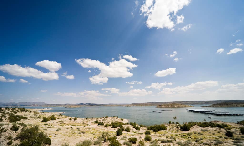
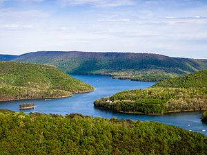
3. Mattamuskeet Lake
Lake Mattamuskeet is the largest natural lake in North Carolina.
©iStock.com/Rod Vamosi
The name “mattamuskeet” may sound like food, but it’s a coastal lake encompassing 18 mi (29 km) long and 7 mi (11 km) broad. Lake Mattamuskeet is North Carolina’s largest natural lake. The name directly translates to “dry dust” and holds many stories. Despite being the state’s largest lake by surface area, it is a shallow coastal lake with a depth of 2 to 3 feet. One story claims that flames burning deep below the peat soil cleared the region of plants, allowing water to drain and fish to flourish. The lake has always contained little water and has been kept fresh by rain and rivers. Fish such as black crappie, channel catfish, largemouth bass, warmouth, yellow perch, chain pickerel, and white perch navigate the wild celery.
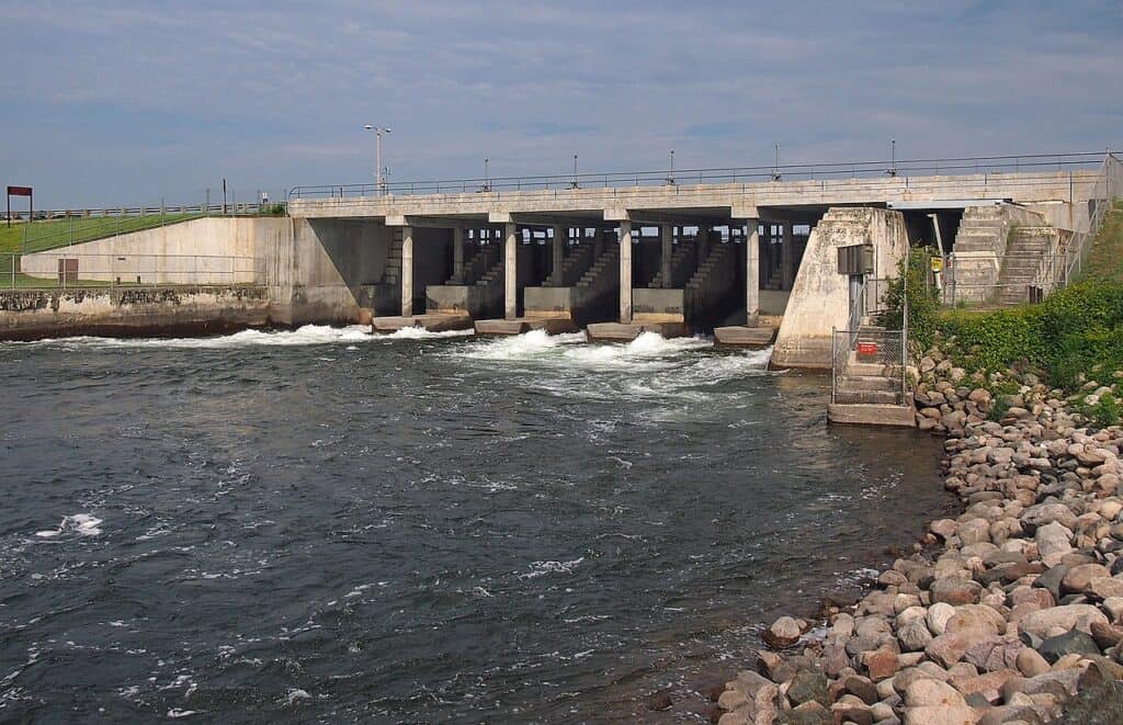
4. Lake Wallula
Lake Wallula was constructed in 1954.
©Gregory Varnum / Creative Commons – License
On the Columbia River in northeastern Oregon and southeastern Washington, Lake Wallula offers water recreation and leisure. Wallula Gap, where the canyon narrows, is the scene of colorful Indian legends and remarkable natural occurrences during the Great Missoula Floods, a cataclysmic prehistoric catastrophe. The reservoir was constructed in 1954 when McNary Dam was built.
The terrain around Lake Wallula is diverse. Within the industrial development limit, port districts control roughly 1,500 acres. At eight different locations, commercial establishments or boat clubs offer facilities. The public properties surrounding the lake are used for water-connected industrial development, recreational purposes, wildlife habitat, and wildlife mitigation.
5. Elephant Butte Lake
Elephant
Butte Lake is New Mexico’s largest state park.
©iStock.com/pmphoto
Perhaps one of the weirdest and funniest names on this list, the Elephant Butte, may give anyone a laugh upon hearing it the first time, but its meaning is not the same as you might think. The name “Elephant Butte” came from the weathered center of an old volcano, now an islet in the reservoir shaped like an elephant. While fossils of the stegomastodon were unearthed just west of the reservoir, the zone was not named after its former and formidable inhabitants.
Elephant Butte is a town in Sierra County, New Mexico, where Elephant Butte Lake State Park sits. Elephant Butte Lake State Park is a nature reserve in New Mexico, located 7 miles (11 kilometers) north of Elephant Butte Reservoir. The park encompasses New Mexico’s biggest reservoir and is the state’s largest state park.
6. Prettyboy Reservoir
Baltimore controls the Prettyboy Reservoir.
©iStock.com/AppalachianViews
Prettyboy Reservoir is one of three reservoirs that supply water to Baltimore. It holds 19 billion gallons of water, serving a population of nearly 2 million people in four Maryland counties. Its name holds quite a unique origin story. A colt owner, a local farmer, had traveled to the creek several times and called out the name of his cherished steed. Prettyboy Creek was named after the farmer’s lost colt, and when Baltimore City flooded the area to create a reservoir, it was renamed Prettyboy Creek. Prettyboy Reservoir, commonly known as the Hereford Zone, is a 79.7 sq mi or 206.5 sq km reservoir in northern Baltimore County, Maryland. Even though the reservoir is located within the county, Baltimore controls the reservoir and the neighboring watershed area.
7. Naknek Lake
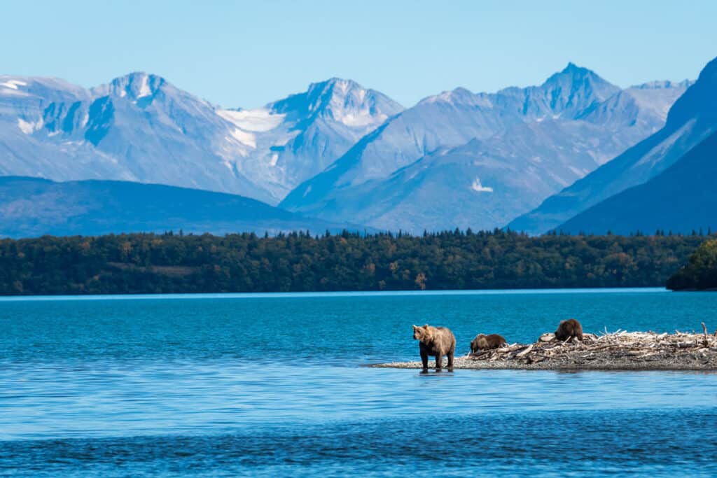
The biggest lake in Katmai National Park and Preserve is the Naknek Lake.
©iStock.com/N8tureGrl
Naknek Lake, located near the edge of the Alaska Peninsula in southern Alaska, is the biggest lake in Katmai National Park and Preserve. The lake stretches 40 miles (64 kilometers) long and 3 to 8 miles (4.8 to 12.9 kilometers) wide. The Naknek River, which flows west into Bristol Bay, drains the lake.
The lake was first named Naknek by a Russian explorer, but it was afterward renamed “Akulogak” by another. Ivan Petrof named Lake Walker after Francis Amasa Walker, the 1880 United States Census Superintendent. The lake is well-known for its sport fishing, including one of the biggest king salmon harvests in southwestern Alaska. However, king salmon are dominated by sockeye, pink, and chum salmon.
8. Lake Titicaca
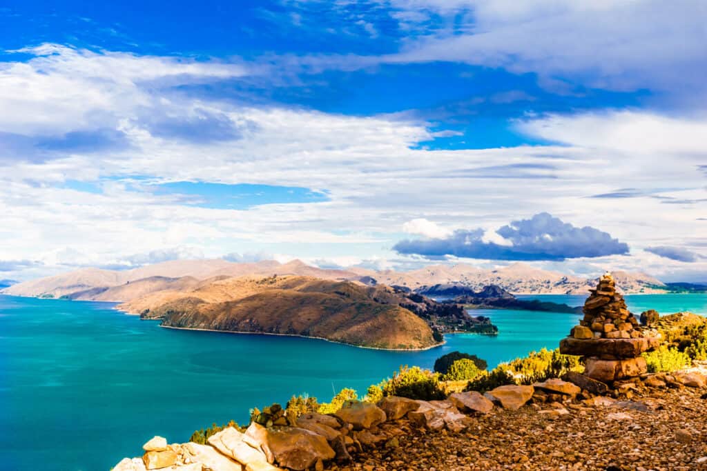
Lake Titicaca is the largest lake in South America.
©iStock.com/StreetFlash
Because it is the largest lake in South America and the world’s highest navigable lake, Lake Titicaca is one of the most well-known lakes in the world. Lake Titicaca, which stretches between Bolivia and Peru and is located in the Andes highlands, has 3,232 square miles (8,372 square kilometers).
The Aymara and Quechua people lived in the area before the Incas named Lake Titicaca. “Titi” means puma, which was the lake’s shape according to the indigenous groups. Now, “caca” means “poop” in Spanish, but they didn’t know Spanish when they named the lake. Lake Titicaca is also known as the “Birthplace of the Sun” and the “Birthplace of the Incas.” Funnier enough, the Desaguadero River, which flows into “Lake Poopó,” is the only water supply for Lake Titicaca.
9. Lake Disappointment
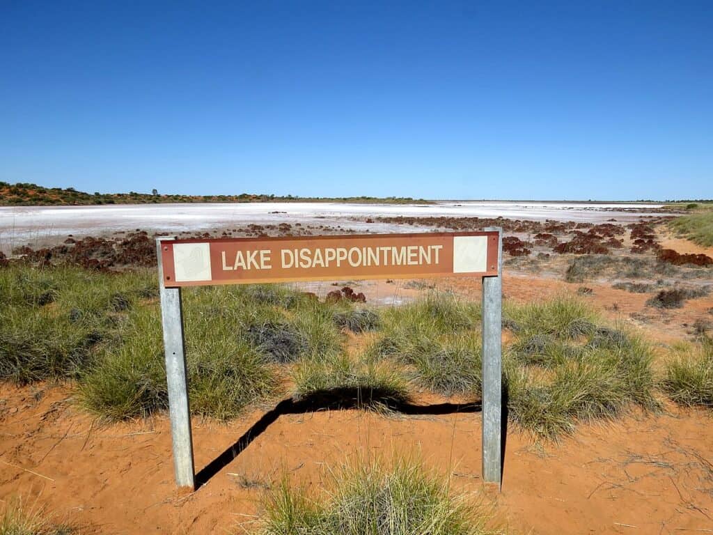
Lake Disappointment is usually dry.
©Summerdrought / Creative Commons – License
Kumpupintil Lake, first named Lake Disappointment, is an endorheic saline lake in Western Australia’s Pilbara region. Lake Disappointment is approximately 186 miles or 300 kilometers east of Newman and is around 99 miles or 160 kilometers long. In 1896, explorer Frank Hann named the lake “Lake Disappointment” after his disappointment when following creeks in search of a freshwater lake. The lake appears to have been formed due to outlets being clogged by numerous factors, including dunes, deflation, and tectonic activity. Except for highly wet periods like the 1900 floods and multiple recent tropical rainy seasons since 1967, the 33,000-hectare (82,000-acre) lake is usually dry. The lake is essential to the Martu people for religious ceremonial purposes and for providing water and local dishes.
10. Lake Poopó
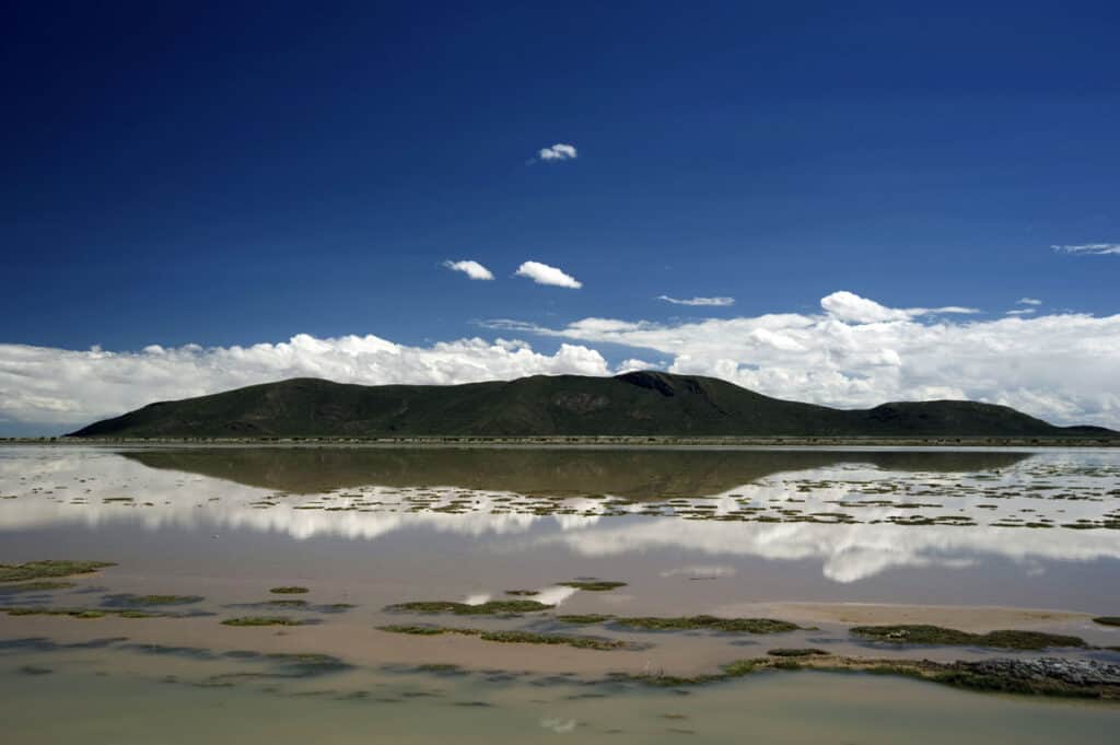
Having a total surface area of 1232 square miles, Lake Poopó used to be South America’s second-largest lake.
©iStock.com/FernandoPodolski
Lake Poopó, or at least as it was called, has a total surface area of 1,232 square miles (3,191 square kilometers). The lake used to be South America’s second-largest, but it has nearly completely dried up. The Desaguadero River used to feed it, filling the permanent part of the lake, which is around 391 square miles or 1,000 square kilometers. The lake would reach about 70 kilometers long during wet seasons, enough to engulf a tiny country like Luxembourg. Ironically, like its name, the lake now is no longer a body of water but a mass of muddy grounds. In recent decades, its water level has dropped, and El Nido caused it to dry up in 2015. The continent’s second-largest lake is now little more than a salty mudslide.
The photo featured at the top of this post is © iStock.com/Rod Vamosi
How to Add Us to Google News


Thank you for reading! Have some feedback for us? Contact the AZ Animals editorial team.