
In the northern region of Arizona sits the city of Flagstaff. Locals revere it, and visitors plan their trips around it. It’s already elevated above other portions of the state at 7,000 feet. It boasts vibrant seasons, with fall rolling through with a dazzling display of warm colors. In contrast, winter brings snowfall, and spring comes alive with countless blossoms. The historic downtown area is an attraction all on its own, but the highest point in Arizona is a snow-covered paradise. It’s important to know that the trek to reach the mountain’s peak is reserved for those who train all year.
Highest Point In Arizona
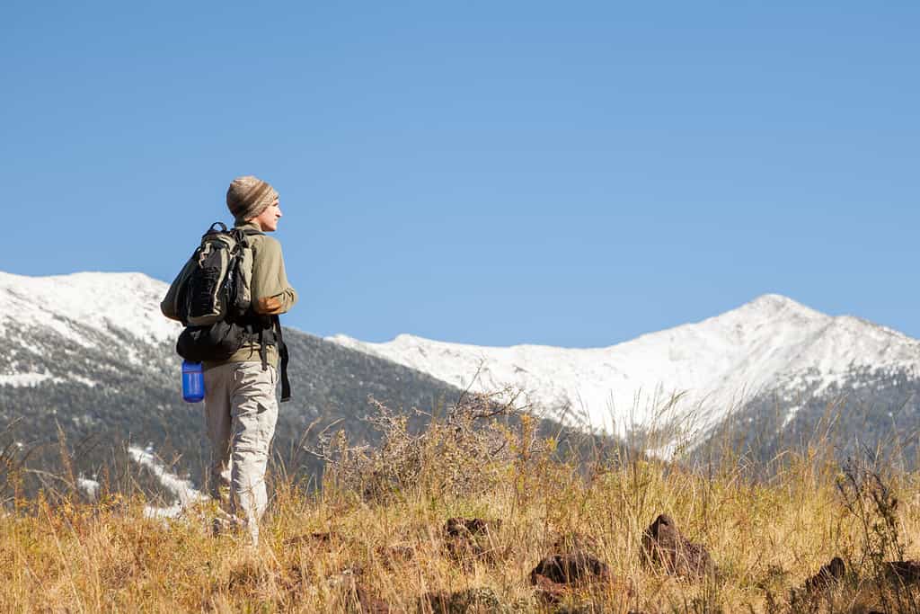
To make it to Humphrey’s Peak, you need your best hiking shoes and all your supplies.
©Jim David/Shutterstock.com
The highest point in Arizona is Humphreys Peak, which is one of three peaks you can find on the San Francisco Mountain in Flagstaff. This mountain is a stratovolcano that has eroded significantly over the years. The highest point, Humphreys Peak, reaches 12,633 feet. There are plenty of places to hike in Arizona, but this is it if you want the toughest challenge.
The terrain is steep and jagged, and definitely not for the hiking newbie. Flagstaff is already 7,000 feet above sea level, and when you first start the hike up to Humphreys Peak, you’re at 9,300 feet. Elevation sickness is real, so only those with experience hiking in high-elevation environments should proceed. Not only do you have less oxygen to work with, but the higher you get, the more you deal with changes in temperature and weather conditions (including sudden storms).
Where Is Humphreys Peak Located On A Map?
Humphreys Peak is in the Coconino National Forest, about 14 miles northwest of downtown Flagstaff. Arizona is part of the four corners region, the only location in the United States where four states meet – in the southwest with Utah to the north, Colorado to the northeast, and New Mexico to the east. Arizona is also bordered by California to the west, Utah to the north, New Mexico to the east, Nevada to the northwest, and the Mexican states of Sonora and Baja California to the west.
How Does Humphreys Peak Compare to the Rest of Arizona
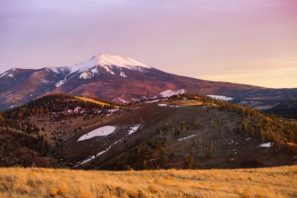
One could say a hike to Humphreys Peak is also soul-nurturing, though the experience is less about unwinding and more about pushing through.
©Matthew Mellinger/Shutterstock.com
Arizona is known for its beautiful scenery, including one of its major attractions, the Grand Canyon. The weather is dry, hot, and sunny during the summer, and winters can be mild, especially around Phoenix. Aside from the Grand Canyon and Phoenix, the state’s capital, other popular locations that attract tourists include Sedona and Tucson. Sedona has long been attracting visitors because of the indescribable magic it holds. It’s a place you go to unwind, recover, and nurture your soul.
One could say a hike to Humphreys Peak is also soul-nurturing, though the experience is less about unwinding and more about pushing through. Tucson is another popular destination, where downtown energy buzzes with excitement and where nature abounds just a few steps away in any direction your heart decides to take you. Around Humphrey’s peak, you’ll find a vibrant culture and amazing dining experiences. Overall, nature is there to greet you no matter where you go. Each section of Arizona has its own distinctive draw, and you’re always just steps from an escape with breathtaking backdrops.
Can You Drive To The Top Of Humphreys Peak
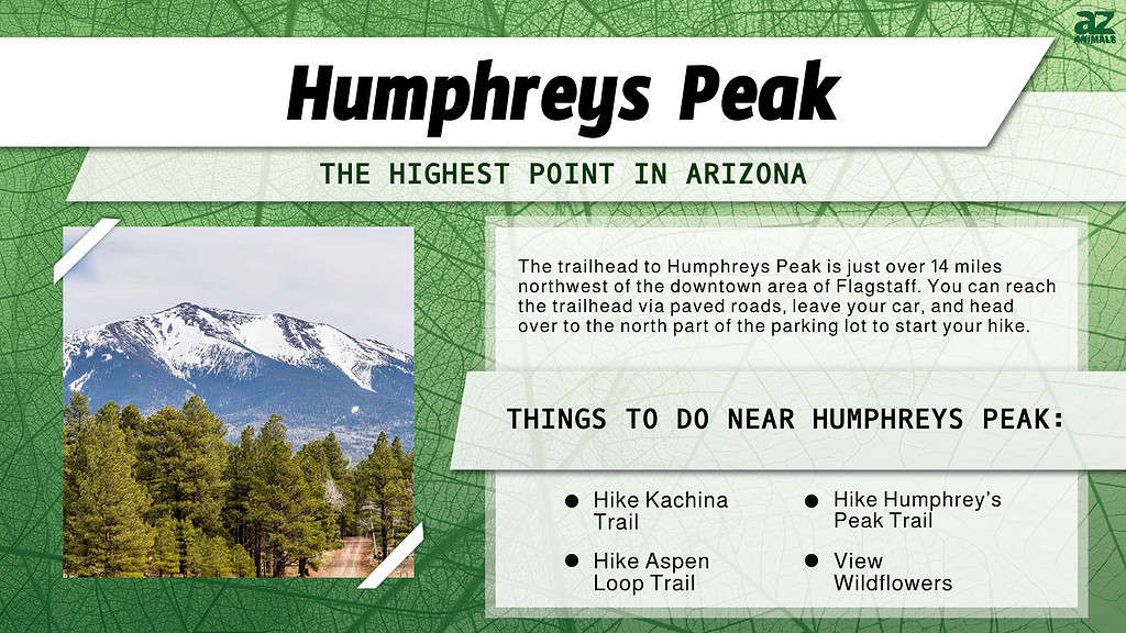
The trailhead to Humphreys Peak is just over 14 miles northwest of the downtown area of Flagstaff. You can reach the trailhead via paved roads, leave your car, and head over to the north part of the parking lot to start your hike. To make it to Humphrey’s Peak, you need your best hiking shoes and all your supplies. The one-way trek takes about six to eight hours, during which you ascend a total of five miles and 3,333 feet. No road leads all the way to the top, and even if you embark on this hike, there’s no place to camp out at the peak. Anyone attempting to complete this hike is urged to descend if they start to experience acute mountain sickness.
Highest Point In Arizona: Things To Do Near Humphreys Peak
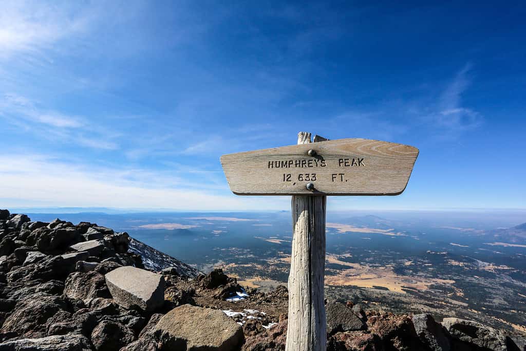
Humphreys Peak takes the cake regarding the highest point in Arizona.
©Nicole_N/Shutterstock.com
If you are headed out toward Humphreys Peak but know you won’t make it all the way to the top, don’t worry. You have two much easier options for hiking. The Aspen Loop is only 2.5 miles all the way through and is considered an easy to moderate hike you can enjoy. It delivers you right back to where you started. For a bit more of a challenge, you can try Kachina Trail. It’s just as long as the Humphrey’s Peak trail but not nearly as steep. It’s classified as moderate to difficult, and you can enjoy gorgeous colors during the fall or get blissed out with the colors of wildflowers during the summer season.
Five Highest Points In Arizona
Humphreys Peak takes the cake regarding the highest point in Arizona, but there are a few other high points worth mentioning. Agassiz Peak, for example, is right on Humphreys Peak’s tail, reaching 12 356 feet. It’s also part of the San Francisco Peaks range. The third highest peak in this region is Fremont Peak, which stretches 11,973 into the sky. The fourth highest peak is Doyle Peak at 11,460 feet, even though it does fall short of both Aubineau Peak and Rees Peak; however, these other two aren’t nearly as popular, so Doyle Peak gets the spotlight. The fifth highest point in Arizona is Mount Baldy, which stretches upward a total of 11,403 feet.
The photo featured at the top of this post is © Nicole_N/Shutterstock.com


How to Add Us to Google News


Thank you for reading! Have some feedback for us? Contact the AZ Animals editorial team.