
If you want to explore the Bluegrass State on a bike, there are plenty of options. There are three US Bicycle Routes that have been officially designated by the Adventure Cycling Association. There are US Bike Routes 21 and 23, which go north to south across the state, as well as the 76 Transcontinental Route, which connects the Atlantic Ocean to the Pacific Ocean.
In addition to this, Kentucky’s cycling community is working on new routes so that people can explore all of the natural beauty that the state has to offer from different angles.
The Longest Biking Trail in Kentucky
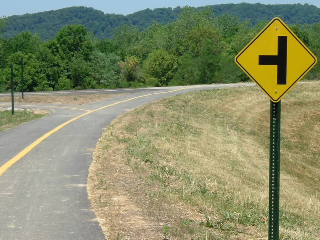
The longest biking trail in Kentucky is the Louisville Loop; it is currently still under construction and will be a 100-mile trail circling around the city.
©Angry Aspie / CC BY 3.0 – License
The longest biking trail in Kentucky is the Louisville Loop. This is actually still a work in progress at this point. The ultimate goal is to have a paved trail of over 100 miles that goes all around the community.
This path is going to connect various neighborhoods and parks within the city of Louisville. It should also incorporate other counties in Kentucky and Southern Indiana. At this point, the Louisville Loop is about 25% to 50% complete. A cyclist or pedestrian can travel along the trail from downtown to Riverside, the Farnsley-Moremen Landing.
The Louisville Loop Route
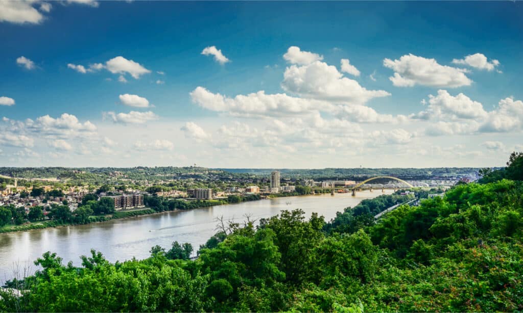
The Louisville Loop is a 100-mile loop that starts south of the Ohio River and goes through various landscapes in Kentucky.
©Nat Chittamai/Shutterstock.com
As the name implies, the Louisville Loop is essentially a 100-mile loop that goes around the city of Louisville and through surrounding communities. The Loop is divided into five physiographic regions.
Ohio River Valley
Ready to explore? This is a stretch of 23 miles that passes through Waterfront Park, Shawnee Park, Chickasaw Park, Rubbertown and Riverside, and the Farnsley-Moremen Landing. This is the region on Kentucky’s side of the Ohio River, where the Ohio River has flooded multiple times, depositing gravel, sand, and sediment. You can see natural flood walls that are a result of these events.
The Knobs
This stretch has not yet been completed. However, the area is known for geologic remnants, specifically sediment remains that were deposited at river deltas about 360 million years ago when an ancient sea was in this location. The slopes are steep here, and the soil is relatively nutrient-poor. You will see a lot of siltstones and shale here.
Shale Lowlands
This is another stretch that is still a work in progress. This is a lowland that is only a little bit above the level of the floodplain of the Ohio River. Because of the multiple wetlands and creeks in this area, it was known as the “wet woods” when European settlers first found the area. Even though engineered concrete ditches somewhat drained the area, the area is still muddy and prone to floods.
Floyds Fork
One of the two sections of the trail that is ready to bike, this segment goes through the Parklands of Floyds Fork. The trail runs through many parks, including Beckley Creek Park, Pope Lick Park, Turkey Run Park, and Broad Run Park. You can also bike past the Floyds Fork Watershed. This area is full of creeks and is known as the oldest exposed bedrock in the county.
Limestone Belt
Not yet open to cyclists, this area is known for a gradual slope of about 200 feet. The ground is multiple layers of limestone, with layers of dolomite and shale mixed in as well. There are many creeks here, as well as interesting topography that has made it a great area for agriculture and farming.
Planning for a Tour of the Louisville Loop Route
If you want to see all of the natural beauty and scenery that Louisville has to offer, this is definitely a great way to do it. Keep in mind that a lot of this trail is still incomplete. You may want to avoid these areas until they are developed.
Also, it’s good to remember that because the terrain is so varied between the five physiographic regions included in the trail, you may have to bike through mud, on top of gravel, and on some other challenging types of terrain. Checking the weather before you set out on your journey would also be smart.
The Louisville Loop goes through many parks and past many worthwhile natural and man-made landmarks. It would be a good idea for you to do some research before you start your trip. This way, you can figure out what you’d most like to see.
Navigating the Route
The Louisville Loop is part of a state-run initiative to make the city more friendly for non-motorized travel and connect many parts of the city of Louisville. The developed parts of the trail have signage that can guide you along the way. However, it would help to have a map of relevant parts of the trail as well. You can find maps of different parts of the trail on the website.
Mileage calculations start downtown, right at the zero point of the Louisville Loop at Big Four Bridge. Mileage signs go in a counterclockwise direction. Sections of the trail that are still developing may not have these mileage signs. As such, you should be wary of biking in these areas.
The Louisville Loop Difficulty
The Louisville Loop is a somewhat difficult trail simply because of its length. Additionally, as it goes through five physiographic regions, you will encounter multiple different types of terrain. You should be prepared for this when setting out on your journey.
However, if you are a biking novice, you can make it easier for yourself by only biking on certain parts of the trail. This way, you won’t have to bike the entire distance, and you can choose terrain that is favorable to you.
At this point, since many parts of the Louisville Loop are not yet complete, you might want to focus on the parts of the trail that are, such as the Ohio River Valley and Floyds Fork. These parts of the trail are more likely to have helpful signage that can guide you along your way.
Where is the Louisville Loop Located on a Map?
The Louisville Loop is a 110-mile multi-use trail that circles the city of Louisville, Kentucky. It is made up of several trails, with several trailheads throughout the city. These include the Big 4 Bridge Trailhead, the Waterfront Park Trailhead, the Iroquois Park Trailhead, the Chickasaw Park Trailhead, and the Parklands of Floyds Fork Trailhead.
Wildlife on the Louisville Loop Route
The wildlife that you will see will vary somewhat depending on where you are. For example, in the Ohio River Valley stretch of the trail, you’ll see many mammals and amphibians living off of the rich soil. You’ll also see riverside forests.
At Floyds Fork, you can observe current wildlife at Catfish Bend, such as the catfish for which the spot is named. You can also hunt for fossils of the current wildlife’s ancestors at Mussel Bend.
You may see a wild elk at some point. If you do, try your best to stay at least 50 yards away, as elk can be dangerous when approached. Black bears are also present in Kentucky, and they also mostly attack when humans go too close to them.
If you see one of these animals approach you, slowly back away and allow the animal to pass you (although black bears have been known to back away in response to aggressive reactions as well).
As you bike through the forests of Kentucky, you’ll see all sorts of animals. These include squirrels, white-tailed deer, and raccoons. There are also more than 350 species of birds that you could potentially see flying through the air above during your journey. You may even see migrating bald eagles and sandhill cranes.
The photo featured at the top of this post is © iStock.com/marekuliasz


How to Add Us to Google News


Thank you for reading! Have some feedback for us? Contact the AZ Animals editorial team.