
If you want to explore nature in Maine while riding a bike, there are so many options. Whether you want to experience small-town charm by the coastline, look out at the vast woodlands, or give yourself a real challenge with mountain biking, you can find a trail in the state of Maine. In fact, there are nearly 200 trails to choose from! Keep reading to find out which route is the longest biking trail in Maine.
The Longest Biking Trail in Maine
The Down East Sunrise Trail is the longest biking trail in Maine, at 87.9 miles; it is the longest off-road segment of the East Coast Greenway.
©Doctor Rod/Shutterstock.com
The longest biking trail in Maine is the Down East Sunrise Trail. This is the longest off-road portion of the East Coast Greenway, which is a safe route for cyclists and pedestrians that stretches for 3,000 miles along the East Coast, from Maine to Florida.
The East Coast Greenway stretches through not only Maine and Florida but also New Hampshire, Massachusetts, Rhode Island, Connecticut, New York, New Jersey, Pennsylvania, Delaware, Maryland, Washington DC, Virginia, North Carolina, South Carolina, and Georgia. It connects 450 communities, and the Down East Sunrise Trail is a part of that!
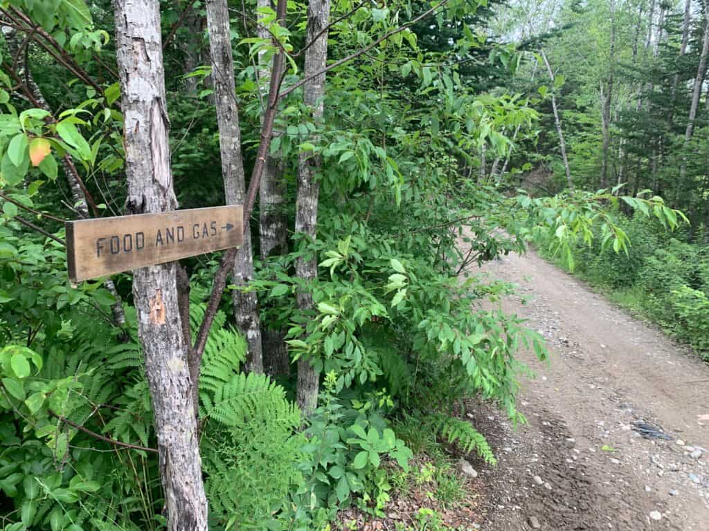
The Down East Sunrise Trail itself extends for 87.9 miles and connects Eastern Maine to the East Coast Greenway. If you choose to bike along the Down East Sunrise Trail, you’ll experience quiet forests, lots of interesting and diverse wildlife, and very pleasant coastal villages in the state of Maine. The trail goes through Hancock and Washington counties.
The Down East Sunrise Trail Route
The Down East Sunrise Trail is divided into three segments; it starts around Ayers Junction and extends to the East Coast Greenway.
©TFolsom99999/Shutterstock.com
This trail runs along the Down East coastal area of Maine. It connects many scenic conservation areas. The trail ultimately stretches from Ayers Junction, which is just south of Moosehorn National Wildlife Refuge, to Washington Junction on the East Coast Greenway. There’s an alternate on-road route as well, which mostly runs alongside the off-road path. This route is divided into three segments:
- Western Trail: This segment runs from Washington Junction all the way through Unionville Crossing. At Washington Junction, you can enjoy wildlife sightings and go to various parks, then take in a breathtaking view of Schoodic Mountain or go camping at Franklin Crossing, go hiking and swimming at Tunk Lake Road, and have a nice picnic at the historically notable salmon pool at Unionville Crossing.
- Central Trail: This segment of the trail runs from Cherryfield Crossing to Whitneyville Crossing. Along the way, you can spend some time in the historic district of Cherryfield Crossing, experience the blueberry barrens and see the Pleasant River at Harrington and Columbia Falls Crossings, enjoy a quaint and remote area at Jonesboro Station, and see the upland forests and freshwater marshes of Whitneyville Crossing.
- Eastern Trail: This segment runs from Machias to Ayers Junction. Along this path, you can experience the flea and farmers’ markets, along with a nationally renowned blueberry pie-making restaurant of Machias Dike. Take a detour to the camping and boating areas on the shore of Rocky Lake in East Machias, enjoy the natural beauty of Rocky Lake Crossing, and experience state parks close to Ayers Junction, including the Moosehorn National Wildlife Refuge.
Planning for a Tour of Maine’s Longest Biking Trail
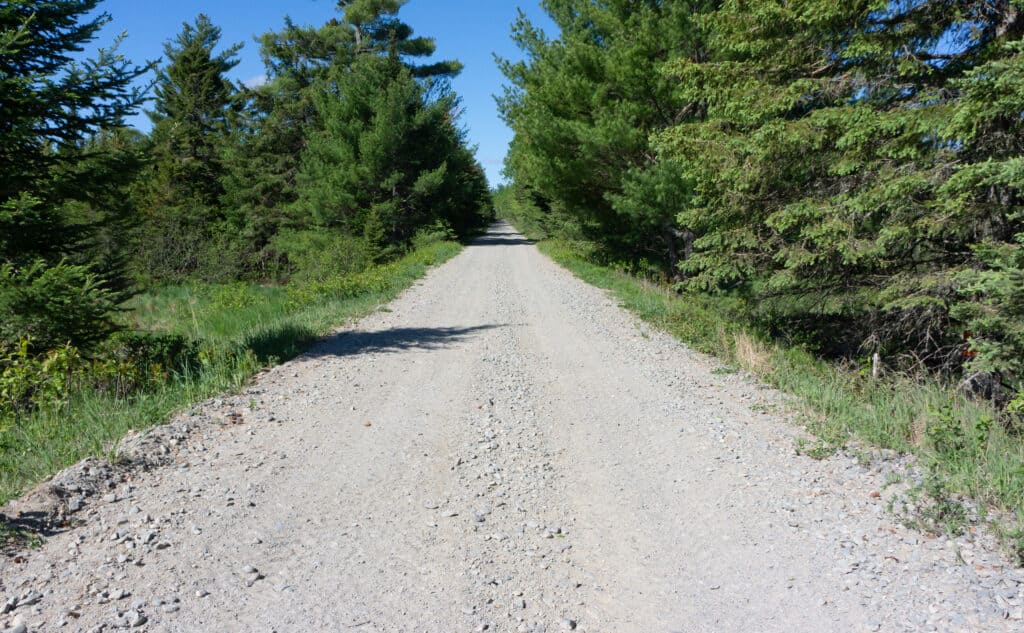
If you’re open to enjoying the trail and the scenery, this is definitely a great first step. You should keep in mind that the trail itself is unpaved. Because of this, you’ll mostly be biking on crushed stone and gravel.
It would definitely be a good idea to do research on the route before you set out on your journey. There are so many things to see and do on this route. It would be a good idea to pinpoint the ones that interest you most.
Also, it’s a good idea to check the weather before you start your journey. Keep in mind that this trail, just like others in the area, will not be open at times in the spring (mud season).
Navigating the Route
The Down East Sunrise Trail is maintained by the Maine Division of Parks and Public Lands and the Maine Department of Transportation. It’s well-maintained and managed, so you can use the mileposts along the trail to guide you. Keep in mind that there are small sections at the beginning and end where there are no signs, from Ellsworth to Washington Junction Road and Ayers Junction to Perry.
However, it’s also a good idea to have access to a map of the trail, at least the segment you are on. This way, you can keep track of where you are relative to the landmarks you want to visit. You can find maps of all three segments of the trail on the trail’s website.
The Down East Sunrise Trail Difficulty
The Down East Sunrise Trail is moderately challenging because of its length and terrain, but there are plenty of places to stop.
©TFolsom99999/Shutterstock.com
Many consider this trail to be moderately challenging. Although it is very long, there are plenty of stops along the way. You will be able to take breaks for meals and find lodging when you want to stop biking for the night.
Overall, there are few elevation changes, and much of the trail is flat. This makes it easier for cyclists at all levels. However, the trail can sometimes be muddy at some points, and you will be biking on gravel quite a bit. This makes for a ride that isn’t always smooth.
Where is the Down East Sunrise Trail Located on a Map?
The Down East Sunrise Trail has two end points, the eastern and western trailheads. The eastern trailhead is in Ayers Junction, Pembroke, which is on Maine SR 214, and is the easternmost point of the trail. The western trailhead is at US 1/ SR 3/High St. and Beals Avenue in Ellsworth.
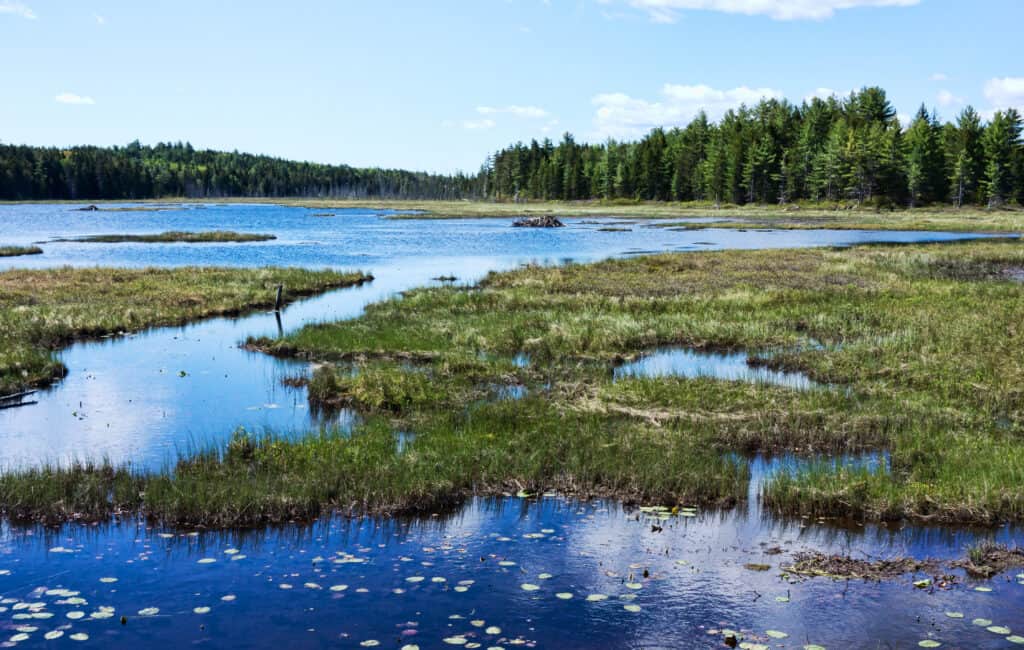
Wildlife on the Longest Biking Trail in Maine
The Down East Sunrise Trail will take you through many natural areas. You can go through forests and along the coastline, and you’re very likely to spot some native wildlife. You’re very likely to see Maine’s iconic moose, in addition to white-tailed deer, scampering across the landscape.
While the moose can be a fascinating sight, keep in mind that these animals can be dangerous. Try to maintain your distance; if the moose starts to approach you, back away. If they charge, run or bike away as quickly as you can. Try to put objects in their path to stop them from catching up to you.
Bird watchers will be happy to know that they may spot osprey, eagles, and wild turkeys.
Particularly when you go close to bodies of water, you’re likely to see waterfowl and beavers. If you’re in the mood to go fishing, some of these waters are abundant with salmon. There’s the salmon pool at Unionville Crossing and the intersecting salmon rivers.
The photo featured at the top of this post is © peteyp8 / pixabay – License / Original


How to Add Us to Google News


Thank you for reading! Have some feedback for us? Contact the AZ Animals editorial team.