
Known as “the city that never sleeps,” New York City is a bustling metropolis. However, beyond New York’s urban center many natural wonders wait to be explored. Forests, mountains, meadows, valleys, rivers, lakes, and waterfalls make up much of the state. The mighty Hudson river, Erie Canal, and the great Adirondack Mountains are some notable features of the landscape. What better way to explore the Empire State than by bicycle? Let’s explore the longest biking trail in New York!
Empire State Trail: The Longest Biking Trail in New York
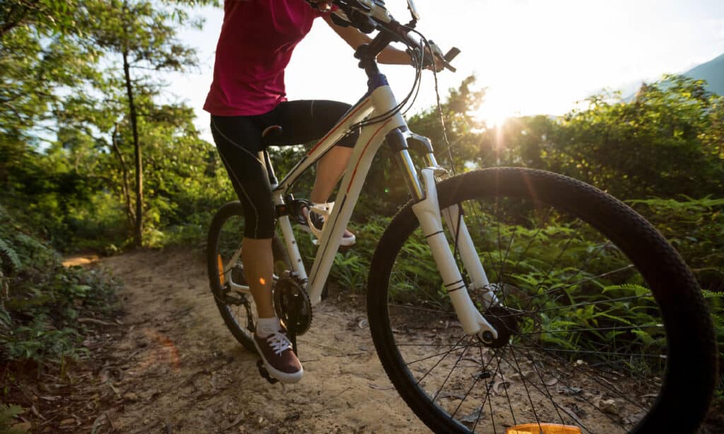
Empire State Trail is the longest biking trail in New York.
©iStock.com/lzf
The longest biking trail in New York is the 750-mile Empire State Trail. The route connects Albany to Buffalo and New York City to the Canadian border, traversing the state east to west and south to north.
The Empire State Trail route is mostly made up of off-road paths. However, city streets, highway shoulders, and small country roads also make up portions of the trail. It offers an incredible opportunity to explore the wetlands, waterways, mountain ranges, and grasslands of New York state. Cyclists can take in the natural beauty of the region and explore its history at a pedaled pace. It is not only the longest biking trail in New York, but also the longest trail in the United States dedicated to non-motorized users. Biking, hiking, snowshoeing, and cross-country skiing are all welcome activities on the trail.
History of the Longest Biking Trail in New York
Governor Andrew Cuomo proposed the project of the Empire State Trail in January 2017. The trail utilizes many formerly existing trail segments. These trails retain their former names while also being counted as a segment of the expansive Empire State Trail. The trail opened to the public in December 2020 after a series of construction projects. These projects were dedicated to creating new trails and eliminating gaps in existing trail segments.
Empire State Trail Navigation
Having a paper map handy to navigate the trail is always a great idea. Cyclists planning for the Empire State Trail route are in luck because the state of New York offers a large paper map of the trail for free! It details the route through the major cities and lists important attractions and trail user information. The map can be ordered online, just be sure to plan ahead as it can take up to four weeks to be delivered via USPS mail.
In addition to having a paper map to navigate the route, you can download a GPX or KMZ/KML file of the trail for use on your computer or GPS device. Find the link for this file and directions for use in the FAQs section of the government site devoted to the trail.
Hudson Valley Greenway Trail: New York City to Albany
The Hudson Valley Greenway Trail is the portion that runs from New York City to Albany. It follows along many rail trails and greenways. These include the Hudson River Greenway in Manhattan, the Putnam Greenway along the Putnam Division of the former New York Central railroad, and the North and South Country Trailways in Westchester County. It traverses the smooth Maybrook Trailway along wetlands and waterfalls, the Walkway Over the Hudson, The Albany-Hudson Electric Trail, and others. The route follows loosely along the eastern shore of the Hudson River. A brief portion of the route brings you along its western shore.
This section of the Empire State Trail is almost entirely off-road. It’s a doable route for most riders. The only on-road section to navigate is between Kingston and Hudson.
Champlain Valley Trail: Albany to Canada border
The Champlain Valley Trail begins in Albany and runs north to the border of Canada where it ends at Rouses Point. It follows along the Champlain Canal from Albany to Whitehall. It then follows Lake Champlain up to Canada. The Champlain Canalway Trail is an off-road path that takes riders along the canal. North of Whitehall, the trail transitions to on-road riding. It follows State Bike Route 9 to the end of the Empire State Trail at Rouses Point.
This section of the trail is best for experienced cyclists comfortable with road traffic. Along this route, you may sometimes find that you need to navigate crumbling and narrow highway shoulders alongside traffic that’s traveling at 55 miles an hour. State Route 22 in the Adirondack Mountains will wind to an elevation of almost 1,000 feet.
Erie Canalway Trail: Buffalo to Albany
The Erie Canalway Trail is 360 miles and runs from Buffalo to Albany via Rochester and Syracuse. It meanders along paths and rail trails that follow the old Erie Canal and later on the New York State Canal System. The route is relatively flat and easy with 85 percent of it made up of dedicated biking paths. The only sections that are on-road are between Clyde and Port Byron, Schuyler and Frankfort, and Cohoes and Watervliet.
The towns along the way are never more than 20 miles apart. This makes it easy to plan for staying at a hotel each night. If camping is more your style there are a few state parks near the trail to pitch your tent. You can also camp at the locks along the canal, which are first-come, first-served sites. If you ride roughly 50 miles per day you can expect to finish cycling this portion of the Empire State Trail in about a week.
Elevation and Difficulty of the Trail
Much of the route follows rail trails and abandoned railway lines that have been repurposed. It also runs along canalway trails built adjacent to portions of the Erie and Champlain Canals. Most of the Empire State Trail is relatively flat with minimal change in elevation.
There are both on-road and off-road sections of the trail. Off-road sections are about 10 to 12 feet wide with an asphalt or stone-dust surface. Stonedust is a finely ground and compacted material that makes for a stable riding surface. The majority of the on-road riding takes place along the 110-mile Champlain Valley Trail section from Whitehall north to the Canadian border at Rouses Point. The off-road sections are designated along roadway shoulders. These portions are only recommended for experienced cyclists who are comfortable riding alongside traffic.
How Long Does the Trail Take to Complete?
Cyclists of all ages and abilities will enjoy the longest biking trail in New York. The time it takes to complete the entire trail will vary greatly depending on each individual’s experience and goals. If you plan to cycle non-stop you might complete the ride in record time. You can complete the Erie Canalway Trail in just over 30 hours. However, if you want to take your time and enjoy the sights and sounds along the route at a leisurely pace, you’ll want about a week for this section of the trail alone.
Experienced long-distance riders will get a thrill from this extensive journey through the Empire State. Those with less experience or who just want a slower-paced or shorter route can take their time and are welcome to choose their own route and speed. Tackle a section at a time or complete the journey end to end from west to east and south to north.
Wildlife on the Longest Biking Trail in New York
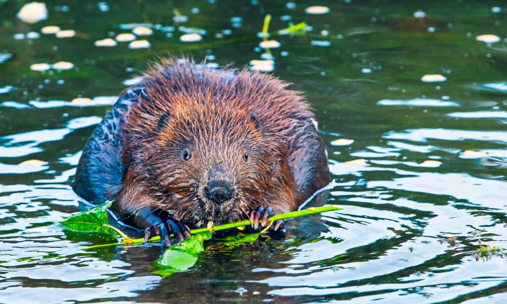
You can find the American beaver along the banks as you ride.
©SERGEI BRIK/Shutterstock.com
The American beaver is the state animal of New York and it’s likely that you’ll spot this slick-furred swimmer along the banks of the Hudson as you ride. White-tailed deer are common in this state and you’ll likely spot them grazing at some point. Look down and you might spot raccoons and squirrels scurrying across your path. Look up to see eastern bluebirds, blue jays, and hawks in flight. While it’s unlikely that you’ll spot a coyote or a black bear as you cycle by, be sure to give them a wide berth if you do pass by.
Bicycling brings you into a state of harmony with the natural world as you travel at a rate that’s aligned with your surroundings. So have fun exploring and be sure to respect the territories you traverse along your way.
The photo featured at the top of this post is © iStock.com/sportpoint


How to Add Us to Google News


Thank you for reading! Have some feedback for us? Contact the AZ Animals editorial team.