
The Great Plains state of North Dakota is known for the rugged Badlands and expansive rolling prairies. While the prairies provide a flat, grassy, easy-going landscape to travel, the Badlands live up to their name. They feature deep canyons; rough ridges; steep hills; and colorful, otherworldly landforms. The longest biking trail in North Dakota will guide you through the peaceful prairie, the challenging yet rewarding Badlands, and much more!
The Maah Daah Hey Trail
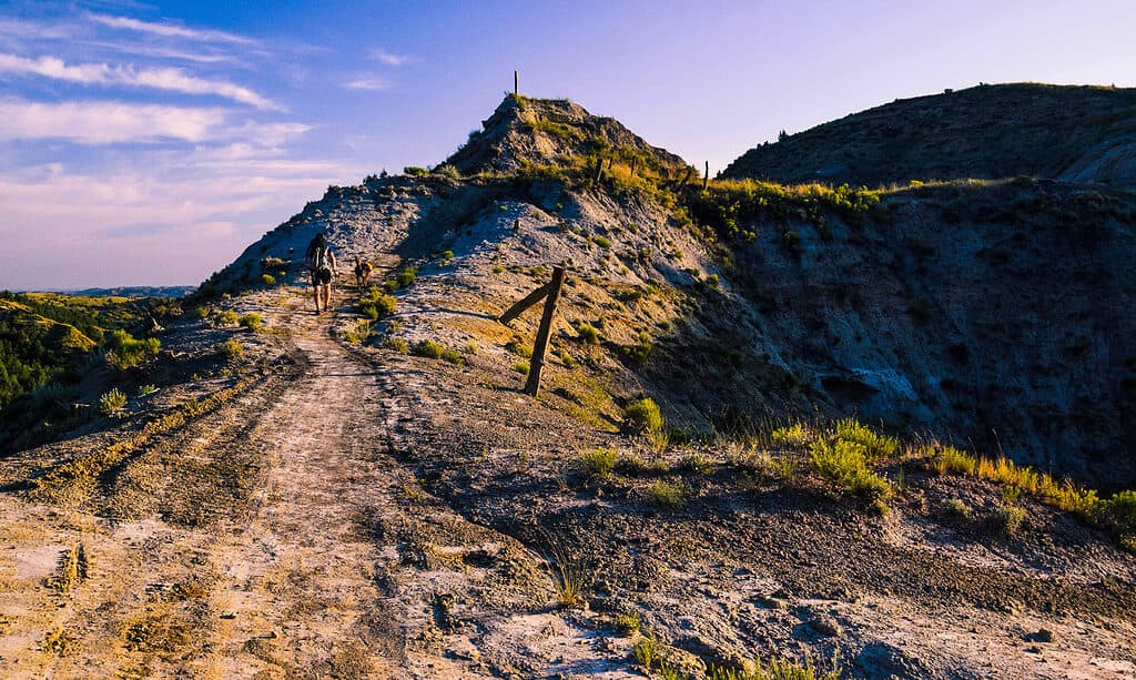
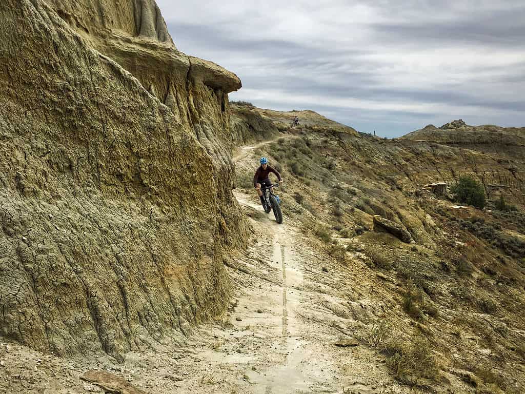
The Maah Daah Hey Trail is the longest biking trail in North Dakota, at 144 miles.
©Deborah Housten/Shutterstock.com
The longest biking trail in North Dakota is the 144-mile Maah Daah Hey Trail. The route begins just under 50 miles south of Medora at the US Forest Service Burning Coal Veins Campground and travels north to the endpoint of the US Forest Service CCC Campground 20 miles south of Watford City.
While mountain biking is by far the most common trail activity, the Maah Daah Hey is a non-motorized, singletrack trail that is open to bicyclists, equestrians, and hikers. The trail winds through the largest grassland in the country, the Little Missouri National Grasslands within the Badlands of North Dakota. You’ll ride along rolling prairies and beside steep clay buttes, dip into lush valleys, and cross over the Little Missouri River multiple times. In addition to being the longest biking trail in North Dakota, the route is actually the longest singletrack mountain biking trail in the United States. It’s a challenging route with difficult hills and varied terrain to navigate. The longest biking trail in North Dakota is an excellent choice if you’re ready for a biking adventure!
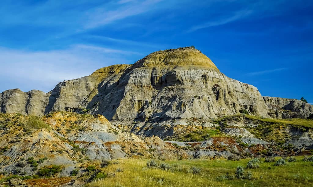
History of the Longest Biking Trail in North Dakota
©Bogdan Denysyuk/Shutterstock.com
Gerard Baker, a tribal member of the Mandan Hidatsa Indians, named the Mash Daah Hey Trail. In the Mandan Hidatsa language, the phrase “Maah Daah Hey” means “Grandfather” or “an area that has been or will be around for a long time.” Trail markers along the route display the image of a turtle, a symbol of the Lakota Sioux tribe. The symbol of the turtle guides cyclists along the trail. It represents unwavering determination, steadfastness, patience, and protection.
The Maah Daah Hey Trail Association (MDHTA) is a nonprofit organization that works to maintain the trail with the help of the public, and volunteers, and through cooperation with the USDA Forest Service.
Elevation & Difficulty of the Trail
There is a total ascent of 15,086 feet on this trail, and it reaches a maximum elevation of 2,941 feet. It’s a challenging route that takes an average of 4-5 days to complete. The route is extensive, physically demanding, and can be logistically challenging.
Navigating the Maah Daah Hey Trail
©drewthehobbit/Shutterstock.com
To prepare for riding the length of the Maah Daah Hey Trail trail guides and maps are available. It’s best to bring along both paper and electronic resources to reference along the way. Trails of the North Dakota Badlands & Prairie A Guide to the Maah Daah Hey Trail, Theodore Roosevelt National Park, & Dakota Prairie Grasslands is a handy guide that is available for purchase on the MDTA site. An electronic version of the map is available as well along with GPX files to download and have ready on your device. A paper map of the trail is always a great idea. You can purchase these at the US Forest Service offices in Medora or Watford City or order one on the MDTA site.
It’s important to note that bicycles are not permitted on the trail as it passes through Theodore Roosevelt National Park. The Buffalo Gap Trail is an alternate route that guides cyclists around the national park boundary.
Camping Along the Trail
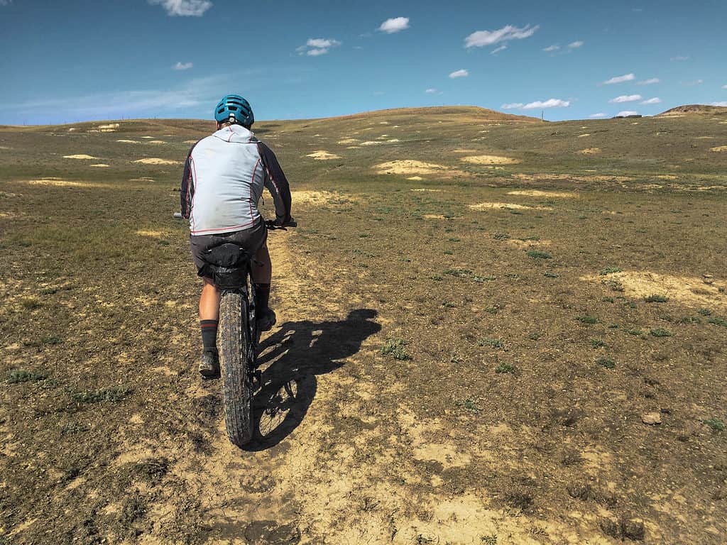
©iStock.com/Paul Schmidt
Both developed and undeveloped camping options are available along the length of the Maah Daah Hey trail. Nine US Forest Service campgrounds exist along the route as well as a North Dakota Parks and Recreation Department Campground. These campgrounds are open year-round and feature camp spurs, potable water, picnic tables, fire rings, and toilets.
If you choose to set up camp in undeveloped areas, you can do so on U.S. Forest Service-managed lands and a permit is unnecessary. Camping on state and private land along the route is not permitted but there are some privately-owned campgrounds in the area.
Water Access
Potable water is available at each campground along the route while weather permits. The pump handles are removed from mid-November through April due to freezing weather conditions. The distance between each campground is about 18 miles or more, so plan for the long stretches. The trail map displays all available water sources including springs, dams, dugouts, and stock tanks. Water at these sites is not declared potable and needs to be accessed at your own discretion. Water may not be dependently available and filtering may be necessary at some of these sources. South of Medora, there are no natural water sources, but water cache sites are set up and marked on the map.
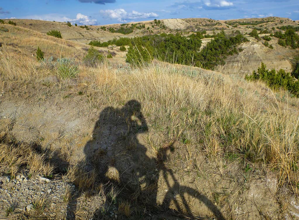
Terrain and Bicycle Type
©iStock.com/Paul Schmidt
Mountain bikes are recommended for the trail. They are the best option for passing the various types of western North Dakota terrain that the route will traverse. Grassy flatlands and ridges give way to rough and steep clay buttes of the Badlands. You’ll travel across rocky river bottoms and wooden draws and cycle your way along rolling prairie grasses. You will access the campgrounds along the way by gravel-surfaced roads. This is an exclusively non-motorized trail and E-bikes are strictly prohibited.
Conditions of the Trail
Although the longest trail in North Dakota is open year-round it may be impossible to ride at times. Difficult and muddy conditions develop during some parts of the year due to snow, ice, and high water. It’s important to check both the weather and water conditions of the rivers before travel. The North Dakota Agricultural Weather Network makes weather data available from weather stations near the towns of Beach, Bowman, Dickinson, Sidney, and Watford City.
The trail crosses the Little Missouri River in two places. In order to determine the river conditions at the time of your planned ride visit the United States Geological Survey website. The website displays up-to-date flow data by location. Check Marmarth, then Medora, then Watford City in order to determine whether the river is rising or falling. The river flows in that direction from Marmarth to Waterford City. If the water depth is lower at Marmarth and higher at Watford, the river is falling, and if vice versa, it’s rising. Consider the currents that can develop and what depth you would feel comfortable navigating across with a bicycle in tow. The clay in the water at these river crossings can get in your drivetrain and cause problems. Carry your bicycle across or bring a chain and cassette cleaning tool along with you to clear the debris.
Wildlife on the Longest Biking Trail in North Dakota
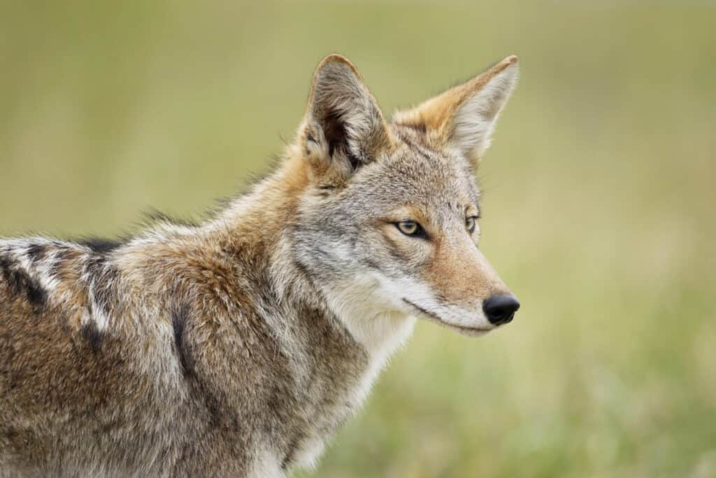
On the Maah Dash Hey Trail, you may see coyotes.
©Paul Tessier/Shutterstock.com
While riding the length of the Maah Daah Hey Trail you are sure to encounter some diverse wildlife. Whitetail deer and antelope are abundant in this part of North Dakota so you’re likely to spot some. Although elusive, coyotes may be spotted, or at least heard. Prairie dogs pop out from their burrows as well as other small animals like skunks and porcupines. Keep an eye on the sky to spot a golden eagle, a falcon, or a red tail hawk flying above. Although a rare sighting, bighorn sheep and elk live in the area and you may see them roaming. Keep an eye out for the incredible sight of wild horses and bison on the range.
There are surprisingly few flying insects to worry about on the trail. The Badlands are bat country and the bats help to keep the biting insects at bay. But be aware of both the dog tick and deer tick that live in the woody areas and tall grasses. Peak tick season is May through July, and it’s a good practice to perform tick checks often. Mountain lions make for a potentially dangerous encounter, but they are a rare sight. Noise, such as bells, can be helpful to alert any wildlife of your presence and avoid any unpredictable encounters. If you do encounter an animal like a mountain lion the best idea is to retreat promptly without running while facing the animal and making yourself seem larger. Snakes, including rattlesnakes, are another potential encounter to be aware of. Making noise to alert them of your presence when passing through any dense vegetation or areas they may be sunning themselves will help to avoid a strike due to surprise.
Up Next…
- The Longest Biking Trail in South Dakota
- The Longest Biking Trail in Vermont
- The Longest Biking Trail in Utah
- The Longest Biking Trail in Tennessee
The photo featured at the top of this post is © iStock.com/Paul Schmidt


How to Add Us to Google News


Thank you for reading! Have some feedback for us? Contact the AZ Animals editorial team.