
Construction began on the Aswan Dam in the summer of 1960. This enormous feat of engineering set out to tame the world’s longest river.
Still to this day, the Aswan Dam on the Nile River is the largest embankment dam in the world. It regulates the flow of the river, prevents catastrophic flooding, aids navigation, generates half of Egypt’s electricity, and provides irrigation for hundreds of thousands of acres of agricultural land in Egypt and Sudan.
A massive structure like this requires a solid foundation, so the builders drilled through the sediments of sand, gravel, and clay in search of bedrock. To their surprise, they discovered that the crystalline granite bedrock lay substantially deeper than anyone expected.
Further analysis and drilling throughout East Africa, up and down the Nile River, as well as in and around the Mediterranean Sea—often with the priority of searching for oil—revealed a fascinating conclusion:
Five and a half million years ago, the Nile flowed through a massive canyon as large as the present-day Grand Canyon of Arizona.
The Rise of the Ethiopian Highlands
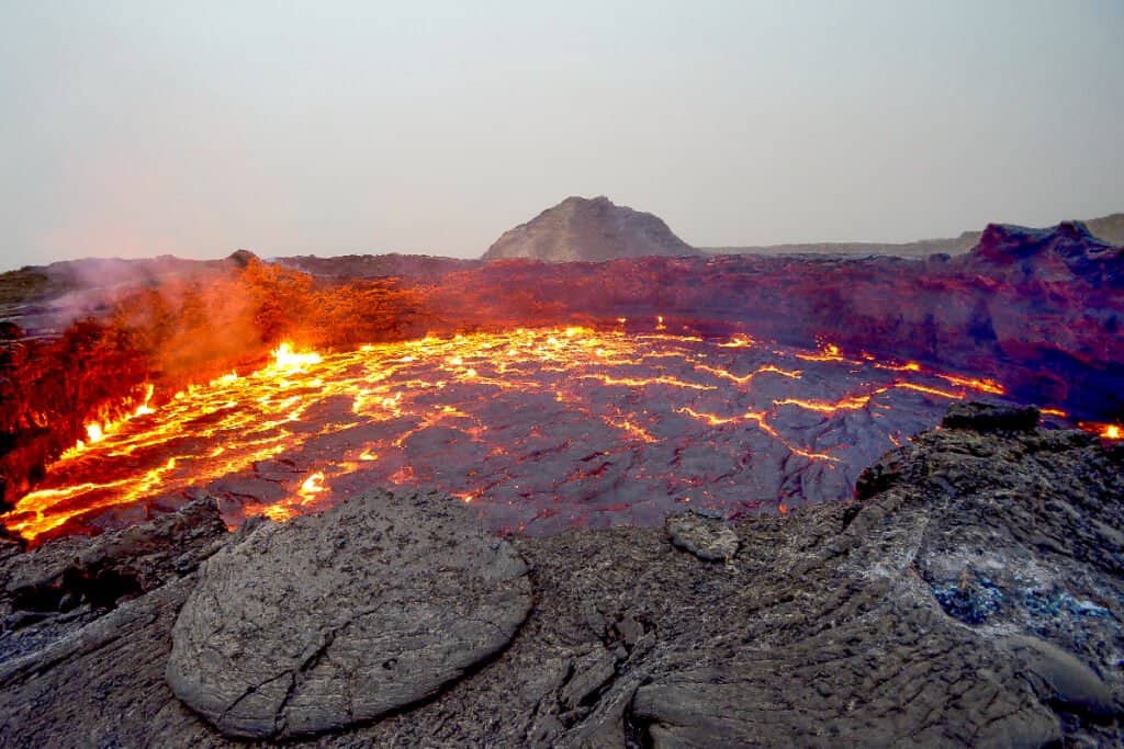
The Ethiopian Highlands are made of volcanic basalt.
©mbrand85/Shutterstock.com
To better understand the geological history of the Nile River, let’s cast our minds back even further back in time—30 million years ago when the Nile’s waters first began to flow (according to the latest and greatest evidence-based models).
Volcanic mantle plumes arising from the Afar Triple Junction (where three tectonic plates, the Nubian, Somalian, and Arabian plates, pull away from one another) poured out layer after layer of basalt lava, forming the Ethiopian Highlands.
As rainwater and meltwater from the highlands flowed down the slopes, streams developed into rivers. One of these rivers flowed downhill all the way north to the saltwaters of the Mediterranean Sea, nearly 1,500 miles away. And so, the course of the Blue Nile took shape.
The Drying of the Mediterranean Sea
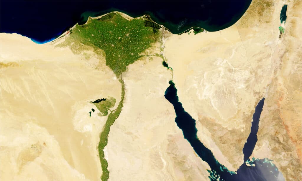
Today, the Nile and its Delta provide essential irrigation in the middle of the African desert, but millions of years ago, the landscape looked very different.
©SRStudio/Shutterstock.com
Underneath the Mediterranean Sea floor lies a 3-kilometer (1.84 miles) thick layer of salt. This was confirmed in 1970 by the drilling of the Deep Sea Drilling Project, which sampled sediment and rock cores from the Mediterranean seabed (and all around the world).
This thick salt layer, along with erosion patterns and fossil evidence, led to the conclusion that the Mediterranean Sea dried up around 6 million years ago. This event is now referred to as the Messinian salinity crisis.
Although it’s not fully understood how this happened, it is suspected that global cooling (leading to increased freezing of glaciers and icebergs, and therefore a drop in sea level) combined with tectonic shifts, caused the Strait of Gibraltar (the narrow passageway between Europe’s Spanish peninsula and Africa) to close up, blocking the inflow of water from the Atlantic Ocean to the sea. Without that constant supply of water from the ocean, the Mediterranean Sea gradually evaporated over the next thousand years. And when this happened, all the salt from the saltwater got left behind, trapped in the seabed.
Nile Erosion Creates a Canyon
As the water level in the Mediterranean Sea dropped, the gradient of the Nile River increased. In other words, the river became steeper as it flowed from its headwaters in the Ethiopia Highlands to its outlet in the Mediterranean.
With a steeper gradient and the resulting spectacular waterfalls, the river had more energy and power to erode the land. It carved out a massive canyon through the continental crust, reaching depths of up to 7,900 feet (1.5 miles) underneath present-day Cairo.
For comparison, the Grand Canyon averages a depth of 4000 feet, achieving a similar 6000 feet at its deepest point.
Put simply, the Nile River ran in a deeper canyon than the Grand Canyon!
The appearance of this Nile Canyon probably looked more like the Black Canyon of the Gunnison in Colorado, which has steep black walls composed of a similar type of granite. The Grand Canyon’s walls, on the other hand, are layered with sandstone, shale, and limestone, which give it its characteristic red-orange-brown appearance.
The Mediterranean Sea Refills
Approximately 5.3 million years ago, the Mediterranean Sea began to refill. Again, the exact mechanism for this is not fully understood, but it likely involved a combination of erosion at the Strait of Gibraltar, tectonic fault activity, and ocean level rise.
Some estimates suggest the flooding that occurred (named the Zanclean Deluge) caused the Mediterranean sea level to rise by as much as 30 feet per day! While it likely took thousands of years for the sea to evaporate, it may have completely refilled in only 10 years. However, other geological models hypothesize it might have taken much longer.
When the sea began to rise, the canyon valley that the river had carved out slowly filled with water. At this point, the river was not so much a river, but rather an inlet bay (a long, deep lake) extending all the way south to Aswan, 560 miles upstream.
Sediment Flow Raises the Riverbed
Over the next few million years, the water flow of the Nile River continued to carry sediment downstream from the highlands. The rising sea level led to a less steep gradient for the river, meaning the river would move more slowly and deposit more sediment.
As the river slowed down, it began to meander and form bends, further promoting sediment deposition.
And as more and more sediment filled in the canyon valley, the riverbed rose and rose. Eventually, its waters rose high enough that the river was once again able to overflow its banks and create the floodplain that we see today.
The White Nile Joins the Blue Nile
At some point in time, probably around 15,000 years ago, the waters of the White Nile connected with the Blue Nile, and the river took on its present form. At this time, the North African landscape was very different from what it is today. The climate was more humid, and the Sahara Desert was not yet a desert but rather a lush savanna with grasslands, trees, and lakes.
The White Nile stretches all the way back to Lake Victoria in the uplands of Uganda, Tanzania, and Kenya. From these headwaters, the river winds its way north in a continuous flow for over 4000 miles to the Nile Delta, where it meets the Mediterranean Sea. This enormous length makes the Nile River the longest river on Earth (though there is some debate on this point since the Amazon River is very close in length, and possibly longer, depending on the method of measurement used).
On its way to the Mediterranean, the White Nile joins with the Nile’s other major tributary, the Blue Nile. The Blue Nile originates in the Ethiopian Highlands and is much shorter than the White Nile. However, despite its shorter length, the Blue Nile actually contributes more water and sediment to the integrated Nile than the White Nile.
The Nile River Today
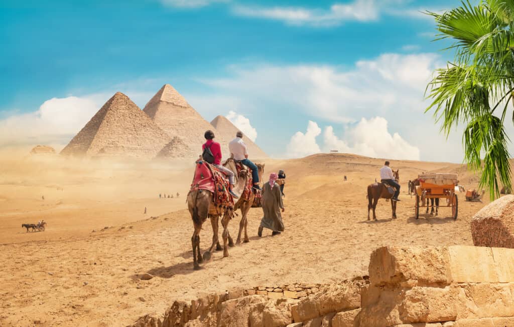
The limestone slabs for the famous pyramids of Cairo were floated down the Nile River.
©givaga/Shutterstock.com
When you stand on the shores of the Nile River today, it is hard to imagine the grandeur and power of this river in its geological past. On the surface, there is little trace of the spectacular canyon that the river once carved out. The Nile today is a slow-moving river, meandering its way through a flat floodplain.
But the Nile is still an incredibly important waterway for the countries it flows through and has played an important role in the region’s history and culture for many millennia. The river continues to be an important transportation route, as well as a source of water for irrigation, drinking, and hydroelectric power.
Famously, the Sphinx and the Pyramids of Giza were built near the Nile River using limestone blocks that were quarried from distant places and floated down the river on barges. The health and well-being of the Egyptian people have always been closely tied to the health of the river, as its annual floods used to deposit a rich layer of fertile silt on the land, ensuring a good harvest. If the river did not flood or flooded too much, the crops would fail, and a tragic famine would ensue.
Nowadays, the water level of the Nile is controlled by a series of dams, which allow for irrigation and hydroelectric power while also protecting against devastating floods.
The Ecosystem of the Nile River
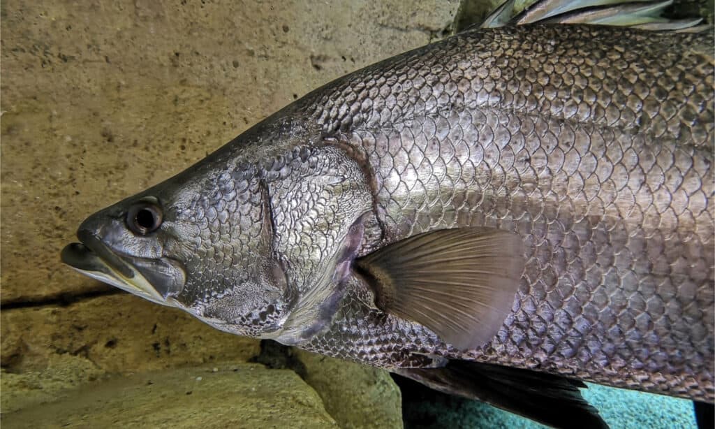
Nile Perch can grow over 6 feet in length!
©Cheng Wei/Shutterstock.com
The Nile is also home to a wide variety of plant and animal life. Papyrus and lotus plants grow in the shallow water along the river’s edge, and reeds, aquatic grasses, and sedges line the banks.
The Nile is home to many fish species, including the Nile Perch, which can grow over 6 feet in length and weigh over 400 pounds! Other fish that live in the river include:
The river’s fertile waters and ample food sources support many interesting animals, such as:
- crocodiles
- hippopotamuses
- cobras
- rock pythons
- monitor lizards
- softshell turtles
The river is also an important stopover for hundreds of species of migratory birds. The Nile Delta is a particularly important resting and feeding ground for these birds, as it is one of the few places in the region with fresh water and ample food sources. However, there is concern that these migrating bird species may be partially responsible for the distant spread of the West Nile Virus—a serious illness that is normally spread by infected mosquitoes.
The Possible Future of the Nile River
The Aswan Dam has been a very helpful resource for Egypt, but it came with some unintended consequences.
©iStock.com/Givaga
The Aswan Dam was built in the 1960s in order to protect Egypt from flooding and provide hydroelectric power. However, the dam has had some unintended consequences.
These negative effects include:
- an increase in soil salinity (saltiness)
- a decrease in water quality due to contamination by chemical fertilizer and pesticide runoff
- the disappearance of some fish species
- increased spread of human diseases
- increased vulnerability to climate change and rising sea levels
- flooding of important historical sites
- displacement of communities who have lived near the Nile for centuries
Additionally, economic and political tensions between the countries that the Nile River flows through (Egypt, Sudan, South Sudan, Ethiopia, Uganda, Kenya, Tanzania, the Democratic Republic of the Congo, Rwanda, and Burundi) have led to disagreements over how to best manage the river’s water resources.
For example, Ethiopia is currently constructing the Grand Ethiopian Renaissance Dam on the Blue Nile. The reservoir created by this dam intends to be hugely beneficial for Ethiopia’s rapidly growing population and economy. However, downstream in Egypt, they are seeing a significant decrease in their water supply as a result.
Also, there are worries that an excessively hot and dry year (growing more and more likely due to systemic climate change) could lead to devastating droughts that would threaten the lives of the 250 million people who rely on the Nile for drinking water, irrigation, and other needs. Egypt and the surrounding areas are already among the most water-scarce places on Earth, and a decrease in the Nile’s flow could be catastrophic.
With proper management and cooperation between the countries involved, it is possible that the river could continue to support life and prosperity in the region for many years to come. However, the challenges are significant, and only time will tell what the future of the Nile River will be.
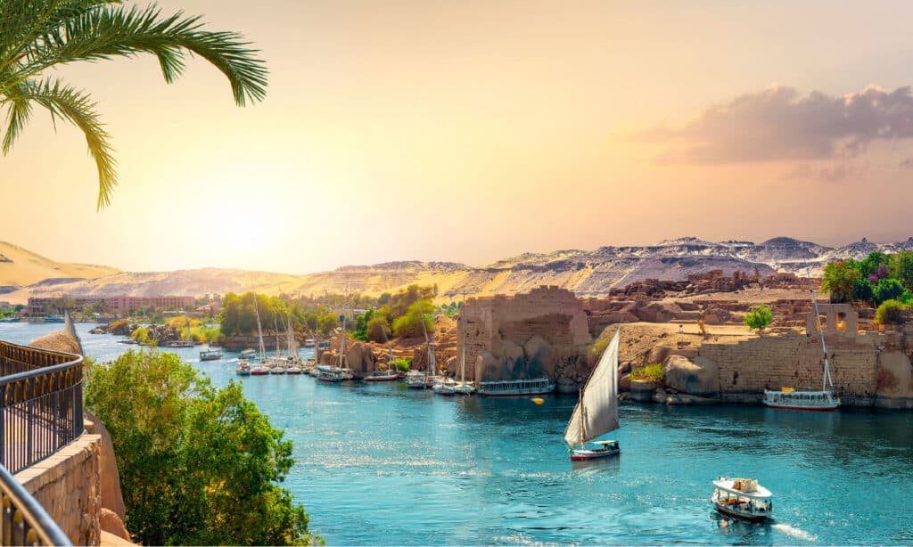
The photo featured at the top of this post is © AlexAnton/Shutterstock.com
How to Add Us to Google News


Thank you for reading! Have some feedback for us? Contact the AZ Animals editorial team.