What is Precipitation?
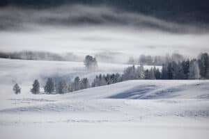
Precipitation is any liquid or frozen water that forms in the atmosphere and returns to Earth. Precipitation is the driving force behind all hydrologic processes, making it a crucial source of water that sustains life. It can fall in many forms, such as rain, snow, hail, sleet, and freezing rain. The temperature when precipitation reaches the ground determines what form it will take: liquid or solid.
In its liquid form, it infiltrates into soil and groundwater systems, then transpiration from plants helps to evaporate some of this moisture back into the atmosphere. Surface runoff moves excess water away from land surfaces until it eventually finds its way to streams, rivers, and oceans.
Solid forms, such as snow, help maintain river flows during dry periods by slowly melting over time – this process is known as baseflow. Channel flow occurs when precipitation-sourced water is directed towards permanent channels like creeks or rivers, where it is transported downstream until reaching its destination body of water. These processes rely on precipitation for their existence, making them vital components within the hydrological cycle. Without precipitation, there would be no freshwater resources!
How Does Precipitation Form?
- Coalescence. The coalescence mechanism is one of the primary ways precipitation can form. It begins when a water droplet forms around a nucleus, such as dust particles, carbon dioxide, salt particles, or other airborne non-water particles. This process often occurs when temperatures drop below the dew point. As more and more water molecules attach to this nucleus, it grows larger and increases its velocity due to gravity until it reaches approximately 7mm in diameter. At this point, it breaks apart into smaller pieces that become new nuclei for more droplets. In windy conditions, these processes may continue before finally reaching the ground as precipitation.
- Cooling. The cooling mechanism of precipitation is caused when the amount of moisture in the atmosphere exceeds what air can hold. When warm, moist air is cooled enough, water will fall out of the sky as a form of precipitation. This cooling process can occur through adiabatic cooling (when an air mass at low elevation is lifted to higher ground), frontal cooling (along the edge between two different weather fronts), contact cooling (warm air blowing over cold bodies of water), and radiation cooling (air heated during the day that cools during the night). Depending on where you are located and which season it is, one type of these processes may be more likely than others. However, all kinds do not necessarily happen everywhere.
What Are the Categories of Precipitation?
The three categories of precipitation are convective, cyclonic, and orographic. Convective occurs in warm weather with vertical air currents causing droplet condensation. Cyclonic results from low-pressure systems or storms where moist air rises and cools off. Orographic is caused by moisture-laden winds that rise over mountainsides, leading to heavier rain on one side than the other due to leeward effects. All relate closely to weather patterns; understanding them aids in predicting conditions and preparing for extreme events like floods or droughts.
Convective
Convective precipitation is usually associated with thunderstorms and other forms of severe weather. When warm, moist air rises in the atmosphere, it expands as pressure drops due to the increasing elevation. This condition causes the temperature of the air to drop below its dew point, resulting in condensation and, eventually, rainfall. Convective precipitation is usually short-lived but can be intense, producing large amounts of rain or snow over a short period. Additionally, convection currents are often responsible for creating strong winds, which can cause damage when combined with heavy rains or snowfall.
Cyclonic
Cyclonic precipitation is a type of weather associated with low-pressure systems. Low-pressure systems form when warm, moist air is drawn into the cold front and rises due to adiabatic cooling. The intensity of the cyclonic precipitation depends on the magnitude of the low-pressure system and how much warm, moist air it has drawn in. As warmer, moist air enters this area, there will be heavier rainfall or snowfall, depending on the season. These types of storms can also produce thunderstorms or hail if conditions are right. Cyclonic precipitation often affects large areas as these low-pressure systems move across oceans and continents, affecting many regions over a period of days or even weeks before dissipating.
Orographic
Orographic precipitation occurs when an air mass is forced up the side of a mountain range due to the cold front associated with it. As the air rises, it cools adiabatically, resulting in condensation and, thus, precipitation. You will most often see this form of precipitation on mountains around the world as they experience regular storms and winds associated with frontal systems. An orographic lift can also cause localized rain shadows. These dry areas occur on leeward sides of hills or mountains due to reduced moisture availability caused by increased elevation changes needed for orographic lift.
How Is Precipitation Measured?
Point precipitation measurements involve using a gauge of some kind, such as a rain gauge, measuring cylinder, or snowboard. These tools measure the depth of liquid that has fallen at one location over a certain period of time.
Spatial precipitation measurement involves using radar technology to map out the amount and intensity of rainfall across large areas. Radar is able to track where large amounts of rain are falling, which helps meteorologists predict the likelihood of flooding in certain regions. Hydrologists and other scientists can use the data gathered from these two types of measurements to understand weather patterns and water cycles on Earth.
8 Types of Precipitation
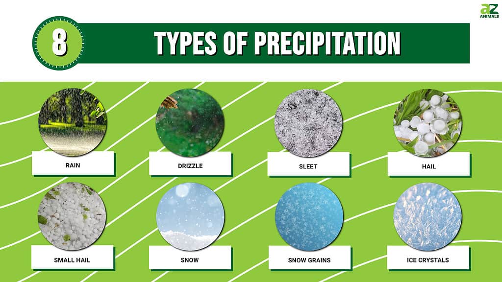
Today we will discuss eight different types of precipitation and describe them in detail.
Rain
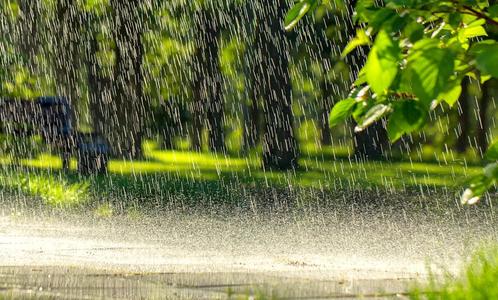
Rain often falls in a steady shower and can last for several hours at a time, depending on the weather system that produces it.
©mykhailo pavlenko/Shutterstock.com
Rain is the most commonly observed form of precipitation. Drops larger than 0.02 inches or 0.5 mm diameter are typically considered raindrops. However, smaller drops can also be classified as rain if they are widely spaced apart from one another (as opposed to drizzle, which consists of closely spaced droplets). Rain often falls in a steady shower and can last for several hours at a time, depending on the weather system that produces it. The intensity of rainfall varies significantly around the world; some regions may experience light showers while others receive torrential downpours lasting many hours or even days.
Drizzle
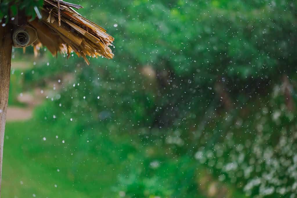
In many cases, drizzle and fog occur at the same time as one another; this is especially common in places with high humidity or in areas near bodies of water.
©ANAWIN17/Shutterstock.com
Drizzle is a type of precipitation composed exclusively of small, uniform drops that are very close together. It appears to float in the air and move with the currents, but unlike fog droplets, it will eventually fall to the ground. In many cases, drizzle and fog occur at the same time as one another; this is especially common in places with high humidity or in areas near bodies of water. Even though drizzle falls from the sky as raindrops do, it does not make much noise when hitting surfaces because its droplets are so light and small. Additionally, since these drops are so tiny, they usually evaporate before accumulating on solid surfaces such as roads or sidewalks. This fact makes them difficult to measure accurately using traditional measuring equipment such as rain gauges.
Sleet
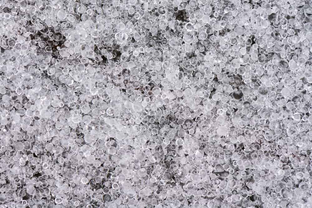
Sleet occurs when either raindrops or snowflakes fall through a layer of warm air before hitting a colder layer near the Earth’s surface.
©Ayman Haykal/Shutterstock.com
Sleet is a type of precipitation consisting of frozen raindrops or snowflakes that have fallen to the ground and then refrozen. The pellets, which can vary in size from small grains to large chunks, are usually transparent or translucent in appearance. Sleet occurs when either raindrops or snowflakes fall through a layer of warm air before hitting a colder layer near the Earth’s surface. This trip causes them to melt partially and then refreeze as they reach the lower atmosphere. It is often referred to as “freezing rain” because it appears like frozen drops of water falling from the sky. When sleet accumulates on surfaces such as roads, sidewalks, and bridges, it can become slippery and cause hazardous conditions for drivers and pedestrians alike.
Hail
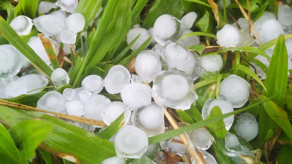
The size and shape of hailstones vary depending on how many times they’re lifted up again before finally reaching the ground.
©krengkamon/Shutterstock.com
Hail is a type of precipitation that falls from the sky in the form of small balls or pieces of ice, each about ¼ inch (5 mm) or larger in diameter. It is associated with thunderstorms and can cause extensive damage to crops and property when it reaches 1 inch (2.5 cm) in diameter or more. In this case, the storm is considered severe by meteorologists.
Hailstones are formed due to strong updrafts within thunderclouds, which carry droplets of water high into the atmosphere, where they freeze into solid pieces of ice before falling back to Earth. The size and shape of hailstones vary depending on how many times they’re lifted up again before finally reaching the ground – sometimes forming irregular lumps as multiple hailstones stick together during their descent through turbulent air currents caused by winds associated with thunderstorms.
Small Hail
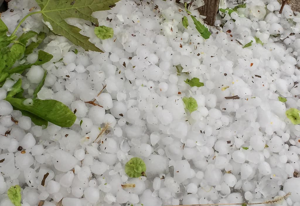
©Tony Webster / CC BY 2.0 – License
Small hail, also known as snow pellets, is a type of precipitation consisting of white and opaque grains of ice. These grains can come in either round or conical shapes, with diameters measuring less than ¼ inch (5 mm). Small hail usually falls during thunderstorms and other severe weather conditions.
It is an important form of precipitation and can significantly impact the environment. For example, it can damage crops or disrupt power lines if it accumulates enough in one area. In addition to its environmental impacts, small hail can also be hazardous for people who are outdoors when it falls due to its hard texture and sharp edges.
Snow

Snow can vary in size depending on temperature; very cold temperatures will result in smaller snowflakes, while warmer temperatures cause larger flakes to form.
©fotohunter/Shutterstock.com
Snow is a type of precipitation that falls from the sky in the form of small ice crystals. These snow crystals are usually branched and star-shaped, with six distinct points. They form when water vapor freezes in clouds and then falls to the ground.
Snow can vary in size depending on temperature; very cold temperatures will result in smaller snowflakes, while warmer temperatures cause larger flakes to form. Generally, most snowflakes are only a few millimeters wide or long. Depending on its location and time of year, different regions experience different types of snowfall.
Snow Grains

©Alexirius Multimedia/Shutterstock.com
Snow grains are a type of precipitation that consists of very small, white, and opaque grains of ice. They form when tiny water droplets freeze in cold temperatures to become snowflakes. Snow grains can be described as frozen drizzle – a combination of freezing rain and snowfall.
Snow grain showers usually occur during spring or early summer due to the warmer temperatures causing snowflakes to melt before reaching the ground. However, if conditions are just right, these tiny ice particles can accumulate on the ground forming a thin layer of a white powdery substance similar to frost.
Ice Crystals
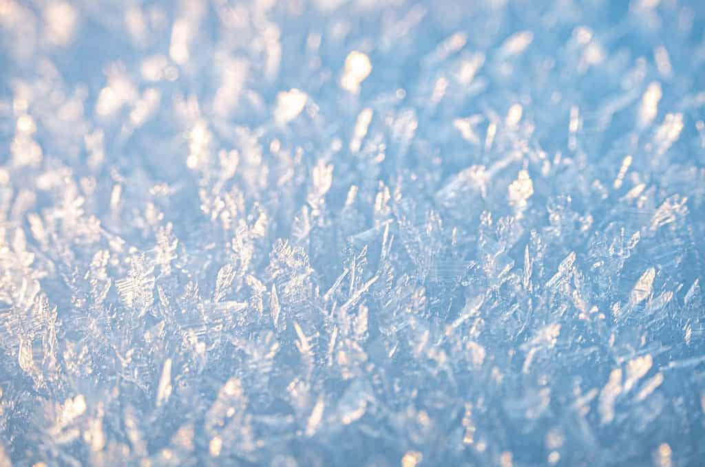
©Dennis Alp/Shutterstock.com
Ice crystals, generally occurring in very cold regions, are a type of precipitation formed by falling crystals of ice. They usually appear as needles, columns, or plates and can also be referred to as ‘diamond dust.’
Unlike other types of precipitation, such as rain or snow, which form droplets from water vapor condensing into liquid drops before freezing and falling, individual water particles forming directly as ice cause the formation of ice crystals.
The shape of the individual ice crystals causes a unique optical effect known as the ‘light pillar’ above any light source (such as street lights) located beneath them. This phenomenon is caused by flat faces on certain shapes reflecting light like mirrors when they align with a light source below them.
How Does Global Warming Change Precipitation?
Global warming is leading to changes in the amount, intensity, and frequency of precipitation around the world. When temperatures rise, more ice melts and evaporates into the atmosphere. This warmth eventually leads to an increase in rainfall over certain areas, such as parts of North America. In contrast, other humid tropical areas may experience drier conditions due to increased evaporation from warmer oceans.
Furthermore, when moisture-laden air moves over land or converges into a storm system, it can create much heavier rain and snow storms than would have normally occurred without global warming. These extreme weather events are becoming increasingly common as temperatures continue to rise around the world.
A Summary of 8 Types of Precipitation
| Number | Precipitation |
|---|---|
| 1 | Rain |
| 2 | Drizzle |
| 3 | Sleet |
| 4 | Hail |
| 5 | Small Hail |
| 6 | Snow |
| 7 | Snow Grains |
| 8 | Ice Crystals |
The photo featured at the top of this post is © ANAWIN17/Shutterstock.com
Sources
- The Earth Observatory, Available here: https://earthobservatory.nasa.gov/images/144568/unstable-precipitation-leads-to-unstable-pastures
- U.S. Department of the Interior, Available here: https://www.usgs.gov/special-topics/water-science-school/science/precipitation-and-water-cycle
- USACE Hydrologic Engineering Center, Available here: https://www.hec.usace.army.mil/confluence/hmsdocs/hmstrm/precipitation/basic-concepts
- JetStream, Available here: https://www.weather.gov/jetstream/preciptypes
Thank you for reading! Have some feedback for us? Contact the AZ Animals editorial team.


