
If you want to visit the North Rim and the South Rim of the Grand Canyon in the same day you will have to drive (or take a helicopter). There are no bridges that visitors can drive on to get from the North Rim to the South Rim (or vice versa) in the park. You must take the surrounding roads over and around to access the other side. However, with its vast length, there are areas in the Grand Canyon beyond the popular North and South Rims that visitors flock to.
Are there any bridges that cross the Grand Canyon? If there are, how tall are the bridges? Can you walk across the Grand Canyon? Let’s find out what bridges cross the Grand Canyon.
How big is the Grand Canyon?
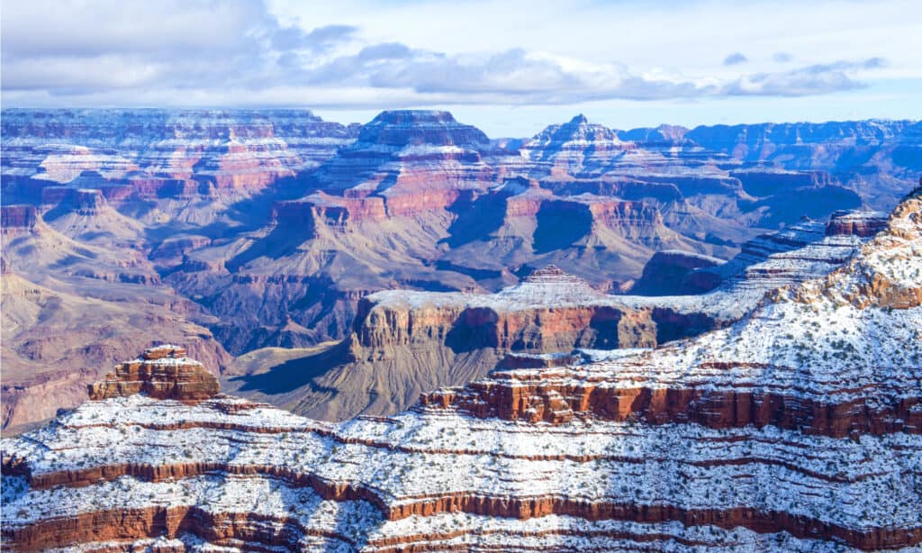
The Grand Canyon is 277 miles long and 18 miles wide at the widest point.
©Kobby Dagan/Shutterstock.com
The Grand Canyon in Arizona is 1,904 square miles in size, a little bigger than the whole state of Rhode Island! It is 277 miles long and 18 miles wide at its widest point. The Colorado River runs through it having formed the great canyon 6 million years ago. The canyon officially begins at Lees Ferry and ends at Grand Wash Cliffs. The Colorado River continues on through Nevada, California and down to Mexico where it empties into the Gulf of California.
The Navajo Bridge (there are 2 of them)
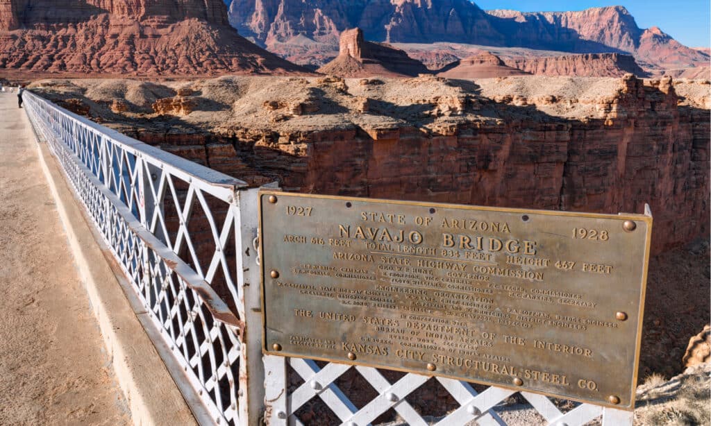
There are Two Navajo Bridges, the historic and the modern. The modern one is now used for vehicles to cross the Grand Canyon on Highway 89A.
©Serge Yatunin/Shutterstock.com
The Navajo bridge provides access for vehicles to cross the Grand Canyon on US Highway 89A. Although it is only 10 miles from North Rim to the South Rim as the crow flies, it is around 212 miles to drive down and around (or up and around). The drive takes around 4 ½ hours to complete. It takes 1 hour 50 minutes to drive the 85 miles from the North Rim to the Navajo Bridge and it takes around 2 hours 16 minutes to drive the 125 miles from the South Rim to the Bridge.
There are 2 bridges, the old one (historic) and the new one (modern). The historic bridge remains intact and is used as a pedestrian bridge, where visitors can cross and visit the visitor center. The new modern bridge is used by vehicles of all kinds on US Highway 89A. The bridge needed a new design because automobiles and trucks became heavier and there was concern about the weight limit of multiple vehicles. There was also limited sight lines coming onto the bridge, which led to 72 accidents over a 13-year period.
How tall is the modern Navajo Bridge?
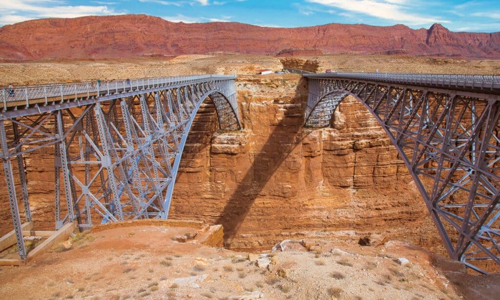
The historic and modern Navajo bridges as they stand today. The modern Navajo Bridge is on the right.
©Fine Art Photographs/Shutterstock.com
The modern Navajo Bridge is 470 feet tall with the Colorado River rushing below it. The modern bridge was built between 1993-1995 and was completed on September 14, 1995. It is 909 feet long and 44 feet wide. The Navajo bridge cost $14,700,000 to build (equivalent to about $28 million in 2022 dollars).
How tall is the historic Navajo Bridge?
The historic Navajo Bridge is 467 feet tall above the Colorado River. The bridge was completed on January 12, 1929 and was a record-breaking feat being the highest steel arch bridge in the world at the time. It was called the Grand Canyon Bridge originally and was changed to the Navajo Bridge five years later. The bridge is 834 feet long and 18 feet wide. The design of the bridge was so well designed that the new bridge looks almost identical, keeping the same construction plans.
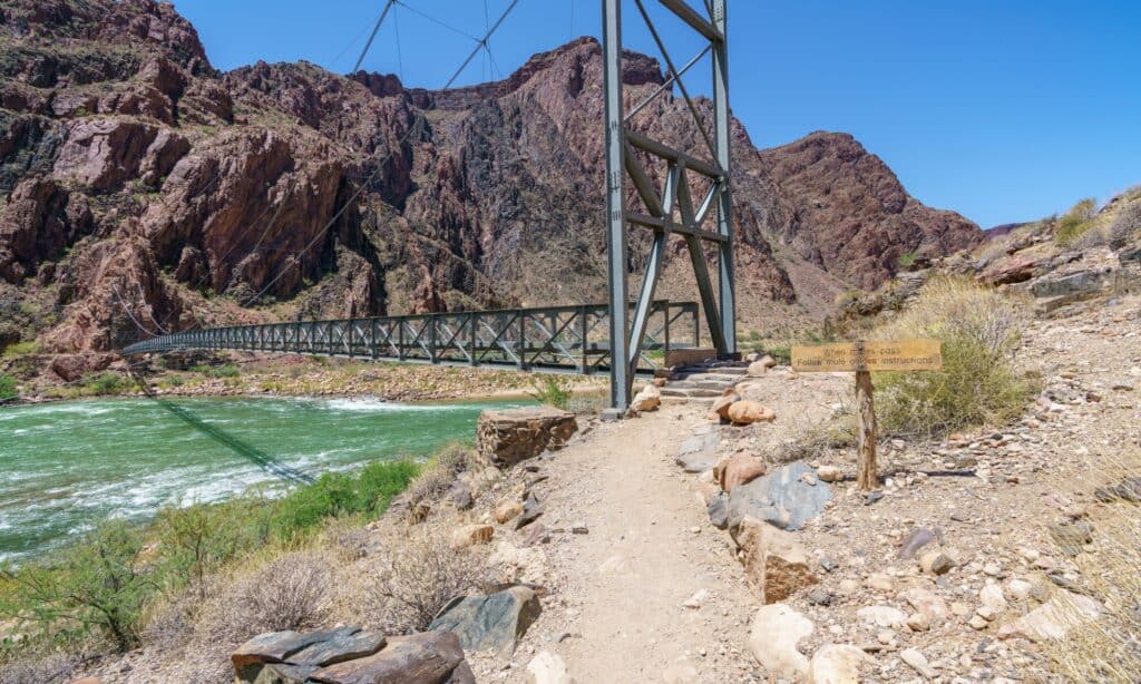
The Black Bridge
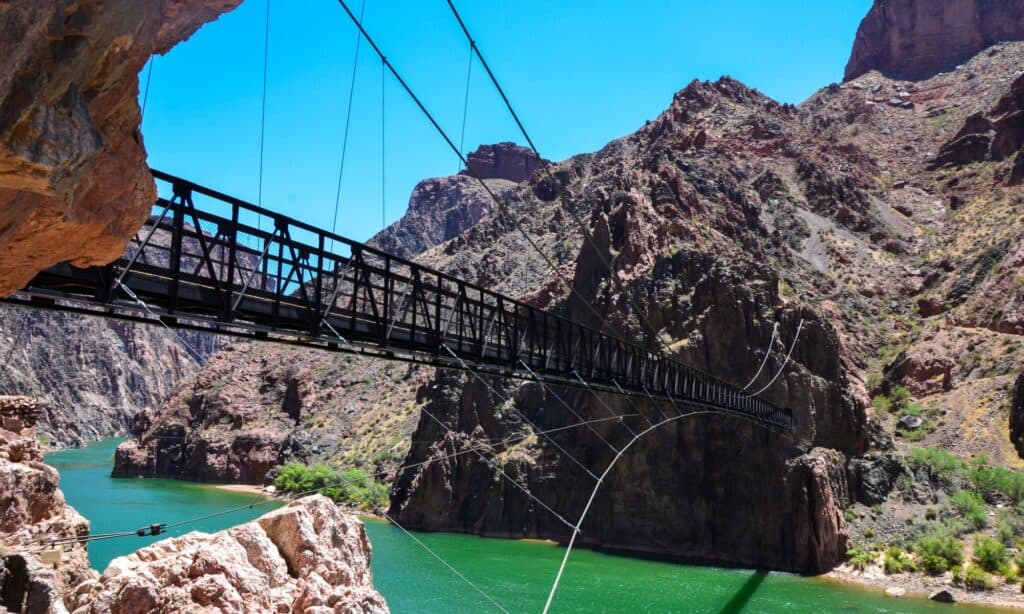
The Black Bridge is at the bottom of the Grand Canyon
©FANGYIMYIM/Shutterstock.com
The Black Bridge is down in the heart of the Grand Canyon. It is one of only two trail bridges that cross the Colorado River for hundreds of miles. You have to hike to the bottom of the Grand Canyon to get to the Black Bridge. Although the Grand Canyon is known to be a mile deep, the trails that wind back and forth to get down to the bottom are much longer. There is a trail from the North Rim that goes down to the bottom and 2 trails at the South Rim. The trail from the North Rim is 14.2 miles to the bottom. The South Kaibab Trail is 6.5 miles to the bottom and the Bright Angel Trail is 8 miles. The Black Bridge is used by hikers, pedestrians, and mules to cross going in either direction.
How Tall is the Black Bridge?
The Black Bridge is 65 feet tall and 440 feet long. At five feet wide it is a safe passage for the many mules that carry visitors down into the canyon and across. Can you imagine what a complex project it was to build this bridge back in the late 1920s? This was before the helicopter had been invented and vehicles could not travel the narrow trails so all materials had to be brought in by people and mules. It was a dangerous task but by 1928 the bridge was completed and provided safe crossings for visitors.
The Silver Bridge
©cb_travel/Shutterstock.com
The second bridge in the Grand Canyon is the Silver Bridge. It is built just downstream from the Black Bridge. It was built in the 1960s and connects the Bright Angel Trail to the North Kaibab Trail. This suspension bridge is also an important structure for the Transcanyon water pipeline. It provides fresh spring water from the North Rim to the South Rim for all the visitors, restaurants, and lodges. Water is difficult to get to the South Rim. This bridge and the pipe and pump system delivers 500,000 gallons of water a day.
How Tall is the Silver Bridge?
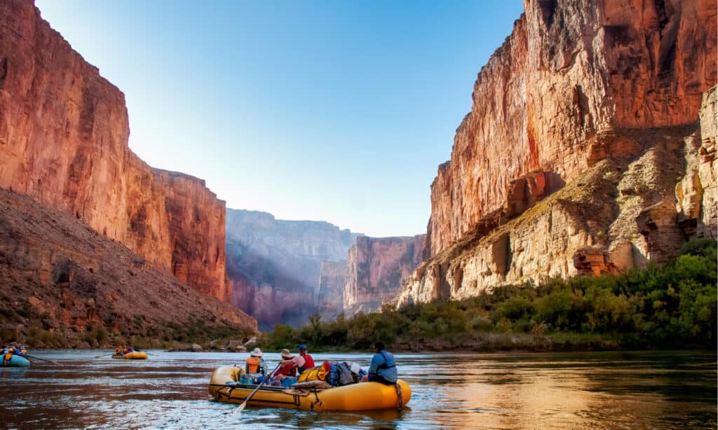
When you cross the Silver Bridge you can often see kayakers and rafters making their way down the Colorado River.
©Jim Mallouk/Shutterstock.com
The Silver Bridge is about 500 feet long and less than 5 feet wide. It is too narrow for mules so pedestrians are the only ones allowed on the bridge. It is not as tall as the Black Bridge but tall enough to allow boats underneath. Kayakers and rafters can often be seen going under the bridge. It would be exhilarating to cross because it moves a little as a suspension bridge.
In September of 2020, the bridge was closed so engineers could examine it. Repairs were made and it was reopened to visitors. During the closure, hikers had to hike an extra 1.5 miles to access the Black Bridge instead.
Can you hike across the bridges in a day?
If you want to hike to the bottom of the Grand Canyon you need a permit and you need to be in excellent physical health.
©CrackerClips Stock Media/Shutterstock.com
No, it is not a day hike to hike to the bottom of the Grand Canyon, across the Silver or Black Bridge and then up the other side. You have to have a permit to hike to the bottom and be in excellent physical condition. Many people need to take several days to make the entire hike. There is a campground half-way down on the North Rim side and the South Rim side. There is the Bright Angel Campground at the bottom of the Canyon. With a fair amount of planning and endurance, the trek across the bridge of the Grand Canyon would definitely be an adventure!
The photo featured at the top of this post is © Fine Art Photographs/Shutterstock.com


How to Add Us to Google News


Thank you for reading! Have some feedback for us? Contact the AZ Animals editorial team.