
Mapping is probably older than mathematics and writing and it’s most likely that an ancestor of Homo sapiens first started drawing primitive maps as a form of communication in their communities. We’ll discuss what the five oldest maps tell us about known civilizations now.
1. Saint-Bélec Slab: 3,500 Years Old
Dated between 1900 BCE and 1640 BCE in the Bronze Age, the Saint-Bélec Slab is considered the oldest extant map in the world. It’s from the Early Bronze Age and it was found as part of a prehistoric grave. It’s a map of the Odet valley in France.
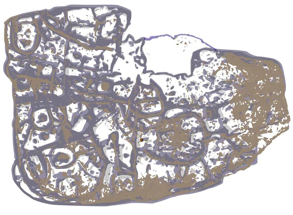
The Saint-Bélec slab is considered the oldest extant map in the world.
©FlorinCB, CC0, via Wikimedia Commons – License
What the Saint-Bélec Slab Tells Us About Civilization
The way the slab is carved shows the undulations of the local terrain. This indicates that a rough concept of representative geography had developed by this time.
This map wasn’t meant to be interpreted literally. It was more of a display of political importance than an accurate guide. Since it was found broken and buried as a wall to a square grave, it’s believed that this grave signified a shift in political thinking.
Perhaps the old worldview was buried with the old authority. Defining the boundaries of someone’s controlled land implies ownership. As a result, this slab shows the importance of land possession and that hierarchical order was an important component of Early Bronze Age life.
2. Imago Mundi: 2,500 Years Old
The Imago Mundi, also known as the Babylonian World Map, was found in the city of Sippar in Iraq north of where the city of Babylon was in antiquity. It’s a Babylonian map that dates back to the fifth century BCE and it survived all of these years because it’s on a clay tablet.
In cuneiform, the tablet states that it was based on an earlier map that no longer exists. This map is usually interpreted as one of the first attempts to draw the entire world.
The city of Babylon is shown and so is the Euphrates River. Nearby towns are also shown, and all of this is surrounded by a circle which represents a body of water. Beyond this body of water are eight islands inhabited by strange beings.
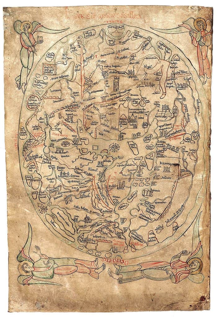
Imago Mundi is also known as the Babylonian World Map and it’s one of the oldest maps in the world at 2,500 years old.
©Honorius Augustodunensis, Public domain, via Wikimedia Commons – License
What the Imago Mundi Tells Us About Civilization
When early recorded civilizations began creating maps, their city or cultural center was at the center. For Babylonians, their city and point of view are at the center of the known universe.
There is no sense of proportion on this map because this map wasn’t created for accuracy. It’s an idealized version of the general landscape around Babylon. It wasn’t a detailed record for enforcing rules nor was it meant to give comprehensive directions to a specific place.
That’s because most people didn’t travel more than a few miles away from their homes throughout their entire lives. Detailed maps weren’t needed and directions were memorized and passed on orally.
The far-flung islands have descriptions in cuneiform that explain they’re beyond a bird’s reach or they’re too far away from the sun. These islands are also believed to be populated with beasts and beings that are unlike anything found in the known world. Early cultures knew there were unexplored places and they imagined these places as almost otherworldly.
3. Anaximander Map: 2,500 Years Old
Anaximander was an Ancient Greek geographer and historian that died around 546 BCE. His work was pivotal in furthering the realizations made by subsequent scholars. This map is the first map that was ever published according to contemporary sources.
The Aegean Sea is at the center of this map. Everything depicted on the map is surrounded by a circular ocean.
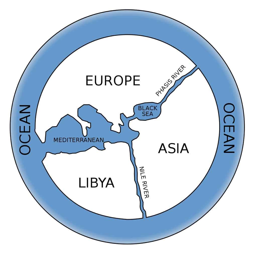
Anaximander world map illustrated the world as being flat.
© – License
What the Anaximander Map Tells Us About Civilization
This map was reconstructed based on written text left behind by Herodotus. This illustrates how important it was to world understanding at the time to have a published map. A circulated map allows for communal geographic referencing that can be expanded upon between generations.
At this time, the world was seen as flat. This is shown by the relative lack of coordinates present. While some sense of proportion is attempted, it isn’t part of a spherical grid nor is there any suggestion of land distortion through curvature.
The Aegean sea is at the center of this map as opposed to a specific city. This shows that the world was now conceived in its entirety. The perception wasn’t that the immediate environment exists and that what remains is outside the periphery or strange.
Instead, everything that has been seen is present and what isn’t known isn’t present. The entirety of the earth is centered and the Ancient Greek population is seen as another piece of a larger puzzle.
4. Hecataeus of Miletus Map: 2,450 Years Old
Hecataeus of Miletus wrote a series of books called the Periodos Ges that carefully described different regions. With it was a map that was based on the contemporary Anaximander map. While the original texts and map haven’t survived, a Byzantine scholar compiled most of the information we know about this map today.
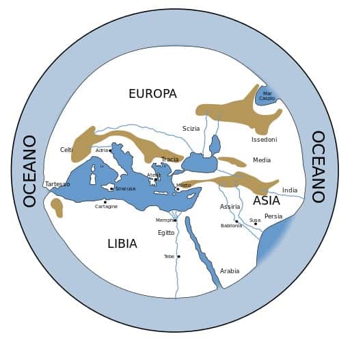
The Hecataeus of Miletus map is similar in nature to the Anaximander map.
© – License
What the Hecataeus of Miletus Tells Us About Civilization
A more accurate land mass is shown in a style similar to the Anaximander Map. This shows the intrigue that the Anaximander Map caused and how churned interest led to a better version of similar concepts. This search for the most precise mapping possible continues to this day.
5. Eratosthenes Map: 2,200 Years Old
Eratosthenes was a thinker respected in many disciplines in Ancient Greece. He worked at the Library of Alexandria as the chief librarian.
His largest contributions helped structure today’s concept of geometry and he’s responsible for some of the terms still in use in that subject area. Eratosthenes calculated the circumference of the earth and identified its axial tilt.
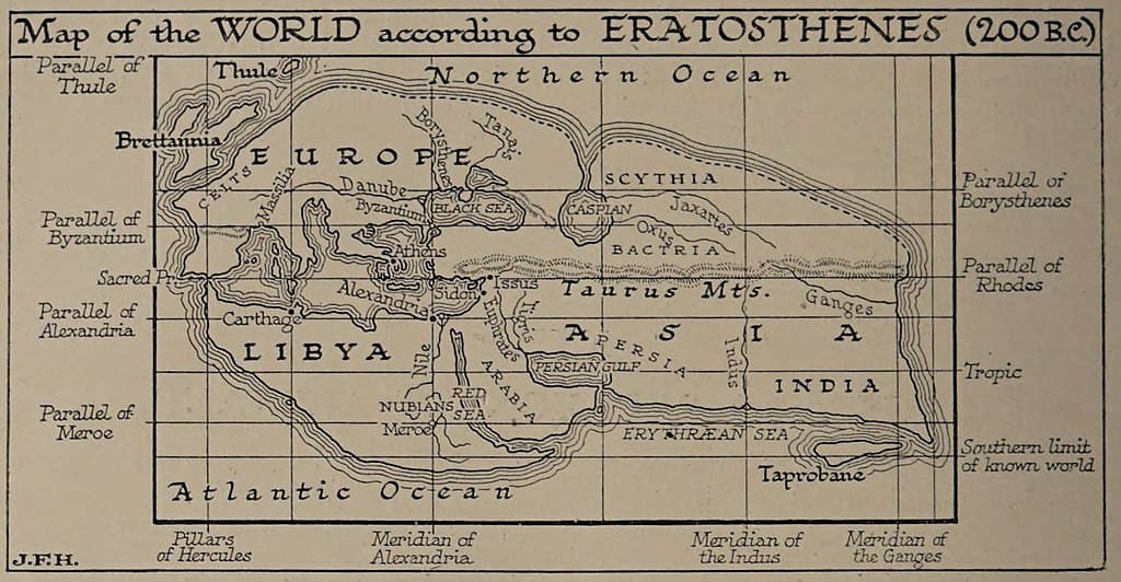
Eratosthenes’s map was one of the first maps to depict the world as being spherical in shape.
©J. F. Horrabin / Public Domain – License
What the Eratosthenes Tells Us About Civilization
This map is one of the first that confirms an understanding that the world is spherical. This is shown by the use of meridians and parallels.
The Eratosthenes Map is an updated view of the world as informed by the conquests of Alexander the Great. Asia is much larger than in the past since more is now understood about the enormity of the continent.
Up Next:
- The 3 Most Amazing Mythical Creatures You’ve Ever Seen
- The Flag of Macedonia: History, Meaning, and Symbolism
- Discover the 12 Most Beautiful Islands in the World
The photo featured at the top of this post is © J. F. Horrabin / Public Domain – License / Original


How to Add Us to Google News


Thank you for reading! Have some feedback for us? Contact the AZ Animals editorial team.