
When you think of “the west” of the United States, images of cowboys, gunfights, and horse riding probably come to mind. However, the area is much more than that!
Other names for the westernmost part of the US include The American West, The Far West, and The Western United States.
Which States Does the American West Include?
According to the US Census Bureau, the west includes:
- Montana
- Idaho
- Wyoming
- Nevada
- Utah
- Colorado
- Arizona
- New Mexico
- Washington
- Oregon
- California
- Alaska
- Hawai’i
The west also sometimes includes the territories of Guam, American Samoa, and the Northern Mariana Islands.
The western states are divided into two divisions. The Mountain region includes Montana, Idaho, Wyoming, Nevada, Utah, Colorado, Arizona, and New Mexico. The Pacific region includes Washington, Oregon, California, Alaska, and Hawai’i.
The other regions the US Census Bureau tracks are called The South, The Midwest, and The Northeast.
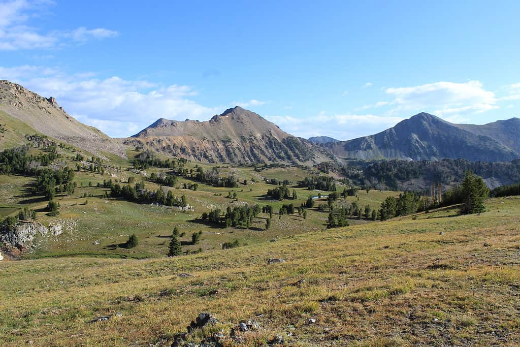
The Mountain region includes the western states of Montana, Idaho, Wyoming, Nevada, Utah, Colorado, Arizona, and New Mexico.
©Emily Kerns/Shutterstock.com
What Is the Population of the Western United States?
The states defined as the west of the US by the US Census Bureau have a population of 78,588,572, according to the 2020 census.
What Is the Most Populous State in the West?
The most populous state in the west is California with a population of 39,538,223.
What Is the Least Populous State in the West?
The least populous state in the west is Wyoming with a population of 576,851. However, if you count the three American territories, American Samoa has the lowest population at 49,437.
What Is the Area of the Western US?
The area of the western US as defined by the US Census Bureau is 1,751,053.31 square miles.
Which Western State Has the Largest Area?
The western state with the largest area is Alaska which is 570,640.95 square miles.
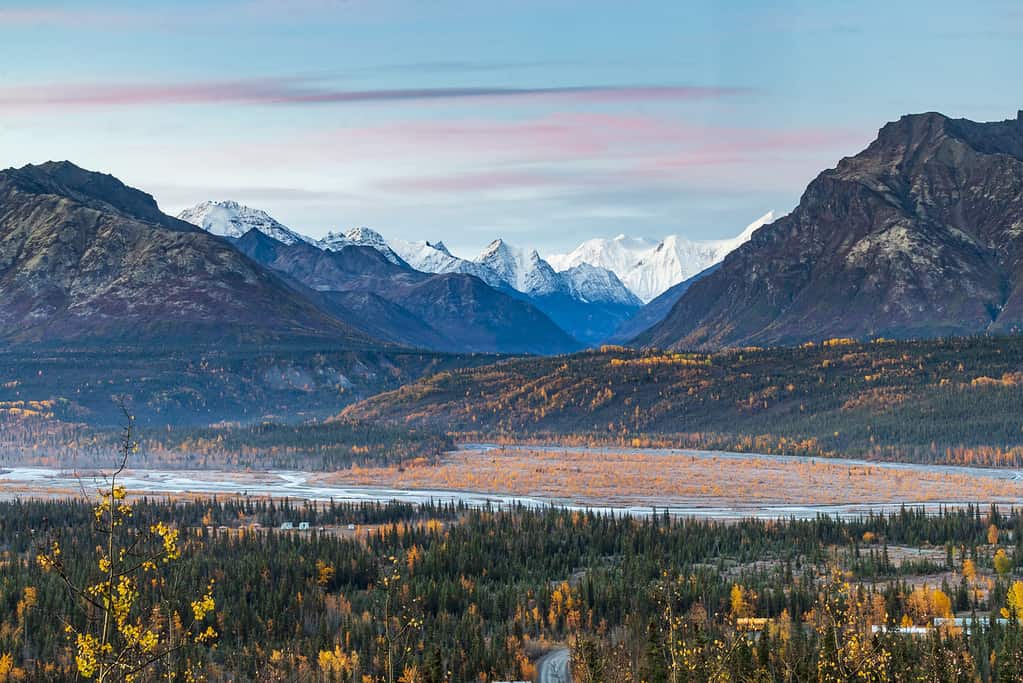
Alaska is the western state with the largest area spanning 570,640.95 square miles.
©iStock.com/Nathaniel Gonzales
Which Western State Has the Smallest Area?
The western state with the smallest area is Hawai’i which is 6,422.63 square miles. However, if you count the three territories, American Samoa is the smallest at 86 square miles.
The Climate of the American West
With such a large area, there are many different geographical features and climates in the western United States. In general, the entire western US has a semi-arid climate. This means much of the area does not get that much precipitation but receives more than a desert environment. However, some areas of the west get a lot of precipitation, mainly in the Pacific Northwest.
Additionally, temperatures are highly variable. They are generally warmer in the southern part of the west and cooler in the north. The desert portions of Arizona are generally quite hot in the summer and mild in the winter. However, the hottest place on earth, Death Valley National Park, is located in California.
The Geography of the American West
The American West contains several important mountain ranges including the Rockies, the coast ranges (a series of mountains on the west coast), The Sierra Nevada Mountains, and The Cascades. These mountain ranges affect weather patterns and create fertile valleys where much of our country’s food is grown.
The Rockies contain 54 peaks over 14,000 feet, most of which are in Colorado. However, the tallest peak in the west and the entire lower 48 of the United States is Mount Whitney in the Sierra Nevada at 14,505 feet.
There are also two deserts: The Mojave Desert and The Sonoran Desert. The Mississippi River forms the boundary of the west to the east. The Colorado River snakes through the west and is what has formed The Grand Canyon. Another important river in the west is the Rio Grande.
The Pacific region of the west is the most seismically active area of the US. California and Alaska regularly experience earthquakes. Oregon and Washington state have active volcanos, as well as inactive ones and geographic features formed by lava flows.
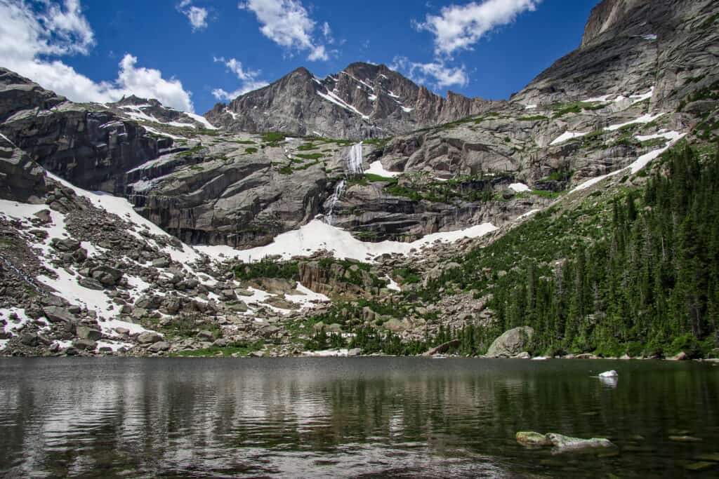
The American West contains several important mountain ranges including the Rockies.
©iStock.com/StevenSchremp
What Are the Demographics of the American West?
The west is typically more sparsely populated than other regions. Only two states in the region, Washington and California, have a population density that is higher than the national average. The west has the following demographics according to the 2010 census:
- 1.9% American Indian/Alaska Native
- 0.6% Pacific Islander
- 4.8% Black
- 28.6% Hispanic/Latino
- 9.3% Asian
- 66.4% White
- 12.4% Another Race
- 4.6% Two or more races
What is the Largest City in the West?
The largest city in the western US is Los Angeles. According to the US Census Bureau, the Los Angeles Metropolitan Statistical Area which also includes Long Beach and Anaheim has a population of 13,200,998.
Other large metropolitan areas in the west include:
- Phoenix-Mesa-Chandler
- San Francisco-Oakland-Berkeley
- Riverside-San Bernadino-Ontatio
- Seattle-Tacoma-Bellevue
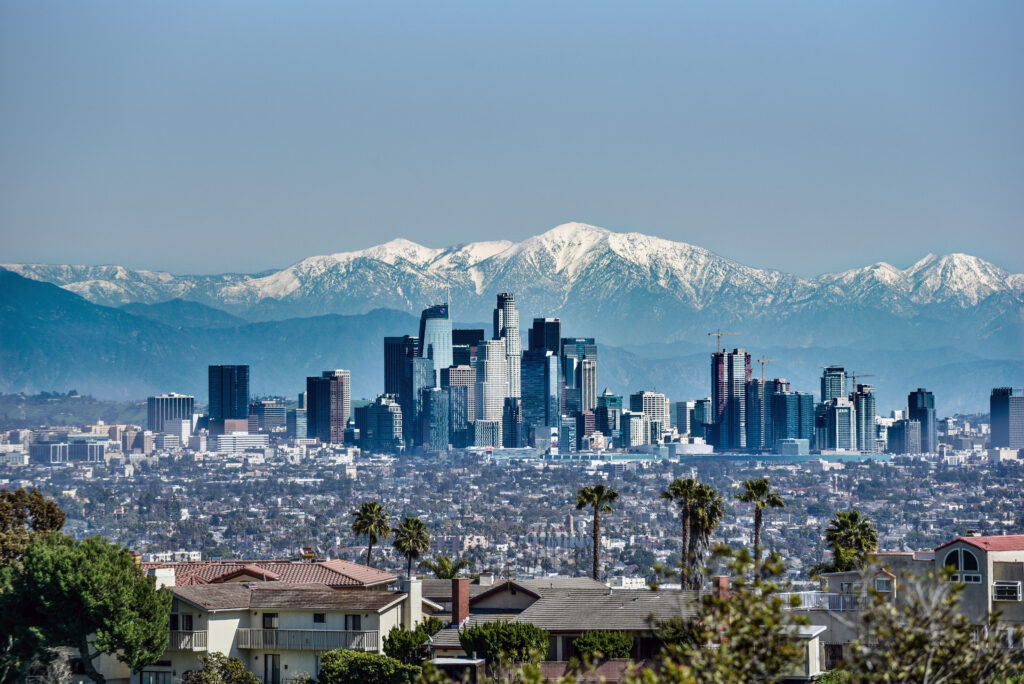
The largest city in the western US is Los Angeles, California.
©John Dvorak/Shutterstock.com
The photo featured at the top of this post is © iStock.com/bluejayphoto


How to Add Us to Google News


Thank you for reading! Have some feedback for us? Contact the AZ Animals editorial team.