
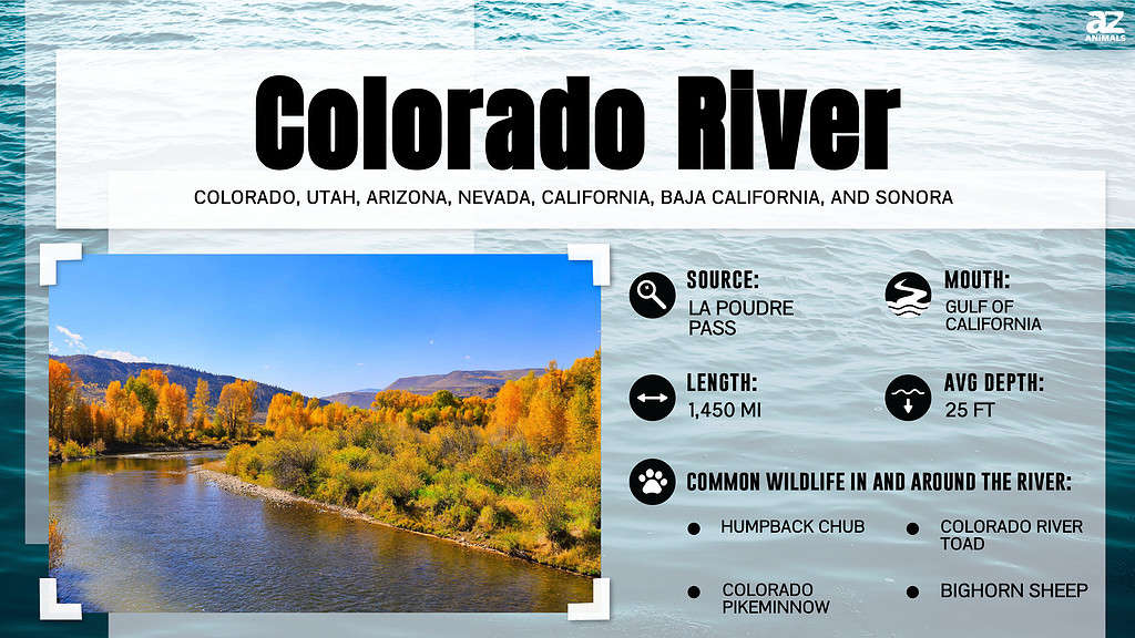
The Colorado River is a major North American River that rises from the Rocky Mountains in the U.S. state of Colorado and flows into the Gulf of California. The river, at 1,450 miles long, is the sixth-longest river in the United States, flowing through seven U.S. states. The Colorado River basin covers 260,000 square miles, or about 8% of the continental United States. Famed for its spectacular canyons and whitewater rapids, it is one of the most important rivers in the Southwestern United States and northern Mexico. This long river drains a huge desert watershed that spans seven U.S. states and two Mexican states. But, where does the Colorado River end? And where does the Colorado River start?
The Colorado River also serves as an important landmark, forming the international border between the United States and Mexico for 17 miles. With all this knowledge about the famed river, we couldn’t help but ask – where does the Colorado River start? And, where does the Colorado River end? Below, we will show you the starting and end point of the American River and other fascinating facts.
Where Does the Colorado River Start?
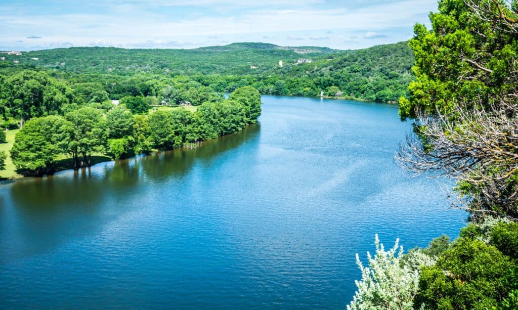
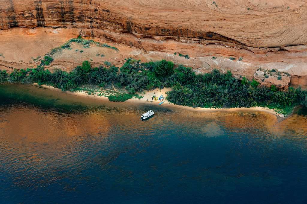
While confusing, the Colorado River in Texas doesn’t leave the state.
©Roschetzky Photography/Shutterstock.com
Where does the Colorado River start? The Colorado River starts in La Poudre Pass Lake, a lake in Colorado’s Rocky Mountains. The famed river may be a thousand-mile-long, but it starts small. The Colorado River’s headwaters are a minor stream in the northern Colorado highlands accessible by a short trail. The water is pumped from a lake in Rocky Mountain National Park’s La Poudre Pass and goes to Grand Lake and Lake Granby. Rocky Mountain National Park is a popular tourist destination in and of itself, with 4,670,054 visits in 2019.
Granby is where a lot of the water is redirected. Rather than flowing downstream, it is pumped to houses and businesses on the side of the mountains through a system of tunnels. Although the Colorado River only runs on the western side of the Continental Divide, the river provides nearly half of the water utilized in the Denver metro area.
The river travels southwest from north-central Colorado across the Colorado Plateau area, southeastern Utah, and northwestern Arizona, flowing through the Grand Canyon. Prior to entering Mexico in the Colorado Desert, it bends south near Las Vegas, Nevada, creating the Arizona–Nevada border in Lake Mead.
Where Does the Colorado River End?
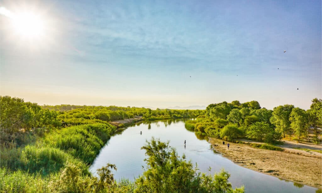
The Gulf of California is where the Colorado River drains into.
©Enrique Alcala/Shutterstock.com
The Colorado River drains into the Gulf of California, finishing in Mexico’s Sonoran Desert shortly before the Gulf.
The Gulf of California, also known as the Sea of Cortez, the Spanish Golfo de California, or the Mar de Cortés, is a huge entrance to the eastern Pacific Ocean off Mexico’s northwest coast. Regarding the origins of the Gulf, there are two schools of thought. One theory says it is physically a part of the Pacific Ocean, while the other claims that Baja California is progressively breaking away from the continent as it advances north along with the enormous San Andreas Fault system. The Colorado River enters the Gulf through a vast delta at its head, and the Fuerte, Sonora, Mayo, Sinaloa, and Yaqui Rivers enter from the east along a wide coastal plain.
The Gulf of California runs over 900 miles and is home to the blue whale, the world’s most massive creature. It also supports a diverse range of marine life, including several reef fish species, sharks, turtles, and the vaquita, the world’s smallest porpoise. Replete with shrimp, anchovies, sardines, and giant squid, the Gulf of California is Mexico’s most important fisheries zone, and it’s also vital for billfish and tuna sport fishing. The Gulf’s gorgeous beaches and colorful reefs also attract tourists every year.
What States Does the Colorado River Flow Through?
The Colorado River flows through seven U.S. states: Arizona, New Mexico, Colorado, California, Nevada, Wyoming, and Utah. The water supply, fish, hydropower production, and other benefits of this river are important to all seven states. Its 25 major tributaries also offer water to millions of people in the seven states through which it flows. The river passes through eleven national parks, including the Grand Canyon, Rocky Mountain National Park, and Arches National Park. The Colorado River Basin encompasses the river and its tributaries, including the Green, Gunnison, Little Colorado, San Juan, Virgin, Bill Williams, and Gila Rivers and the areas they drain.
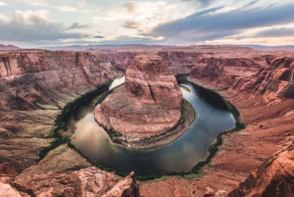
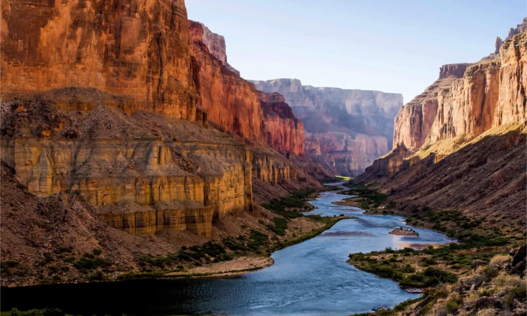
The Colorado River helped carve the Grand Canyon
©Markue/Shutterstock.com
Colorado
The Colorado River begins as a little stream draining a wet meadow on the Continental Divide above La Poudre Pass in Rocky Mountain National Park, about 25 miles north of Lake Granby. The Continental Divide separates the Gulf of Mexico and Pacific Ocean watersheds of North America, Colorado’s Grand and Larimer counties, and Rocky Mountain National Park’s northern limit near the river’s headwaters.
In contrast to the steep mountain gorges above Grand Junction, the Colorado River becomes a meandering river in the Grand Valley. It varies in width from 200 to 1,200 feet, and in depth from 6 to 30 feet, with some deeper places. As it enters the Colorado Plateau, the river bends northwest, passing through Fruita and Ruby Canyon. Just before entering Utah, it turns southwest once more.
Utah
The Colorado River reaches the Colorado Plateau’s high desert canyon area in Utah, rushing fast southwest through Westwater Canyon. Near Dewey, it joins the Dolores River, which feeds the western side of the San Juan Mountains with its contributor, the San Miguel. It traverses the Fisher Towers and constitutes Arches National Park’s southern border before entering the Moab Valley. It passes via “The Portal,” a 1,000-foot deep mountain pass just south of Moab.
The San Juan River meets the lake several miles downstream, carrying runoff from the southern slopes of the San Juan Mountains and the Four Corners region in Colorado and New Mexico, and it creates a 70-mile-long arm of the lake. Despite generating roughly one-tenth of the Colorado River’s flow, the San Juan is exceptionally muddy, accounting for up to 40% of the total sediment load.
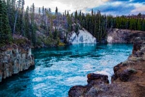
The Colorado River flows through Glen Canyon in Utah.
©HannaTor/Shutterstock.com
Arizona
The Glen Canyon Dam, which forms Lake Powell, is located in Page, Arizona, about 15 miles from the Utah border via the river. The Colorado River is held back by the 710-foot dam, mainly used for hydroelectric power generation. The Glen Canyon Bridge, located in front of the dam, spans the Colorado River and carries U.S. Route 89. The Colorado River travels through Glen Canyon’s final 16 miles, crossing the picturesque Horseshoe Bend, before surfacing abruptly from its canyons at Lee’s Ferry.
Further downstream, it passes through the Uinkaret volcanic area, where massive lava dams were built millions of years ago by basalt eruptions. The Colorado River then curves steeply south before turning northwest of Peach Springs, exiting from the Grand Canyon, where it swells into Lake Mead’s upper reaches. This location also marks the general border between the Colorado Plateau and the Mojave Desert. It begins to create the border between Nevada to the north/west and Arizona to the south/east shortly west of that point.
Nevada
With a full capacity of 28,945,000 acre-feet, Lake Mead is the largest reservoir in the United States, built by the 726-foot-high Hoover Dam southeast of Las Vegas, Nevada. However, the lake has not been filled in many years due to a mixture of drought and excessive water use by Colorado River Basin states. The Colorado River turns due south via Black Canyon at Hoover Dam and will continue in this direction until it reaches the Gulf of California. It runs beneath the Mike O’Callaghan–Pat Tillman Memorial Bridge, the world’s highest concrete arch bridge, which carries U.S. Route 93 900 feet above the Colorado River.
The Colorado River expands near the mouth of Black Canyon into Lake Mohave, which was formed by the Davis Dam in Pyramid Canyon above Laughlin, Nevada. The river then travels across Arizona, passing through Bullhead City and Fort Mohave, as well as the Fort Mojave Reservation.
California
For the majority of its journey through the Lower Colorado River Valley (LCRV), the Colorado River serves as a border between California to the west and Arizona to the east. Here, the Colorado River has a width of 700 to 2,500 feet and a depth of 8 to 100 feet. It gradually loses volume because of evaporation and enormous outflows for irrigation, urban areas, industry, and thermoelectric power generation.
How Long is the Colorado River?
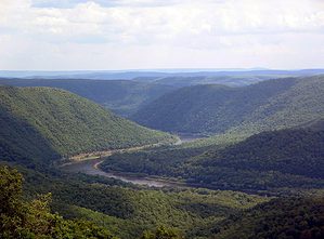
Slightly longer than Chicago and Miami, the Colorado River is 1,450 miles long.
©Beth Ruggiero-York/Shutterstock.com
The Colorado River stretches over 1,450 miles. For comparison, that is slightly longer than the distance between Chicago and Miami. The distance between Chicago and Miami is 1,384 miles, and the Key Largo in the Keys is 1,443 miles away, roughly the same distance.
The Colorado River is estimated to be roughly 20 feet deep on average, yet holes are as deep as 90 feet beneath the surface. Other sections of the river are only 6 feet deep, with rapids and calm water. They can record elevation points in the riverbed using various current technologies such as aerial photography, and multibeam sonar sensors dropped into the water.
The Colorado River provides drinking water to over 36 million people, irrigates over 4 million acres of farmland, supports a $26 billion water-based recreation economy, and sustains 30 endemic fish species and critical river habitat for the millions of birds using the Pacific Flyway.
The photo featured at the top of this post is © Lebid Volodymyr/Shutterstock.com
How to Add Us to Google News


Thank you for reading! Have some feedback for us? Contact the AZ Animals editorial team.