
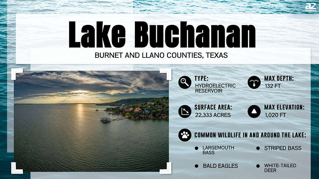
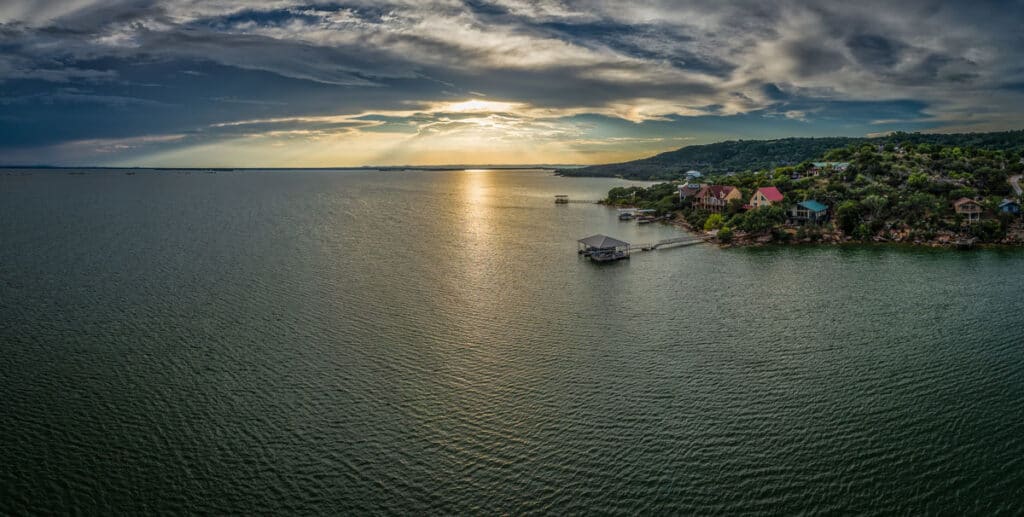
Lake Buchanan is located 60 miles northwest of Austin, 200 miles west of Houston, and 200 miles south of Fort Worth and Dallas. Located west of Burnet City in Texas, the lake’s surface occupies parts of Llano and Burnet counties.
Texas is known for many things. It’s the largest state in the continental US, the home of the Alamo, and where JFK was tragically assassinated. Texas’s landscape is also filled with many attractive features. There are many rivers, mountains, sand dunes, and natural and artificial lakes. Lake Buchanan is one of the state’s largest water bodies. Today, we discover the depth of Lake Buchanan in Texas. We also explore the lake’s history, features, and activities.
How Deep Is Lake Buchanan?
Lake Buchanan is not always full, meaning its depth varies. Although it is barely full for most of the year, it reaches a depth of 132 feet when full.
The lake has an extensive shoreline measuring about 12 miles, a width of about five miles, and a length of 30 miles, making it one of the largest lakes in the state.
Despite its large size, Lake Buchanan is not a natural lake. However, it is the first lake to emerge in the highland regions of Texas.
History of the Lake
Lake Buchanan emerged after the Buchanan reservoir and dam were built across the Colorado River.
Adam Johnson, a surveyor at Burnet County, is credited for identifying the region where the dam and lake would lie and sketching its plans as early as the 1850s. However, the plans lay idle for several years until April 1931, when a subsidiary of Insull Utility Company finally began constructing the dam. At that time, it was known as the Hamilton Dam.
Unfortunately, Insull Utility Company went bankrupt 18 months into the project, causing construction to stall.
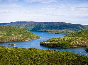
The Buchanan Dam built in the 1930s caused water to collect in Lake Buchanan.
©iStock.com/Ryan Conine
Alvin Wirtz assumed receivership of the dam. In 1933, Wirtz sponsored legislation that created the lower Colorado River Authority (LCRA). He received federal government financing to complete the half-built dam. The federal government agreed to fund the remainder under the condition that it would channel the funds through a Texas State public agency.
The dam was renamed in honor of U.S. Representative J.P. Buchanan, who helped secure further financing from the government.
With funding available, LCRA launched reconstruction activities in February 1935, while promising residents that the dam would prevent floods, generate electricity, and support soil conservation and reforestation activities once complete.
The dam began collecting water in February 1935, as construction continued. It was eventually completed in 1938.
The dam, which was one of six projects on the river, occupies a surface area of 9,038 hectares and a volume of 875,566 acre-feet. The crest of its spillway is elevated 1,020 feet above sea level.
The dam, which caused the water to collect in Lake Buchanan, took a multiple arch design measuring 145 feet high and 11,200 feet long.
The Highland Lakes
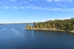
Lake Buchanan is the largest highland lake among the many water bodies that dot the central Texas region.
Much of the water in the Colorado River section that serves Lake Buchanan and its dam comes from the heavy rains that fall in the upper sections of the Colorado River basin.
Run-offs from uphill counties such as Mills, San Saba, Llano, Burnet, and Lampasas reach Lake Buchanan relatively fast, sometimes prompting the LCRA to release the flood waters into lakes downstream, which eventually drain into the Gulf of Mexico.
Power Generation at the Lake
The water from the dam on the southern part of the lake is primarily used to generate electricity at three power plants: Inks, Mansfield, and Austin. Each of the power plants can generate 11.25 megawatts of electricity.
The water also supports mining, irrigation, and recreational activities.
The turbines release water from the lake during operation, but several gated spillways also release flood water.
The dam also has a 14,500-horsepower pump-back mechanism that pumps back water from the tailrace to the reservoir at a rate of 840 cubic feet every second. The pumping mechanism runs during off-peak hours when the cost of power reduces considerably due to reduced demand.
The Climate Around Lake Buchanan
As mentioned earlier, Lake Buchanan is located in the highlands. Although it does not snow here, it receives about 33 inches of rain annually and has about 229 sunny days.
The coldest month is January, which records an average of 37 degrees Fahrenheit. Meanwhile, July is the warmest and most comfortable month to swim in the lake. July temperatures average 94 degrees Fahrenheit.
Recreation Around the Lake
Apart from power generation, Lake Buchanan also supports many recreational activities. Indeed, several lodges, cabins, RV spaces, campgrounds, and resorts are located at different parts along the lake’s shores.
The west shore has a famous winery frequented by visitors and fishermen eager to quench their thirst.
Some areas along the lake’s shores are filled with granite gravel, forming a kind of beach, which makes them ideal spots for sunbathers, swimmers, and waders. The lake also attracts boaters, fishermen, and campers.
Fishing
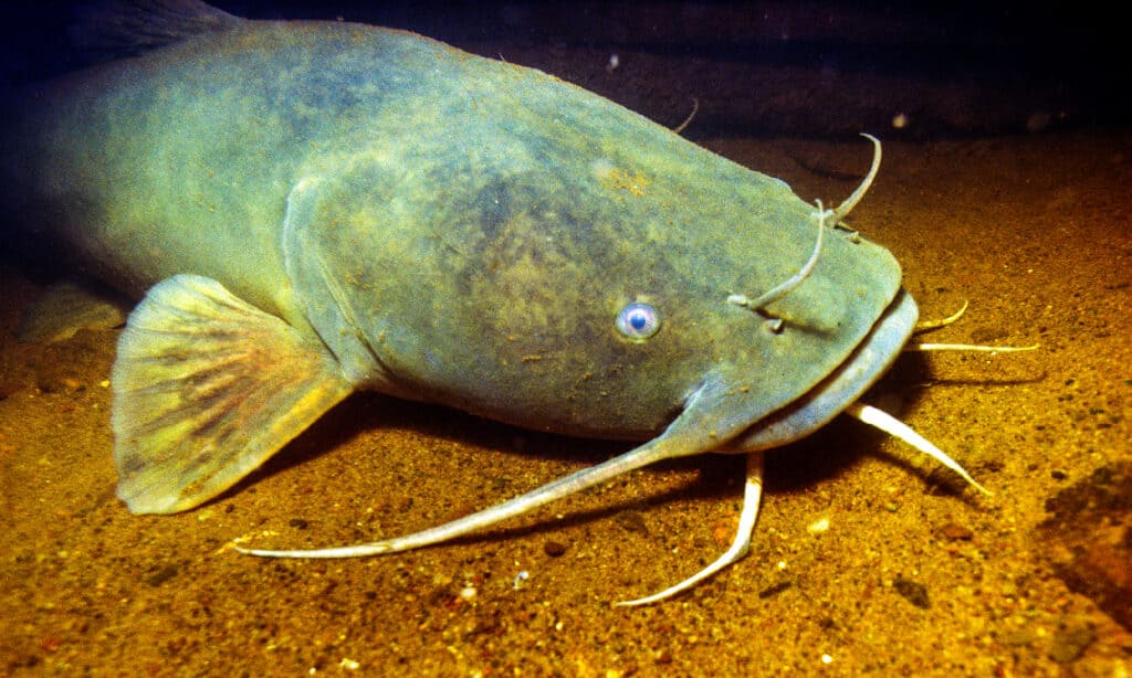
The lake has several areas to attract fish species, like flathead
catfish
.
©iStock.com/stammphoto
Lake Buchanan has considerable striped bass stocks, making it a popular destination for fishing. The fish species live and move together as schools. Although there are times when schools of the striper can be observed near the lake surface, they prefer to move to the deeper sections where the temperatures are cooler.
The best time to fish is during the cooler months between October and June. But fishermen also have to pay attention to the time of the day, moon phases, wind direction, and water temperature if they hope for a good catch.
Luckily, a fishing guide provided by the lake’s administrators will give you all the information you need.
The guide spells out 18 inches as the minimum permissible fish length you can catch. Catching smaller fish is disallowed. The limitation is placed because the striped bass does not reproduce in the lake. Lake Buchanan Conservation Corporation and the Texas Parks and Wildlife Department restock the striped bass regularly.
The lake has several areas to attract other fish species. The dam area and the eastern part of the lake have rocky underwater, chunk rock banks, ledges, and rock piles. The western section of the Lake has many flat coves that provide excellent cover for the fish.
Apart from the striped bass, other fish species include:
- Largemouth bass
- White bass
- Flathead catfish
- Channel catfish
- Blue catfish
- Bluegills
- White crappies
- Guadalupe bass
- Redbreast sunfish
- Spotted gar
- Longnose gar
- Hybrid striped bass
Although you can catch catfish and hybrid striped fish species all year round, fall and spring are the best seasons to catch the largemouth bass. All species reproduce in the lake except the striped bass.
Boating
The dam’s rocky section and the southern Silver Creek area make most areas around the dam unsuitable for boating activities. But 20 miles from the dam in the northern direction is ideal for boats.
The small arm of the mighty Colorado River hosts several organizations that offer boats, such as:
- Ski boats
- Pontoons
- Deck boats
- Fishing boats
- Personal watercraft
The organizations can launch or even deliver a boat to you, but you must check availability and book in advance.
The lake has several public ramps which you can access at a small fee. You can access these ramps at:
- Thunderbird Lodge
- Eagles Canyon
- Buchanan Dam
- Black Rock Park
Swimming
The best area to swim in Lake Buchanan is the western shoe, characterized by granite pebbles and captivating beaches. Apart from swimming, you can also windsurf, water ski, and picnic along the western shores. Some designated swimming areas include Beaver Creek and Morgan Creek.
The eastern side is too rugged and has deep waters, making it unsuitable for swimming.
For those who love adventurous swimming experiences, the Lake Buchanan Waterfall is the place to go. The cool waters and beautiful scenery promise an unforgettable thrill, especially during the warmer months.
Vacation Homes, Parks, and Hiking Spots
Most developments around Lake Buchanan are privately owned, including vacation homes and camps. Visitors have a wide choice of rentals, ranging from small cabins to large homes. Each facility has various amenities, including fire pits, swimming pools, docks, and private beaches.
Eagles Resort Canyon
If you value seclusion, then you will find Eagles Resort Canyon captivating. It offers exclusive cabins with swimming pools, so you don’t have to interact with other visitors as you enjoy peace and tranquility.
Cedar Point Recreation Area
You’ll notice a lot of RV parks dotting the lake’s shoreline, but the Cedar Point Recreation Area is the largest camp area. This camp hosts hiking, fishing, and camping activities. Sometimes the camps get busy, and the operators allocate space depending on who shows up or books first.
Inks State Park
Inks State Park, located on the southern section of Lake Buchanan, is the other significant camping zone along the lake’s shores. The Texas Parks and Wildlife Department operates the park, which has over 22 cabins and 200 campsites.
Although the RV spots are easily accessible, they are usually packed during the warm months when tourists flock in large numbers. Therefore, calling first and booking space during summer is always advisable. Although stores are present in some of the parks, it’s always advisable that you bring your own supplies when venturing out to the camp.
The most popular hiking spot around Lake Buchanan is the Canyon of Eagles. However, the Inks State Park also has hiking trails that span nine miles. Along these tracks, the cedar tree forests, mesquite, and cactus add to the adventure. Additionally, Lake State Park is ideal for novice hikers.
Real Estate Around Lake Buchanan
Lake Buchanan attracts visitors and investors to the region. There are several pieces of land and lake slots for sale. If you don’t want to go through the trouble of developing a home from scratch, you can approach any of the developers who have already-constructed homes for sale.
The closest shopping center to the lake is the Walmart Super Center at Marble Falls, 15 miles south.
Lake Buchanan has two school districts, namely Burnet and Llano ISDs, but they are an hour and a half commute.
Wrapping Up
Lake Buchanan, as the first artificial lake in the highland region of Texas, holds the title of the deepest lake in Texas when at full capacity. Since the late 1930s, it has provided power generation to many residents. The well-loved lake also supports irrigation and a variety of recreational activities, including fishing, boating, swimming, and camping. Visiting this lake on a nice summer day is certainly worth the effort!
Where is Lake Buchanan Located on a Map?
The formation of Lake Buchanan occurred through the building of Buchanan Dam by the Lower Colorado River Authority with the dual purpose of supplying water to the surrounding area and generating hydroelectric power. Buchanan Dam, an impressive structure stretching over 2 miles, was fully constructed in 1939.
Here is Lake Buchanan on a map:
The photo featured at the top of this post is © iStock.com/Ryan Conine
How to Add Us to Google News


Thank you for reading! Have some feedback for us? Contact the AZ Animals editorial team.