
Texas is the second-biggest state in the United States by land area (after Alaska) and population (after California). Texans pride themselves on their slogan, “Everything is bigger in Texas”, which is one of the reasons they have resisted dividing their state into several smaller states, despite many proposals to do so. But how did Texas get its large shape?
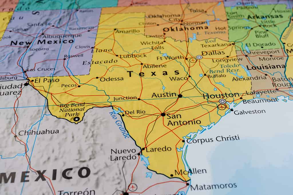
How did Texas get its shape . . . and why isn’t it even bigger?
©Alexander Lukatskiy/Shutterstock.com
Texas As a Colony and a Country
Texas, along with the rest of what is today the Southwestern United States, started off as part of the Spanish Empire. But by 1810, Napoleon was invading Spain and the country couldn’t hold on to its far-flung colonies. Mexico took the opportunity to declare its independence. The Mexican government decided to allow American settlers to cross the border into Texas, as the area was thinly populated and subject to frequent Comanche raids. The settlers resisted laws against slavery, taxation, and other efforts at Mexican administrative control and ultimately staged a successful revolution in 1835. Now independent, Texas had a boundary dispute with Mexico over its southern border but didn’t have the military power to enforce its claims. This is one of the reasons Texas decided to join the United States.
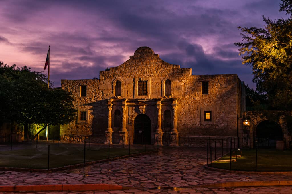
“Remember the Alamo” was a famous battle cry from the Texas Revolution.
©iStock.com/Greg Meland
Texas As a State
Texas joined the U.S. in 1845 and the American military entered the territory that was in dispute with Mexico. This began the Mexican War that ended in U.S. victory in 1848 and the seizure of 55% of Mexico’s territory, which now makes up the American Southwest. The peace agreement extended the southern border of Texas all the way to the Rio Grande River. The eastern border with Louisiana and what is today Oklahoma (except the panhandle) had already been settled with the boundaries of the American Louisiana Purchase from France.
However, Texas was a lot bigger then than it is today. Its territory included the eastern half of New Mexico, the Oklahoma panhandle, Southwestern Kansas, and a meandering strip of territory that split Colorado in two and even went into southern Wyoming. Heavily in debt, though, Texas agreed to give up these territories to the federal government for $10 million in the compromise of 1850. This decision completed the Texas borders as we know them today.
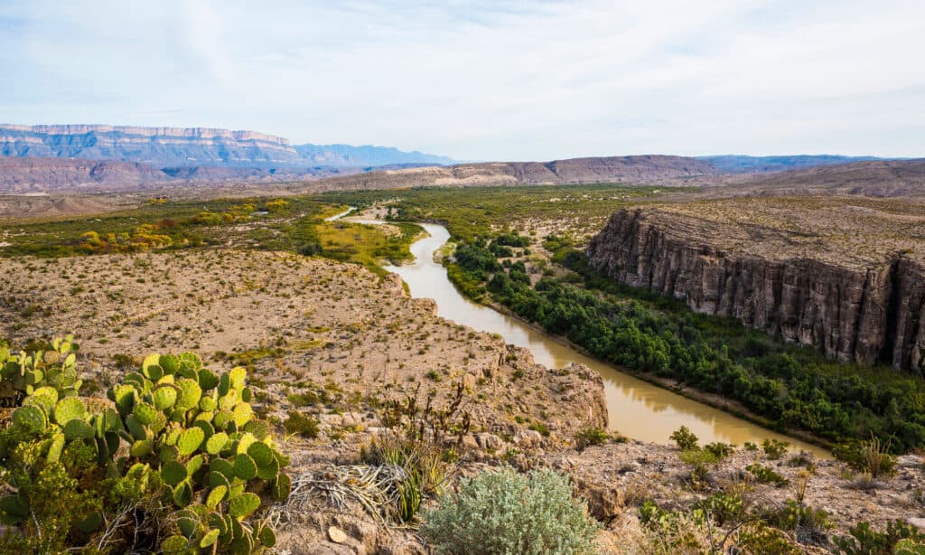
The Rio Grande forms the southern border of Texas with Mexico.
©Fred LaBounty/Shutterstock.com
Do We Want More Texases?
There have been multiple proposals to divide Texas into as many as five states, for various reasons. For one thing, it would give Texans more influence at the federal level, as each state would have two senators in the American Congress. So, five states would have 10 senators, rather than the two senators the one state currently has. In the past, the physical size of the state made it difficult to administer, although that is not an issue today due to enhanced technology and transportation systems. Today, some proposals for division or even independence for Texas are related more to political and cultural differences between different parts of the state, with more progressive urban areas seen as out of touch with the viewpoints of people in rural areas.
None of these proposals are likely to move forward, though. Creating multiple states would require establishing new state bureaucracies at great expense. Texans take great pride in their state and shared history. Dividing them into a number of unremarkable states would be an assault on their heritage and self-image. Any political advantages are not enough to motivate changes to the status quo.

Texans take great pride in their history and culture. They are unlikely to agree to divide their state.
©iStock.com/jeannehatch
How Did the U.S. Acquire the Rest of Its Territory?
The 50 States
- The Eastern Seaboard: The 13 British Colonies that declared independence in 1776
- From Appalachia to the Mississippi: Ceded by France to Britain after the 7 Years’ War. Claimed by the United States as part of the spoils of the successful American Revolution
- Florida: Acquired from Spain in 1821
- Louisiana and the Midwest: Purchased from France in 1803
- The Northwest: Claimed by Lewis and Clark 1804-1806, boundary with Canada settled in 1846
- The Southwest: Seized in the Mexican War of 1848
- Alaska: Purchased from Russia in 1867
- Hawaii: Seized in a coup and annexed in 1898
When Alaska was purchased from Russia, many Americans thought it was a mistake.
©FloridaStock/Shutterstock.com
American Territories
- American Samoa: Seized after a civil war in 1900
- Guam and Puerto Rico: Acquired from Spain in 1899 at the end of the Spanish-American War
- Northern Mariana Islands: Seized from Japan in 1944-45 at the end of World War II
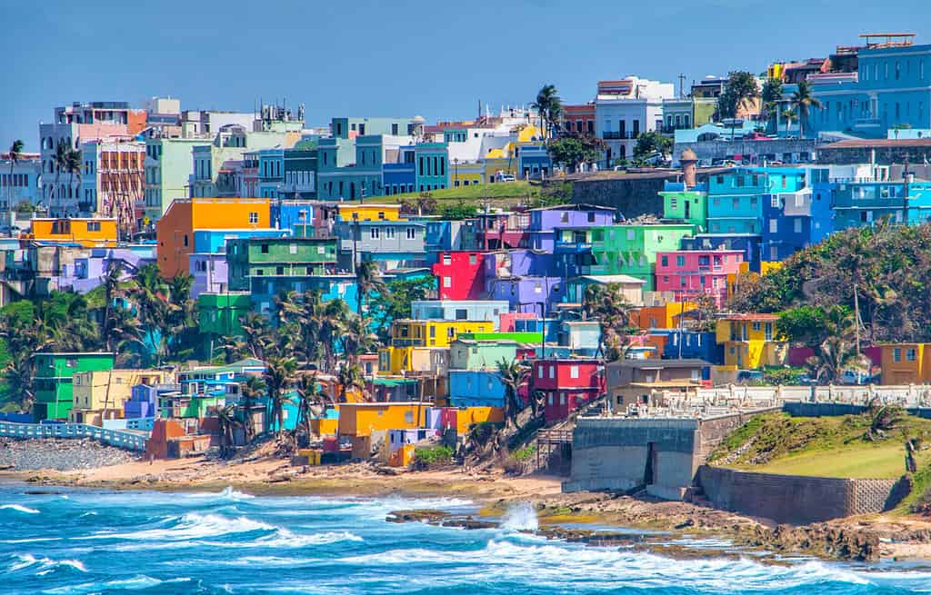
- U.S. Virgin Islands: Purchased from Denmark in 1917
The U.S. Virgin Islands were purchased from Denmark for $10 million.
©Dartrider / CC BY-SA 4.0 – License
Will the U.S. Add Other New States?
Of the current American territories, the one that has the best possibility of becoming a state in the future is Puerto Rico. It has a larger population than several of our current states, and there is a strong statehood movement on the island. Moreover, enormous numbers of Puerto Ricans live in the mainland U.S., so the connections are strong. However, votes for statehood in Puerto Rico have never been overwhelmingly decisive. Many people there are content with the status quo.
There are also political obstacles on the mainland. Some people are uncomfortable with the idea of a predominantly Spanish-speaking state. In some cases, this is not-so-subtle racism, but others have a legitimate concern about long-term national unity if some states are significantly culturally different from the others. Economics is also an issue. The standard of living is higher than the rest of the Caribbean, but still far below that of the mainland United States. If Puerto Rico became a state, residents would become eligible for a wide range of social services they don’t currently enjoy, and this would increase federal spending.
Residents of the island also tend to be more politically progressive, so adding Puerto Rican congressmen to the House of Representatives and the Senate would affect the current balance between the political parties. Interestingly, this problem could be avoided by creating an additional politically conservative state in Texas or California to balance a more liberal Puerto Rico in the federal government. But as we’ve already discussed, that’s unlikely.
Puerto Rico is the most likely candidate to become the 51st state, but political obstacles remain.
©Martin Wheeler III/Shutterstock.com
And Now You Know
We’ve reviewed how Texas got its unique shape, and how the whole country took the shape it has today. Even though there have been proposals for new states or reorganization of old ones, most people are content with the status quo. We’re unlikely to see dramatic changes to the map of North America in our lifetime.
The photo featured at the top of this post is © Alexander Lukatskiy/Shutterstock.com


How to Add Us to Google News


Thank you for reading! Have some feedback for us? Contact the AZ Animals editorial team.