One doesn’t need to be heavily versed in meteorology to know all about different types of clouds, and it’s both an informative and fascinating subject. By the end of this read, you should recognize and name types of clouds which isn’t something just anyone can do!
We should all know what clouds are; we look up into the sky and see them each day. Clouds occur in our atmosphere when water condenses. What we see as a cloud is a massive number of tiny droplets of water and other particles floating in the air.
When clouds get very dense and saturated with these tiny drops of water, that’s when they’ll end up spilling rain down onto the surface of the earth.
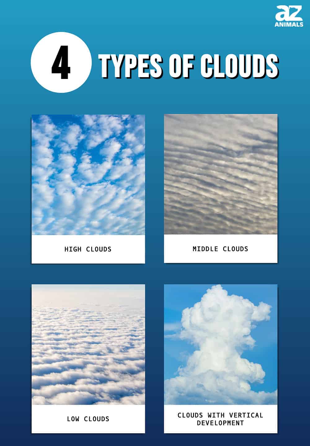
The 4 Main Types of Clouds
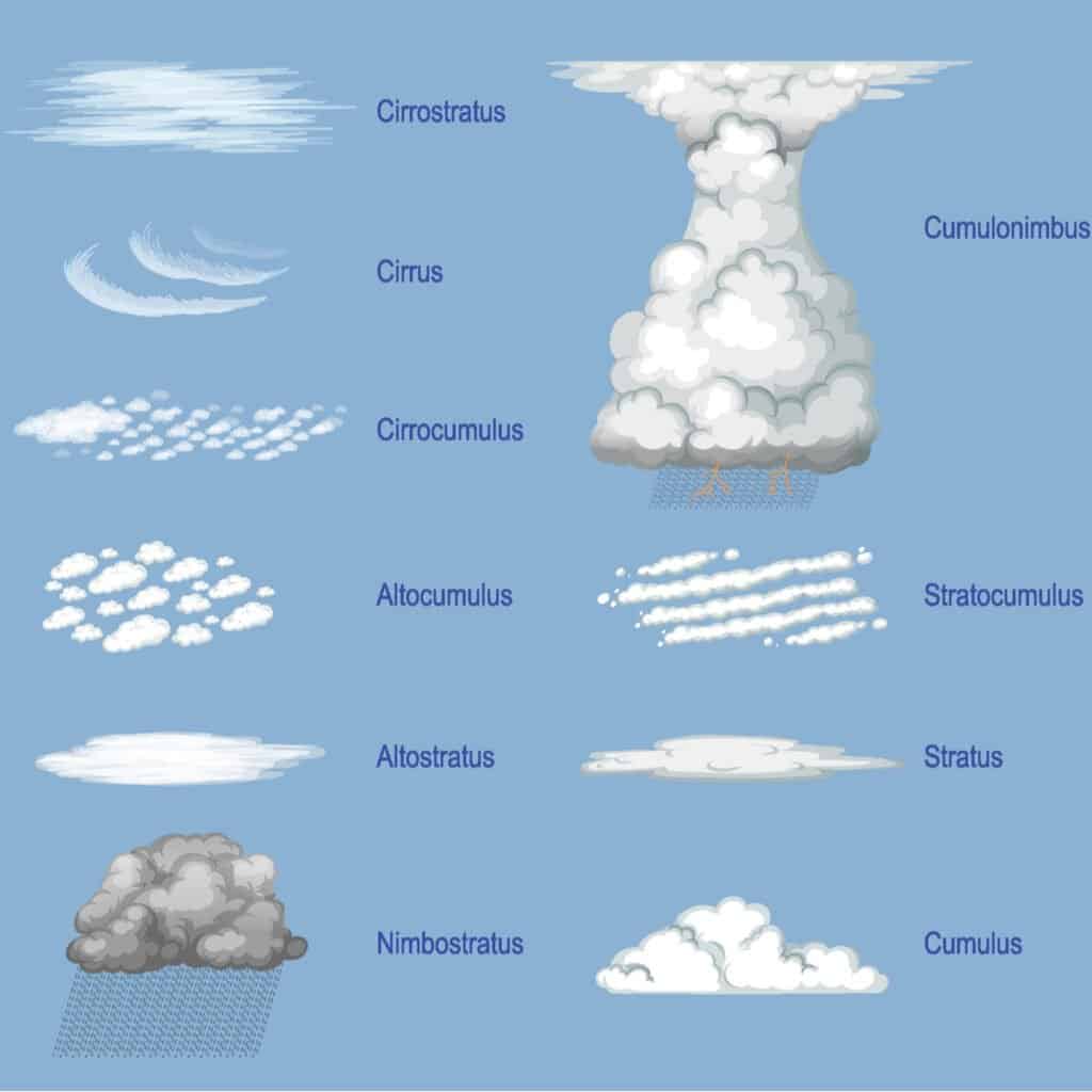
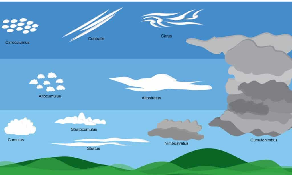
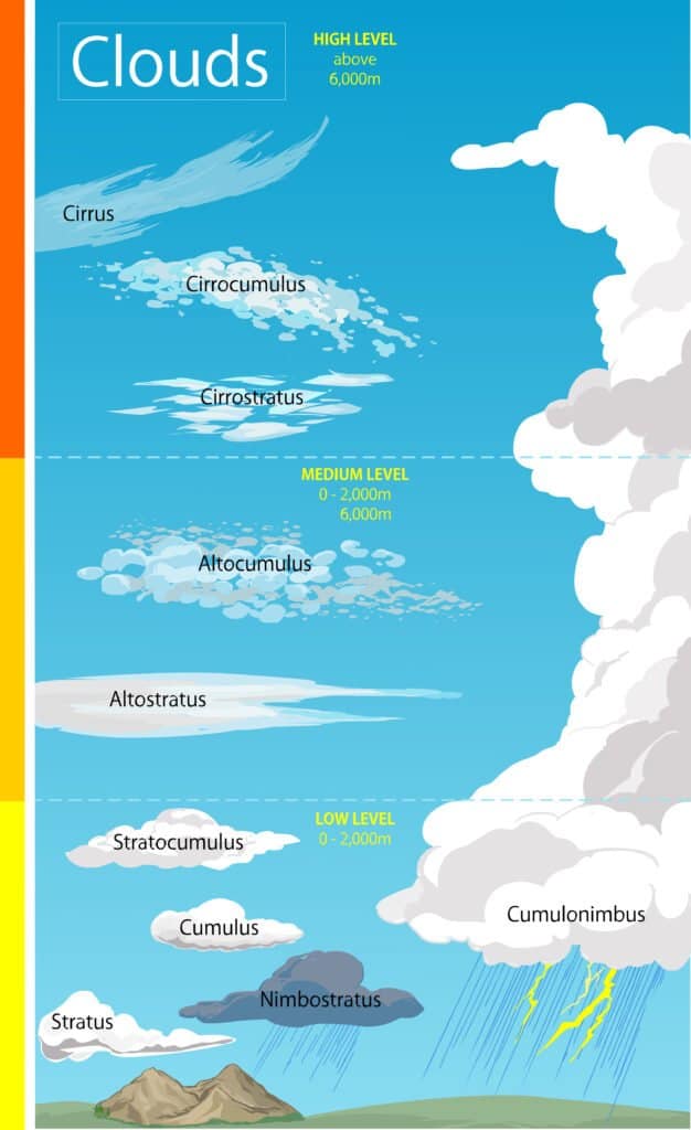
There are four cloud groups and ten different categories of clouds.
©BlueRingMedia/Shutterstock.com
There are four main cloud groups, and among these, there are ten different categories of clouds.
- High Clouds
- Cirrostratus
- Cirrus
- Cirrocumulus
- Middle Clouds
- Altostratus
- Altocumulus
- Low Clouds
- Stratus
- Stratocumulus
- Nimbostratus
- Clouds with Vertical Development
- Cumulus
- Cumulonimbus
We’ll take a look et each type of cloud below, starting with high clouds.
What Are High Clouds?
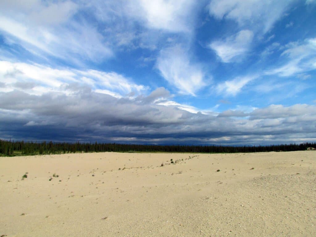
High clouds contain Cirrostratus, Cirrus, and Cirrocumulus clouds.
©iStock.com/46travels
High clouds form above 16,000 ft, where the air is more dry and cold. These clouds are typically white in color except when reflecting colors as the sun rises and sets. They can be a watercolor tableau of colors from purple and pink to yellow and orange from sunrise or sunset.
These clouds are a common sight and they appear lovely and loose, drifting across the blue sky. Let’s take a look at the three different types of high-level clouds.
Cirrostratus Clouds
Cirrostratus clouds stretch across the sky in a long “sheet.”
©Paulius Beinaravicius/Shutterstock.com
Cirrostratus clouds tend to look like long sheets of transparent clouds across the sky. They are broken up slightly with specks of the sky or sun peeking through, but most are like a thin layer of stretched cotton.
When you see these clouds, you can know that the upper atmosphere is indeed cold, as these are all formed of ice crystals falling around together. You can only see a slight halo at times to know they are there, and if you see that, then snow or rain is about half a day behind.
Cirrus Clouds
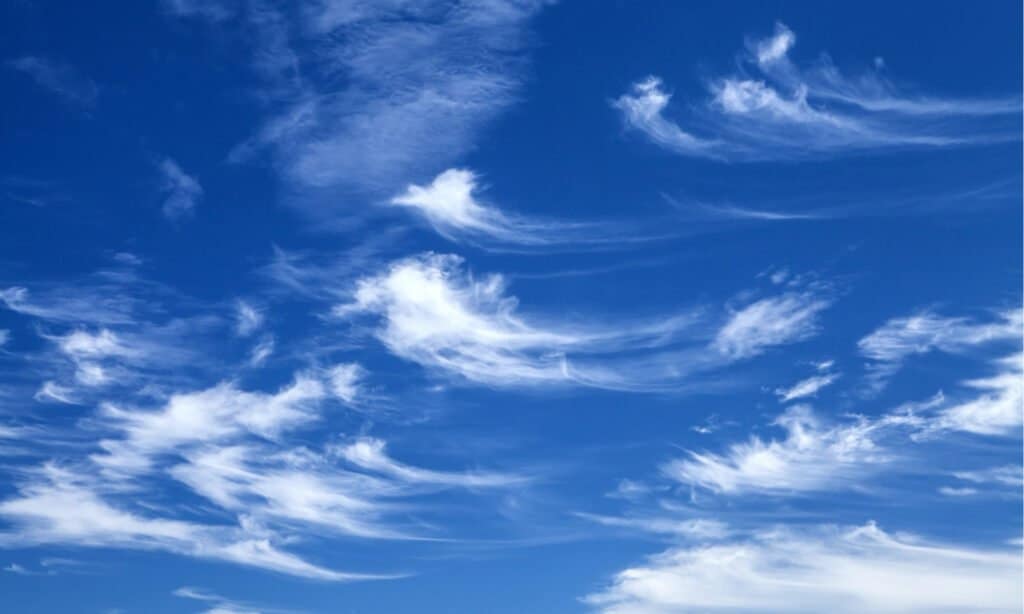
Cirrus clouds have what’s called “Mare’s Tails.”
©CE Photography/Shutterstock.com
Long and lovely, these clouds follow a uniform path usually, from west to each, and can tell you what direction the air is blowing way up high. The winds push them up higher, and you see them on clear days.
They also have what is referred to as Mare’s Tails, and that’s because heavy winds blow the ice crystals into lines or streamers. They can look soft and feathery even as they are made of sharp and spiky ice drops.
Cirrocumulus Clouds

Cirrocumulus clouds look like a row of puffy clouds that can fill the sky.
©KETNARONG/Shutterstock.com
Less common, cirrocumulus clouds are no less stunning than the other clouds listed here. A row of short, puffy cirrocumulus clouds can make the sky appear to be scaled. Their thicker nature means they can reflect the colors of the setting or rising sun in an exquisite manner.
They appear in small amounts or rows but don’t usually spread too far across the sky.
What Are Middle Clouds?

High clouds contain altostratus and altocumulus clouds. These clouds are mostly made of ice crystals.
©Bella Bender/Shutterstock.com
Middle clouds develop above 6,400 ft and up to 23,000 ft. These clouds are made more of water droplets than ice crystals, unlike high-level clouds, which are mostly ice crystals. These middle-level clouds can cause rain if their centers grow saturated enough with water droplets.
Altostratus Clouds
©coco312/Shutterstock.com
These clouds appear lightly gray and misty, and if you look at the sun through them, it’s more like a watercolor painting. They can be gray and blue-gray, and the whole sky is painted in them if you see these clouds.
An excellent way to know if these clouds are altostratus is if they cause shadows or not. If you can see a shadow, these are probably not altostratus clouds.
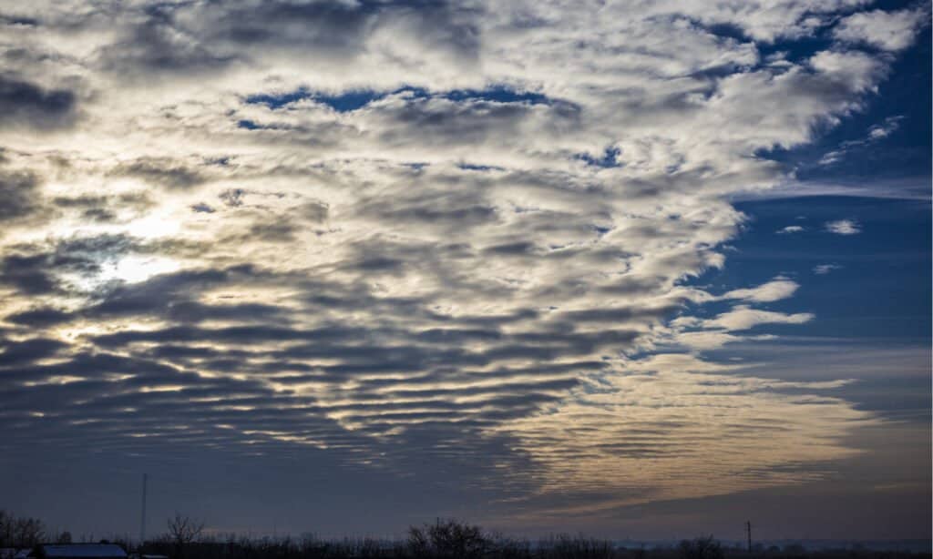
Altocumulus Clouds

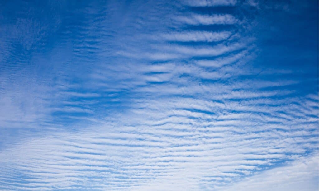
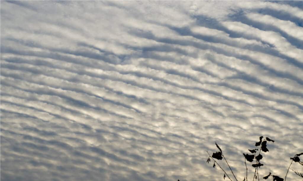
Altocumulus clouds have patches of clouds – or “cloudlets.”
©Thon Varirit/Shutterstock.com
Altocumulus clouds are the waves of the sky coming across in bands. If you look out over the ocean and see stacks of clouds heading toward you the color of stone and darker, then you can expect a heavy thunderstorm. In Florida, where the humidity is severe, you can see these all summer long.
You might also spy birds speeding away from them, a lovely sight but another indicator of a storm heading your way. Once we are through with this article, you will be able to impress your friends with your seemingly innate meteorological skills.
What Are Low Clouds?
Low-level clouds include the types stratus, stratocumulus, and nimbostratus. These clouds mean a higher chance of it being damp weather.
©Fluke Cha/Shutterstock.com
Low clouds form right at 6,500 ft, their bases usually beginning at that line. These clouds are created entirely out of water droplets, though they sometimes have various ice crystals. These low-level clouds are a few we see that can drop rainwater on us.
Stratus Clouds
Stratus clouds have horizontal layering and a uniform base.
©Cristian Zamfir/Shutterstock.com
If you see a vast fog-like thickness covering the sky, then you are looking at stratus clouds. Imagine waking in the morning, and the streets are wreathed in thick white curling strands, and the ground is covered in dew.
As the mist fades or dissipates, you are left with the bottoms of these clouds up in the sky. Stratus clouds indicate a damp day ahead, with rain and mist drizzling and floating around, the sun barely peeking through.
Descending further than others of similar appearance, you can differentiate them from other clouds when glancing at the sky because they are a much darker gray.
Stratocumulus Clouds

Stratocumulus clouds have large rounded masses and are usually grouped together.
©SubstanceTproductions/Shutterstock.com
Large lumpy clouds crisscrossing across the sky indicate stratocumulus clouds; they have usually broken off of larger cumulus clouds at the end of the day.
Stratocumulus clouds are the ones often depicted in paintings of saints, where you see rays of the sun cutting swathes through the clouds. The light peeks through them as they move through the sky. They can be light gray or dark gray and has huge poofing clouds.
Nimbostratus Clouds
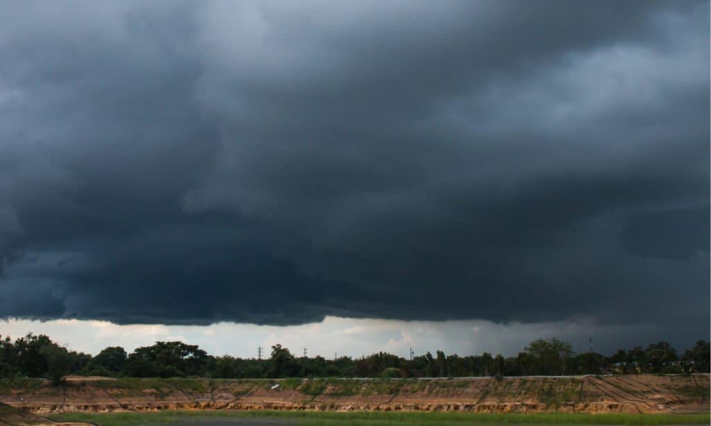
Nimbostratus clouds are dark and ominous-looking.
©Somyot Mali-ngam/Shutterstock.com
When you look up to the sky and know it will be a dreary day because all you can see is gray, those are the nimbostratus clouds. They can look like globs of wet paint, and they spill snow or rain and look like bits of ragged cloth over a lighter gray backdrop. Often you can’t see the sun.
These clouds are present when raining, so it can be hard to define which clouds they are precisely. Safe to say that if it’s raining steadily, there are nimbostratus clouds somewhere in the sky.
Clouds With Vertical Development
These types of clouds include cumulus and cumulonimbus. They usually mean light storms below and heavy storms above.
©Drp8/Shutterstock.com
These clouds grow vertically instead of horizontally, starting on the lower end at around 6,000 ft. They grow upwards of 39,000 feet and bring us rain, storms, and wind. These clouds can tell you what the weather will soon be looking like.
Let’s talk some more about clouds with vertical development.
Cumulus

Cumulus clouds are typically lower but have vertical development.
©Prapat Aowsakorn/Shutterstock.com
These clouds are the big white fluffy clouds we see floating across the sky most days. They drift along in various shapes and are the ones we try to imagine are shaped like dogs or cats. They are fluffy with harsher lined bases, where they start from.
These are also the clouds closest to the ground and mainly receive precipitation from. They can be anywhere from white to light gray to dark gray as they grow to a storm.
When we talk about a spring shower, these are the types of clouds to produce them. They appear on sunnier days, and the rain comes in quick bursts.
Cumulonimbus
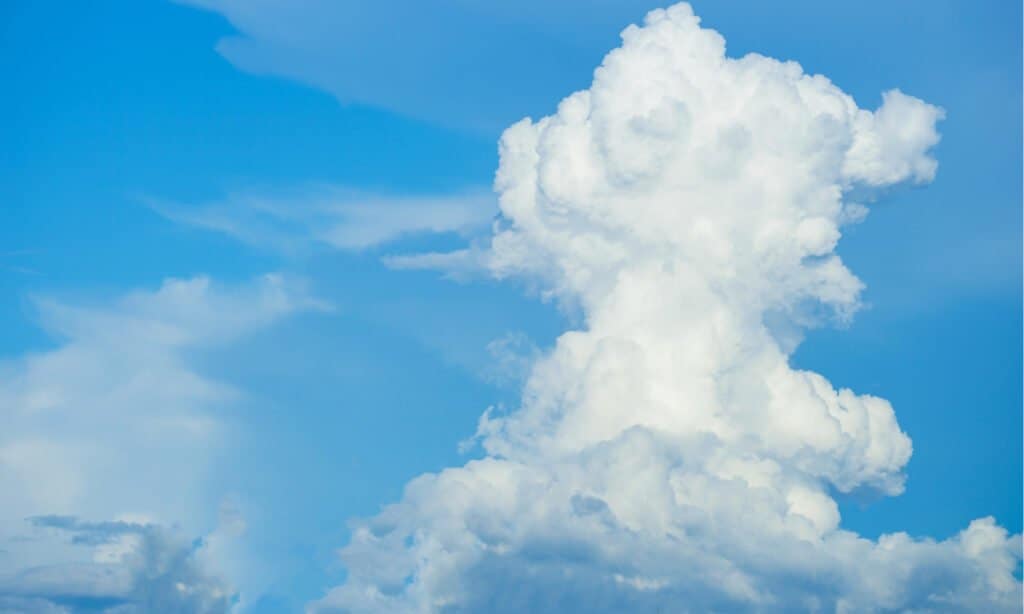
Cumulonimbus are sometimes called thunderheads and often occur before extreme weather.
©Verin/Shutterstock.com
Cumulonimbus clouds often grow outward to look like mountainous cliffs and reflect the colors of the sky around them in various blinding white and grays. They can block the sun or moon and cast shadows across the ground, and it can be one large cloud or part of a smaller group.
A cumulonimbus cloud can extend farther than many others than where they begin and are large and overtake the sky.
The cumulonimbus cloud comprises all types of thickness and droplets, considering its massive size. So there are water droplets and ice drops that form the cloud and its extensive shape.
Wind pushes these clouds upwards and then outwards, so it is likely windy when you see these clouds in the sky. Further up in the cloud, there may be snowstorms or hail storms away from the weather we are likely to experience.
Not a Cloud in Sight Now that We Know the Types
Are we budding meteorologists yet? The subject of the clouds and their types can be fascinating even to the general observer.
A lot more goes into predicting the weather but this is a splendid list to have in your arsenal, especially if you’re looking to impress the people around you in the day-to-day.
Hopefully learning the ten types of clouds and their categories have helped you become more informed about the world around you. We witness clouds every day, why shouldn’t we understand them a little better?
Summary Of The 4 Types Of Clouds
| Rank | Cloud Group | Clouds in Each Group |
|---|---|---|
| 1 | High Clouds | Cirrostratus Cirrus Cirrocumulus |
| 2 | Middle Clouds | Altostratus Altocumulus |
| 3 | Low Cloudstratus | Stratus Stratocumulus Nimbostratus |
| 4 | Clouds with Vertical Development | Cumulus Cumulonimbus |
The photo featured at the top of this post is © Jeff Gammons StormVisuals/Shutterstock.com
Thank you for reading! Have some feedback for us? Contact the AZ Animals editorial team.


