
In the annals of Canadian weather history, few events stand out as prominently as the October Nova Scotia Snowstorm of 1974. This unforgettable blizzard sticks to the minds of Canadians of a certain age like wet snow to the convexities of metal shovels. Indeed, it reminds the nation of the unpredictable power of nature in the Great North. Sure, Canada has seen its fair share of intense snowfalls. Over the years, historical October snowstorms have tested the resilience of the nation’s populace. But some, such as the Novia Scotia Snowstorm of 1974, even helped change Canada’s approach to winter preparedness and response.

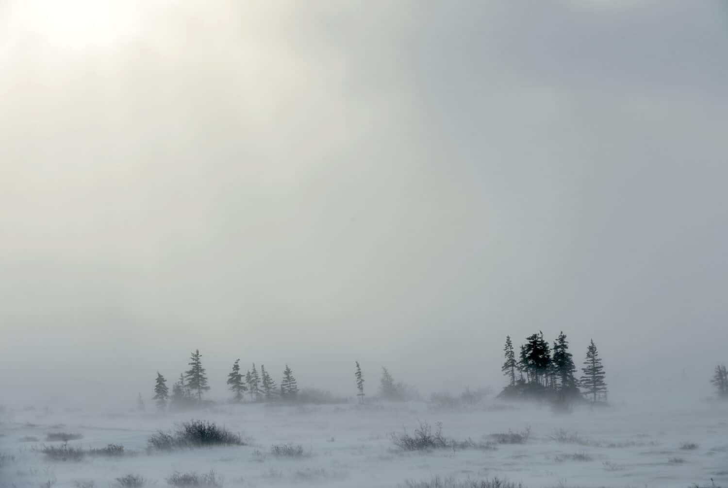
Southeast of New Brunswick and off the coast of New England, Nova Scotia is no stranger to snow. But October snow it barely knows.
©Therato/Shutterstock.com
Historical Perspective on October Snows in Canada
The mention of October snowstorms in Canada inevitably brings to mind the Okanagan snowstorm of 2020, an event that captured national attention. Breaking a staggering 120-year-old record, Kelowna saw about 13 centimeters of snow, while Penticton matched a near-century-old record with 11 cm. And let’s not forget Calgary’s 2018 October snowfall record of 32.8 centimeters. These events may arguably be snowier through the lens of a given period, i.e., 24-hour snow accumulation. But as we venture further back in time, no October snowstorm looms larger in collective memory than the one that hit Nova Scotia in 1974, in scope and impact. As such, with “air asterisks,” we dub the 1974 Nova Scotia snowstorm the biggest to blast Canada in the month of October.
The Nova Scotia Snowstorm of 1974: A Cold Tale for the Ages
In Canada’s meteorological history, the events of October 20, 1974, in Nova Scotia stand out with striking clarity. Fall in the Maritimes is known for its unpredictable nature, thanks to the competing air masses that navigate the region. This dynamic interplay can result in a myriad of weather patterns in quick succession: brilliant sunshine, sudden rain showers, overcast skies, and unexpected cold snaps.
However, the early season nor’easter that hit Nova Scotia in 1974 was in a league of its own. A rapidly developing low-pressure system off the southeastern US merged with moisture and wrapped it into the cold air hovering above southwestern Nova Scotia. This meteorological concoction resulted in an intense snowstorm that blanketed the region, turning familiar autumnal landscapes into winter wonderlands overnight. The city of Halifax found itself submerged under a whopping 38.6 cm of snow, while Yarmouth and other surrounding areas experienced similarly unprecedented October snowfalls.
Moreover, the storm didn’t limit its wrath to just snow. Cape Breton had to contend with a ferocious windstorm. Powerful gusts wreaked havoc, damaging more than 1,500 homes in Sydney alone and rendering 33 families homeless.
To put the magnitude of this snowstorm into perspective, one only needs to compare it with typical Canadian snow events. The sheer volume of the snow was astonishing, but the timing – in October, a month typically associated with fall foliage and dwindling warmth – made it even more remarkable.
Snowstorms: Canada’s Frosty Giants
The Power of Snowstorms
Snowstorms, particularly those in Canada, can often present as intense meteorological phenomena that can paralyze vast regions, transforming familiar landscapes into frigid wastelands. One of the hallmark features of a snowstorm is the challenging visibility conditions. Imagine a swirling mass of snowflakes enveloping you, blurring the world in front of you, and making each step forward feel like a leap into the Great White unknown.
Anatomy of a Snowstorm
But what really goes into the making of a snowstorm? There are some essential elements. Cold air is paramount, as it ensures that the precipitation remains frozen. Moisture, typically sourced from bodies of water, provides the necessary raw material, transforming into snow crystals in the frigid atmosphere. Finally, lift, often from the wind, causes the moist air to rise, cool, and form snow. Disturbances or fronts, combined with specific atmospheric conditions, can intensify the snow production, leading to the heavy, prolonged snowfall characteristic of snowstorms. When such conditions last longer than 4 hours, it crosses into blizzard territory.
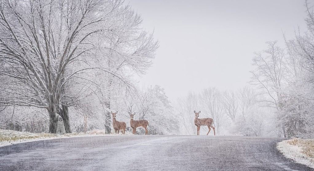
Just as it often is for humans, untimely snows can also be disconcerting to wildlife.
©LanaG/Shutterstock.com
October Snow: A Rare Nova Scotian Tale
Nova Scotia, with its maritime climate, often enjoys a temperate fall season. Snow in October is not part of the usual script. The province generally witnesses the transformation of its lush landscapes into a canvas of autumnal hues during this month, making the occurrence of snow an anomaly. When it does happen, as it did in 1974, it’s a stark reminder of the unpredictability of weather, particularly in a world increasingly affected by climate change.
Snapshot: October 1974 Snowfall Totals in Nova Scotia
| Location | Snowfall (cm) |
|---|---|
| Halifax | 38.6 |
| Yarmouth | 37.6 |
| Greenwood | 29.5 |
| Kejimkujik | 27.9 |
| Annapolis Royal | 25.4 |
| Shelburne | 20.3 |
| Truro | 17.5 |
Note: This table provides a snapshot of the significant October snowfall in Nova Scotia in 1974. It’s worth noting that such substantial amounts of snow in October are unusual, to say the least, for the region.
Snapshot: Average Annual Snowfall Across Canadian Regions
For context and perspective, the annual average snowfall of Canada’s provinces looks something like the following:
| Region | Average Annual Snowfall (cm) |
|---|---|
| British Columbia | 220 |
| Alberta | 190 |
| Saskatchewan | 150 |
| Manitoba | 140 |
| Ontario | 220 |
| Quebec | 310 |
| Newfoundland and Labrador | 330 |
| Nova Scotia | 250 |
| New Brunswick | 290 |
| Prince Edward Island | 275 |
| Yukon | 145 |
| Northwest Territories | 120 |
| Nunavut | 110 |
Note: The figures above are approximate averages and can vary significantly within regions due to factors like proximity to bodies of water, elevation, and local climate variations.
For the History Archives
As the official government report (now archived) prepared by Public Safety Canada made clear, the October 1974 snowstorm had profound ramifications on the region.
Vehicular Movement
Cars, typically a symbol of freedom and movement, became trapped, immobilized by the white deluge. Roads, often taken for granted, turned treacherous and impassable. The streets in Sydney, Nova Scotia, became paralyzed. Zero transportation was possible. This led to residents abandoning their vehicles and trudging through snowdrifts to seek shelter.
Educational Institutions
The storm didn’t discriminate. Schools, places of learning, and youthful exuberance fell silent. Schoolswere forced to close, delaying educational activities and programs. Children, while rejoicing at the unexpected holiday, remained confined, watching a world turned alien by snow from their windows. (Remember, this is pre-Internet times.)
Commercial Sector
For businesses, the storm meant disruption and loss of revenue. With transportation at a standstill, deliveries were halted, affecting supply chains. Stores, often the hub of community activity, remained closed or sparsely visited, as residents prioritized safety over shopping.
The storm also set new benchmarks for Nova Scotia, both in terms of snowfall and temperature drops. Snowfall records shattered, with Halifax registering an astounding 38.6 cm. The temperature too took a nosedive, solidifying the storm’s uniqueness in the annals of weather history.
The Nova Scotia Snowstorm of 1974 remains etched in the collective memory of Canadians, not just as an event of climatic significance but as a testament to human resilience, adaptability, and community spirit. As the snow blanketed streets, homes, and landmarks, it also brought to the fore stories of heroism, camaraderie, and endurance.
Amidst the white expanse, neighbors checked on each other, strangers helped, and communities united to brave the cold. Radio stations, particularly CJCB, became lifelines, providing crucial updates and keeping spirits up.
This snowstorm, while a natural calamity, also underscored the importance of preparedness, communication, and leadership. Sydney’s Mayor, the Emergency Measures Organization (EMO), and other officials demonstrated commendable agility in responding to the crisis, aided significantly by prior disaster simulations. Guess practice does make perfect, or as near to it as we can hope for.
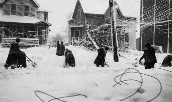
As happened during the Great Lakes Storm of 1913 (pictured), natural disasters can bring out the neighborly best of people.
©600 × 359 pixels, file size: 140 KB, MIME type: image/jpeg – Original / License
Summary of Appendix A: Timeline of the Storm’s Progression and Impact
To get a sense of how quickly the storm escalated, we have summarized Appendix A, the official timeline, from Public Safety Canada’s report:
Before Noon
- Persistent rain in the morning with strong N/NE winds.
- A sudden calm around noon with even a hint of sunshine.
1 PM
- Winds shift to S/SE, intensifying to 40 mph with gusts up to 57 mph.
- Barometer starts to drop rapidly.
2 PM
- Onset of the crisis.
- Severe damages begin, especially in MacDonald Heights with roofs being torn off.
- Only one radio station, CJCB, remains functional.
- Numerous trees fall, and live electrical wires are downed.
- The city’s power goes out.
- The Mayor receives an urgent call at 12:15 PM
- By 2:30 PM, the Emergency Measures Organization (EMO) is ordered to activate, designating Police HQ as the emergency headquarters.
3 PM to 4:30 PM
- The storm’s impact intensifies.
- Total of 42 trees have fallen by this point.
- Continuous phone problems escalate.
- 44 live wires are reported down.
- Windows get smashed in many areas.
- Trees continue to fall, and loose electrical wires pose risks.
- By 4:30 PM, the storm begins to wane, but gusts still reach up to 64 mph, nearing hurricane force.
5 PM
- Children are evacuated from a local theatre for safety.
- The police radio system gets knocked out, leading to the use of walkie-talkies for communication.
- The Mayor urges citizens to stay indoors and off the streets.
- CB patrol initiates damage assessment.
- The first official meeting of key personnel takes place.
- The Mayor emphasizes the potential danger of fires due to the storm’s damage.
- Cleanup efforts begin.
- The militia is sworn in to prevent possible looting in the aftermath.
The timeline in Appendix A provides a detailed hourly account of the rapid escalation and effects of the storm on the community, highlighting the various challenges faced and the measures taken in response.
Climate Change and Canadian Winters
In recent years, the impacts of climate change on Canada’s winter weather patterns have become increasingly evident. While Canada is known for its cold and snowy winters, rising global temperatures have introduced a degree of unpredictability. In some regions, warmer temperatures have led to reduced snowfall, while in others, there have been instances of heavier-than-usual snow due to increased moisture in the atmosphere. (As the record-breaking snowfalls of 2018 and 2020 at the start of this article attest to.) This variability not only impacts daily life but has broader implications on sectors like agriculture, infrastructure, and even winter tourism. As Canada grapples with these evolving challenges, it becomes imperative for the nation to adapt, innovate, and develop strategies to mitigate the effects of a changing climate.
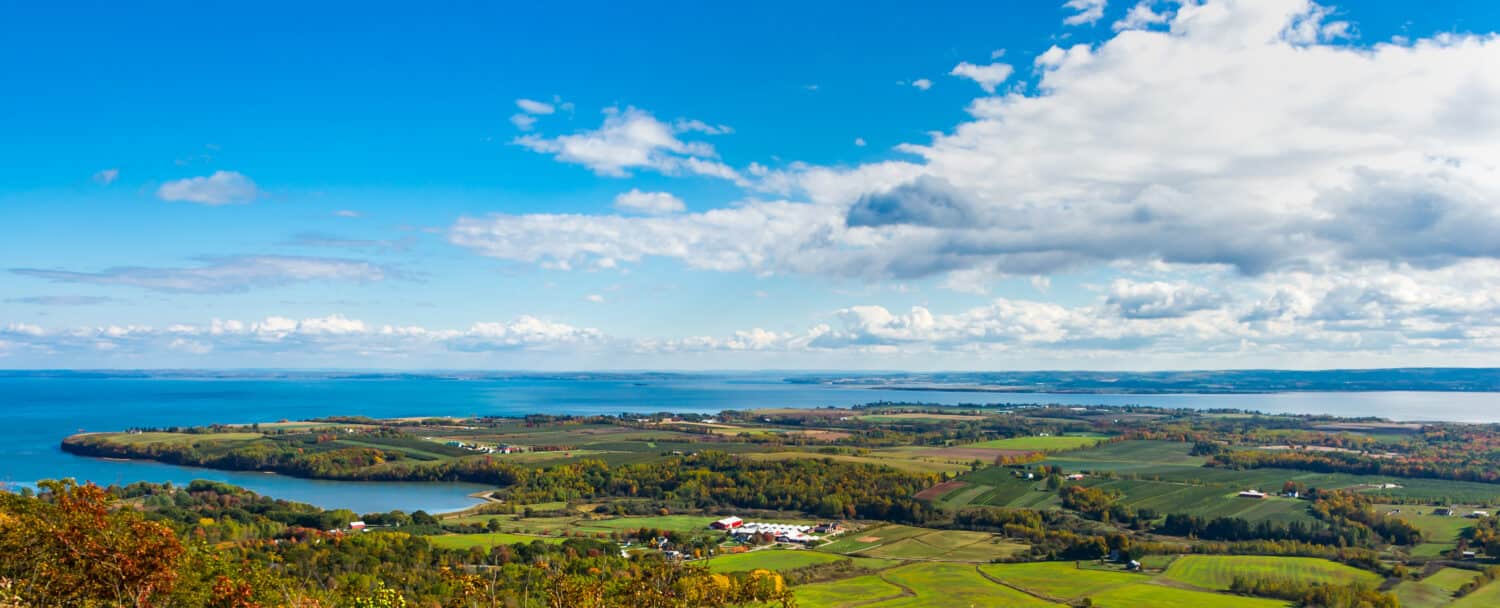
What Halifax usually looks like in October. (Pictured: Annapolis Valley)
©Tetyana Dotsenko/Shutterstock.com
Conclusion
The Nova Scotia Snowstorm of 1974 remains the biggest and baddest to blast Canada in the month of October. Its sheer magnitude, coupled with the myriad challenges it posed, makes it a topic of discussion even decades later. Beyond the snowfall statistics and the cold temperatures lies a deeper narrative. This blizzard serves as a testament to the resilience and spirit of the Nova Scotian people. It reminds us of the unpredictable nature of weather, the humbling power of nature, and the profound impacts such events can have on the fabric of a community. As the years roll on, and as climate patterns evolve, the story of the 1974 snowstorm will remain a beacon, a lesson in preparedness, adaptation, and unity.


How to Add Us to Google News


Thank you for reading! Have some feedback for us? Contact the AZ Animals editorial team.