
When the city feels stifling, and you just want to be alone, come to the most remote spots in Tennessee. This guide explains where to go and how to get there. Happy traveling!
1. Chilhowee Lake

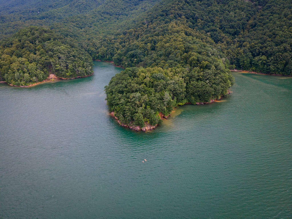
A rich supply of gamefish makes Chilowee Lake a popular spot for anglers.
GPS coordinates: 35.5465° N, 84.0498° W
Nearest city: Maryville (approximate population: 31,907)
Drive south from Knoxville, and you’ll eventually arrive at Chilhowee Lake, an artificial reservoir resting between the Great Smoky Mountains National Park and Cherokee National Forest.
The cool, narrow waterway stretches across 1,747 acres. It’s not very deep, but there’s enough space to house plenty of game fish, including largemouth and smallmouth bass, crappie, trout, yellow perch, and walleye. Trout are particularly abundant because the Tennesse Wildlife Resources Agency restocks the lake every year.
If the idea of a big catch doesn’t entice you, you can check out the attached Chilhowee Dam.
Driving Directions (from Knoxville):
- Drive from US-129 S/Alcoa Hwy to Blount County
- Take TN-335 S/W Hunt Rd and Louisville Rd to US-129 S in Alcoa
- Drive to US-129 S in Tallassee
2. Walls of Jericho

The Walls of Jericho stretch into Tennessee and Alabama.
GPS coordinates: 35.9448° N, 85.7762° W
Nearest city: Winchester (approximate population: 9,375)
The Walls of Jericho is a 21,000-acre swath of land hugging the Tennessee-Alabama border. However, most visitors come for a single spot — “the Walls.”
You’ll need to wear your hiking shoes if you want to go. Getting to the Walls requires a 3.5-hour hike into a canyon. You’ll know you’re there when you see an amphitheater in the ravine. The 200-foot stone walls are dotted with holes where water pours out, creating sparkling waterfalls and shallow pools.
Have fun and explore, but save energy for the strenuous, multi-hour climb back to society.
Driving Directions (from Chattanooga):
- Get on I-124/US-27 S from Carter St and W 12th St
- Follow I-24 W to TN-50 W/US-64 in Pelham. Take exit 127 from I-24 W
- Follow US-64 and TN-16 S to AL-79 S in Estillfork
3. Frozen Head State Park
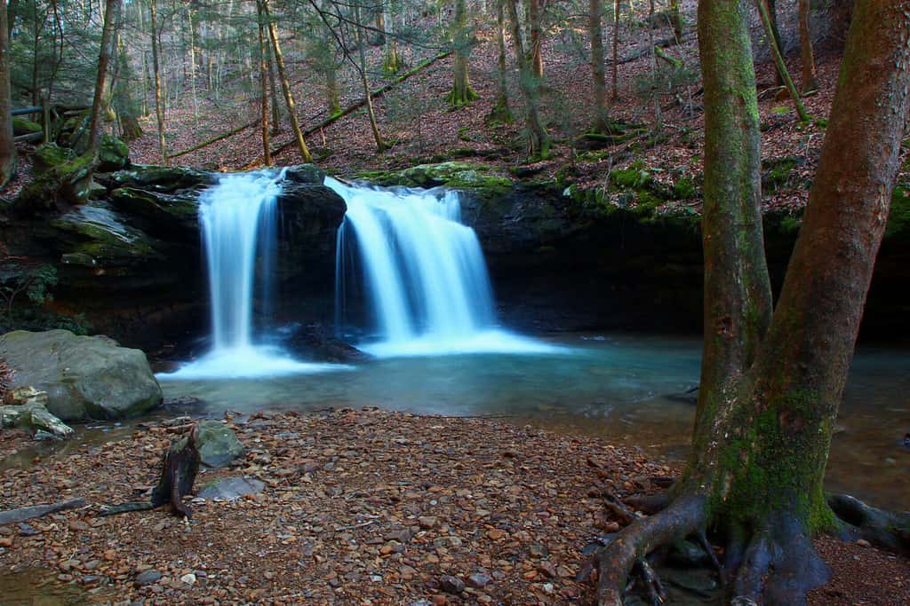
Frozen Head State Park contains gorgeous waterfalls.
©Kannan Sundaram/Shutterstock.com
GPS coordinates: 36.1249° N, 84.5043° W
Nearest city: Watburg (approximate population: 848)
Come to Frozen Head State Park when you want to connect with nature. The former Cherokee hunting grounds offer 24,000 acres of breathtaking scenery in one of the most remote spots in Tennessee. You can hike along trails studded with gushing waterfalls or trek snow-capped mountains.
Campers rave about the solitude Frozen Head State Park offers.
Driving directions (from Knoxville):
- Take I-40 W and TN-62 W to Flat Fork Rd in Morgan County
- Turn right onto Flat Fork Rd
4. Savage Gulf
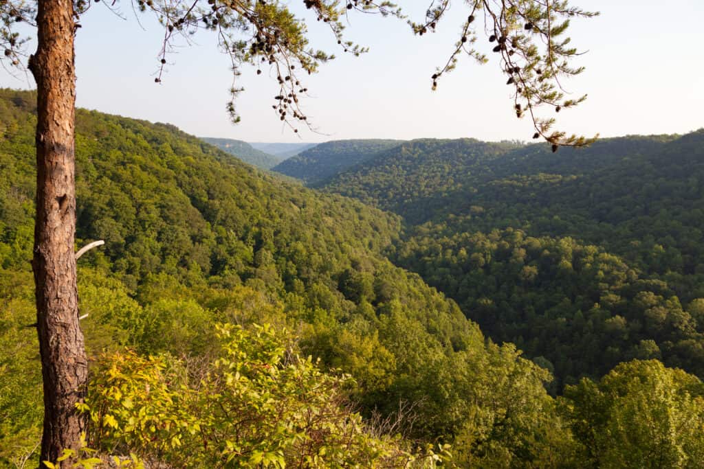
Savage Gulf is found on the edge of the Cumberland Plateau.
©Melinda Fawver/Shutterstock.com
GPS coordinates: 35.4466° N, 85.6562° W
Nearest city: Beersheba Springs (approximate population: 434)
Savage Gulf is a remote wilderness area noted for its rugged beauty. Think deep canyons and mountains stretching to the sky. You can find it on the western side of the Cumberland Plateau.
Hikers and backpackers might think Savage Gulf is the perfect vacation spot because there are 50 miles of mostly empty trails to explore. Bringing friends will make the trip even better, but leave your little ones at home. Most of the trails are ten miles or more.
Driving directions (from Chattanooga):
- Get on I-124/US-27 S from Carter St and W 12th St
- Follow I-24 W to TN-28 N in Jasper. Take exit 155 from I-24 W
- Continue on TN-28 N to US Hwy 41
- Continue onto US Hwy 41
- Take TN-56 N to Stone Door Rd
5. Herb Parsons Lake
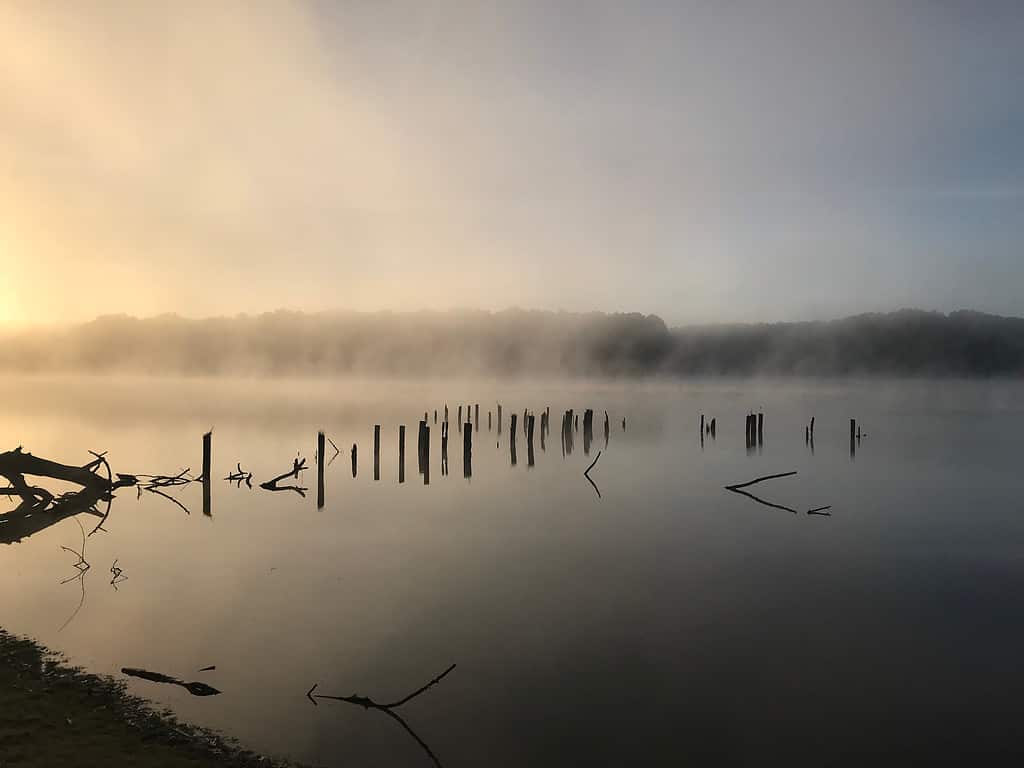
Foggy mornings are common at Herb Parsons Lake.
©Sterling Studios/Shutterstock.com
GPS coordinates: 35.1338° N, 89.6199° W
Nearest city: Collierville (approximate population: 51,343)
Tennesse has over 1,000 glittering lakes, and Herb Parsons Lake is one of the prettiest, although it’s not one of the top three most remote spots in Tennessee. It might have some of the best fishing in the state, with anglers reeling up redear sunfish, crappie, bluegill, and largemouth bass.
The lake is named after a local exhibition shooter who passed away in 1959. It was initially called Fisherville Lake.
Driving directions (from Memphis):
- Get on I-40
- Follow I-40 and I-269 S. Take exit 11 from I-269 S
- Follow TN-193/Macon Rd and Fisherville Rd to Herb Parsons Wy in Fayette County
6. Watauga Lake
Watauga Lake is in the Cherokee National Forest.
©iStock.com/Eifel Kreutz
GPS coordinates: 36.3385° N, 81.9944° W
Nearest city: Elizabethton (approximate population: 14,546)
If Herb Parsons Lake is for those who love to fish, Watauga Lake is for people who want to relax. You can cast a line here, too, but your catch won’t be as diverse.
What Watauga Lake does offer is almost unlimited freedom from others. Its remote location means it’s easy to carve out your own little space away from bustle and stress.
Like most lakes in Tennessee, Watauga is a manufactured reservoir.
Driving directions (from Knoxville):
- Get on I-40 E
- Continue on I-40 E. Take I-81 N to TN-67 E/US-321 N in Johnson City. Take exit 24 from I-26 E/US-23 S
- Continue on TN-67 E/US-321 N. Take State Hwy 2377/TN-362 S, US-321 S, Hwy 67 W E and Dry Hill Rd to Carl Trivette Rd in Johnson County
Summary of the Most Remote Spots in Tennesse
| # | Location Name |
|---|---|
| 1 | Chilhowee Lake |
| 2 | Walls of Jericho |
| 3 | Frozen Head State Park |
| 4 | Savage Gulf |
| 5 | Herb Parsons Lake |
| 6 | Watauga Lake |


How to Add Us to Google News


Thank you for reading! Have some feedback for us? Contact the AZ Animals editorial team.