
The Chicago River is a shallow waterway with deep importance. How deep is the Chicago River? It’s 21 feet at its deepest point but averages a measly 1 to 2 feet deep overall. So why is it a big deal? This river is so significant because it provided the city with a transportation network. And, via a canal, the Chicago River provided a connection to the Mississippi River. It effectively turned Chicago into a Gulf of Mexico port. This transformation is part of the secret sauce of Chicago’s explosive growth into the third-largest city in the United States.
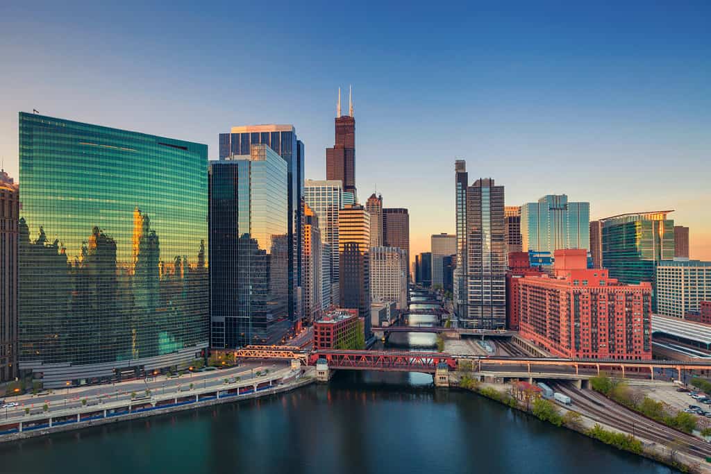
The Chicago River is now controlled in a series of waterways through downtown, crossed by numerous bridges.
©Rudy Balasko/Shutterstock.com
The Founding of Chicago
Louis Jolliet and Jacques Marquette were the first European settlers on record to visit the Chicago River. When they visited in 1673, the area was inhabited by the Ojibwe, Odawa, Potawatomi, and Miami tribes. They realized that a river emptying into the vast Great Lakes would be a strategic location for a trading post. Word spread quickly, and it soon became a popular stopping point for French and British fur traders and missionaries. Over time, Chicago completely transformed from a small, rowdy, frontier settlement to a bustling, industrial boomtown. It filled with builders, hustlers, and businessmen. Canal workers and land speculators transformed Chicago into one of the world’s most rapidly growing cities in the early 1800s.
In 1848, the Illinois and Michigan Canal was completed. This 96-mile canal connected the Chicago River to the Illinois River, and thus, Lake Michigan to the Gulf of Mexico. Irish immigrants dug the canal with hand tools at a rate of a dollar a day for 15-hour days. Many died of disease from working in swampy, brackish water or were injured or killed from workplace accidents. After some 12 years of work and great human suffering, the job was done. Chicago effectively became a port city on the Gulf of Mexico, outstripping St. Louis as the center of Midwestern trade.
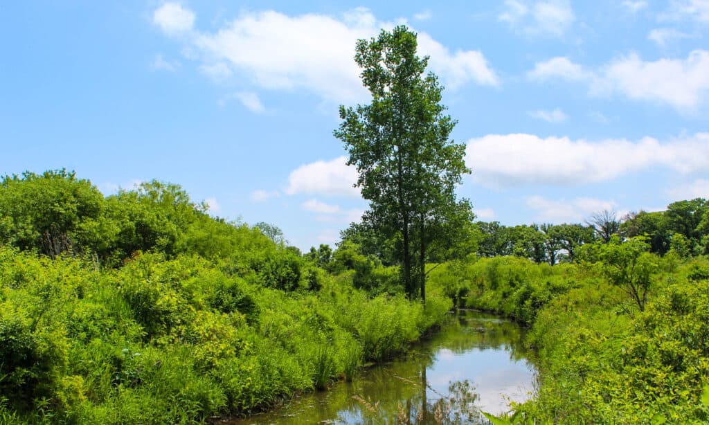
This is the Middle Fork of the North Branch of the Chicago River at Middlefork Savanna Forest Preserve
©John Ruberry/Shutterstock.com
How the Chicago River Was Reversed
The Chicago River was a slow-moving river that drained a flat plain into Lake Michigan. As the city grew, the river became so polluted with sewage and industrial waste that locals called it the “stinking river.” It became a source of periodic outbreaks of typhoid, cholera, and dysentery. In 1900 the city decided to build a system of canal locks to completely and permanently reverse the flow of the river so that it emptied into the canal system to the south, keeping the lakeshore and the river system in the city relatively clean. This is especially important because the city of Chicago draws about 1,600 cubic feet per second of water from Lake Michigan for its drinking water supply. An equal quantity pumps down the canal system to keep dirty water flowing south.
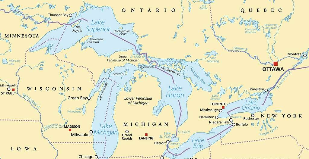
The Great Lakes are an interconnected waterway that connects landlocked States and Canadian provinces to the Atlantic.
©iStock.com/PeterHermesFurian
Ecology of the Chicago River
It would be a mistake to think of the Chicago River exclusively as an urban river. Although it is only 156 miles long, it drains a watershed of 674 square miles. Outside the city, it flows through prairies, woodlands, and wetlands, as well as residential and commercial zones. As a result, at different parts of its length it supports a wide variety of wildlife, some of which, like coyotes and bats, have adapted to urban life. Other species you might notice in a walk along the river are muskrats, beavers, raccoons, foxes, otters, skunks, and white-tailed deer. Birdwatchers may spot swallows, kingfishers, herons, terns, cormorants, ducks, ospreys, and egrets. The river itself hosts eels, black bullheads, sunfish, catfish, carp, green sunfish, bass, and pike.
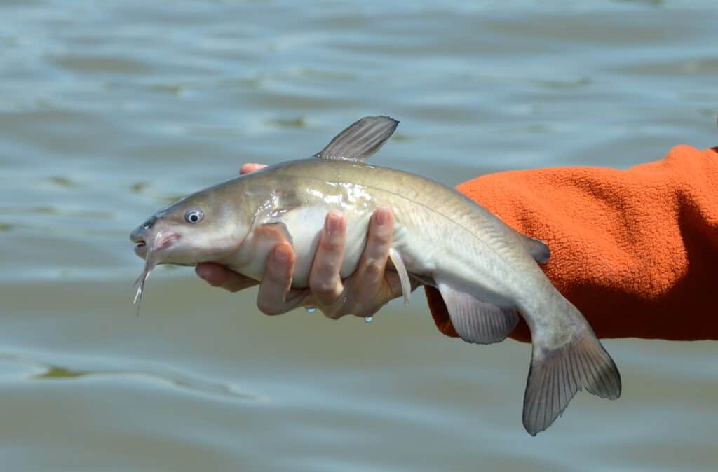
Catfish are one of many species you might catch, fishing from designated locations on the Chicago River.
©M Huston/Shutterstock.com
What To Do On the Chicago River
The Chicago River Walk is an ideal place to stroll leisurely along the river, with restaurants and concession stands, benches, scenic overlooks, tours, boat rentals, and performance areas. If you love architecture, you can take a boat tour of downtown Chicago with a knowledgeable guide to point out noteworthy buildings and their importance in the city’s architectural heritage. Along the River Walk, you can also enjoy the Vietnam Veterans Memorial Plaza, and the McCormick Bridgehouse & Chicago River Museum. Restaurants with riverfront views are abundant.
Some people like to kayak down the river. You can fish off the riverwalk if you are in a designated fishing area and have an Illinois fishing license as well as your own fishing gear. While the Chicago River appears to be clean these days, officials do not recommend swimming in it, as it does become polluted at times. However, if you happen to be in town on St. Patrick’s Day, don’t be alarmed if the river is bright green; it’s not pollution but dye to celebrate the most popular Irish holiday in the country.
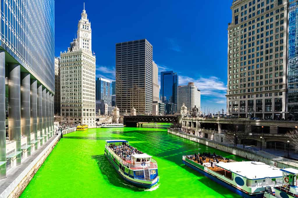
No that’s not radioactive pollution! Chicago dyes its river green each year in celebration of St. Patrick’s Day.
©vichie81/Shutterstock.com
Whether you prefer to spend your time in the city or the country, the Chicago River offers plenty of opportunities for every age and interest . . . and for millions of people, it’s right in your backyard!
Where Is the Chicago River Located on a Map?
The Chicago River snakes its way through the entire city which gives it its name, bordered by sidewalks and bridges that give citizens and visitors a beautiful view of the waterfront which comes to an end at the southernmost bank of the massive Lake Michigan.
The photo featured at the top of this post is © Sean Pavone/Shutterstock.com


How to Add Us to Google News


Thank you for reading! Have some feedback for us? Contact the AZ Animals editorial team.