
The Skagit River is a vital and prominent river in the Pacific Northwest that possesses unique characteristics. This article dives into how deep the Skagit River is and reveals its ecology, geology, history, and more.
How Deep Is the Skagit River?
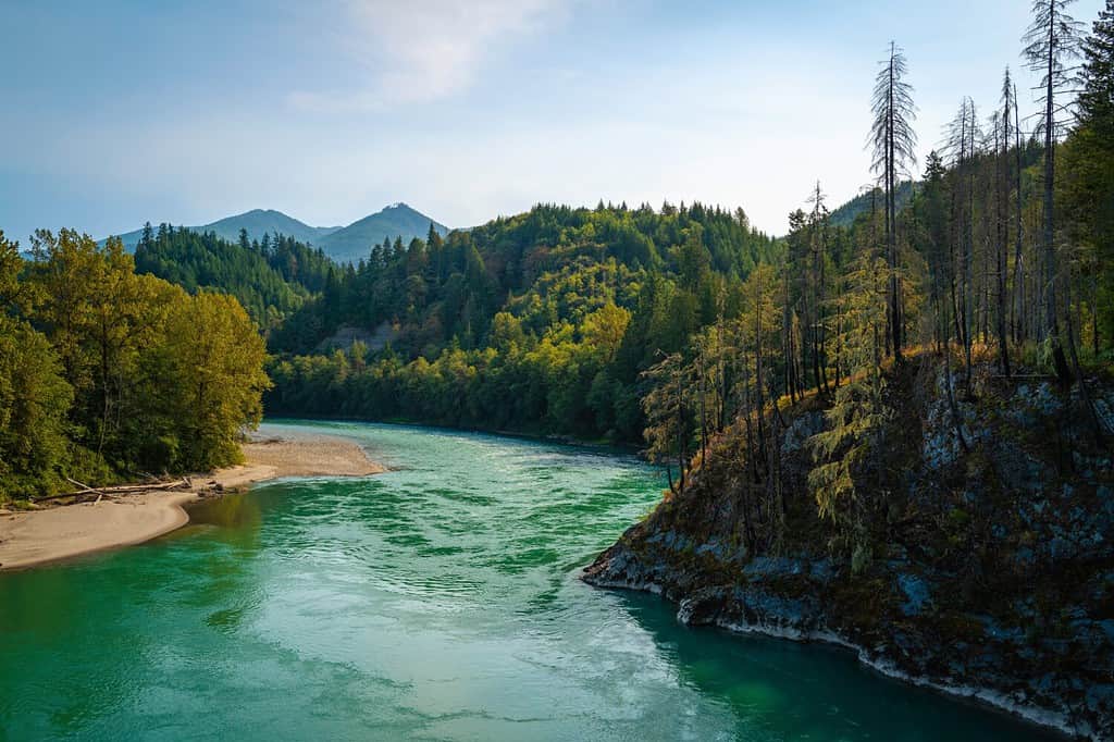
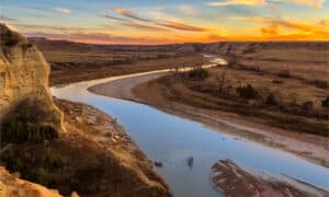
The Skagit River has depths ranging up to 83 feet.
©NayaDadara/Shutterstock.com
The Skagit River is known and protected for its beauty and quality. According to Snoflo, the Skagit River reaches a depth of approximately 83 feet (25.3 meters) in Newhalem, WA. This significant depth exemplifies the geological processes that have shaped the riverbed over many years.
Regarding its average depth, the Skagit River typically maintains a more modest depth of around 10 to 20 feet (3 to 6 meters) across most of its course. This relatively consistent depth supports a diverse range of aquatic life, including various species of fish and invertebrates that rely on the river’s water resources for survival.
Furthermore, many sections throughout the Skagit River’s course measure up to four feet (1.2 meters) or less, such as in Concrete, WA.
The Skagit River’s depth plays a crucial role in its ecosystem, influencing water temperature, nutrient levels, and habitat availability for its inhabitants. Thankfully, under the Wild and Scenic Rivers Act that was created in 1968, the United States Congress, in 1978, established the Skagit Wild and Scenic River System. This protects and enhances efforts to improve the Skagit River and its tributaries, the Sauk River, Suiattle River, and Cascade River. Understanding and preserving this river and its tributaries is essential for the ongoing conservation efforts aimed at protecting the natural world and its influence.
Location of the Skagit River
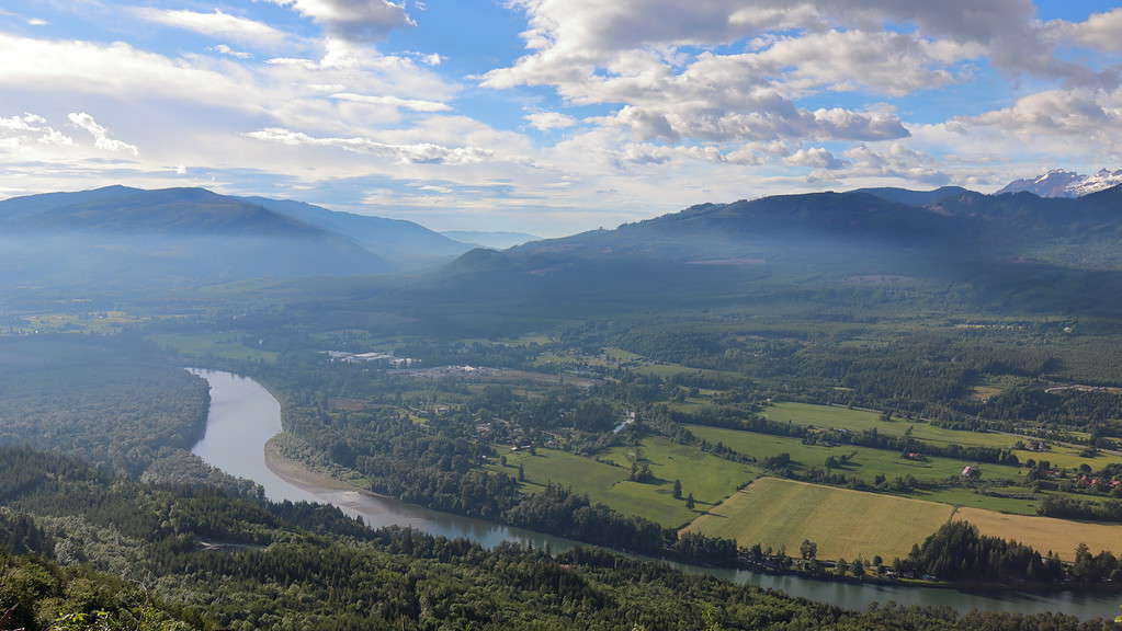
North Cascades Highway runs along a large section of the Skagit River in Washington and provides excellent views of the river.
©Michael Jagla/iStock via Getty Images
The Skagit River resides in the Pacific Northwest of the United States and southwestern Canada. It is approximately 158.5 miles (255.6 kilometers) long. The Skagit River also includes over 38,000 acres and is one of the deepest rivers in Washington. In the United States, it specifically flows through northwestern Washington. In Canada, it flows through a section of southwestern British Columbia. To truly appreciate this river’s significance, let’s explore its source, path, and mouth.
Furthermore, approximately fifty percent of the river system is privately owned, as it runs through private lands. Moreover, roughly forty-four percent is owned by the National Forest System. Lastly, the state or other agencies own the remaining six percent.
The Skagit Wild and Scenic River, which includes the Skagit River and its tributaries, is managed by the United States Forest Service and is considered a part of the Mount Baker-Snoqualmie National Forest.
Source
The source of the Skagit River begins in Allison Pass in the E. C. Manning Provincial Park within British Columbia. This area is surrounded by towering peaks and lush forests filled with evergreens. The river is primarily fed by glaciers, in addition to snowmelt and various alpine streams. These water sources all contribute to its crystal-clear waters, often a brilliant shade of bright blue.
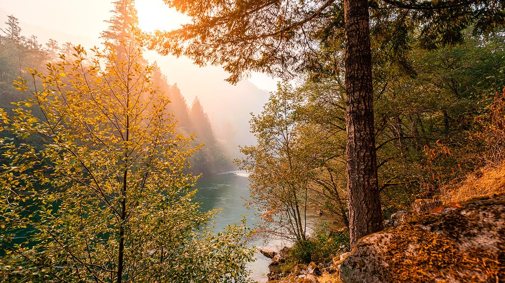
Along its path, the Skagit River meanders through a breathtaking landscape, weaving its way through rugged mountainous landscapes and dense forests. Some of the deepest sections of the Skagit River reside within the North Cascades. It passes through Diablo Lake, Gorge Lake, and Ross Lake, renowned for their turquoise waters and dramatic scenery. These reservoirs were created by the construction of dams, which serve multiple purposes, including hydroelectric power generation and flood control. The presence of these dams has added an interesting dimension to the Skagit River’s journey, emphasizing the need for sustainable resource management to harmonize with nature.
Continuing its course, the Skagit River flows westward, nourishing the fertile Skagit Valley. This region is renowned for its organic and pasture-raised agriculture, with the river’s waters supporting the growth of crops such as tulips, daffodils, berries, and many types of vegetables. The Skagit River’s influence on the Skagit Valley’s agriculture highlights the intricate relationship between water, land, and life.
Mouth
Ultimately, the Skagit River completes its expansive journey at its mouth, where it merges with the waters of Puget Sound near the towns of Mount Vernon and La Conner. However, before emptying into the Puget Sound, the Skagit River diverges into two forks. They include the north and south forks. These forks form Fir Island and empty into Skagit Bay, part of the Puget Sound. Its mouth serves as a vital estuarine ecosystem, where freshwater and saltwater meet, providing a crucial habitat for various species of fish, birds, and marine life.
The Skagit River’s path from its source to its mouth epitomizes the delicate balance between human activity and environmental conservation. It reminds us of the importance of responsible stewardship to ensure that this natural wonder and its surrounding ecosystems continue to thrive.
Other Rivers Similar to the Skagit River in Washington State
The Columbia River is another prominent river, like the Skagit River, that runs through Washington.
©iStock.com/JPLDesigns
The Skagit River is renowned for its quality and beauty, its intricate network of tributaries, and its unique characteristics compared to other rivers in the region.
Tributaries of the Skagit River
Several tributaries feed into the Skagit River, each contributing to its flow and depth. Notable tributaries that are a part of the Skagit Wild and Scenic River include the Sauk River, Suiattle River, and Cascade River. Other tributaries include the Baker River, Skaist River, Sumallo River, and Klesilkwa River. These tributaries originate from the surrounding mountainous terrain, adding to the Skagit’s overall volume.
While specific depth measurements for these tributaries may vary along their courses, they generally share the characteristics of the Skagit River, with varying depths ranging from two to twenty feet (0.6 to 6 meters) on average due to the rugged topography of the region. Moreover, the combination of these tributaries contributes to the Skagit River’s dynamic and diverse ecosystem.
Other Rivers in Washington State
Washington State is graced with an array of rivers, each with its unique features. When we consider the depths of the Skagit River compared to some of these other rivers, we find that the Skagit stands out as one of the region’s deeper and more significant rivers.
On the contrary, the Columbia River, which flows through Washington, is one of North America’s longest and deepest rivers. According to a United States Department of the Interior/Geological Survey, its depth can vary significantly, with specific sections, particularly around The Dalles, measuring up to 300 feet (91.4 meters).
Another notable river in Washington is the Yakima River. While it is not as deep as the Skagit, with depths ranging from 4 to 40 feet (1.2 to 12.2 meters), it plays a crucial role in irrigation and agriculture in the Yakima Valley.
Comparatively, the Skagit River’s maximum depth of around 83 feet (25.3 meters) in specific stretches, as mentioned in previous sections, highlights its significance in terms of depth. This depth, coupled with its scenic beauty and rich biodiversity, makes it a captivating natural feature in the state.
Furthermore, the Skagit River is distinguished by its role in supporting salmon populations. Moreover, it is the only river in Washington to support all five salmon species, including sockeye, Chinook, chum, Coho, and pink. The river’s cold, clear waters provide crucial spawning habitat for these iconic fish, emphasizing its importance in conservation efforts.
Overall, the Skagit River’s depth, tributaries, and unique characteristics set it apart as a prominent and ecologically significant river in Washington State. Its depth, when compared to other rivers in the region, showcases its exceptional attributes.
Ecology of the Skagit River
Swimming is possible in the Skagit River, but the waters are frigid year-round as it is fed by glacial runoff.
©LoweStock/iStock via Getty Images
The ecology of the Skagit River shows the intricate interplay between water, land, and life about how deep it is. This majestic river has a vibrant and diverse ecosystem amongst the incredible landscape it flows through.
Flora and Fauna
The Skagit River’s ecology is teeming with a rich diversity of flora and fauna. Its clear waters and riverbeds provide a vital habitat for a multitude of species. One of the most iconic inhabitants of the Skagit River is the salmon. The river hosts five species of salmon and two species of trout. The salmon make remarkable journeys from the Pacific Ocean to the river’s headwaters to spawn, contributing to the river’s ecological cycle. Moreover, the trout rely on the river’s cool, oxygen-rich waters for their survival.
The river’s lush banks are adorned with various plant species, including big-leaf maple, red alder, Sitka spruce, cascara, Douglas fir, Oregon ash, and quaking aspen trees, amongst many others. These trees provide important shade and nutrients to the river, helping to maintain water quality and provide habitat for wildlife. Other plants found along the river include invasive knotweeds and bulrush, which grow abundantly in lower sections of the river.
Moreover, the Skagit River draws wintering bald eagle populations every year. These majestic birds of prey congregate along the riverbanks to feed on the salmon during the spawning season. There is a higher population of bald eagles from October through February, with January being the most abundant and busy.
The Skagit River and its estuarine areas serve as critical stopovers for migratory birds along the Pacific Flyway. Thousands of waterfowl, including snow geese, trumpeter swans, and various species of ducks, grace the river’s shores and surrounding Skagit Valley during their seasonal migrations. The river’s wetlands and marshes offer these feathered travelers essential foraging and resting areas.
Human Impact and Conservation
Human activities, such as agriculture and urban development in the Concrete, Skagit Valley, Mount Vernon, Burlington, Sedro-Woolley, and surrounding developments, have positively and negatively impacted the river’s ecology. While agriculture in Skagit Valley provides sustenance for local communities, it can also introduce pollutants and runoff into the river if not managed sustainably. Conservation efforts and sustainable farming practices are crucial to maintaining the delicate balance of the Skagit River’s ecosystem.
Conservation organizations and local and national government agencies have been actively involved in protecting the Skagit River’s ecology. They work to preserve critical habitats, implement sustainable land management practices, and ensure the continued health of the river for future generations. The protection and initiatives provided by the Skagit Wild and Scenic River designation have been monumental in conservation efforts.
The ecology of the Skagit River is a captivating tapestry of life and natural processes. From the iconic salmon runs to the diverse birdlife that graces its waters, this river’s ecosystem reflects the intricate interconnectedness of all living things. Furthermore, conservation efforts are essential to safeguarding this remarkable ecosystem, ensuring that the Skagit River continues to flow with abundance.
Geology of the Skagit River
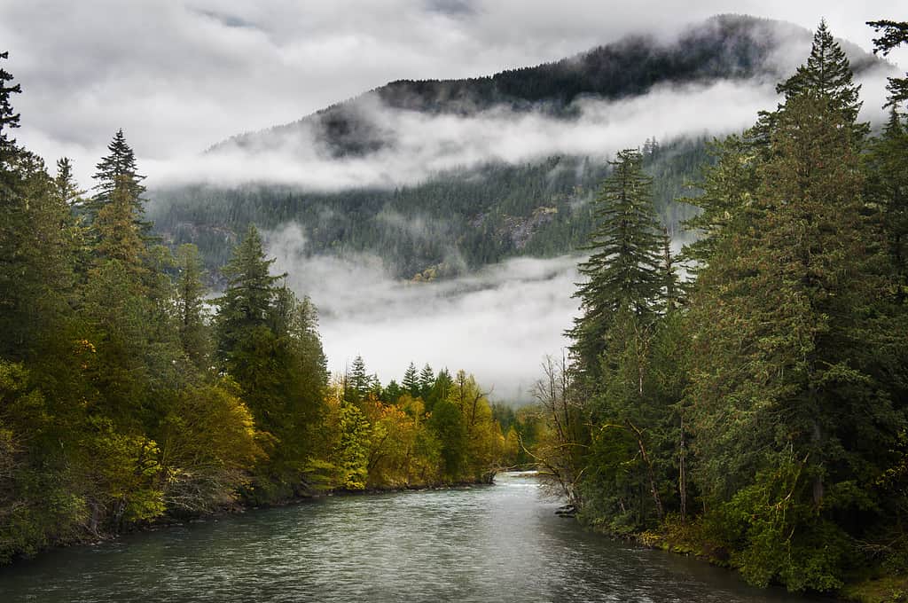
The Skagit River is approximately 158.8 miles long.
©Jacob R King/iStock via Getty Images
The geology of the Skagit River unveils the Earth’s dynamic processes, shaped over millions of years, and directly reflects how deep it is today. This majestic river’s formation shows the results of the forces of nature that have sculpted its course through time.
Within the geological history of the Pacific Northwest region, the story begins with the birth of the North Cascades, a mountain range renowned for its rugged terrain and towering peaks. Furthermore, the mountains in the area where the Skagit River now lives are composed of various types of rock, including plutonic and metamorphic rocks.
10 million Years Ago
Approximately 10 million years ago, tectonic forces set the stage for the Skagit River’s emergence. The uplifting of the North Cascades arc created the topography that would eventually guide the river’s flow. Like many rivers in the region, the Skagit River was born from the gradual accumulation of snowmelt and glacial runoff, forming streams that converged to create a larger river.
19,000 to 10,000 Years Ago
During the last ice ages, specifically the last one around 19,000 to 10,000 years ago, massive glaciers covered the North Cascades. The Puget Lobe of the Cordilleran Ice Sheet highly influenced the Skagit River. As the Cordilleran Ice Sheet repeatedly advanced and retreated, moraines consisting of ice and gravel changed the course of the Skagit River multiple times until the Cordilleran Ice Sheet retreated permanently. As the glaciers advanced and retreated, they scoured the landscape, carving deep gorges and valleys and depositing sediments, including glacial till and moraines.
Furthermore, the Skagit River’s modern course and depth are ultimately the result of this glacial activity. The erosive power of the glaciers carved out deep valleys and created the river’s characteristic profile. As the ice melted, it left behind the sediments that characterize the riverbed of the Skagit River today.
The Skagit River has been flowing for thousands of years with a history deeply rooted in the Earth’s recent evolution. Moreover, its journey from the mountains to the sea reflects our planet’s dynamic and ever-changing nature.
Overall, the formation of the Skagit River began millions of years ago with the Cascade Mountains. It was further sculpted by the advance and retreat of glaciers during the last ice ages. Today, the river stands as a living example of the Earth’s constant evolution.
Activities and Destinations on the Skagit River
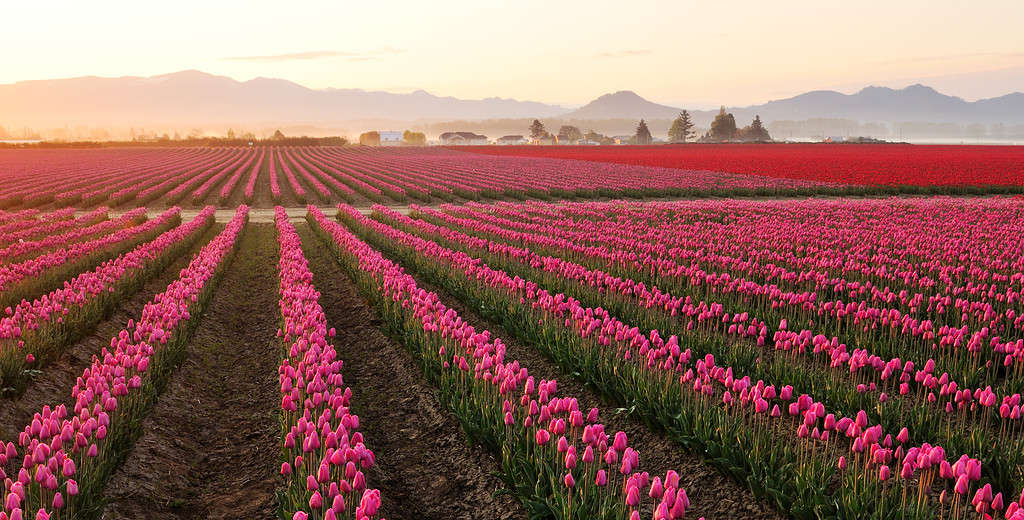
Skagit Valley in Washington, near the mouth of the Skagit River, is an abundant agriculture valley filled with bountiful food and events such as the annual tulip festival.
©Lijuan Guo/iStock via Getty Images
The Skagit River offers a wide range of activities and destinations that cater to those seeking outdoor experiences. This incredible river provides an array of experiences that allow visitors to connect with the natural world.
Activities
Whitewater Rafting and Kayaking
Thanks to how deep the Skagit River is, it is a wonderful destination for up to class III whitewater rafting and kayaking. Moreover, its clear and cold waters offer both beginners and experienced rafters thrilling opportunities. The river’s varied rapids and stunning scenery make it a popular destination for those seeking an adrenaline rush or casual float on the water.
Fishing and Swimming
The Skagit River has exceptional fishing opportunities. As previously noted, it is home to five salmon species and two trout species, amongst other fish species. Anglers flock to the river to try their luck in catching these prized fish. Moreover, the river also provides a tranquil setting for fly fishing, attracting those seeking a more relaxed fishing experience.
Furthermore, though less popular due to the frigid glacier-fed waters, various sections along the river offer opportunities for safe swimming.
Birdwatching and Wildlife Viewing
The Skagit River and its surrounding wetlands and estuaries serve as critical habitats for a plethora of bird species. Moreover, during winter, birdwatchers can particularly delight in observing migratory waterfowl, including snow geese, eagles, and trumpeter swans. The Skagit River, especially in the Skagit Valley region, is a designated Important Bird Area, making it a must-visit destination for bird enthusiasts.
Furthermore, the Skagit River is teeming with wildlife, including river otters, black bears, deer, and beavers. Observing these creatures in their natural habitat is a rewarding experience for wildlife enthusiasts and photographers.
Hiking and Camping
All along the river throughout Washington and Canada, numerous hiking trails wind through lush forests, mountains, and valleys. Moreover, these trails provide an opportunity to explore the river’s ecosystem up close while enjoying scenic vistas. Notable trails include the Skagit River Trail and the Sauk Mountain Trail.
Furthermore, several campgrounds along the Skagit River provide a chance to immerse oneself in the beauty of the natural surroundings. Camping by the river, such as at Rasar State Park, allows visitors to connect with nature, with the soothing sound of flowing water as a backdrop.
Destinations
These destinations along the Skagit River provide a diverse range of experiences for individuals and families alike. Whether you’re interested in outdoor adventure and exploration or simply immersing yourself in the natural world, the Skagit River and its surroundings have something to offer for everyone.
Skagit Valley Provincial Park (Canada)
For those interested in exploring the Canada section of the Skagit River, the Skagit Valley Provincial Park in British Columbia, Canada, is a stunning wilderness area with hiking trails, camping options, and breathtaking scenery.
Ross Lake National Recreation Area and North Cascades National Park Complex
The Ross Lake National Recreation Area resides within the North Cascades National Park Complex. This destination, which the Skagit River runs directly through, encompasses a vast wilderness of rugged mountains, glaciers, and pristine rivers. Furthermore, visitors can access the park from various points along the Skagit River and explore its numerous trails, visitor centers, campgrounds, and scenic vistas.
Marblemount
Marblemount serves as a gateway to the North Cascades National Park. It’s a popular starting point for outdoor adventures, including hiking, fishing, and exploring the surrounding wilderness. Moreover, there are rustic accommodations in and surrounding Marblemount as well.
Rockport State Park
Nestled along the Skagit River, Rockport State Park is a tranquil haven for nature lovers. Furthermore, visitors can enjoy hiking trails, picnicking areas, and camping, enjoying the park’s old-growth forest and riparian habitats.
Rasar State Park
Situated on the banks of the Skagit River, Rasar State Park provides camping facilities. It also has hiking trails and opportunities for wildlife viewing. Moreover, the park’s diverse ecosystems make it an excellent destination for nature enthusiasts.
Skagit Valley (Washington)
Nestled between the North Cascades to the east and the Puget Sound to the west, Skagit Valley in northwestern Washington is a picturesque agricultural region encompassing the Skagit River’s lower reaches. Skagit Valley has fertile farmlands, ample birdwatching opportunities, a vibrant annual tulip festival, seasonal events, and cultural attractions. Moreover, the nearby town of La Conner, a charming historic waterfront town, has a rich art history, galleries, boutique shops, and the popular farm-to-table restaurant Nell Thorn.
Where is the Skagit River Located on a Map?

The Skagit River flows westward from southwestern British Columbia in Canada through northwestern Washington in the United States.
©july7th/iStock via Getty Images
The Skagit River starts in southwestern British Columbia in Canada in E. C. Manning Provincial Park. From there, it first flows through northwestern Washington in the United States. It starts by flowing south into the North Cascades. From there, it flows westward, continuing through the North Cascades and passing through the towns of Newhalem, Marblemount, Rockport, Concrete, Sedro-Woolley, and Mount Vernon. Finally, from Mount Vernon, it empties into the Skagit Bay within Puget Sound.
The photo featured at the top of this post is © Michael Jagla/iStock via Getty Images

How to Add Us to Google News


Thank you for reading! Have some feedback for us? Contact the AZ Animals editorial team.