Pittsburg, New Hampshire, is a dot on the New England map in an area the locals call “The Great North Woods.” Incorporated in 1804, the tiny burg borders Quebec, Canada. As of 2022, 830 people called Pittsburg home, up from 817 the year before. The town revels in its obscurity, boasting on its website of being the “Snowmobiling Capital of New England” where there are “more moose than people!”
While that may be so, there is something else infinitely more important going on in Pittsburg. Although the community is a speck of a town with miles of rivers, ATV trails, and landlocked salmon (not to mention myriad moose), Pittsburg is also where the Connecticut River, New England’s longest, begins. The river starts its life not far from the Canadian border on Fourth Connecticut Lake, a 2.5-acre pond chiseled from the last ice age. How long is the Connecticut River from start to end? Let’s find out by going back in time, some 10,000 years.
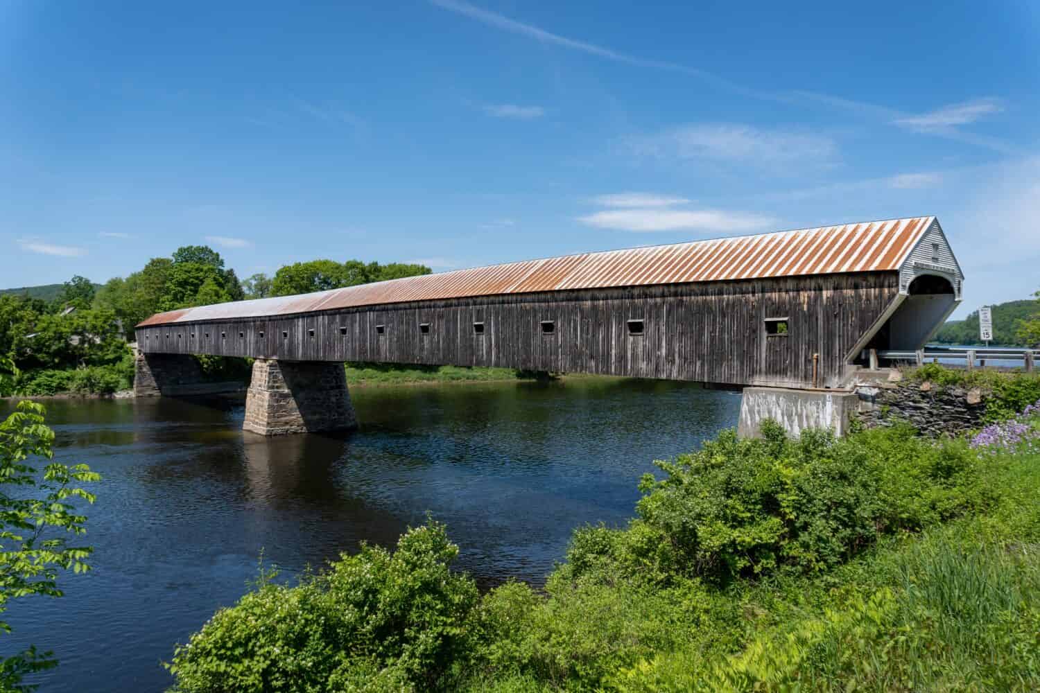
This covered bridge, built in 1866, spans the Connecticut River and connects Cornish, New Hampshire, with Windsor, Vermont.
©EWY Media/Shutterstock.com
Carved from Ice
The last time Earth experienced an ice age was during the Pleistocene era, which began 2.6 million years ago and ended some 11,700 years ago. During that period, a large chunk of the globe, including what would later become New England, was locked in a thick slab of glacial ice. As the ice built up, it got heavier and heavier, pressing down on the land. All that pressure scraped off tons of rock, adding even more weight. But around 10,000 years ago, the huge glacier that had covered the region for centuries began its retreat as temperatures warmed. At the time, the ice that covered a good portion of New England was a mile thick.
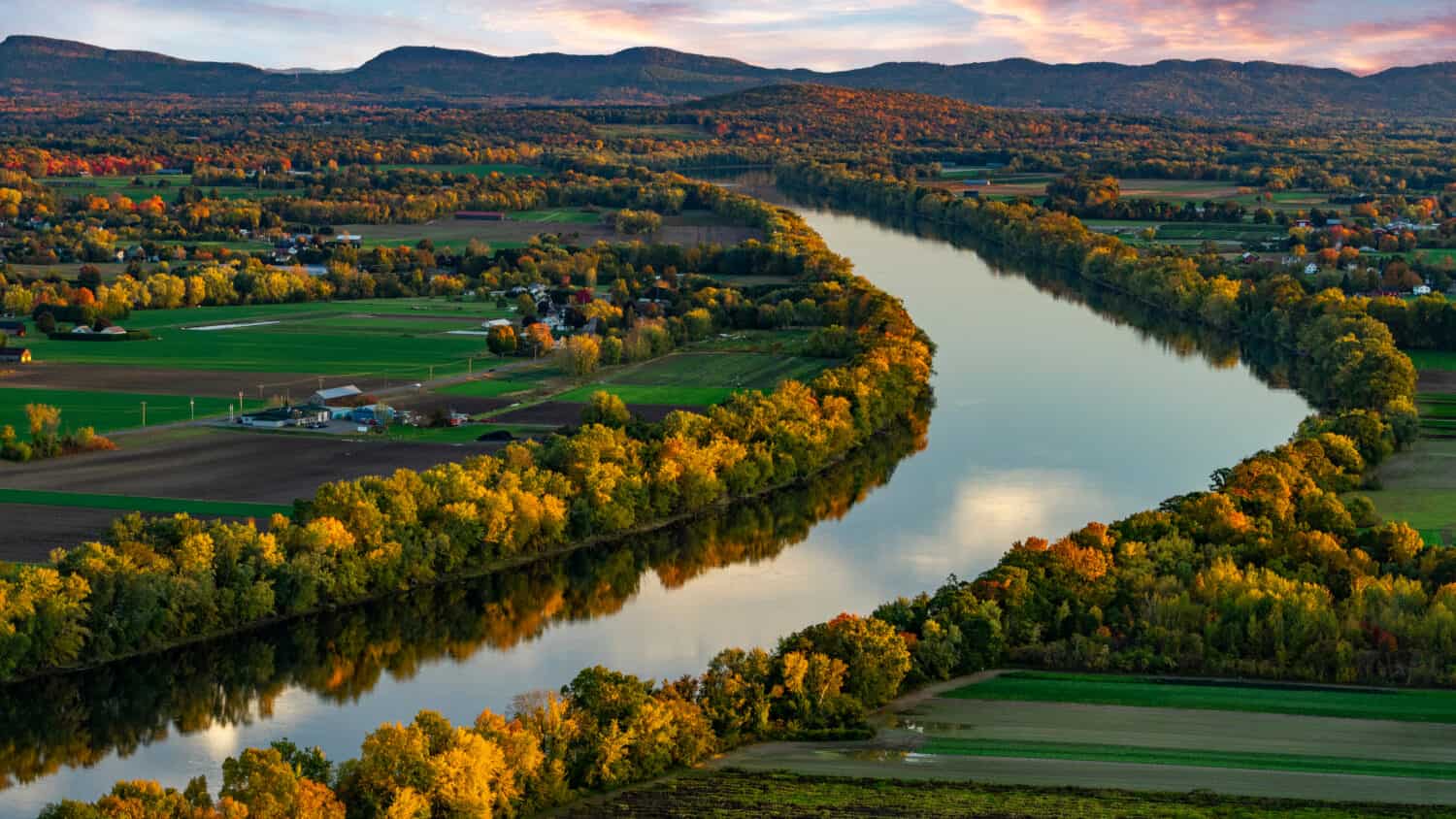
As the glacier twerked, it deposited tons of sediment, creating vast lakes and chiseling the surrounding landscape, which lessened the amount of weight on the earth. Little by little, the land began to bounce back like a trampoline. Melting water gathered into ponds and lakes. One of those lakes was Fourth Connecticut Lake in northern New Hampshire. The glacier also carved out rivers, streams, and valleys, including the Connecticut River Valley. Today, the valley extends from northern New Hampshire through Vermont, Massachusetts, and Connecticut.
The Connecticut River has three sections: The Upper Connecticut River runs through Vermont and New Hampshire. The Middle Connecticut River runs through Massachusetts into central Connecticut. The lower Connecticut River encompasses the southern portion of Connecticut to Long Island Sound.
The Connecticut River winds its way through Deerfield, Massachusetts.
©Joshua Lehew/Shutterstock.com
First People
The first inhabitants of the region saw how important the Connecticut River was. They had been living along its banks for about 6,000 years, using the waterway for travel, trade, fishing, and hunting. The Connecticut River, which the Algonquian people called the “long tidal river,” was a cornucopia of flora, fauna, and fertile land. By the 1600s, the first Europeans—the Dutch—arrived looking to see what they could take. The Dutch set up an important trading post along the river in what is today Hartford, Connecticut.
England was another European power that had its sights on the river valley’s natural resources. At first, the English had no intention of settling the river valley. Eventually, they came to the region in 1633 when a group of Massachusetts settlers from Plymouth sailed their boats up the river.
More settlers from Massachusetts arrived and set up their colony — Connecticut. They saw that the Connecticut River could enhance their economic fortunes, especially as the settlements moved farther upriver into what is today New Hampshire and Vermont. The British traded first in furs but then later began shipping lumber down the river. Shipbuilding later became an important industry.
Industrialization and Pollution
Yet, it would be industrialization that would influence the Connecticut River the most. People diverted the river’s water and used it as a source of power for their factories and mills. But with progress came environmental degradation. Factories and shops dumped their waste in the water, threatening its fragile ecosystems.
The land along the river was some of the most fertile in all of New England. As settlements grew, so did farming. Runoff from those farms further polluted the environment and continued unabated for centuries. Pollution became such a problem that in 1965, actress Katharine Hepburn, whose family owned a large estate at the mouth of the river near Long Island Sound, narrated a film where she called the Connecticut “the world’s most beautifully landscaped cesspool.” The film spurred activists into action. Among other things, communities built more wastewater treatment plants in the watershed while lawmakers placed tighter restrictions on industrial polluters.
Connecticut River by the Numbers
The Connecticut River is 410 miles long from its northern beginnings in New Hampshire to its end on the Long Island Sound between Old Lyme and Old Saybrook, Connecticut. The river drops from 2,670 feet from Pittsburg to sea level in Connecticut. Seventy-seven percent of the area in the river’s watershed is wooded.
The river forms a 255-mile border between New Hampshire and Vermont, descending more than 2,480 feet as it snakes its way into Massachusetts. It is in the Massachusetts town of Gill that the river is the deepest, some 130 feet. The river is its widest — 2,100 feet— at the Massachusetts town of Longmeadow, which straddles the Connecticut border. It is above Longmeadow, where the river’s most populous city, Springfield, stands on cliffs above the river near the Chicopee and Westfield rivers, the two largest tributaries that feed into the Connecticut.
Meandering Water
South of Springfield, the Connecticut River winds past Hartford, Connecticut’s capital, Middletown, and many other communities. The river’s watershed from north to south and east to west is huge, about 11,260 square miles. It includes 148 tributaries, hundreds of lakes, and 38 important rivers.
The Connecticut River does not necessarily flow unimpeded. A number of falls dot the waterway, including those in White River Junction, Vermont, and Turners Falls in South Hadley, Massachusetts. Over the decades, workers built a series of canals to bypass some of these falls, including in South Hadley. The canals helped people transport goods up and down the river.
Moreover, dams abound. The Connecticut River and its tributaries boast 3,000 active as well as non-active dams, some of which provided power for mills and factories and irrigation for farmland. In fact, the first dam built was in Moose Falls, in Pittsburg. Several current dams are hydroelectric. One is in Holyoke, Massachusetts, at South Hadley Falls. Workers constructed the 30-foot-high dam out of granite. Construction began in 1895 and lasted for five years. Two hydroelectric turbines generate 33 megawatts of power. There is also a fish ladder so migrating fish can travel upstream.
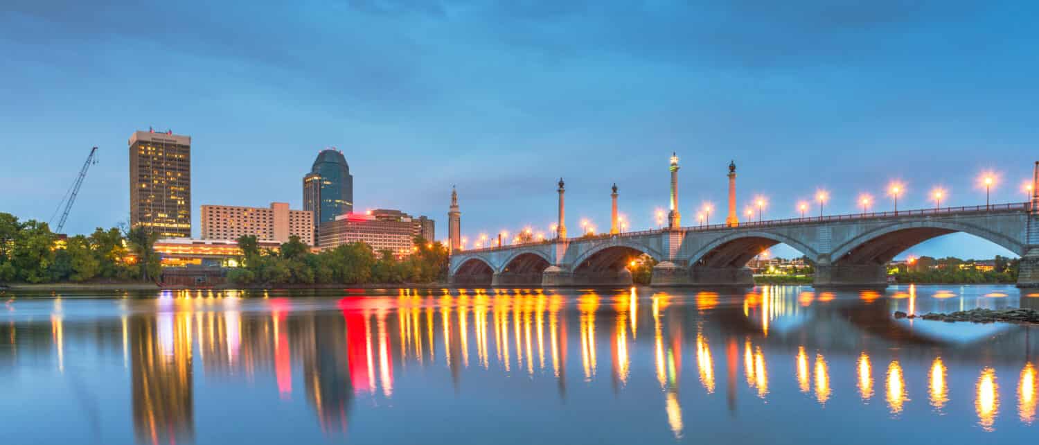
Springfield, Massachusetts, on the Connecticut River.
©Sean Pavone/Shutterstock.com
Flora and Fauna
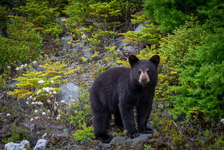
While the Connecticut has come far since being called a “cesspool,” more work needs to be done. Wildlife is abundant up and down the waterway. A number of different songbirds and other fowl, including bald eagles, call the Connecticut River Valley home. Many birds are year-round residents of the region, while others are migratory. Moose, lynx, wild turkeys, trout, shad, and nearly a half dozen threatened or endangered species thrive in and along the river. About 2 million people populate the region, most living north of Springfield to Hartford and Middletown in Connecticut.
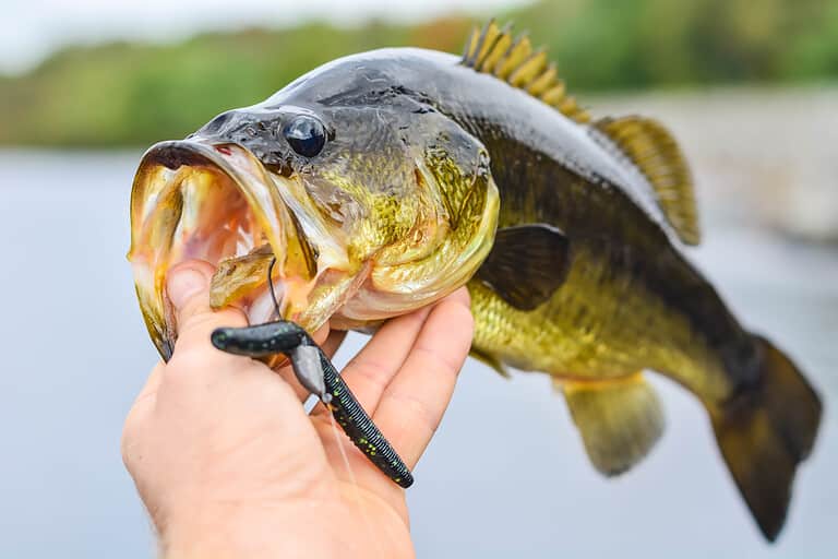
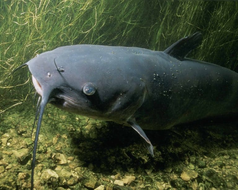
The Connecticut River is also a fisherman’s paradise. It teems with an assortment of marine life. Many freshwater species thrive along much of the river, including various species of trout and bass. But at the lower end of the Connecticut, the fishery expands to include brackish and saltwater.
In fact, the Connecticut is the largest tidal river in the Northeast. The tidal basin in Connecticut, as well as the adjacent wetlands, are home to species such as the shortnose sturgeon, Atlantic sturgeon, summer flounder, and seabass. In addition to fish, the tidal basin is a prime nesting area for osprey, plovers, and egrets.