
Rivers are the lifeblood of the world. They offer fresh water access to billions of animals and humans, define the borders of states and countries, and provide rich riparian habitats to a variety of species. The Eel River is a river that winds through the northwestern portion of California. This beautiful river has five forks (north, south, middle, Van Duzen, and main) and drains 3,684 square miles of the rugged North Coast. Over 350 miles of the waterways associated with this river are protected by the State and Federal Wild and Scenic Rivers designations. These protections prevent river damming and elevate environmental concerns above development and industry. Today, we’ll explore the length of the Eel River and learn about where it goes, what it supports, and how long it really is. So, how long is the Eel River? Let’s find out!
How Long is the Eel River?
The main stem of the Eel River is about 200 miles long.
According to Rivers.gov, the Eel River stretches over 200 air miles and over 800 river miles. This is a measurement from the headwaters above Lake Pillsbury all the way to the mouth – where it meets the Pacific Ocean. This measurement seems to be inclusive of all of its forks and major tributaries. This river – and its tributaries – make up the third-largest watershed entirely in the state of California.
The main stem of the river, which flows from the Coast Range Mountains all the way to the ocean, is about 200 miles long. Along this course, it connects to four tributaries – the Van Duzen River, the North Fork, the Middle Fork, and the South Fork. The maximum depth of this river varies considerably over seasons and in different areas.
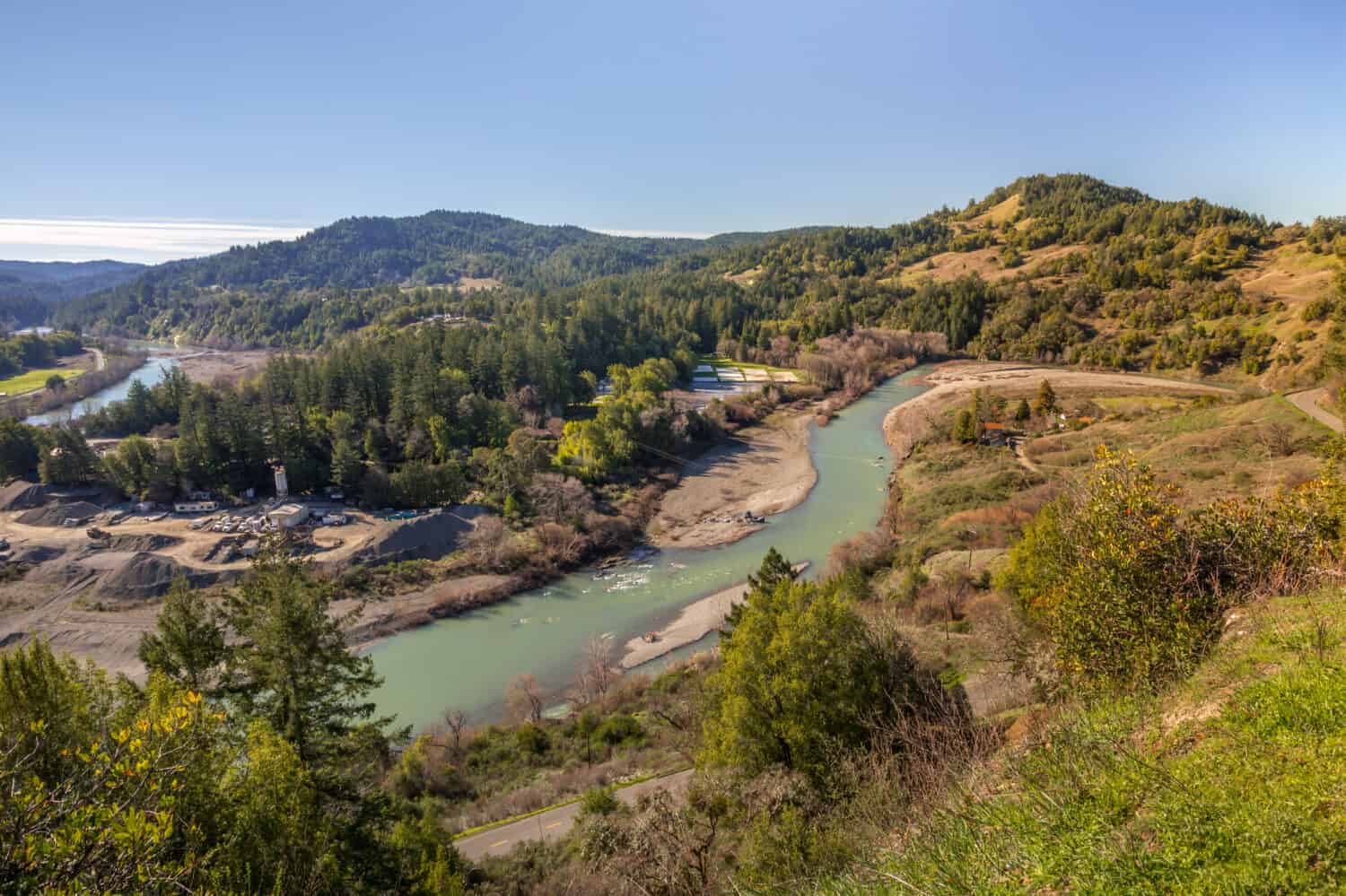
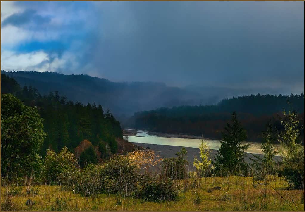
The Course of the Eel River
©Bureau of Land Management California / CC0 – Original / License
The Eel River’s headwaters begin on the south side of Bald Mountain in Mendocino. It then flows southward to meet with Lake Pillsbury, which is a man-made reservoir. Shortly afterward, it flows to the west and then is partially diverted into the Russian River. The course then turns northward and meets the Middle Fork, which joins the main stem from the east. This defines one border of the Round Valley Indian Reservation. It keeps flowing north and meets the North Fork, which also meets it from the east, and defines the northern edge of the Reservation.
The South Fork joins from the west and then the Van Duzen River from the east. It continues flowing north through Fortuna and then pivots west to flow through an estuary and then meet the Pacific Ocean.
The Eel River flows through California towns such as Dos Rios (population 70), Alderpoint (population 26), Rio Dell (population 3,367), and Fortuna (population 12,482).
Where is the Eel River on a Map?
We decided it would be a good idea to share a map that shows the Eel River as it gets close to the Pacific Ocean. This interactive map is focused on the river from where it flows slightly west of Fortuna to its mouth. Interactive maps are incredibly cool because you can change the point you’re looking at. We used this map to explore the entire main stem of the river mile by mile. You can use this map however you’d like, including looking at points not associated with the Eel River. However, for the purposes of this article, we encourage you to check out the river as it winds through beautiful Northern California.
You can see that the river and the famous Highway 101 share a path for a while before the river turns east away from the highway near Mahan Plaque and Founders Tree.
The Forks of the Eel River
Let’s talk about the course of each river fork. This will give us a better idea of the major parts of the watershed and where they flow. The Middle Fork of the Eel River is the first major fork we run into while traversing the river from headwaters to mouth, so we’ll start with that and make our way in order of location as we drift toward the ocean.
- Middle Fork Eel River is a wild river that begins at the southern boundary of the Middle Eel-Yolla Bolly Wilderness. This fork of the river is the Eel’s largest tributary and flows 69.8 miles before meeting the main stem at Dos Rios. It is not its length that makes it the largest tributary, but its watershed area. This portion of the river drains has a watershed of 745 square miles and drains about 20 percent of the entire Eel River Basin. The Middle Fork is joined by the Black Butte River, which flows from the north side of Hill Mountain before finding the Middle Fork to the east of Covelo.
- North Fork Eel River is about 35 miles long, with all of its river miles existing within Trinity County, California. Its headwaters rest on the south end of the Hettenshaw Valley. This fork drains 286 square miles and meets the main stem south of Ramsey.
- South Fork Eel River is the only one of the major tributaries to meet the main fork from the west. Laytonville, California is the birthplace of this river, and from there, it makes its way nearly due north. It sees ancient redwoods and other wonders as it finds its way to the main stem, just south of Pepperwood, California. It is 105 miles in length and Highway 101 follows it after the main stem branches east.
- The Van Duzen River is a scenic river that defines the fourth major tributary of the Eel River. It begins at Dinsmore Bridge in the North Coast Range and flows 63 miles before meeting the Eel River.
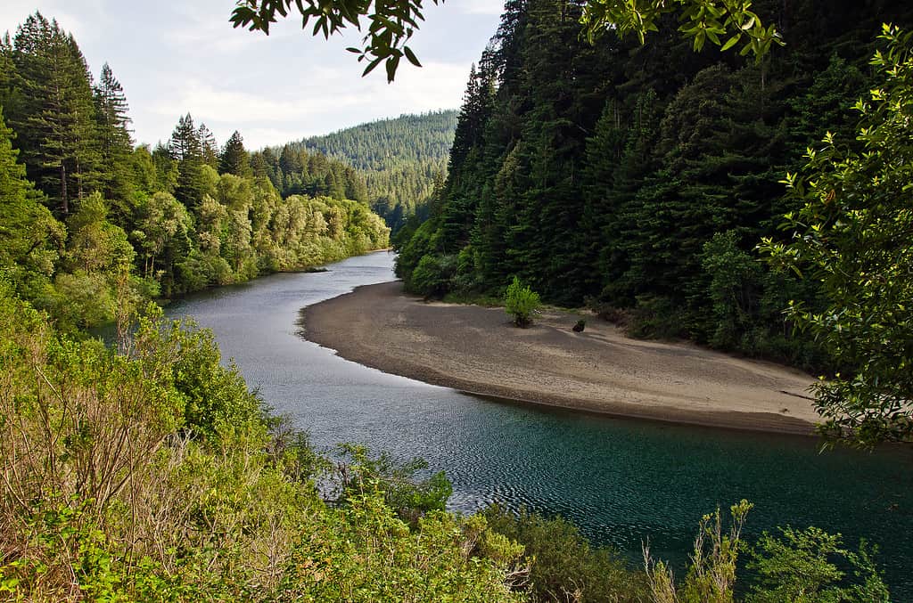
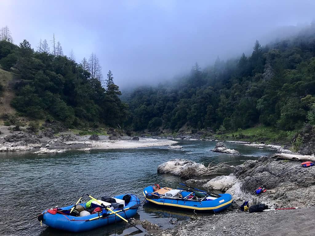
Is the Eel River Safe to Swim in?
There are plenty of wonderful swimming holes along the Eel River.
Many portions of the Eel River are wonderful to swim in, including spots on a 30-mile stretch in the Humboldt Woods State Park. These spots are situated along both the main stem and the south fork of the river through the State Park. Recommended swimming sites include Landsdale Bar, Eagle Point, Leatherwood Bar, Garden Club of America Grove, and Williams Grove. There are plenty of other lovely places to take a dip in the waters of the Eel River.
Officials warn that the South Fork Eel River is rain-dependent and that visitors should pay attention to weather patterns to avoid getting stuck in a dangerous river swell. Officials also warn that you should keep an eye out for blue-green algae blooms, which can pose a toxic risk to humans and animals. Pay attention to local advisories when considering a dip in the river, and always practice water safety, such as being in the presence of a strong swimmer, paying attention to currents, staying hydrated, and taking breaks after extended swims to avoid wearing out. Always check the water for hazards, such as sharp rocks, strong currents, sudden drops, or other obstacles.
Pollutants in the Eel River
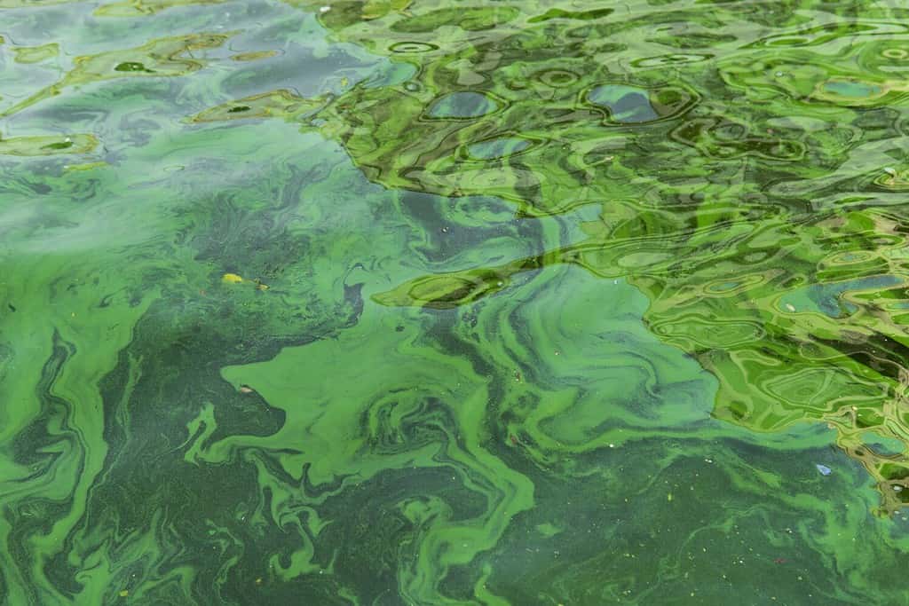
Blue-green algae, while a natural eco-system balancing act, now poses a danger to rivers and lakes – and the animals, plants, and people that rely on them.
©Aleksandrkozak/Shutterstock.com
The Eel River Recovery Project wonderfully expounds on the risks posed to the Eel River by a variety of pollutants. One major concern is related directly to cannabis farming in the watershed. Often, farming operations use a variety of chemicals and natural nutrients to care for their crops. These chemicals and nutrients eventually drain into the surrounding rivers. Watersheds ensure proper soil drainage, and the excess water runs to the river, whether via creeks, underground waterways, or rainfall.
Runoff from these farms and gardens, especially when they’re using highly concentrated mineral fertilizers, can stimulate algae blooms. Algae blooms are a natural balancing reaction of our environment. Unfortunately, when elevated levels of minerals, nutrients, chemicals, and detergents enter the water table, the environment overreacts to compensate. This creates dangerous algae blooms and hypoxic waterways. A hypoxic waterway is one that has little to no oxygen in it. High levels of minerals and nutrients such as nitrogen choke the oxygen out of water and make life difficult or impossible for all of the organisms that rely on it to survive.
The main sources of this form of pollution are:
- Runoff from pesticides in gardens.
- Leaking septic tanks.
- Detergents, such as laundry and dish detergents.
- Salt-based fertilizers and other chemical treatments.
- Garbage that gets dumped or that flows into the river.
- Chemical waste products from industrial processes (cyanide, copper, mercury, zinc, nitrates, and sulfates).
In summary, it is a variety of factors that cause water pollution in the Eel River. Chemicals, trash, bacteria, and parasites are four of the largest issues in our water. There are so many ways we can reduce our impact, including using products for our gardening, laundry, and households that have smaller or no impacts on our local waterways. You can also join several clean water protection groups to find out how you can help your waterways on a local level or rally to reduce chemical runoff from large industries.