How long is the Illinois River, from start to end? The one that’s mainly in the state of Illinois is 273 miles long. It starts southwest of Chicago and runs down to Grafton, Illinois.
The Illinois River, the One That Is in Illinois
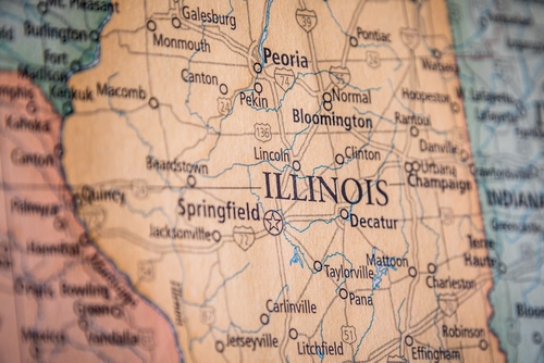
There are numerous rivers in the U.S. named the “Illinois River,”; but the one in this article is the Illinois River in Illinois.
©BestStockFoto/Shutterstock.com
We have to specify which Illinois River because technically, there are four large traveling bodies of water named the Illinois River spread out across various states. But those are smaller tributaries of larger river systems.
And if someone from outside the U.S. were to look at our river names, they’d quickly get confused. The Ohio River starts in Pennsylvania and ends in Illinois, the Mississippi River begins near Minnesota and ends in Louisiana, and there appears to be a Canadian River that begins in Texas!
This River Is a Major Part of the Great Lakes and U.S. Waterways
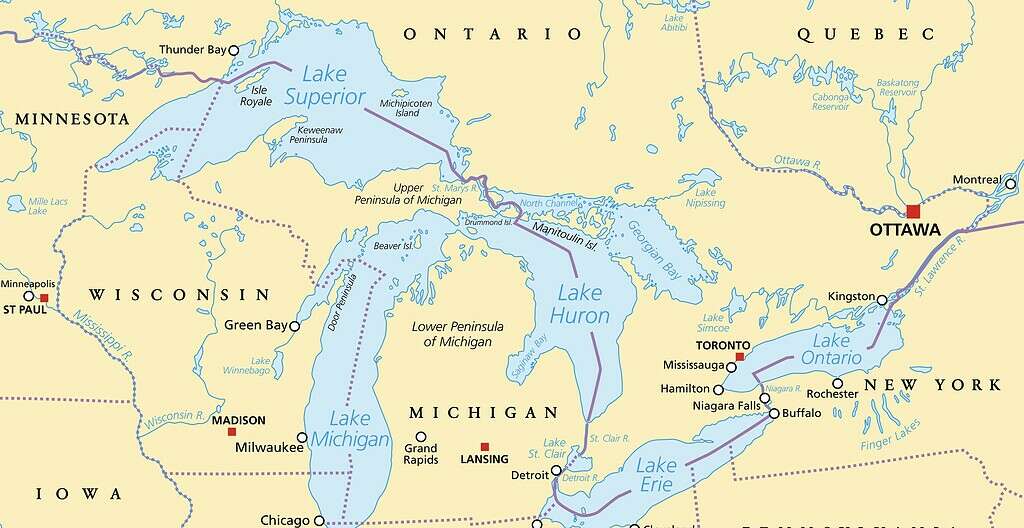
The Illinois River starts with two Lake Michigan tributaries colliding southwest of Chicago.
©iStock.com/PeterHermesFurian
The Illinois River cuts clear across the Great Lakes state of Illinois. It’s a major waterway for the region. The Prairie State is one of four that draws from Lake Michigan. The Kankakee and the Des Plaines rivers collide to form this river, creating a peaceful area around the Des Plaines Dolomite Prairies Land and Water Reserve.
The Illinois River almost wanders into Missouri but stops just short of St. Louis. It is a big ole river with a long history in Illinois. The First Nations peoples traversed the river and others in the region for centuries.
It’s commonly believed that French explorers and fur trappers were the first Europeans to bushwhack through the upper Great Lakes area. And we see many French names in and near the region (Detroit, Des Moines). The earliest European along the River and through the state of Illinois was Jesuit priest Jacques Marquette.
How’s That Gonna Play in Peoria?
The river wanders through numerous cities along its bumpy route through the state. Looking at the map, it also leaves a lot of thin islands. The ancient Illinoisian glacier in this region left a good number of nearby lakes as well. The biggest city on its route is the famous rhetorical device of Peoria, Illinois.
In addition to Peoria, the Illinois River Passes through other interestingly named towns like Montezuma, Havana, and Beardstown.
The Torrents of Spring and Kankakee
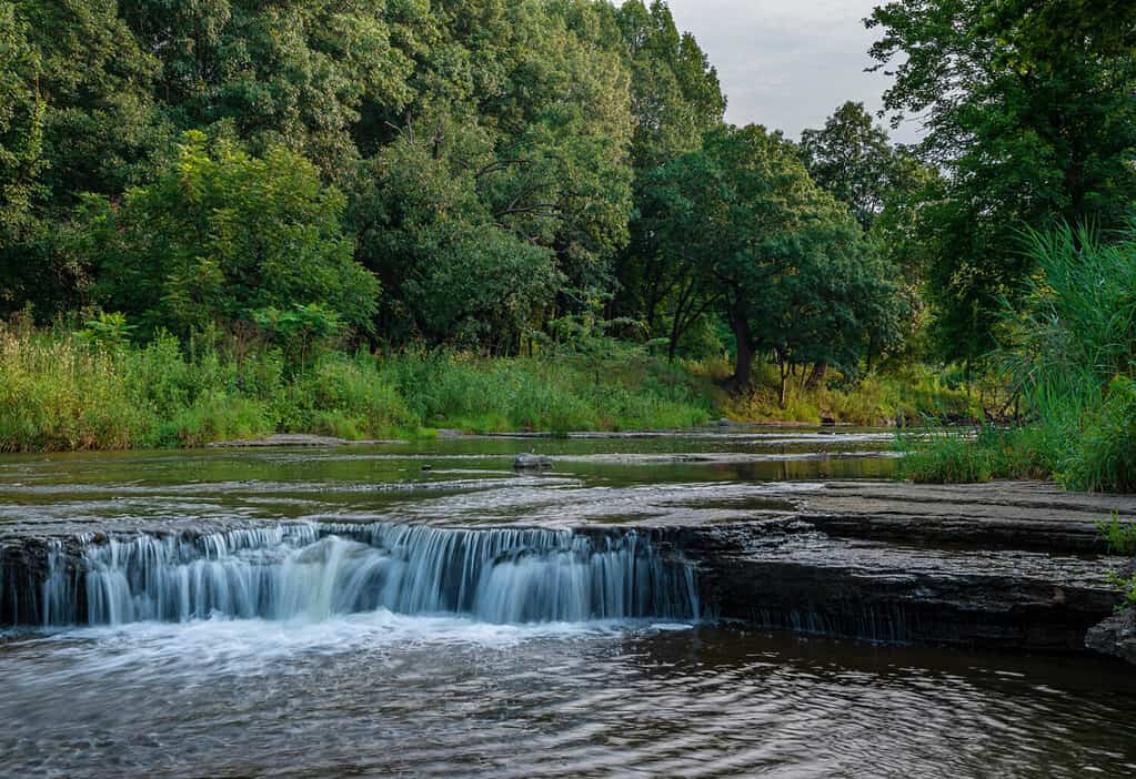
The Illinois River is fed by several tributaries, such as the Kankakee River.
©Hank Erdmann/Shutterstock.com
The Kankakee River feeds into the Illinois River near Chicago. It appears to be named after the Kankakee Torrent, a glacial unleashing of meltwater that helped create this river.
What Are the Characteristics of the River?
From the earliest written accounts, this river and surrounding area were considered a “boundless marsh.” Its floodplain is enormous: the historic flood stage area was 700 square miles.
This river floods easily, but that’s not so surprising: at its deepest point, it only goes down 14.92 feet!
Taking the Floodpulse
The Illinois River and the accompanying floodplain are so large that scientists believe the surrounding ecosystems have a ‘flood pulse advantage,’ a unique adaptation of both aquatic organisms plus land-based flora and fauna to get the most out of each other.
Following the river down a map, there are numerous wetlands, marshes, aquatic and semi-aquatic preserves and areas: Banner Marsh State Fish and Wildlife Area; Rice Lake State Fish and Wildlife Area; Emiquon National Wildlife Preserve, and more.
The Benefits of the Flood Plain, Among Others, Farming
The Illinois River floodplain has, indeed, flooded its surrounding land and created wetlands but also rich, farmable soils. This good dirt has allowed thriving agriculture: 46% of Illinois farmland is within the Illinois basin.
Illinois state produces farmloads of soybeans and corn. Collinsville, IL, grows half the U.S.’s horseradish and is the horseradish capital of the world!
And, for all the Starbucks fans who gear up for that magic drink every fall—we know which one—the river’s rich ecosystem makes the Prairie State America’s number one pumpkin producer!
Illinois Waterway Includes the Illinois River
There is also the Illinois Waterway—a group including the Des Plaines, Calumet and Chicago Rivers—which is a system that includes the Illinois River.
This waterway is 300 miles long. Through various locks, canals and other human-made contours, the aquatic thoroughfare is a commercial and recreational powerhouse.
The Many Plants and Animals Around the Illinois River
Through realistic conservation efforts, the river is ecologically better than it once was. It’s a testimony to the possibilities of integrating commerce and farming in a sustainable way or re-integrating them, perhaps.
Problems from backwater disruption gave way to a zebra mussel invasion, and Asian carp fish have also caused problems as an invasive species. Restoration efforts continue.
The beavers and other furry game that enticed the fashionable French fur-trappers are still in the mix. Otters also like to chill on the river banks.
There are some common birds, swans, and occasionally, a bald eagle. The best birdwatchers might even spot a great blue heron. White-tail deer are seen in nearby forests, and even turkeys have been spotted. A popular fish species is the channel catfish, plus crappie, walleye and certain bass species. Fishing is a popular recreation.
Farms and Barges
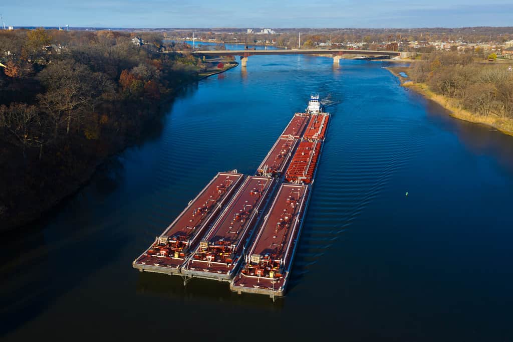
Some but not all parts of the Illinois River can accommodate barges and cargo ships. The river is not particularly deep.
©Steve Gadomski/Shutterstock.com
From the earliest development days along the Illinois River, people noted the enormous richness of its accompanying ecosystems. The farms created a lot of crops to feed the nation, but the river also ferried crops up and down the state.
And the river’s use as a highway for goods also goes back far. Through the 19th century, there was a healthy exchange of goods between Chicago and St Louis via steamship. Still, a maximum depth of 15 feet means some tricky navigation for a bigger, heavier vessel. So, the financial contributions of the Illinois River have been heavily agricultural and recreational opportunities.
A Calmer River Overall
While flooding isn’t very calm, the Illinois River isn’t in much of a hurry. Illinois Paddle, a kayaking and canoeing blog, says the average speed of the River is about one mph. Another whitewater rafting company claims the only place in the state of Illinois for some rapid-shooting is along the Vermillion River, where class III rapids might get up to 3 miles per hour.
Eyeballing the river along a map, the widest point appears to be around Rome, IL, by the Woodford State Fish and Wildlife Area, where it looks to be about 1.5 miles across. It opens up a bit in this spot between Goose Island and Partridge Creek.
A River Runs Through It, the Longest Rivers in Illinois
How does the Illinois River measure out in terms of the state’s other rivers? That depends on what rivers are “in” Illinois. The Mighty Mississippi is 2,350 miles long, and it runs through Illinois—technically, at its border—on its way to the Gulf of Mexico. For the longest river that’s entirely or almost entirely in the boundary of the state of Illinois, its namesake river looks to be the longest.
As for the deepest bodies of water, Devil’s Kitchen Lake in Williamson County, IL, goes down 90 feet. Numerous sources say it is the deepest lake in the state. Lake Michigan is split four ways between four states, so pinpointing the deepest spot in the Illinois territory is difficult. But the deepest spot in the Great Lake that is Lake Michigan is by Chippewa Basin, where it plumbs 925 feet. The constant temperature there is a frigid 39 degrees!
Illinois River Goes Along
The Illinois River, the one in Illinois, is Illinois’ own Illinois River. It cuts through almost the entire state, and nearly the whole state is within its accompanying ecosystems. It helps the state eat and have fun. What could be better?
The photo featured at the top of this post is © EJ_Rodriquez/iStock via Getty Images
Thank you for reading! Have some feedback for us? Contact the AZ Animals editorial team.


