
When people think of Alaska, they often don’t think of what it’s like during the summer seasons. Alaska has many climates, some very surprising due to the state’s snowy reputation. With Alaska spanning over 665,400 square miles, there is plenty of different environments that have varying weather. August weather in Alaska varies depending on where you are in the state.
Alaska can reach 70s degrees Fahrenheit or higher in the south and interior of the state with rain and sunshine. However, in the northern areas, the average is around 40 degrees Fahrenheit, and deep snow is more common.
As you can see, it can be tough to pinpoint an average for the whole state. So, let’s take a closer look at August weather in Alaska around the state.
Average August Weather in Alaska
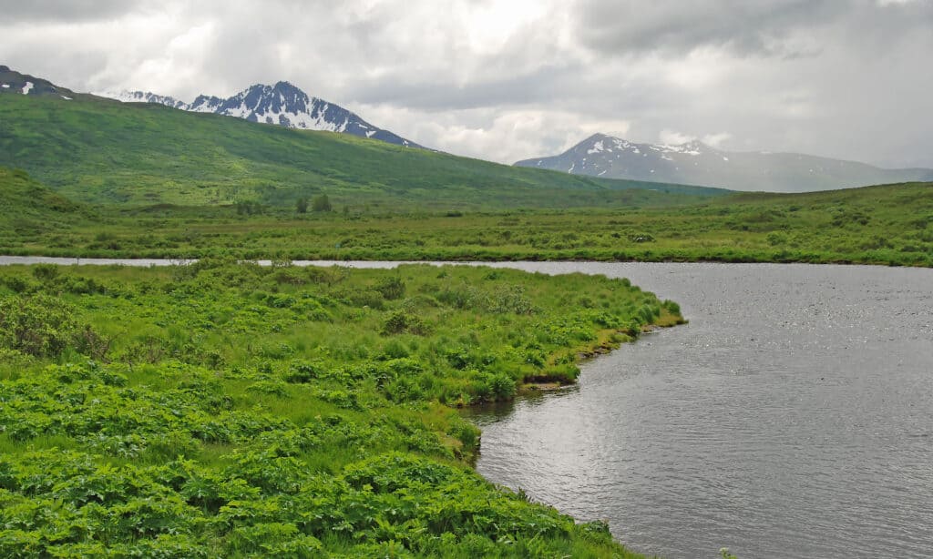
Alaska’s weather changes depending on the region. Kodiak Island is known for having mild weather with frequent rainfall.
©iStock.com/Wildnerdpix
The average weather in Alaska will change depending on which area you are in the state. Alaska has five different regions, each with its unique weather and climate. This includes the five regions including Inside Passage, Southcentral, Interior, Arctic, and the Southwest. Let’s look at the five regions to understand Alaska’s average weather better.
Inside Passage
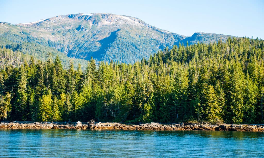
Tongass National Forest spans over 500 miles of southeastern Alaska.
©iStock.com/ad_foto
Inside Passage is a coastal route alongside three islands, Princess Royal Island, Vancouver Island, and Pitt Island. The passage is a network where ships can cruise and weave inside. It’s located on the Pacific Northwest coast of the North American Fjordland. It’s home to the Tongass National Forest and is where the tribes Tsimshian, Haida, Eyak, and Tlingit reside.
While it doesn’t snow in this region in summer, it does get plenty of rain. August is the last month when this region sees around 6.6 to 9.8 inches of rainfall monthly. Aside from the weather, Inside Passage also gets 16 hours of sunlight during August.
Southcentral
The state’s central region has a wide variety of temperatures and weather.
©FloridaStock/Shutterstock.com
Southcentral Alaska is known as the Gulf Coast Region for its uplands and shorelines. This is the most densely populated region in Alaska and contains most major cities, including Anchorage, Palmer, Wasilla, and Kenai. This region is known for being the hub center of the state, hosting most of the transportation, including Ted Stevens Anchorage International Airport, Alaska Railroad, and Port of Anchorage.
Standard weather includes snowy peaks with mild temperatures along the coastline. The days appear longer in August as the Southcentral area tends to get 18 hours of sunlight.
Interior
The interior has the biggest range of weather and temperatures, which can be very hot or below zero.
©Erika Bisbocci/Shutterstock.com
Interior Alaska is located in the state’s center. It can be located by the boundary of the Alaska Range and the Brooks Range. Central Alaska doesn’t have many cities, but there are a few towns, including the North Pole, Fairbanks, Tok, Delta Junction, and more. Three mountain ranges lay within the boundary, which are Denali Mountain, Wrangell Mountains, and Ray Mountains. The tribes in the area are the Athabaskans.
Out of all the regions in Alaska, the Interior is the most unstable. It often sees extreme seasonal temperatures and weather. Often, summers tend to be very sunny and hot. However, the winters are frigid and have plenty of snow.
Arctic
The Arctic Circle is one of the coldest climates in Alaska.
©iStock.com/Wirestock
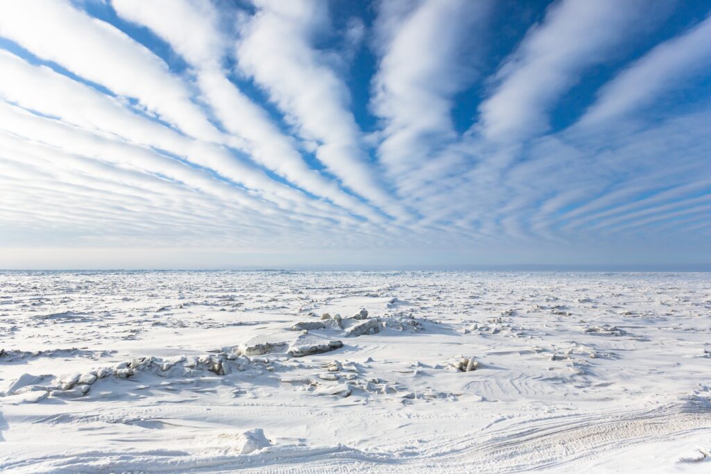
As you can imagine, Arctic Alaska is part of the state located in the northernmost area. It’s part of the Arctic Circle and includes areas close to the Arctic Ocean. Multiple boroughs are included in this area, such as the North Slope Borough, Nome Census Area, and Northwest Arctic Borough. Towns include Prudhoe Bay, Kotzebue, Nome, and more, and is home to the Inupiat people.
The weather is often very stagnant, as you can think of the tundra like a dessert. There is only a small change aside from the frigid winters. During the summer, temperatures tend to stay the same, but some weather changes exist. This can include five inches of rain, which is mainly dropped during the summer months. However, areas can see more than 17 inches of rain, especially around Nome, AK.
Southwest
The Southwest area of the state is home to many volcanoes and sees the most rainfall.
©photomatz/Shutterstock.com
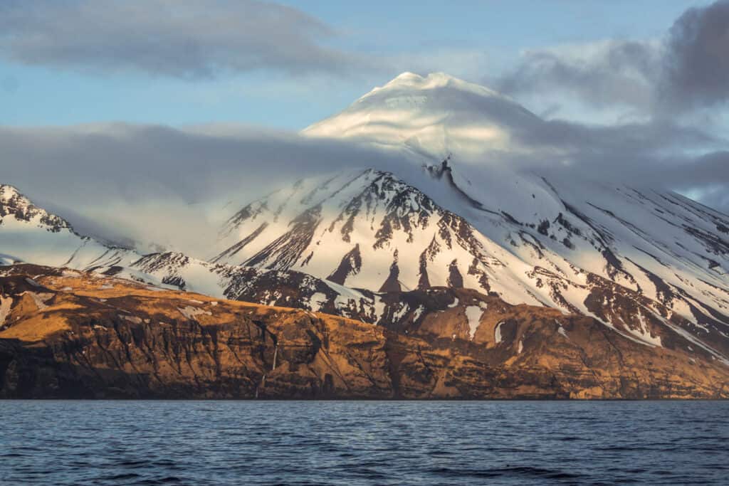
Southwest Alaska is next to the western Bering Sea coastline and is home to the Unangax, Sugpiaq, and Yup’ik tribes. The boundary is mainly made up of mountains such as the Aleutian Range and the Ring of Fire, including a handful of Alaska’s active volcanoes. The boundary includes the Pribilod Islands, Nunivak Island, and the Bering Sea Islands. It also includes the Aleutian Chain Islands, which spans to the Southeast.
The climate tends to change depending on ocean currents and maritime conditions. For weather, the area sees a lot of gusts and wind due to being near the coast. Islands also see swift winds throughout the year.
Average Temperatures, Daylight, and Rainfall

Alaska is known to have the most sunlight in the summertime compared to any other state in the United States.
©enjoy photo/Shutterstock.com
August weather in Alaska also has varying temperatures due to the sheer size of each region. While one region might see close to 75 degrees Fahrenheit, others may not reach higher temperatures, such as 40 degrees Fahrenheit. Below, we’ll list the average temperatures and records for each of the five regions.
Average Temperatures, Daylight, and Rainfall For Inside Passage
The weather is generally mild and does not have that many extremes. During August, the temperature mainly stays in the low to mid-range of 60 degrees Fahrenheit. Specifically, it stays around 65 degrees Fahrenheit on the high and 53 degrees on the low ends. There are generally only 12 days of rain.
Inside Passage tends to see around 16 hours of sunlight per day. This is a decrease from the previous month, which sees around 17 hours. In the following month, the sunlight decreases as the state heads into the fall season.
In addition to sunlight, there is also plenty of rainfall. Inside Passage tends to see around 6.6-9.8 inches of rainfall for the month of August.
Average Temperatures, Daylight, and Rainfall For Southcentral
The Southcentral area is subarctic, with long, cold winters but short, warm, and cool summers. Temperatures during August tend to be around 45 degrees Fahrenheit to 60 degrees Fahrenheit. However, it has been known to reach 65 degrees Fahrenheit or higher in recent years.
On average, the Southcentral region of Alaska gets around 18 hours of daylight. The daylight hours decreased from 19 hours in July to 16 in September.
The Southcentral part of Alaska doesn’t see that much rainfall despite August being the rainiest month in the state. On average, the region sees anywhere from 1.9-5.4 inches of rainfall in August.
Average Temperatures, Daylight, and Rainfall For Interior
While the summers can get as hot as 100 degrees Fahrenheit, this isn’t true of August. Temperatures in August range from low 35 degrees Fahrenheit to 40 degrees Fahrenheit. On the other hand, the weather tends to be dry due to the towering Alaska Range. There are also large temperature shifts, which result in a change of 30 degrees Fahrenheit in one day.
Interior Alaska tends to see 16 hours of sunlight during August. It’s at its peak in July, and the region gets 18 hours of sunlight. During September, it decreases to 14 hours.
Rainfall tends to be anywhere from 1.3-3.0 inches during August. However, the state does often see more rainfall than the average.
Average Temperatures, Daylight, and Rainfall For Arctic
The environment is mainly tundra and experiences long and extremely cold winters. The summers are often very short, but there is some warmth. For August, the average temperature stays around 30 degrees Fahrenheit to 40 degrees Fahrenheit.
One notable condition is that Arctic Alaska has almost 22 hours of sunlight this month. There is relatively no night sky except for two hours a day. During July, there is almost full sunlight throughout the month. A simple look at the Earth’s rotating axis explains that the 23.5 tilt allows the sun to become nearly 24 hours and is called the summer solstice, which happens on June 21.
The Arctic region of Alaska receives the least rainfall in the state. The average tends to be anywhere between 1.1-3.2 inches. Most of the rainfall is done during the summer season.
Average Temperatures, Daylight, and Rainfall For Southwest
Temperatures tend to be around 45 degrees Fahrenheit to 55 degrees Fahrenheit. However, it’s been known to get up to 60 degrees Fahrenheit or more.
For daylight, the region sees around 17 hours of daylight in August. This isn’t much different from the previous month, as the peak in July is 18 hours. During September, there are only 16 hours.
Southwest Alaska is known for seeing the most rainfall in the state. Depending on the area, it rains 1.7-4.9 inches during the month of August.
Alaska’s Record High and Low Temperatures
Weather in Alaska can range from below zero to over 100 degrees Fahrenheit.
©Ed Connor/Shutterstock.com
The state is known for being cold and frigid but can also become severely hot with August weather in Alaska. With so many regions, it’s important to understand which parts of the state get hot and cold. Below we’ll discuss the state’s record high temperatures and lows.
August Record High Temperature
August, it’s known to be the last month of summer and is often starting to cool off. However, in 2016, an area became so severely hot that even native Alaskans didn’t know what to do. The location was False Pass, which is located on Unimak Island. It’s located on the Aleutian East Borough in southwestern Alaska.
The record ended up reaching 127 degrees Fahrenheit on August 14, 2016. The year 2016 was known for being the warmest year in history. Many residents have never experienced the heat, and even fans and cooling devices were sold out and out of stock. The hottest year is often due to the Latitude Marine Heat Wave, affecting more than just Alaska.
August Record Low Temperature
The state’s lowest temperature on record for August is -3 degrees Fahrenheit. Chulitna River is located in the southern part of Interior Alaska and is a tributary of the Susitna River. It’s right next to the town of Talkeetna. The lowest drop in temperature happened on August 28, 1971.
Since then, Alaska hasn’t seen another cold day like that during the August month. While -3 might seem cold compared to other places in the world, it’s actually not that bad for the state. Alaska’s lowest recorded temperature on record is -80 degrees Fahrenheit, located in Prospect Creek Camp on January 23, 1971.
Natural Disasters in Alaska During August
While the state isn’t prone to many natural disasters, a few still happen in August weather in Alaska. Alaska is known for its flooding, earthquakes, and summer storms. The state’s government lists the many types of natural disasters that can happen in Alaska. Below, we’ll cover what they are and when they’ve happened.
Flooding
The southern regions of Alaska can get a decent amount of rainfall during the summer months. Often, continuous days of rainfall can cause flooding. Alaska’s many streams, rivers, lakes, and other bodies of water can overflow.
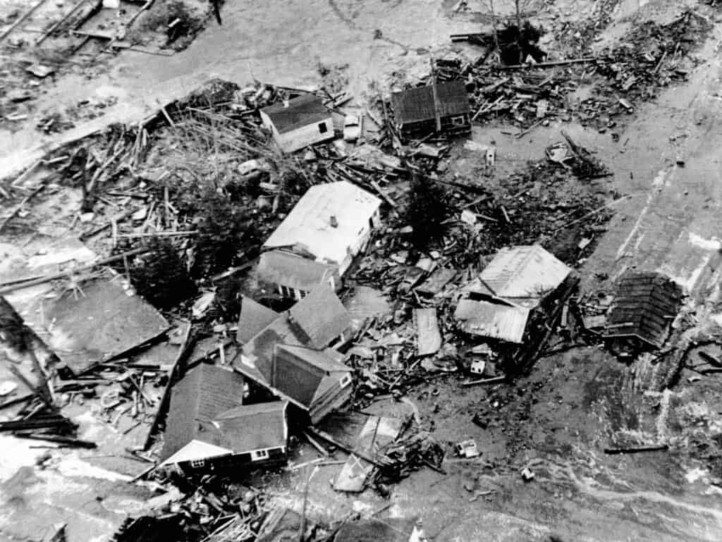
There can be 200 inches or more of rain annually in the coastal areas. That is much higher than other states’ yearly averages of 50-60 inches. One notable flood in Alaska happened in Fairbanks in the summer of 1967. The town saw over five feet of water, with 95% of the town being flooded.
Earthquakes
The state of Alaska has the most frequent and devastating earthquakes in the United States.
©Everett Collection/Shutterstock.com
Alaska has the most earthquakes out of any state in the United States. On average, Alaska has 50-100 earthquakes daily. Many of these earthquakes are not noticeable and fall on the lower end of the magnitude scale. However, Alaska is reported to have six magnitude 6-7 earthquakes annually. August earthquakes happen frequently, but the most notable was in 2022, which reached a magnitude of 5.3.
Tsunami
Following an earthquake, a tsunami isn’t uncommon in Alaska. While it doesn’t relate to the month of August, there are plenty of reasons why a tsunami can occur. For those of you who don’t know, a tsunami is a giant wave of ocean water that builds up speed and size before hitting land. The devastation of these events can completely hinder ecosystems and wildlife.
Luckily, Alaska only sees tsunamis across its coastlines. However, that puts the Alutian Chains and islands at high risk. The state has not seen any significant damages due to tsunamis during August, but there have been warnings.
Summer Storms
Storms happen all over the state, but August is known for its windstorms. August is the last summer month in Alaska, and there are plenty of thunder and wind storms during this time. The average wind speeds are 11-13 mph, but windstorms have reached 120 mph.
Landslides and Rockslides

Rockslides are common in the mountainous areas of Alaska.
©iStock.com/TACrafts
While less common amongst flatland areas or tundra, the rockier regions get landslides frequently. Mountainous areas are known to have landslides and rockslides regularly. If the mountains have any deterioration, parts of it can fall and cause significant damage.
Other disturbances that compromise the natural stability of the slope can cause a landslide. This can include droughts, earthquakes, rain, volcanic activities, etc. In the state, it’s common to see rockslides and landslides in Southeast Alaska. The most common place for them is the Tongass National Forest.
Conclusion
Alaska sees a wide range of weather and temperatures, but these are the averages. If you’re planning on visiting Alaska, August is generally the best time, as the season is moving into fall. That being said, the state is known for having variable weather. So, it’s best to understand the averages for each region.
The photo featured at the top of this post is © iStock.com/Lucia Gajdosikova


How to Add Us to Google News


Thank you for reading! Have some feedback for us? Contact the AZ Animals editorial team.