
North Carolina is a southern state known for having beautiful beaches, mountains, and plenty of opportunities for hiking, fishing, and swimming. The Tarheel State may be a popular tourist destination, but there are plenty of spots you can still find that are off the beaten path. Here are the 10 most remote spots in North Carolina and how you can get to them.
1. The Road to Nowhere Tunnel
You can find this spot near Bryson City in the Great Smoky Mountains National Park. The tunnel is located at the end of a winding, six-mile-long road that dates back to the 1940s. During that time, Swain County ceded a large portion of land to the federal government, which was overseeing the creation of the national park and Fontana Lake.
As a result, many families that had been in the area for generations were displaced, their community was destroyed, and the road that led to their homes was flooded deep under the waters of Lake Fontana. The government pledged to create a new road to provide these families with access to their ancestral cemeteries.
However, construction on the new road was halted in the 1960s due to environmental issues, and today, Lakeview Drive — the Road to Nowhere — ends rather abruptly with a tunnel. To reach the tunnel, take Everett Street north out of Bryson City. The road’s name will change to Fontana Road, and you’ll continue about two and a half miles before the Lakeview Drive entrance for the Great Smoky Mountains National Park. The tunnel will be about six miles up the road.
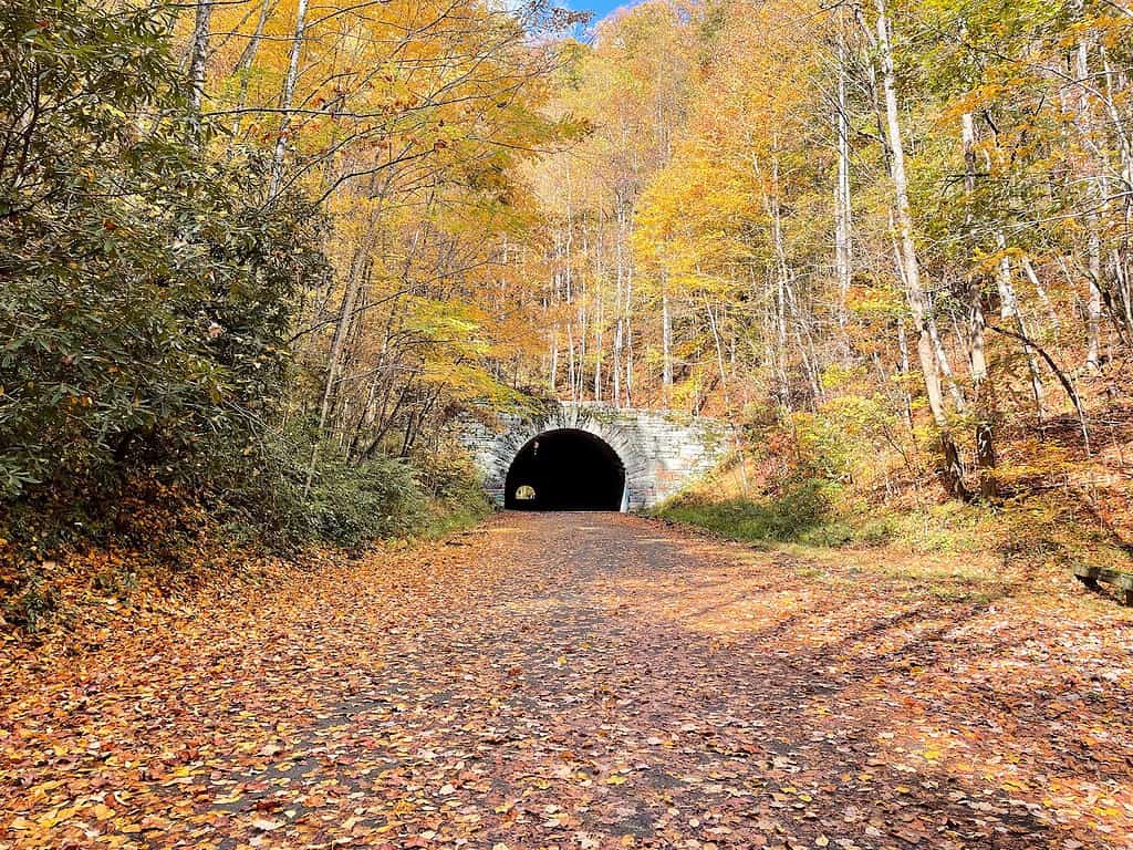
Lakeview Drive, also known as the Road to Nowhere, is located within the Great Smoky Mountains National Park.
©sf-dvs / CC BY 2.0 – License
2. Lassiter Swamp
Located deep inside Merchants Millpond State Park, the landscape at Lassiter Swamp is dominated by old-growth cypress trees laden with Spanish moss, giving the area an otherworldly appearance.
Merchants Millpond State Park and Lassiter Swamp are located in the northeastern corner of North Carolina. The park is centered around the nearly 200-year-old millpond, which covers 760 acres. Previously, the pond powered a grist mill. Today, the swamp is home to an abundance of wildlife, including beavers, foxes, salamanders, and almost 100 species of birds.
You can explore the state park and Lassiter Swamp with a series of hiking trails or by paddling on a kayak or canoe. There are some remote spots for camping that are only accessible by paddling!
To reach Lassiter Swamp, head east from Murfreesboro, North Carolina, on US-158 for about thirty miles. Turn right onto Mill Pond Road, and you’ll reach the entrance to the state park in about two miles.
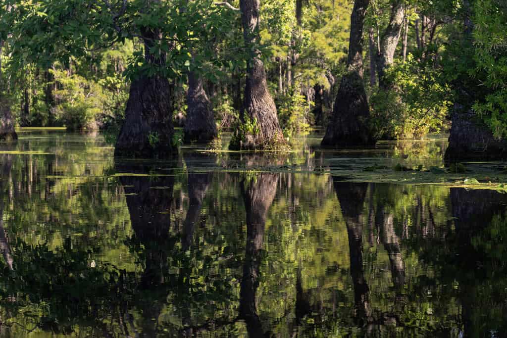
The U.S. Geological Survey has estimated that some bald cypress trees in Lassiter Swamp are over 500 years old.
©Nature’s Charm/Shutterstock.com
3. Frying Pan Mountain Lookout Tower
This is the tallest fire lookout tower in Western North Carolina and has been standing since the 1940s. Due to its remote location and rugged terrain, the people who worked as fire lookouts would often camp at a cabin near the tower for days at a time. The tower has not been used to spot fires since the 1990s, but it is open to hikers and anyone who is looking for spectacular views.
The Frying Pan Tower is 70 feet tall and sits atop Frying Pan Mountain, which rises to 5,340 feet above sea level. It is located southwest of Asheville in the Pisgah National Forest. To reach this remote spot, take the Blue Ridge Parkway south from Asheville for about 15 miles, then turn right onto Frying Pan Gap. Look for a dirt pull-off, but be sure not to block the gate.
From there, you’ll take a 1.5-mile hike to the historic structure. The hike has moderate elevation gains, although the wide gravel road is relatively easy to navigate. If you’d like to add two more miles to the hike, you can begin at Mt. Pisgah Campground.
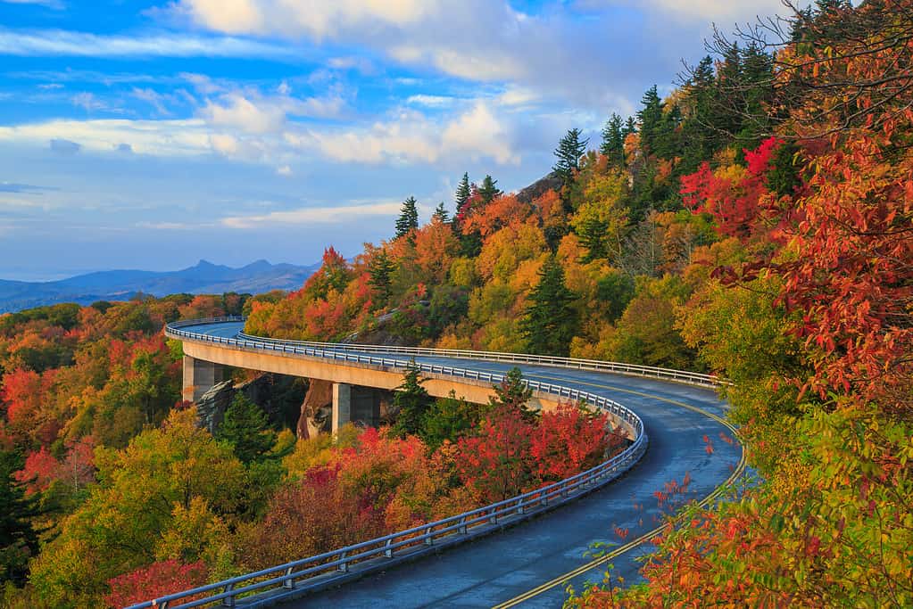
The Blue Ridge Parkway stretches almost 300 miles through North Carolina and Virginia.
©jaredkay/iStock via Getty Images
4. Outer Banks Scenic Byway
This scenic drive starts at the Whalebone Junction Information Center, located south of Nags Head on North Carolina’s Outer Banks. The route follows NC 12 southward for nearly 140 miles through Bodie, Hatteras, and Ocracoke islands. Along the way, you can explore some of North Carolina’s most remote spots, such as the Down East community.
As you drive south, the Atlantic Ocean will stretch out to the east, and the Pamlico Sound will be to the west. You’ll see sand dunes and marshes, and you’ll pass by two wildlife refuges. The drive takes about five and a half hours, including two ferry rides between islands.
To start this drive at the Whalebone Junction Information Center, head east from Raleigh on US-64. Continue on the interstate for about 180 miles through Williamston and Mann’s harbor. Next, cross the state’s longest bridge and continue across Roanoke Island to reach the information center on Bodie Island.
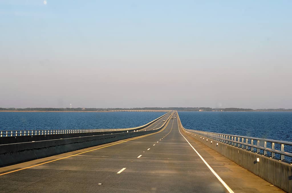
The Virginia Dare Memorial Bridge stretches for 5.2 miles between Mann’s Harbor and Roanoke Island.
©Rita Robinson/Shutterstock.com
5. Max Patch
Located near the North Carolina-Tennesse border, Max Patch is a mountain bald along the Appalachian Trail. This mountaintop meadow sits at 4,629 above sea level, offering breathtaking views of the surrounding Pisgah National Forest.
The clearing was created in the early 1800s for pastures and today is covered in native grasses and wildflowers. The area is home to many species of birds, including the golden-winged warbler, northern bobwhite quail, and golden eagles.
The Max Patch trailhead gives access to a 1.4-mile loop trail and a 2.4-mile loop trail. To reach the trailhead, head south from Hot Springs on US-209 for seven miles. Next, turn right on Meadow Fork Road and continue for about five miles. Turn right on Little Creek Road, and after three and a half miles, turn right again onto State Route 1182. After a mile and a half, the trailhead will be on the right.
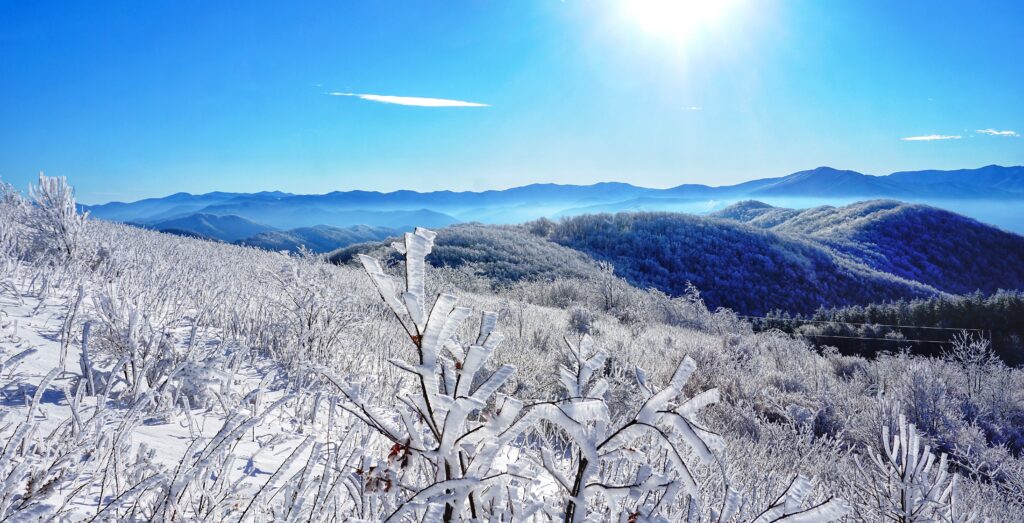
On a clear day, Max Patch offers views of the surrounding mountains in North Carolina and Tennessee.
©Yiwenz/Shutterstock.com
6. Mortimer
Once a small community of 800 people, Mortimer is now a ghost town in the Pisgah National Forest. The community was first developed in the early 1900s to provide housing for workers at the Ritter Lumber Company. In 1906, the growing community had a blacksmith’s shop, church, school, company store, hotel, and many private homes.
However, in 1916, a wildfire followed by flooding caused severe damage to the community and the railroad that the logging company used. A cotton mill opened in 1922, bringing hope that the town would recover. The Civilian Conservation Corps established a campground in Mortimer and made repairs to many of the buildings. Another devastating flood in 1940 convinced most of the remaining families to leave the community.
Today, the Mortimer Campground is open from March through October. To reach this remote spot, head south from Blowing Rock on Johns River Road and continue driving for seven miles after the name changes to Globe Road. The road will turn left and become Anthony Creek Road. After a mile, turn right onto NC-90 W. The campground will be on the right after about six miles.
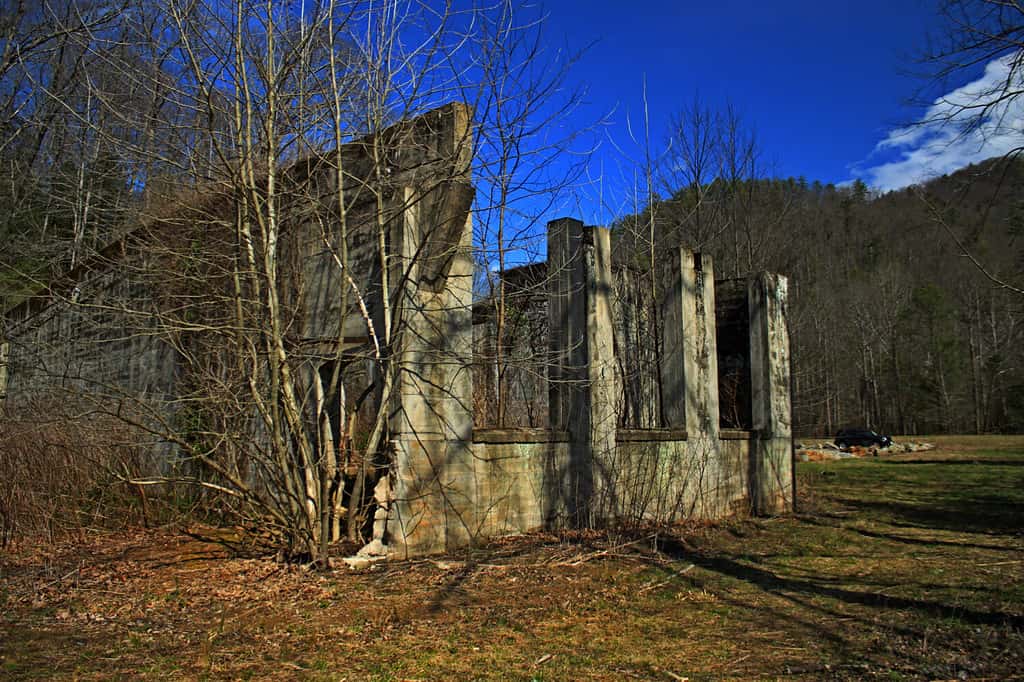
The 1916 flood in Mortimer, NC, was the worst flood in the history of Caldwell County. Many of the damaged structures can be seen today.
©James Robert Smith/Shutterstock.com
7. Carolina Beach State Park
Located south of Wilmington on Pleasure Island, Carolina Beach State Park includes 760 acres of coastal terrain and wildlife. The park is located along the banks of the Cape Fear River near the 50-foot-tall Sugarloaf sand dune, which was used by mariners as early as the 1660s to navigate the dangerous shoreline.
The area is popular with fishermen since the Cape Fear River and the Intracoastal Waterway on the park’s northern border support an abundance of marine life. Carolina Beach State Park offers six miles of hiking trails. Several of these trails will give you good views of Venus flytrap plants, which are only native to the North Carolina coast in the areas around Wilmington.
To get to Carolina Beach State Park, drive south from Wilmington on NC-132. After three and a half miles, keep right to take College Road, then continue onto US-421 S. After six and a half miles, turn right onto Dow Road, and the state park will be on the right.

The Venus flytrap is a carnivorous plant that is native to the southern coast of North Carolina.
©iStock.com/Karin de Mamiel
8. Soco Falls
Located between Cherokee and Maggie Valley, this double waterfall is a short but challenging walk from the main road. From Maggie Valley, take US-19 S for five and a half miles. Keep your eyes open for a small blue sign that says “Soco Falls-½ mile ahead.”
There isn’t any other sign to indicate the falls are nearby, so look for the clearing to pull off the main road and park. Find the break in the guardrail that opens up to a trail, and carefully navigate the steep descent to a viewing platform. You’ll see two waterfalls with 40 and 50-foot drops. Don’t leave the viewing platform for a closer look, though. The rocks are slippery and can be extremely dangerous.
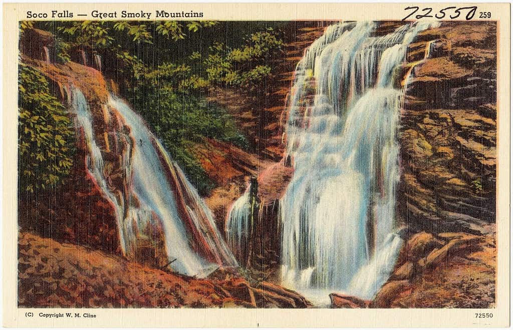
This incredible double waterfall is a short but challenging walk from the main road.
©Pub. by Standard Souvenirs & Novelties, Inc., Knoxville, Tenn. “Tichnor Quality Views,” Reg. U. S. Pat. Off. Made Only by Tichnor Bros., Inc., Boston, Mass., Public domain, via Wikimedia Commons – License
9. Bear Island
Hammocks Beach State Park includes an area on the mainland as well as three barrier islands, including Bear Island. The only way to reach the islands is by boat or ferry, and tickets cannot be purchased in advance, so be sure to arrive early if you’re hoping to reach this remote spot.
You can reach Bear Island with a kayak or canoe, which you could also use to explore the plentiful waterways in Hammocks Beach State Park. Visitors are required to carry their belongings, so if you’re planning on camping, keep the weight of your gear in mind.
The state park has several miles of undeveloped shoreline, hiking trails, camping spots, a boat ramp, and beach access. To reach Bear Island, take NC-24 E from Jacksonville for about 20 miles. Then, turn right onto Hammocks Beach Road. You’ll enter Hammocks Beach State Park, where you’ll find the ferry to Bear Island. The ferry does not run from November through March.
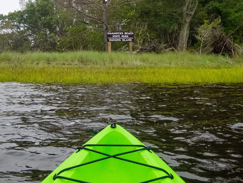
The barrier islands at Hammocks Beach State Park can be reached by kayak, canoe, or ferry.
©Robert Alford/iStock via Getty Images
10. Lake Glenville
This is Jackson County’s largest lake and is also the lake with the highest elevation east of the Rocky Mountains. Lake Glenville offers plenty of opportunities for swimming, paddling, and fishing, with a shoreline that stretches for 26 miles. The lake also features seven islands and three waterfalls.
The Pines Recreation Area is located on the north shore of the lake with a sandy beach perfect for enjoying the mountain views. To get to this remote spot, take US-64 W out of Brevard for about thirty miles. Then, turn right on State Route 107 N and follow the road for six and a half miles. Turn left onto Pine Creek Road, and in two miles, access to the lake will be on the left.
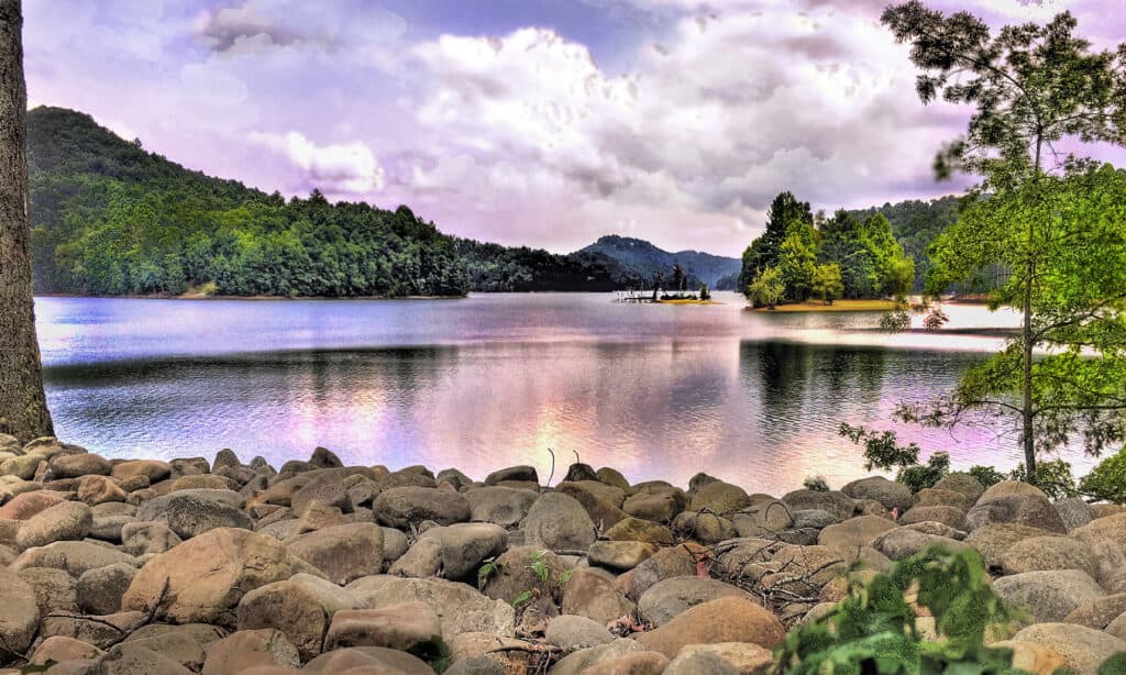
Lake Glenville is a popular spot for bass fishing.
©iStock.com/stan99
| Rank | Location |
|---|---|
| #1 | The Road to Nowhere Tunnel |
| #2 | Lassiter Swamp |
| #3 | Frying Pan Mountain Lookout Tower |
| #4 | Outer Banks Scenic Byway |
| #5 | Max Patch |
| #6 | Mortimer |
| #7 | Carolina Beach State Park |
| #8 | Soco Falls |
| #9 | Bear Island |
| #10 | Lake Glenville |
The photo featured at the top of this post is © klenger/iStock via Getty Images


How to Add Us to Google News


Thank you for reading! Have some feedback for us? Contact the AZ Animals editorial team.