
Between the censuses recorded in 2010 and 2020, only 3 of Vermont’s 14 counties experienced negative population growth. There are various aspects and considerations that play a role in where someone may choose to live. As a result, there are many reasons that someone may choose to move from one county to another, whether in the same state or a different one. Death and birth rates are also important to consider, with more deaths than births during a certain time period resulting in a drop in population.
Below, discover the 3 fastest-shrinking counties in Vermont. Plus, learn more about the history of each of these counties and some of the reasons that they may be experiencing a negative population growth.
Caledonia County
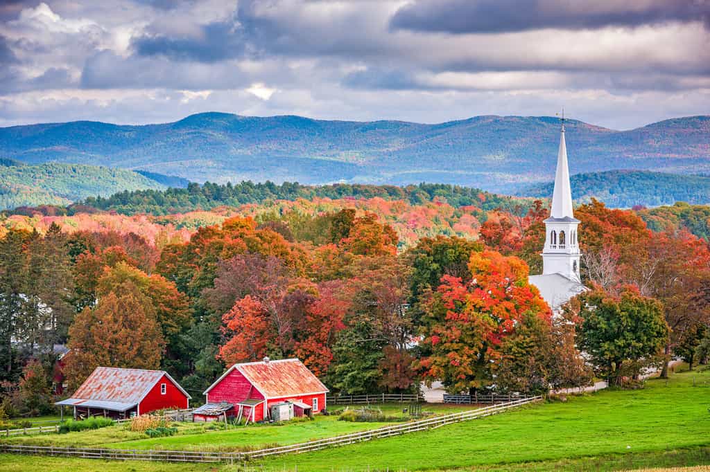
Caledonia County has a decrease in population of -3.2 percent between 2010 and 2020.
©Sean Pavone/Shutterstock.com
The third fastest-shrinking county in Vermont is Caledonia County. Between 2010 and 2020, this county decreased in population by -3.2 percent. This is the equivalent of a 994-person decrease in the total population, which sat at 30,233 as of 2020.
Caledonia County is located in the northeastern region of the state, along the border of New Hampshire. It is also adjacent to the next county on this list, Essex County. The county was first formed in 1792, although it became an organized community under one name in 1796. Its name, Caledonia, is the Latin name of Scotland. This name arose as a way to honor many of the first settlers in the county, whose ancestry came from the country.
This county has a total area of 658 square miles. Most of this area is land, with only a small percentage (8.7 square miles) being water. Although water makes up little of the total area of the county, Caledonia County has an estimated 20 lakes and ponds. Several rivers also run through the county. Despite being a county with a shrinking population, Caledonia County houses the highest population in the northeastern region of the state.
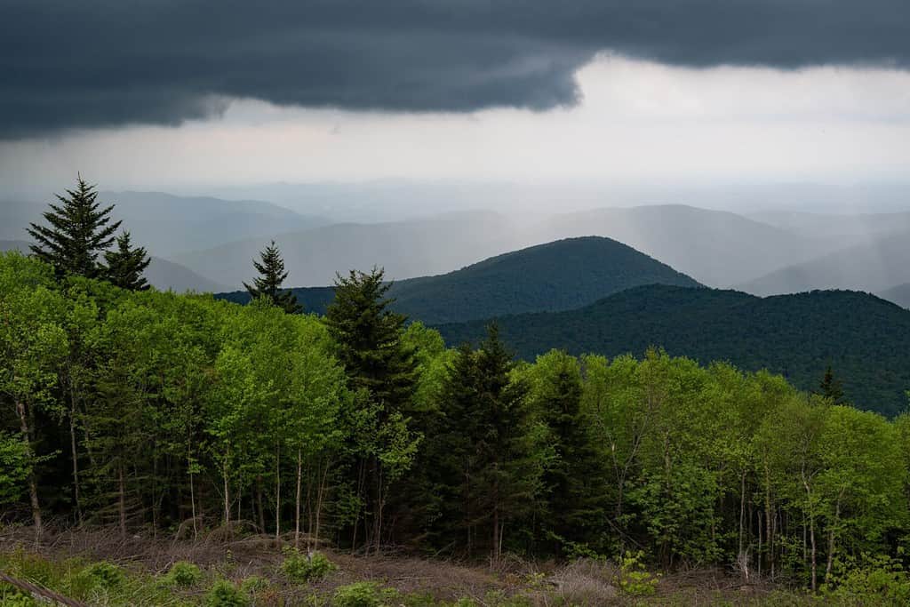
Essex County
The county of Essex had a population decline of -6.1 percent in recent years.
©Metro1/Shutterstock.com
Essex County borders Caledonia County. It is the northeasternmost county within the state of Vermont, bordering both New Hampshire and Quebec. Between 2010 and 2020, Essex County experienced a population growth rate of -6.1 percent, the equivalent of a loss of around 386 people.
Historically, Essex County has housed an impressive population of moose. However, in recent years, moose numbers have been on the decline as a result of ticks. Despite their large size, an abundance of ticks can cause anemia and other health concerns in moose. Normally, the cold winters of Vermont are enough to kill off large amounts of ticks, helping keep the population in check. However, a warmer climate during the winter has resulted in a larger tick population, causing declines in moose.
Prior to European settlers, the Abenaki inhabited the area of Essex County. Essex County was founded in 1800, named for an area in England. Interestingly enough, this county is home to the Nulhegan Basin. Researchers do not know the exact origin of this basin, but it may have been caused by an asteroid strike or a prehistoric volcano.
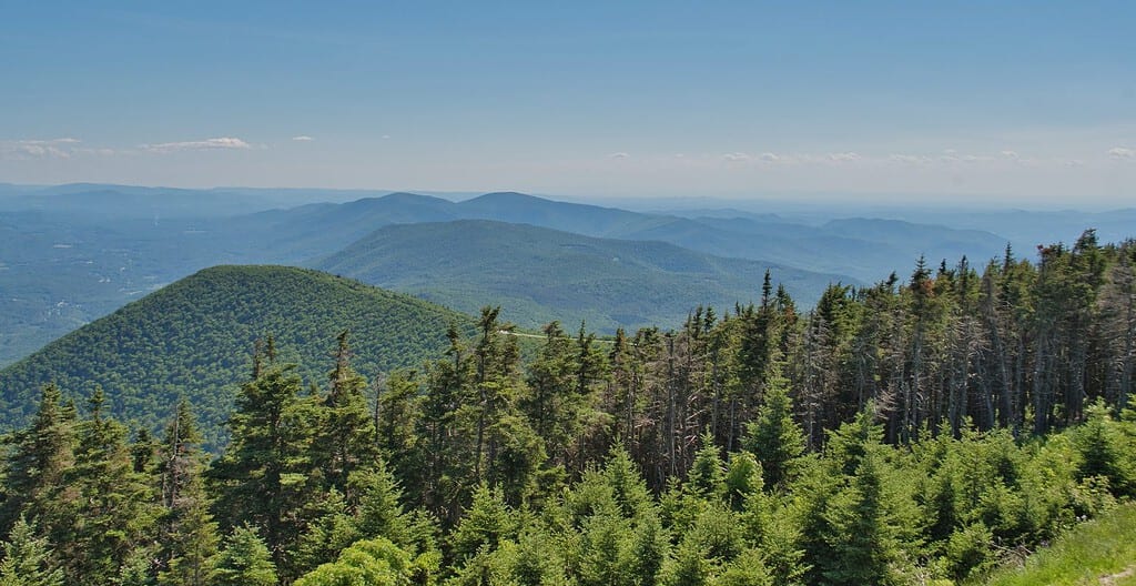
Rutland County
Rutland County is home to the Green Mountain National Forest.
©Ethan Quin/Shutterstock.com
The fastest-shrinking county in Vermont is none other than Rutland County. Rutland County went from a population of 61,659 in 2010 to 57,764 in 2020. This represents a population growth rate of -6.3 percent, the highest in Vermont! However, even with the population dropping, Rutland County is among one of the most populated counties in the state.
This county was founded in 1781, and it is named for Rutland, Massachusetts. Its most populated city, as well as its county seat, is Rutland. In 1894, this county experienced the first outbreak of polio in the United States. Rutland County is located in southwestern Vermont, bordering New York state.
Two nationally protected areas are located in Rutland County. This includes portions of both Green Mountain National Forest and White Rocks National Recreation Area. Rutland County has a total area of 945 square miles. 15 square miles of this total are water, with the rest being land. Along with being the second most populated county within the state of Vermont, Rutland County is also the second largest based on area. Otter Creek, the largest river to run entirely within the confines of Vermont’s state borders, runs through Rutland County. This is the primary stream of the entire county.
Summary of the Fastest-Shrinking Counties in Vermont
| Rank | County | 2010 Population | 2020 Population | Percent Population Change |
| 1 | Rutland County | 61,659 | 57,764 | -6.3% |
| 2 | Essex County | 6,306 | 5,920 | -6.1% |
| 3 | Caledonia County | 31,227 | 30,233 | -3.2% |
The photo featured at the top of this post is © Katherine Welles/Shutterstock.com


How to Add Us to Google News


Thank you for reading! Have some feedback for us? Contact the AZ Animals editorial team.