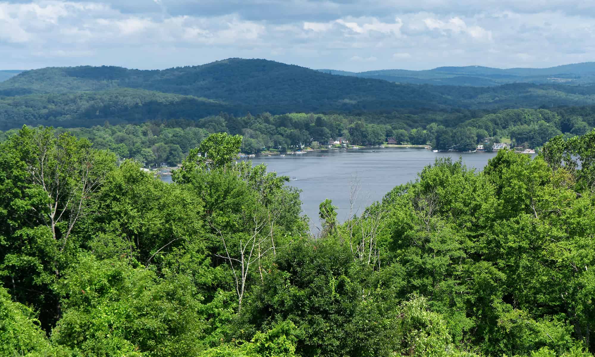

Connecticut’s geography can be divided into 3 main sections:
- The hilly forests of the Eastern Uplands
- The river valley of the Central Lowlands
- The Appalachian Mountains of the Western Highlands
Before we explore the highest peaks in Connecticut, let’s take a closer look at the geological history of how these mountains were formed.
The “Big Crunch” That Formed the Appalachian Mountains
Between 450 and 250 million years ago, the land we now know as the northeastern United States experienced a series of “crunches” that pushed the land upwards.
These crunches occurred because Earth’s continents are very slowly moving around on the planet’s surface. Around 300 million years ago, the continents drifted toward each other and collided together to form a supercontinent called Pangea.

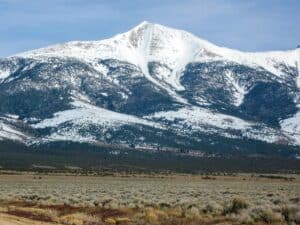
The Appalachian Mountains rose when Earth’s continents collided together to form Pangea.
©ManuMata/Shutterstock.com
There were some smaller crunches before this that began shaping the land. One of these involved a collision with a series of volcanic islands. But the “big crunch” occurred when the North American tectonic plate and the African plate collided. The land of Connecticut was caught in the middle of this huge collision.
The Earth’s crust crumpled and buckled, creating the Appalachian Mountain range. At one point in time, it’s estimated that the mountains were 20,000-30,000 feet tall. That’s five times taller than they are now!
The “Great Crack” That Split Connecticut
Approximately 200 million years ago, Pangea began to split apart into the continents we know today. The land “cracked” open as the tectonic plates pulled away from each other.
A rift valley forms when two plates pull apart from each other, causing the land in the middle to sink down. This is what happened with the Connecticut River valley.
While earthquakes are mild and uncommon in present-day Connecticut, they were not uncommon during the splitting of Pangea. These earthquakes further lowered the lowland area in the state and helped raise the neighboring uplands.
This rifting also provoked volcanic activity in the area. For example, the famous Sleeping Giant of Hamden, Connecticut, was formed by volcanic activity during this time. Magma pushed up through the cracks and seams in the Earth’s surface and cooled to form this traprock mountain.
Glaciers “Scraped” the Land to Form Connecticut’s Current Landscape
Over the past 200 million years, the Appalachian Mountains have slowly been eroded away by wind and rain. The glaciers of the Ice Age played a big role in eroding the mountains and shaping the landscape that we see today.
As the Ice Age glaciers receded and melted, they scraped away the rocks underneath and deposited the sediment in the lowlands. The high peaks were worn down to stumps compared to what they once were. The tallest peaks in Connecticut today are only a tenth of what they were 200 million years ago!
The Top 5 Highest Points in Connecticut
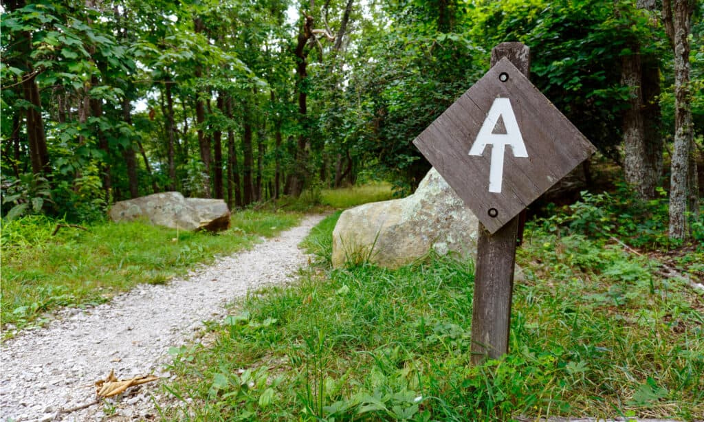
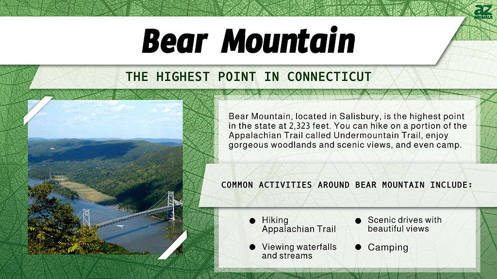
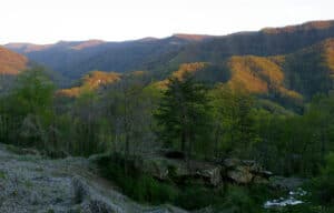
The summit of Bear Mountain is part of the famous Appalachian Trail.
©EWY Media/Shutterstock.com
5. Bradford Mountain — 1,962 feet
The fifth highest peak in Connecticut is Bradford Mountain. It is located in Canaan, Connecticut, in the Northwest corner of the state.
There are no official trails to the summit, and it’s on private land, so it’s not easily accessible to the public. However, the Iron Mountain Trail in the Housatonic State Forest passes by the base of the mountain.
4. Bald Peak — 1,997 feet
Bald Peak is the fourth-highest mountain in Connecticut. It’s located in the northwest corner of the state near the border with New York. Bald Peak is a part of the Taconic Mountain subrange of the Appalachians.
If you’re hiking the Appalachian trail through Connecticut, you’ll see Bald Peak in the west immediately after passing over Lion‘s Head (1,734 feet, Connecticut’s 10th highest point). But there aren’t any paths to the summit of Bald Peak.
3. Gridley Mountain — 2,192 feet
Gridley Mountain is the third highest point in Connecticut. The 3 tallest mountains in Connecticut are all located close together, just a mile and a half from the northwest corner of Connecticut (at the border of New York and Massachusetts).
Gridley Mountain and the others are also part of the Taconic Mountain. This mountain is also on private land and has no official trails to the summit.
2. Round Mountain — 2,280 feet
The second highest point in Connecticut is Round Mountain. As the name implies, it is a rounded mountain with a relatively gentle slope.
It’s a relatively easy and quick climb to the summit on the Mt. Frissell trail. This is a popular path connecting the Appalachian Trail to the South Taconic Trail.
The peak of Round Mountain is just barely within Connecticut. The northern slope of the mountain is actually located across the border in Massachusetts.
1. Bear Mountain — 2,323 feet
Bear Mountain, is a prominent peak of the southern Taconic Mountains. It lies within the town of Salisbury, Connecticut, in the United States.
©Shanshan0312/Shutterstock.com
At 2,323 feet, Bear Mountain has the highest peak in Connecticut. You’ll reach this point by following the famous Appalachian Trail. From the top of Bear Mountain, you can continue on the Appalachian Trail northwards into Massachusetts, or take the trail West toward Bear Mountain and Mount Frissell.
At the summit of Bear Mountain is an inscribed stone marker that reads:
“This monument marks the highest ground in Connecticut 2354 feet above the sea. Built A.D. 1885. Owen Travis. Mason.”
Height estimates of Bear Mountain have been revised since that inscription was created and placed. It’s now known that this peak is not actually the highest ground in Connecticut…
Also: Mount Frissell — 2,454 feet
Although Mount Frissell is taller than Bear Mountain, it is not fully located in Connecticut. The peak of Mount Frissell is in Massachusetts, just north of the border.
However, the southern slope of the mountain extends into Connecticut. At the border, the slope is measured to reach a height of 2,379 feet. So, even though the peak is not in Connecticut, the highest point in the state is found on the southern slope of Mount Frissell. Visitors have stacked a cairn of stones at this spot to mark its significance.
You can reach the summit of Mount Frissell on the same trail that reaches the top of Round Mountain, which is less than a half-mile away. Many hikers ascend both summits on the same trip. Since Mount Frissell has a flatter summit surrounded by trees, most reports suggest that Round Mountain’s summit provides a nicer view.
Where Is Bear Mountain Located on a Map?
Bear Mountain is the highest peak in Connecticut, along the Appalachian Trail. It is part of the town of Salisbury. It is quite a strenuous hike, so be prepared. From this mountain peak, you can continue the Appalachian Trail or head to Mount Frissell in Massachusetts.

How to Add Us to Google News


Thank you for reading! Have some feedback for us? Contact the AZ Animals editorial team.