Canada is a massive North American country that extends all the way up to the Arctic Ocean. It is known for its remote wilderness and sparsely populated north. The longest river in Canada flows all the way from the Omineca Mountains of British Columbia to the Arctic Ocean in the Northwest Territories. This river forms a massive saltwater delta and is home to an abundance of unique Arctic wildlife.

The longest river in Canada is the Mackenzie River. Its main stem is 1,080 miles (1,738 kilometers) long, and its total length including tributaries is 2,635 miles (4,241 kilometers). The main stem of the Mackenzie River is located entirely in Canada’s Northwest Territories. Along with Yukon and Nunavut, Northwest Territories is one of Canada’s three northern territories. This article explores the Mackenzie River including its location, history, nearby wildlife, and recreation opportunities.
Mackenzie River Location
Mackenzie River Headwaters
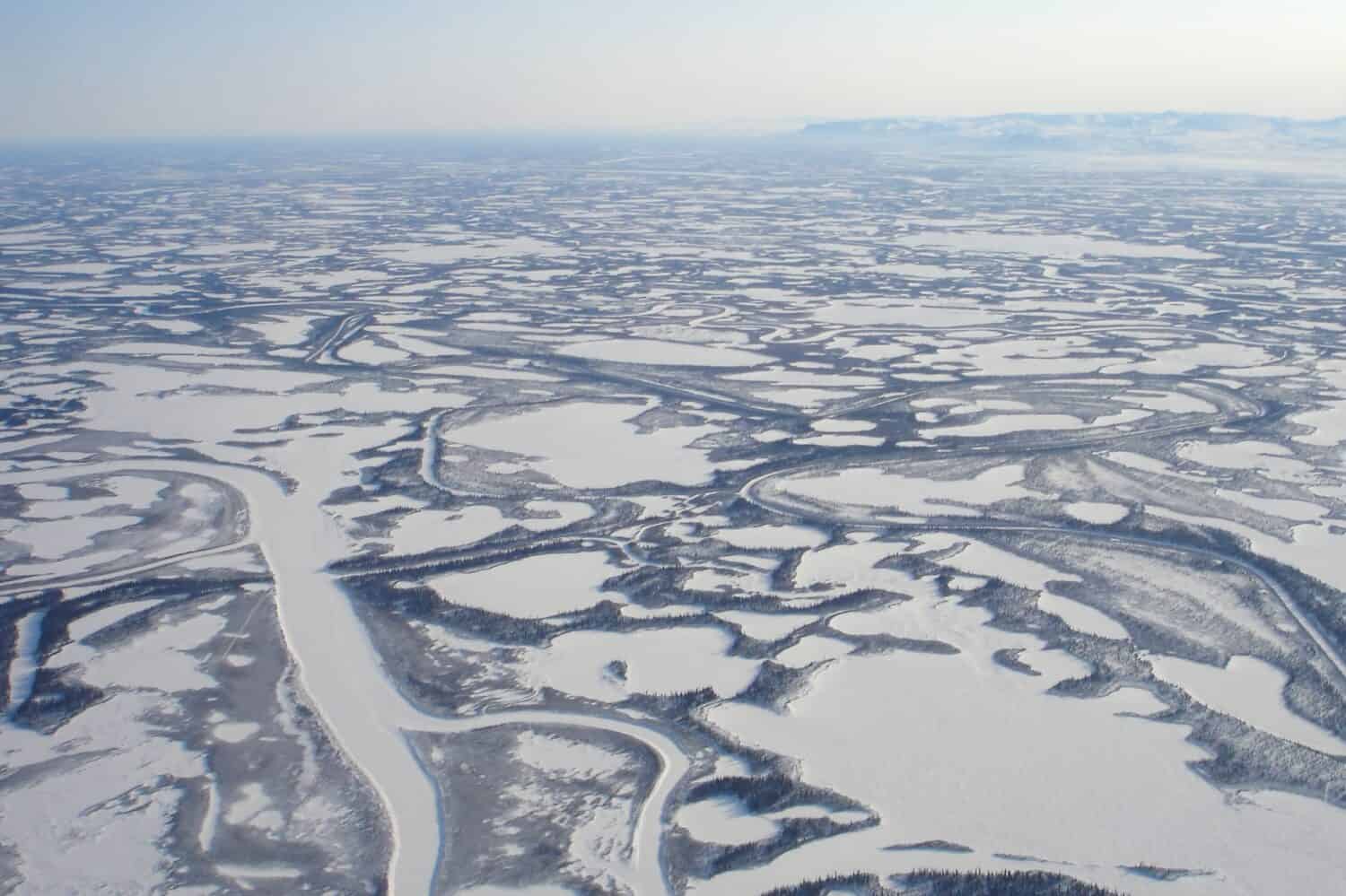
The longest river in Canada is part of the largest river system in the country.
©GeGiGoggle/Shutterstock.com
The Mackenzie River begins at Great Slave Lake in the southern Northwest Territories. However, the entire river system including upstream tributaries begins at Thutada Lake in interior British Columbia. Thutada Lake, in the Omineca Mountains, is about 25 miles (40 kilometers) long and 1.2 miles (2 kilometers) wide. It is the source of the Finlay River, which runs 260 miles (420 kilometers) through the Omineca Mountains to Williston Lake. Williston Lake is 156 miles (251 kilometers) long and 96 miles (155 kilometers) wide. The surface area of Williston Lake is 680 square miles (1,761 square kilometers).
From Williston Lake flows the Peace River, a massive river that is 1,195 miles (1,923 kilometers) long. At the Peace-Athabasca Delta in Alberta, the Peace River meets the Athabasca River. The Athabasca River begins in the Rocky Mountains and is 765 miles (1,231 kilometers) long. These two rivers join to form the Slave River, which flows 270 miles (434 kilometers) into Great Slave Lake. The main stem of Mackenzie River begins at Great Slave Lake.
The longest river in Canada begins at the massive Great Slave Lake in the Northwest Territories. Great Slave Lake is just as impressive as the mighty Mackenzie River. It’s the 10th-largest lake in the world, covering a whopping 10,500 square miles (27,200 square kilometers). What’s more, it’s also the deepest lake in North America, plunging down to a depth of 2,014 feet (614 meters). The Mackenzie River starts its journey at the western end of Great Slave Lake, about 93 miles (150 kilometers) southwest of the city of Yellowknife. With a population of 20,340, Yellowknife is the only city in the Northwest Territories.
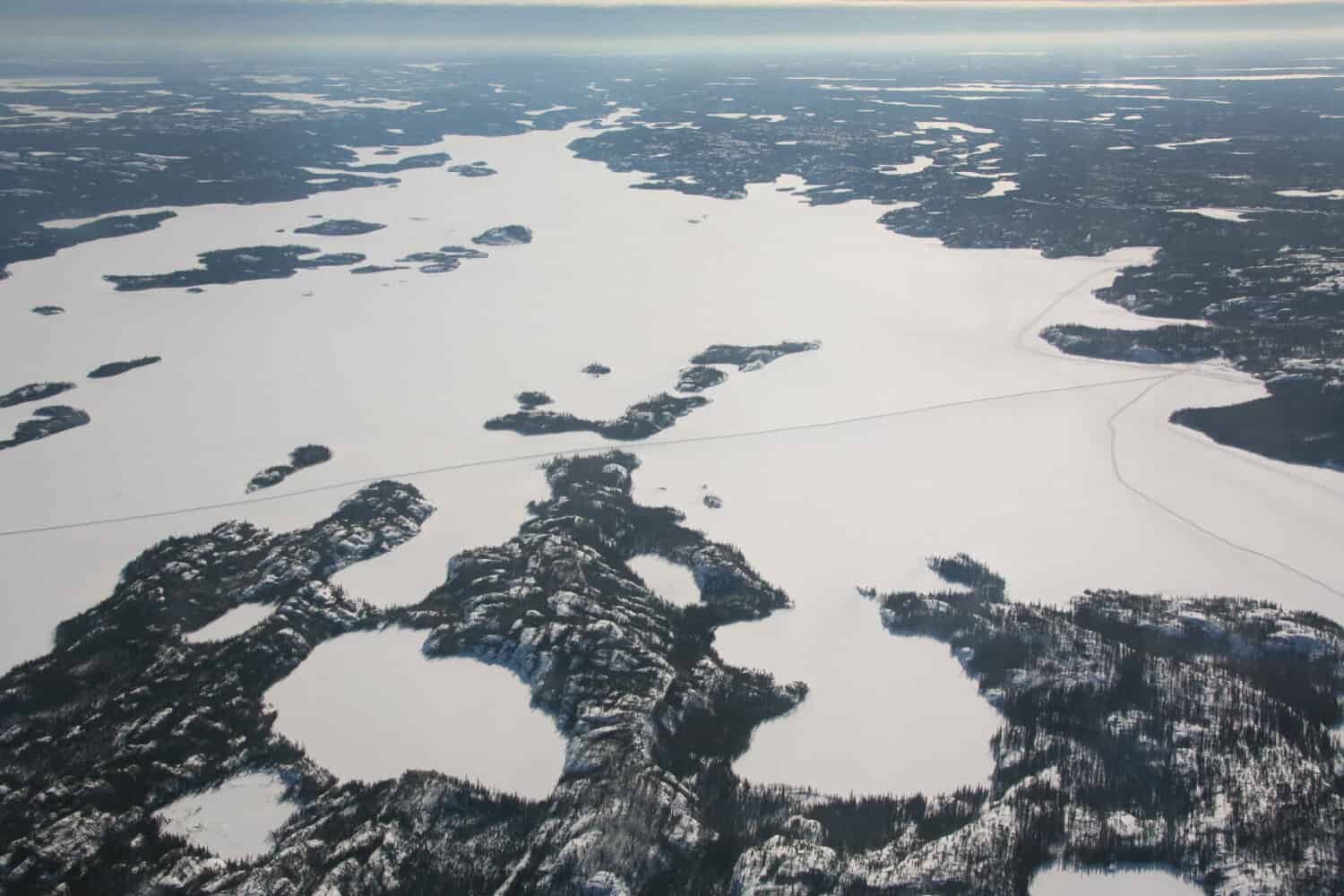
Great Slave Lake freezes during winter, becoming an ice road.
©norikko/Shutterstock.com
Mackenzie River Course
The Mackenzie River flows west from Great Slave Lake through the hamlet of Fort Providence. After passing Fort Providence, the river grows wider and flatter. This wide, flat area is known as Mills Lake, though it is not a true lake. After Mills Lake, the Mackenzie flows 62 miles (100 kilometers) west toward the villages of Jean Marie River and Fort Simpson. At Fort Simpson, the Mackenzie River is joined by the Lizard River. Then, at Camsell Bend, the North Nahanni River also joins the Mackenzie River. From the confluence at Camsell Bend, the Mackenzie flows north through the boreal forest. Along its northward course, the Mackenzie River is joined by the Root, Redstone, and Keele Rivers.
The Great Bear River, which flows from Great Bear Lake, joins the Mackenzie River at the hamlet Tulita. Then, after its confluence with the Great Bear River, the Mackenzie River passes through Sahtu lands. The Sahtu lands are owned by Sahtu and Métis people. At the town of Norman Wells, on Sahtu lands, the Mackenzie River widens to its maximum width. It is around 3.8-4.4 miles wide at this point. From Norman Wells, the Mackenzie River passes through several other small settlements and through Gwich’in lands. Then in Tsiigehtchic, a Gwich’in community, the Mackenzie and Red Arctic Rivers meet.
Mackenzie River Delta and Mouth
From Tsiigehtchic, the Mackenzie flows another 19 miles (39 kilometers) northwest. It then becomes the massive Mackenzie River Delta. At 4,600 square miles (12,000 square kilometers), the Mackenzie River Delta is the largest saltwater delta in Canada. The entire delta is around 130 miles (210 kilometers) long and 30-50 miles (50-80 kilometers) wide. This delta is also the mouth of the Peel River. The two rivers empty into the Beaufort Sea of the Arctic Ocean.
The Mackenzie River Delta is the largest saltwater delta in Camada.
©Max Lindenthaler/Shutterstock.com
Mackenzie River History
Humans have thrived alongside the Mackenzie River for millennia, despite its harsh climate. Indigenous groups, such as the Inuvialuit and Gwich’in, have long inhabited the area. The community of Tsiigehtchic is the oldest continuous settlement on the river. Archaeological evidence supports human activity in Tsiigehtchic for approximately 1400 years.
The Mackenzie River served as the main entryway for European explorers in northwestern Canada. Alexander Mackenzie, a Scottish man, attempted to reach the Pacific Ocean through the river in the late 18th century but instead reached the Arctic Ocean. The Mackenzie River was later named after him. Following Alexander Mackenzie, Sir John Franklin arrived at the river’s mouth in 1825.
These journeys led to the establishment of a fur trade and the arrival of more Europeans in the region. In the 19th century, the North West Company, which was headquartered in Montreal, built fur trading forts along the river. Fur trappers hunted mainly beaver and muskrats, and the populations of these animals began to decline. As more European people arrived in the Mackenzie River valley, life for the indigenous people there was forever changed. Sicknesses brought by Europeans in the late 19th and early 20th centuries devastated native communities on the river.
After oil was discovered near Norman Wells in the 1920s, the Mackenzie River experienced significant industrial development. Oil was pumped, mines were opened, and steamboats traveled along the river carrying people and resources. There are around 400,000 people living near the Mackenzie River today. The people living along the river today include indigenous communities and people who work in the natural resource industries.
Wildlife Near the Longest River in Canada
The Mackenzie River and its massive delta are abundant with wildlife. Since this long river flows through Arctic and subarctic climate zones, it is home to many interesting species that are adapted to freezing temperatures. Let’s dive in and discover two unique animals that call the Mackenzie River home. From huge land mammals to small ground birds, there’s a whole lot to explore on the longest river in Canada.
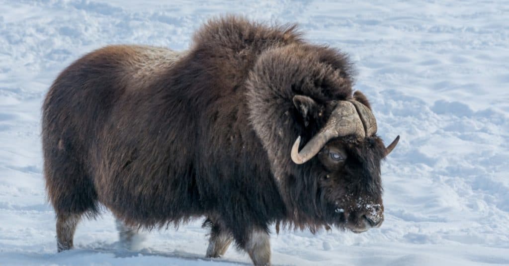
Muskox (Ovibos moschatus)
The muskox is native to the Arctic.
©Fitawoman/Shutterstock.com
The muskox gets its name from the musky odor it emits during mating season. Muskox was nearly wiped out from much of its historical range due to excessive hunting. However, they have since been re-introduced to many places.
White-Tailed Ptarmigan (Lagopus leucura)
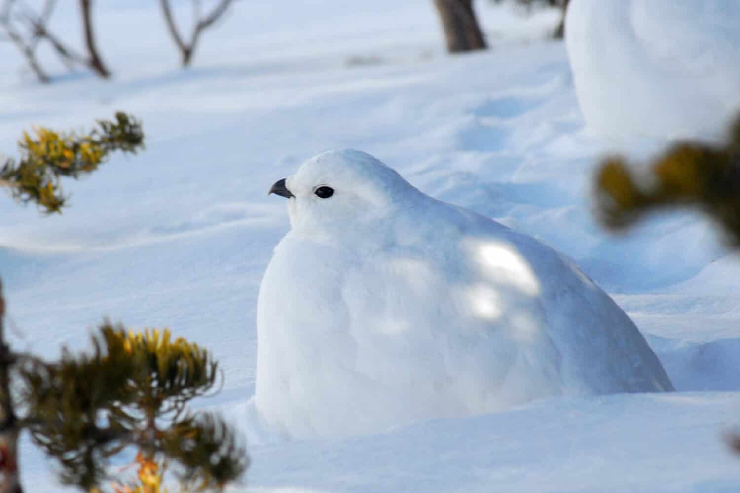
In winter, the plumage of the white-tailed ptarmigan turns completely white.
©Carrie Olson/Shutterstock.com
The white-tailed ptarmigan lives in Western Canada and Southern Alaska. It molts with the seasons to maintain its camouflage. White-tailed ptarmigans also have feathers on their feet to protect them from the icy ground.
What to Do On the Longest River in Canada
Although the longest river in Canada can be quite a journey to reach for people who don’t live there, it is well worth the trip. Visitors can explore the vast wilderness and see the amazing wildlife that lives in the Mackenzie River Valley.
Paddling
During the warm summer months, paddling is a popular form of recreation on the longest river in Canada. One can paddle along the river for a day for some excellent birdwatching, or brave souls can paddle the entire length. Paddling the entire length from Great Slave Lake to the Arctic Ocean takes around four to six weeks.
Driving and Ferries
One can drive around parts of the Mackenzie River to visit the communities along the river and vast wilderness beyond. There is only one bridge over the river, the Deh Cho bridge at Fort Province. Additionally, the Great Slave Lake, the headwaters of the Mackenzie, becomes an ice road in winter.