
Kentucky is the 15th state in the United States and is nicknamed The Bluegrass State. It was first permanently settled in 1774. Half of the land area in Kentucky is commercial forest land, with mainly oak, poplar, and maple trees. The state is third in the nation for hardwood production.
The highest point in Kentucky is the Black Mountain in Harlan County at 4,145 feet above sea level. It’s part of the Appalachian Mountains and near the Virginia border. The lowest elevation in Kentucky is the Mississippi River in Fulton County at 257 feet above sea level. The lowest spot in Kentucky is the bottom of Vulcan Materials’ limestone quarry in Livingston County at 90.3 feet below sea level.
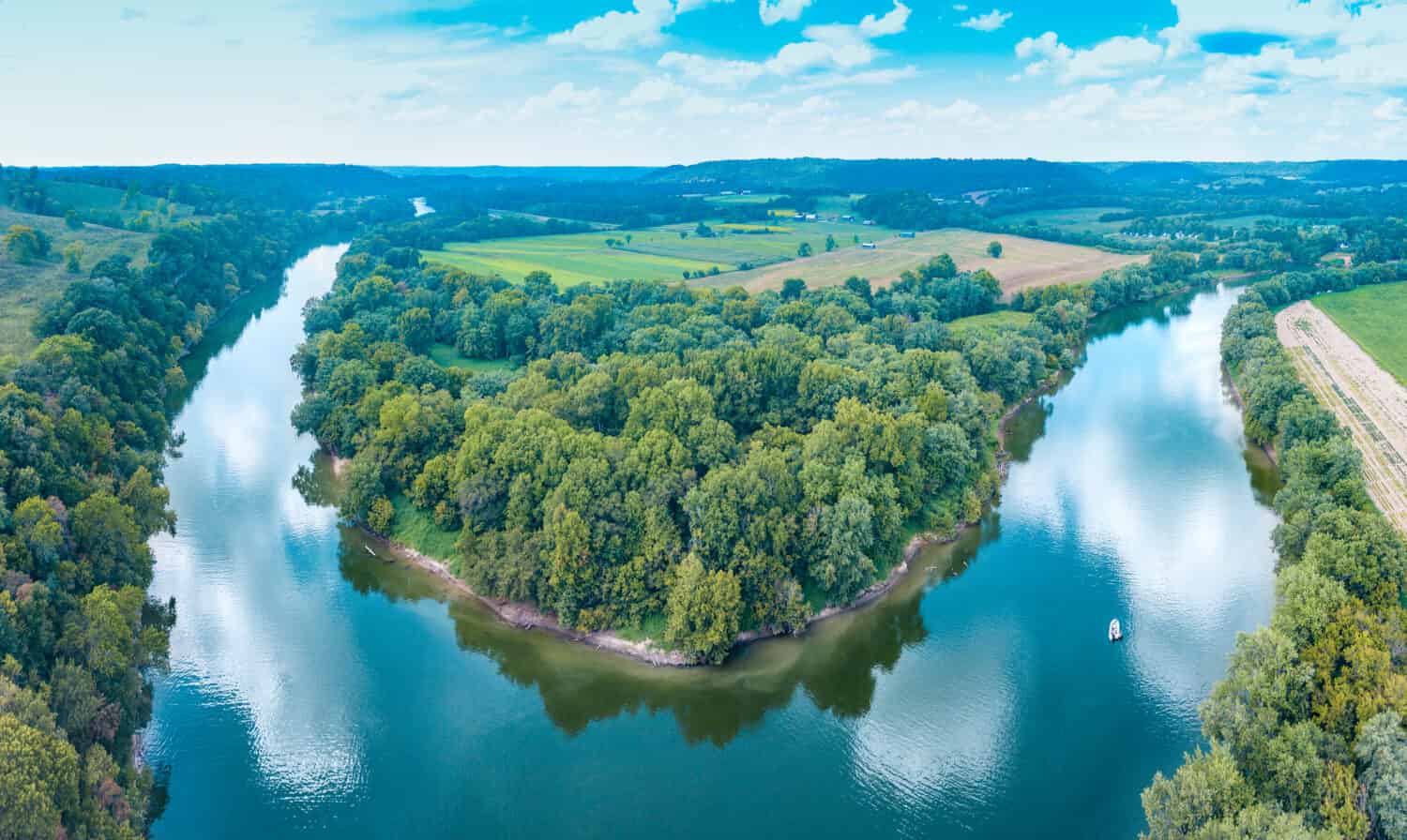
The Mississippi River at Kentucky Bend: Lowest Point in Kentucky
The lowest elevation point in Kentucky is the Mississippi River in Fulton County at 257 feet above sea level. It’s also called the Kentucky Bend. However, there is a spot that’s even lower than this. The Kentucky Aerial Photography and Elevation Data Program established in 2013 that the bottom of Vulcan Materials’ limestone quarry is the lowest spot in the state.
Vulcan Materials’ Limestone Quarry
Vulcan Materials is an American company that produces, distributes, and sells construction materials. It is based in Birmingham, Alabama, and serves 22 states including Kentucky. It’s the largest construction material production company in America. The company sells gravel, sand, crushed stone, and other construction materials. They employ around 12,000 people and have an estimated 400 facilities.
The company branched into Kentucky and acquired Reed Crushed Stone in the late 1980s. Since the area is a quarry, it means that Vulcan Materials is extracting something from the ground like sand, rocks, or minerals. Because of this, the lowest point in Kentucky is not open to the public to visit.
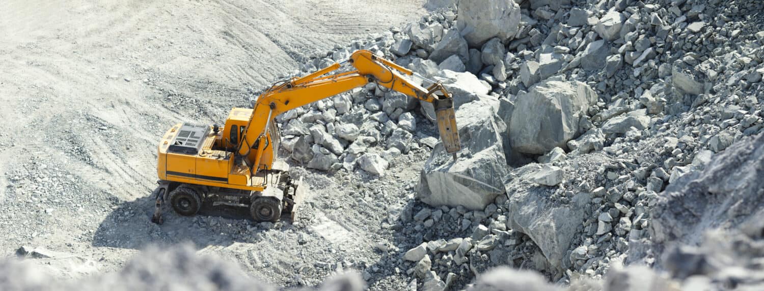
A quarry is an area where something like sand, rocks, or minerals are being extracted from the ground.
©Salienko Evgenii/Shutterstock.com
The Mississippi River at Kentucky Bend
The Mississippi River at the Kentucky Bend is the area of the lowest elevation in the state. Kentucky Bend is where the river almost forms a loop. It’s a part of Fulton County but is considered an exclave because its border doesn’t touch any other part of the county. In fact, the area at Kentucky Bend is completely cut off from the entire state. It’s adjacent to Tennessee and Missouri.
There are only 9 people who live in the Kentucky Bend area as noted on the 2020 census. But in its heyday in 1880, the area had 332 residents. This is likely because of the fertile soil and the success that farmers found with growing cotton in the area. It was also the site of a Civil War battle that lasted from February 28 to April 8, 1862 — Battle of Island Number Ten.
The battle was fought during the early days of the war. The Confederate Army held the area at the Kentucky Bend and attempted to keep Union soldiers from invading the South. Kentucky Bend was the best place to do this because ships had to slow to make the turns in the bend of the river. While the Confederates had an advantage over ships on the river, they had a distinct disadvantage as well. There was only one road in and out of the “island”. This meant that if Union forces took over that road, they could prevent supplies and reinforcements from reaching the Confederate Army. Eventually, the Confederates became outnumbered and conceded to the Union. This marked the first battle on the Mississippi River that resulted in a loss for the Confederacy.
Visiting the Kentucky Bend
Since Kentucky Bend is a public area, you are able to visit and check out the area. However, there really isn’t a lot to do and very few people live there. The area goes by a few names including Bessie Bend, New Madrid Bend, and Bubbleland. The name comes from the shape of the area. It looks like a bubble because of the way the river is curved and where the Kentucky state line meets the river. The area is 17 square miles and contains lakes, farmlands, graveyards, and a few homes. It hasn’t changed much since the Civil War era and there is still only one road in and out.
If you are considering visiting, keep in mind that the most common and notable visitors have been escaped convict inmates. There is a prison nearby in Tiptonville, TN, and prisoners who have escaped headed north hoping to cross the Mississippi. Most were caught before crossing the river in the long stretch of land that is the Kentucky Bend. If you’d really like to visit, you can, but keep an eye out for orange jumpsuits!
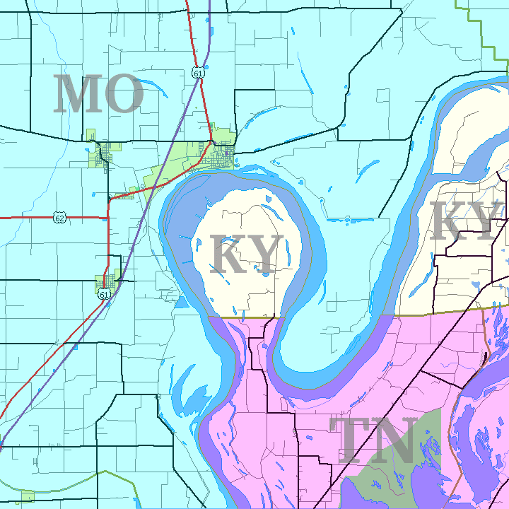
The area looks like a bubble because of the way the river is curved and where the Kentucky state line meets the river.
©Jim Efaw, author of this work / CC BY-SA 2.5 – Original / License
Things To Do on the Mississippi River
Of course, you can always find something to do on or in the Mississippi River. You can swim, fish, kayak, and canoe on the river. Some species you can expect to catch in the river are largemouth bass, walleye, and channel catfish.


How to Add Us to Google News


Thank you for reading! Have some feedback for us? Contact the AZ Animals editorial team.