
Peace and quiet. You will find that in any of Texas’s five most remote spots. Texas is huge and second only to Alaska for the largest U.S. state in land area. Big Bend National Park begins the list of remote places with more than 800,000 acres of land to lose sight of anything or anyone. As the most outlying opportunity for said peace, Travel and Leisure magazine calls the West Texas region an “off-grid paradise.”
A-Z.com researched isolated regions with fewer humans and more nature in the Lone Star State. Between travel guides and Texas officials citing secluded sites, there are plenty of places to leave it all behind in the vast state. However, reaching some of these locations can be dangerous, so A-Z.com offers safe ways to get there. If you’re looking to leave it all behind in Texas, then read on to find out the best places to disappear.
1. Big Bend National Park
West Entry Latitude: 29.542511, Longitude: -104.326348
East Entry Latitude: 29.269902, Longitude: -103.757351
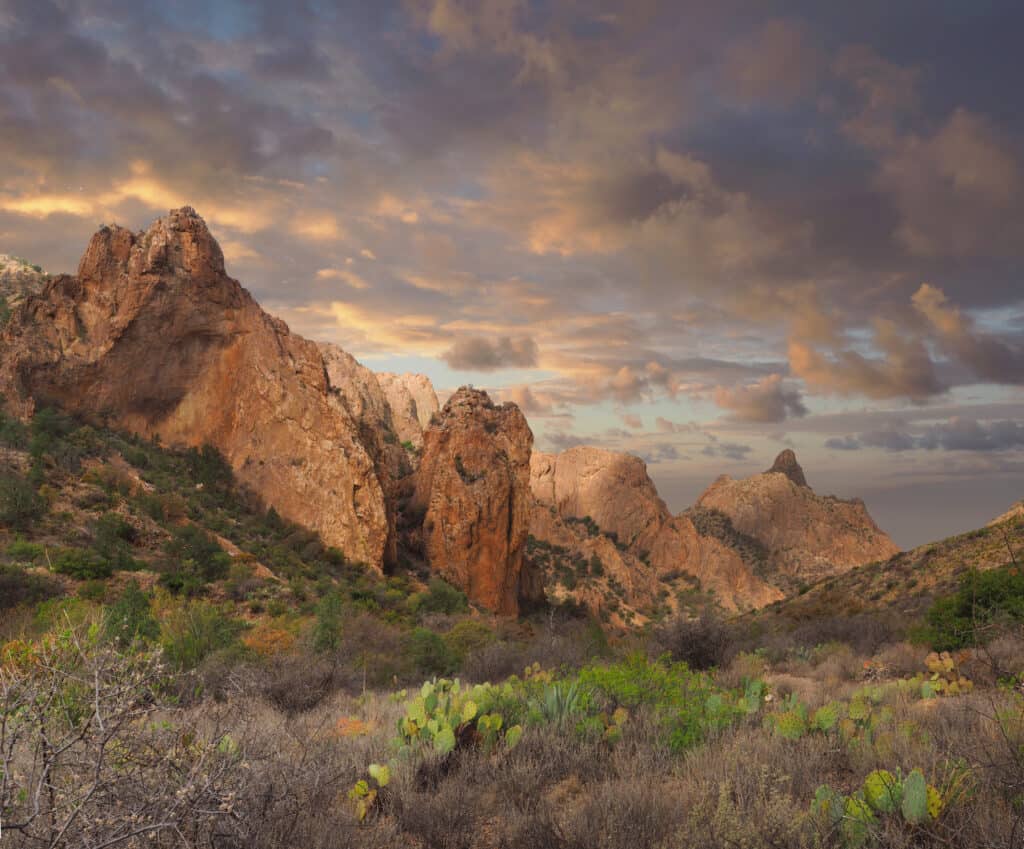
Chisos Basin in Big Bend National Park offers plenty of space minus people and noise.
©iStock.com/sdbower
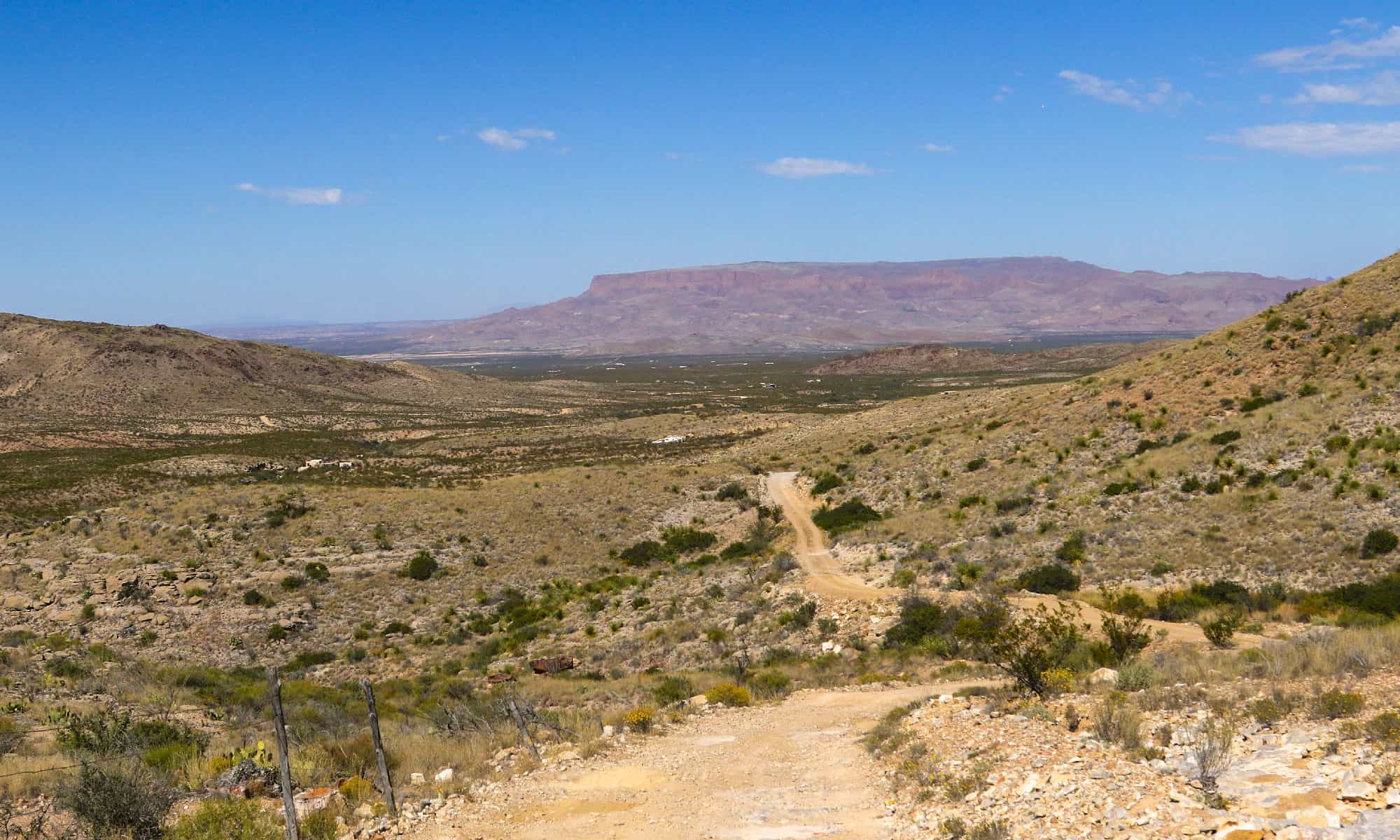
The U.S. National Park Service (NPS) calls this 801,163-acre lot of land covering three counties “splendid isolation.” The park service is so confident visitors will want to whisk away to solitude that they offer one-day to week-long itineraries to explore the many remote miles of land. Getting to the middle of nowhere requires traveling “unimproved” dirt trails, including River, Old Ore, and Old Maverick Roads. Unlike other parts of Big Bend, these backcountry routes come with a warning. Officials say to pay extra alert when traveling “primitive” dirty roads that wind through washboards and boulders. The streets can be so dangerous that only high-clearance vehicles should travel them, and that’s dependent on approved weather conditions.
For those who prefer remote regions on water, the Rio Grande runs through the park. Big Bend encompasses hundreds of miles along the waterway bordering Mexico and the U.S., offering floating adventures through 1,500-foot-deep canyons.
The national park points out exactly how to stay safe in Big Bend. From high temperatures to bad road conditions, officials caution visitors to heed many rules. First, do not drive more than 45 mph deep in the park because of the possibility of hitting any wildlife. Only visitors with four-wheel vehicles should navigate the backcountry routes. Even then, officials advise travelers to bring extra food and water in case they become stuck. Additionally, on-foot travel calls for just as much caution. Hikers must ensure they are mentally and physically prepared to hike in the far-off regions of Big Bend.
Directions to Big Bend National Park begin by taking Texas State Highway 118 from Alpine to Study Butte. If you take FM 170 from Presidio to Study Butte, you must continue 26 miles east to the park headquarters. You can also access the park by U.S. 90 or U.S. 385 to Marathon and then another 70 miles south to an additional park headquarters.
2. Hill Country
Latitude: 29.628034, Longitude: -99.181086
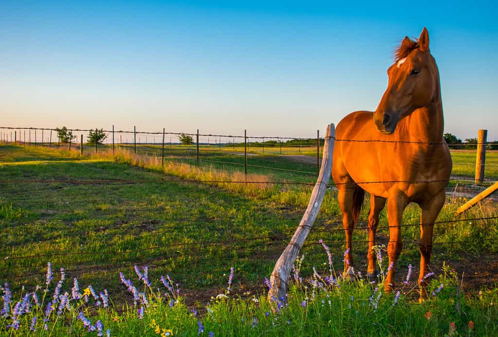
Texas Hill Country prairies boast blue flowers and perfect grazing for horses.
©Roschetzky Photography/Shutterstock.com
This remote central Texas region, west of Austin and north of San Antonio, comprises more than two dozen counties touting thousands of miles of limestone and granite hills. The rolling grasslands that reach the top of Edwards Plateau are one of the quietest sections of Hill country. This part alone is 36,680 square miles and was once home to Native Americans, who came to the region for its unique stones used to make arrowheads for hunting and defense against wildlife. Now, the endangered wildlife in Hill Country attracts visitors seeking solitude among nature.
With walk- or hike-in campsites, including Butterfly Springs or Hermit’s Shack, it is possible to see sightings of wildlife only found in such solitude. Hill Country State Natural Area also offers over 5,000 acres of remote recreation far from manufactured sights and sounds.
Safely getting to any of the more remote Hill Country spots begins with mapping out the destinations beforehand and sticking to advised trails and roads. With all of the five most remote spots in Texas, weather conditions can make or break plans. Going to any remote area during inclement weather is never a good idea. Whether riding a horse, walking a trail, or camping, the Texas Parks and Wildlife Department (TPWD) gives several safety measures for the 40 miles of trails.
First, assess your physical endurance. Rated courses by difficulty give hikers an idea of what’s in store, from easy-moderate to challenging. For visitors who can go the extra mile, the TPWD provides the longitude and latitude of specific points of interest that take a little extra leg effort, including Heritage Garden and Comanche Bluff.
However, no matter what remote part of the Hill Country, getting there without harm entails wearing a helmet, drinking sufficient water, and wearing SPF-rated shirts and insect repellant. When touring Hill Country, the safest measure is telling others where you will be.
There are several routes to take when driving, including the long and short. The long way entails taking on 250 miles of terrain beginning 30 miles north of San Antonio in New Braunfels. The trail is a clockwise loop that ends in Austin. You can also take Texas Highway 46 and 16 to Ranch Road 470, among other routes.
3. Matagorda Island Wildlife Management Area
Latitude: 28.222999108, Longitude: -96.63749745
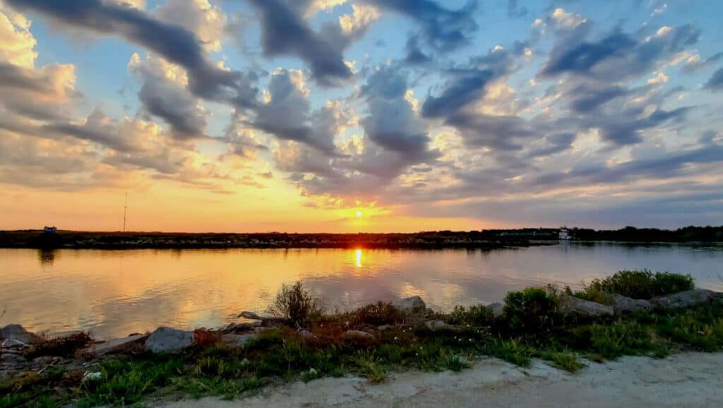
Texas Gulf Coast’s Matagorda Bay has a peaceful aesthetic in the most remote spots.
The only way to get to this remote part of Texas is by boat. While the Matagorda Wildlife Management Area includes thousands acres that make up marshes and barrier islands, the island is only 38 miles long with varying widths. Some parts of the island are less than a mile, and others are up to 4.5 miles wide. TPWD says Mataragorda Island in Calhoun County is known for “seclusion and natural beauty.” There is also up to 20,000 acres of upland set aside for hunting.
It is so remote the island lacks electricity and drinking water. The Gulf of Mexico Beach offers primitive camping among some endangered wildlife, including white-tailed deer, and migratory birds. But with all that water comes danger. Island jetties, passes, and mouth rivers can cause accidents. Officials warn mouth rivers create swift and dangerous rip currents. Checking the weather conditions is the first safety measure when visiting Matagorda, especially near the circa-1852 lighthouse on the island’s north end, which is registered as a national landmark.
Just like land access rules, safety rules apply to this natural area island. Only private and charter boats transport visitors to the island from the check station near Port O’Connor. And there are absolutely no motorized vehicles allowed on the island. Safety measures for Matagorda Island are different than land rules. It is more important to have a life jacket than a backpack when getting here.
Like land animals in some of these remote Texas spots, dangerous animals are swimming in Texas oceans, which is why it is essential to stay in the boat. Other safety tips on the way to the enclave include being weather-wise, devising a float plan, and having an assistant captain in case of an emergency. With no running water or electricity, visitors with medical needs that include charging equipment should not stay on the island.
4. Lost Maples State Natural Area
Latitude: 29.807719, Longitude: -99.570697
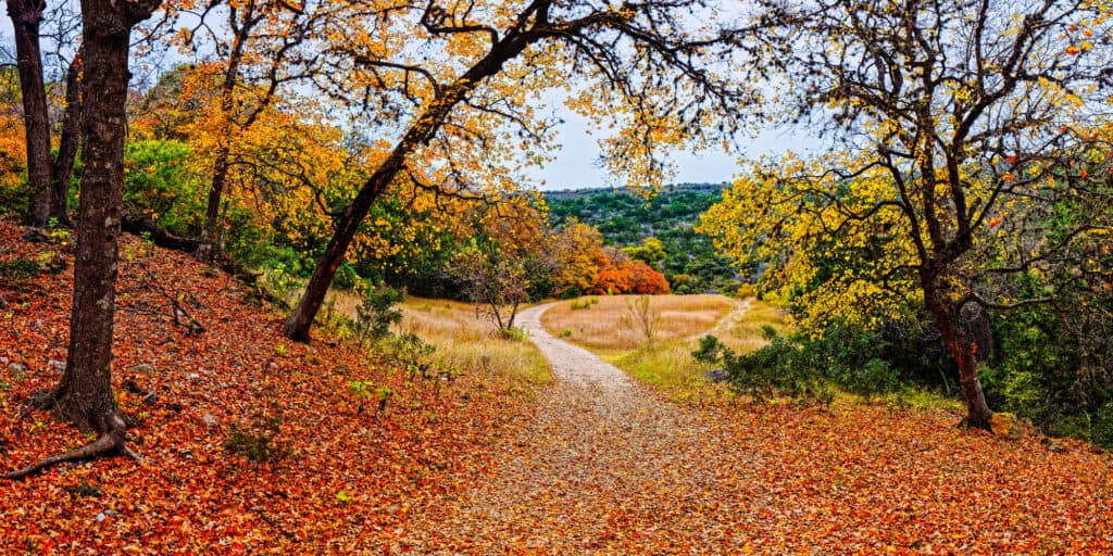
Lost Maples State Natural Area is a sea of orange leaves that fall from the misplaced trees.
©Silvio Ligutti/Shutterstock.com
Lost Maples is so big it takes up to two counties: Bandera and Real. According to TWPD, more than 10,000 years ago, bigtooth maple trees survived in cooler temperatures not seen in Texas; hence, the park received the name Lost Maples. Not nearly as secluded as some other Texas locations, boasting water and electricity, Lost Maples has more than 2,000 acres of solitude.
Located in the Edwards Plateau area, this remote Texas spot hosts Hill Country characteristics with a slighter remote vibe. However, don’t get Lost Maples wrong. It’s remote. The Texas Forum and Capital Coalition detail the 2,200-foot high elevation, five miles from the area entrance, as sparsely populated and primitive, guaranteeing “peace and quiet” in the West Trail.
Opposed to the East Trail, few know about the route, according to the TPWD, detailing it “traverses steep limestone canyons, plateaus, woods, and creeks,” where hikers site foxes, bobcats, or rare birds. Also, timing is everything regarding solitude here. To ensure seclusion, avoid the area in the fall when many flock to see the colorful falling maple leaves.
As with any of these Texas hideaway places, watching for dangerous animals in the desert or hilly plain is crucial. Getting to some of Lost Maple’s most remote areas safely means watching where you step. Due to the steep, craggy landscape, TWPS officials warn travelers to stay on designated trails. Climbing any rocks or hillsides in Lost Maple is not authorized. “Bigtooth maples have shallow roots, and you can hurt the trees by walking over their roots,” warns the TPWD. When hiking in the natural area, hike smart. The U.S. National Park Service says knowing your limits is the first step in planning your hike, followed by having the right supplies.
You can get to Lost Maple from San Antonio to Austin. From San Antonio, you take Texas Highway 16 to FM 337, which leads to the natural area entry. You can also get there from San Antonio by taking Texas Highway 90 towards Sabinal. There are several ways from Austin, including many routes and highways depending on the starting point.
5. Devils River State Natural Area
Latitude: 29.939694, Longitude: -100.970206
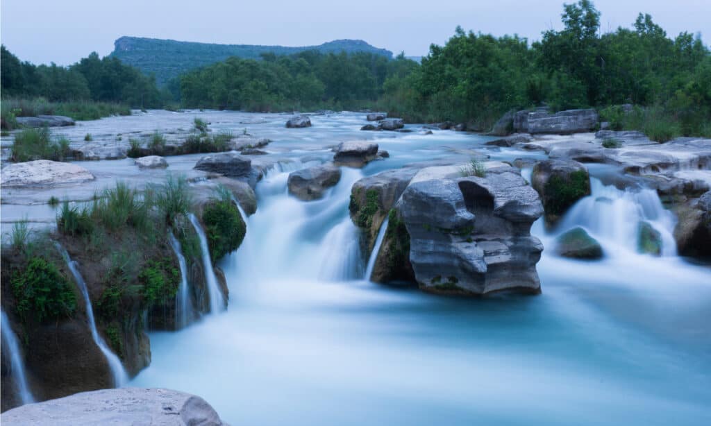
Devils River runs through Dolan Falls, which only skilled boaters should travel.
©Sam C Chen/Shutterstock.com
Don’t let this Texas natural area’s name frighten you. North of Del Rio, the Devil’s River shoreline is secluded and serene, offering a slice of heaven on earth. “South of Sonora and north of Del Rio is something of a blank spot on the Texas map, except for this park,” according to the Texas Forum and Capital Coalition. Noted as the most “unspoiled” Texas river, this natural area is off the map and far away from manufactured pollutants.
Located in Val Verde County, Devil’s River offers primitive campsites and hike-in-only locations. The limited-size sites only allow so many people to gather, keeping the remote vibe for those who venture to the region. Getting to and staying safe in this remote Texas region calls for a few measures, according to TPWD. Any traveler must have a Devils River Access Permit (DRAP) to access the area by water. TPWD warns that only skilled paddlers take the trip with at least three days of water, food and other survival supplies.
Directions to Devil River begin in Del Rio and start on Texas State Highway 277. After traveling north for 45 miles, turn left on Dolan Creek Road. The rough gravel road, with several low-water crossings and surrounding livestock, leads to the area’s entrance.
| Remote Location | Latitude | Longitude |
|---|---|---|
| Big Bend National Park | West Entry: 29.542511 East Entry: 29.269902 | West Entry: -104.326348 East Entry: -103.757351 |
| Hill Country | 29.628034 | -99.181086 |
| Matagorda Island Wildlife Management Area | 28.222999108 | -96.63749745 |
| Lost Maples State Natural Area | 29.807719 | -99.570697 |
| Devils River State Natural Area | 29.939694 | -100.970206 |


How to Add Us to Google News


Thank you for reading! Have some feedback for us? Contact the AZ Animals editorial team.