
While we are all familiar with the 50 states that make up America, many people tend to forget that there is more to our amazing country than initially meets the eye. There are several other territories, islands, and other U.S. locations that are not states but are still as American as apple pie. Below, we will talk about some of these locations, share a little history, and learn the unique details that make these special areas so great.
Washington, DC

The White House in Washington DC with beautiful blue sky
©Vacclav/iStock via Getty Images
Of the U.S. locations that are not states, Washington, DC is one of the most famous of the bunch. After all, this is where our laws are made, and the people who run our country go to work.
Despite some misconceptions, Washington, DC is not a state but a district. The letters “DC” stand for District of Columbia. This beautiful area has been around since the creation of our country and it was created in the U.S. Constitution. It was designed to be an area “not extending 10 miles square that would become the Seat of the Government of the United States.”
In 1790, Congress established this federal district to serve as the nation’s capital. It is made up of parts of Maryland and Virginia, and it is under the jurisdiction of the U.S. Congress.
Although it is not technically a state, Washington DC operates as a state, and it performs the functions of a city and a county. At this time, there are about four million citizens of DC. The area has its own school system, Medicaid programs, and funding. At some point, Washington DC may become its own state, but until then, it is only a district.
Commonwealths of America
There are two U.S. locations that are not technically states but are instead considered commonwealths of America. A commonwealth is an independent country or community. With that said, technically, the only real difference between a state and a commonwealth is the name. There are two commonwealths that are a part of the U.S., and they are Puerto Rico and the Northern Marianas Islands.
Puerto Rico
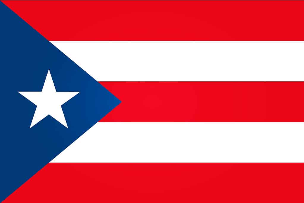
The blue represents the sky and the ocean surrounding the island. The three red stripes symbolize blood from past brave warriors. Next, the two white stripes represent victory and peace, which they should attain after independence. The iconic white star is the island. Finally, the triangle, since it has three sides, represents the three branches of government.
©Artgraphixel/Shutterstock.com
The Caribbean island of Puerto Rico is an unincorporated area with official commonwealth status. It is made up of the main island and several smaller islands, that include Mona, Vieques, and Culebra. The capital of Puerto Rico is San Juan, which also happens to be the most populous city.
Puerto Rico was settled 4,000 years ago, but it wasn’t until 1898 that the area was acquired by the United States after the Spanish-American War. The people who live in Puerto Rico have been considered to be citizens since 1917. However, they are not included in the vote for the President or Vice President, and they typically do not pay federal income tax. However, they do have a non-voting representative in the U.S. Congress. The official languages of Puerto Rico are Spanish and English.
Northern Mariana Islands
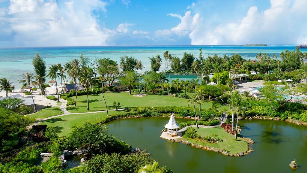
Pristine blue waters of the Micro Beach and the far-off Managaha Island backdrop a perfectly manicured garden with a pond in Saipan, Northern Mariana Islands.
©iStock.com/raksybH
The other commonwealth of the United States is the Northern Mariana Islands which is made up of 14 different islands. Citizens of this area are considered to be politically disenfranchised, which means that they have no representation in the U.S. Congress.
Typically referred to as the Commonwealth of the Northern Mariana Islands (CNMI), the area is home to over 47,000 people. Although there are 14 islands, most of the residents reside on the islands of Saipan, Tinian, and Rota. Most of the other islands have small populations or are uninhabited. In 1978, the United Nations approved an arrangement that would eventually lead the CNMI to become a commonwealth of the U.S. It became official in 1986.
Territories of America
There are three territories that are not states but are still considered to be a part of America. A territory is essentially just a piece of land owned by the United States. It is not a state, and it is not a country. The three territories are Guam, American Samoa, and the U.S. Virgin Islands.
Guam
©ijeongyeun/Shutterstock.com
The territory of Guam is the largest and most populous of the Mariana Islands, which make up the CNMI. The capital city is Hagatna. The native Guamanians are also known as Chamorros, and they are a mixture of Filipino, Mexican, Spanish, and other European and Asian ancestries.
Guam was developed into a U.S. military base which helped their economy and food industry. Now, the territory imports most of its food. The military bases in Guam include Andersen Air Force Base and several Navy facilities. Tourism is also a major part of the economy. More than a million visitors go there every year.
American Samoa
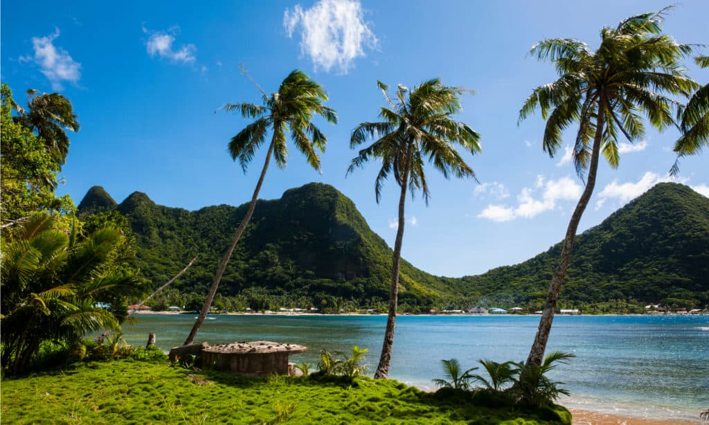
National Park of American Samoa
©Danita Delimont/Shutterstock.com
The territory of American Samoa is technically the eastern part of the Samoan archipelago, which is located in the south-central Pacific Ocean. The area is about 2,200 miles southwest of Hawaii. It is technically part of Polynesia. It has a tropical climate that gets close to 200 inches of rain per year.
A majority of the population is Samoan, and most are fluent in the Samoan language. Their economy is based on services and manufacturing. In 1967, American leaders gave American Samoa the authority to draft its own constitution. Technically, the people there are U.S. nationals but not citizens.
U.S. Virgin Islands
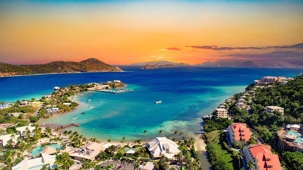
St Thomas US Virgin Islands Drone Aerial.
©iStock.com/Kruck20
As possibly the most well-known of the U.S. locations that are not states, the U.S. Virgin Islands are a group of unincorporated islands that are located about 40 miles east of Puerto Rico. The territory is composed of three major islands: St. Croix, St. Thomas, and St. John. The capital of the islands is Charlotte Amalie, which is located on St. Thomas.
The climate of the Virgin Islands is very pleasant, and temperatures average about 82-88 degrees Fahrenheit, which makes it a great tourist destination. The economy is based on tourism, and one-fifth of the land is farmland. The area was added under the Organic Act of the Virgin Islands, which was passed by the U.S. Congress in 1936. Just like in America, the government has three branches: executive, legislative, and judicial.
Various Insular or Outlying Areas
There are many islands that are a part of the United States and many of them are within miles of Honolulu.
©Danne_I/Shutterstock.com
While the locations above are some of the more well-known U.S. locations, there are many other various insular or outlying areas and islands that are also a part of our great country. Most of these areas do not have a permanent population. They are typically inhabited by military personnel and scientists, or they are uninhabited.
Baker Island
Formerly known as New Nantucket Island, the currently-named Baker Island is located about 1,650 miles southwest of Honolulu. The island is very small only one mile long and less than a mile wide. In addition to having a small human population, the island is also known for being home to dozens of species of seabirds and many endangered sea turtles. It is considered a U.S. National Wildlife Refuge.
Howland Island
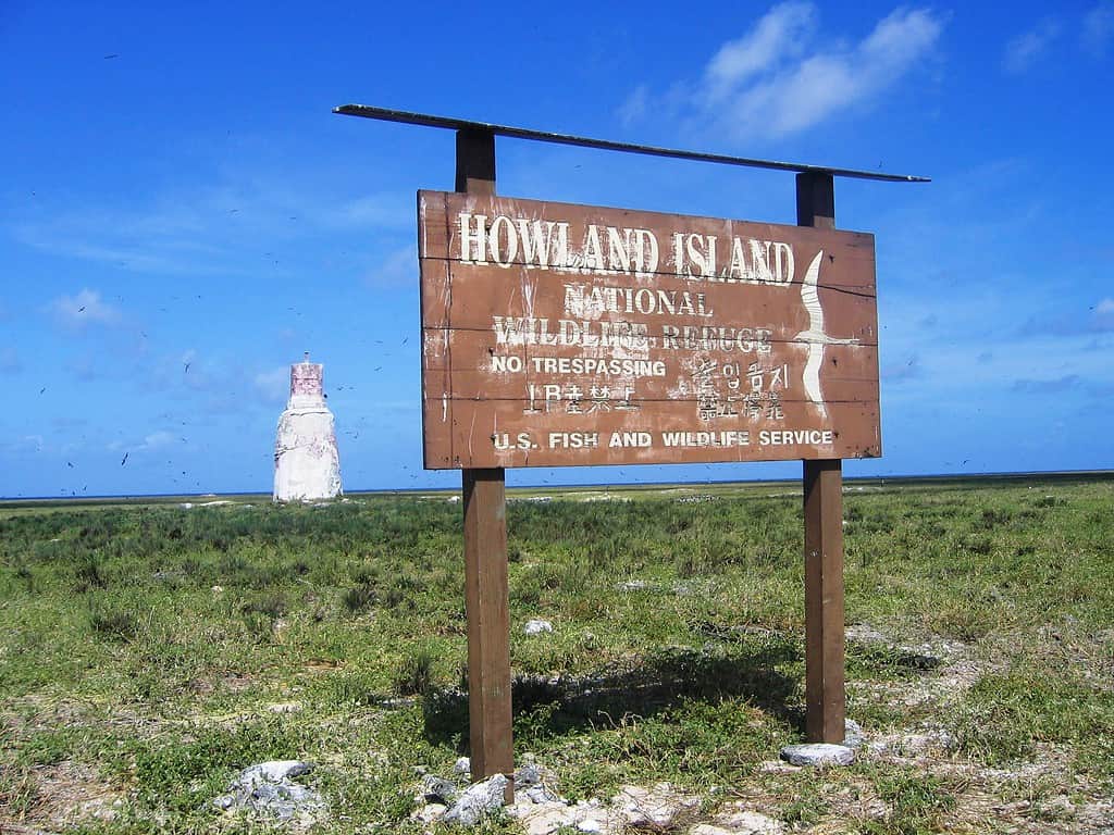
Although formerly known as Worth Island, Howland Island is a tiny area located southwest of Honolulu. The island rises about six feet above sea level. It is also a small island at only 1.5 miles long and half a mile wide. The island was first discovered by whaling ship captain George Worth in 1822.
The United States claimed Howland Island under the Guano Act of 1857. It was placed under the U.S. Department of the Interior in 1936. However, there are no people living on the island.
Jarvis Island
©L.A.B. Pearl Harbor – National Archives, FOIA request / Pubic Domain – Original / License
The area known as Jarvis Island has been known by many other titles, including Brook Island, Bunker Island, Jervis Island, and Volunteer Island. This island is closer to Honolulu. About 1,000 miles southwest. This one was discovered by Captain Brown of the British ship Eliza Francis, and it was also acquired under the Guano Act in 1865. In 1889, Britain claimed it, but it was taken back by the U.S. in 1935. The island has no permanent residents.
Palmyra Atoll
©en:User:Clarkma5 / copyrighted free use – Original / License
Formerly known as Samarang, the area currently known as Palmyra Atoll is also about 1,000 miles southwest of Honolulu. Technically, Palmyra Atoll is a collection of 50 islets that make up four total square miles. In 1862, the area was annexed by the Kingdom of Hawaii and then by Britain in 1889. Finally, in 1898, the U.S. annexed the area as part of the Hawaiian Islands’ territory. The central lagoon was used for airstrips during World War II. Currently, it is an uninhabited tropical wilderness that is home to many unique animals.
Johnston Island
©National Aeronautics and Space Administration Wikipedia User: Surfsupusa / Public Domain – Original / License
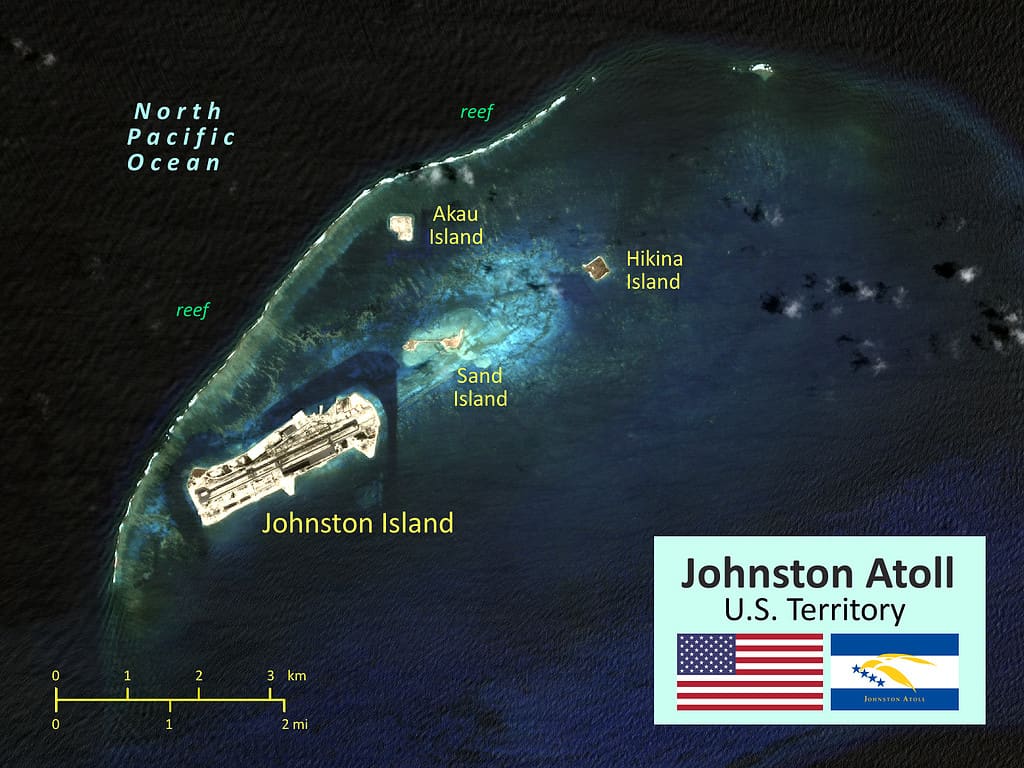
Johnston Island, also known as Johnston Atoll, is another unincorporated territory of the United States. The area is just 825 miles from Honolulu, and it consists of four islands. The land itself is relatively sparse, with limited vegetation and plant life. This area was discovered in 1796, claimed by the U.S. in 1858, and declared a bird sanctuary in 1926 under the U.S. Department of Agriculture. It was also used for nuclear weapons testing until 1962. Finally, in 2009 it was designated as a Pacific Remote Islands Marine National Monument.
Kingman Reef
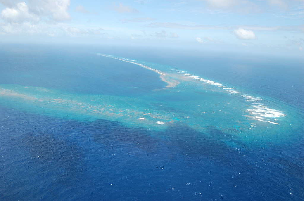
©USFWS – Pacific Region – Kingman Reef NWR. Photo credit: Susan White / Public Domain – Original / License
The coral reef known as Kingman Reef is an unincorporated territory located 920 miles from Honolulu. Technically not really an island. It is more of a thin stretch of reef that only takes up about 0.01 square miles. It was annexed by the U.S. in 1922 and became a naval base. The reef was used as a base of operations for seaplanes. The reef is uninhabited and is mostly home to birds and threatened sea turtles.
Midway Islands
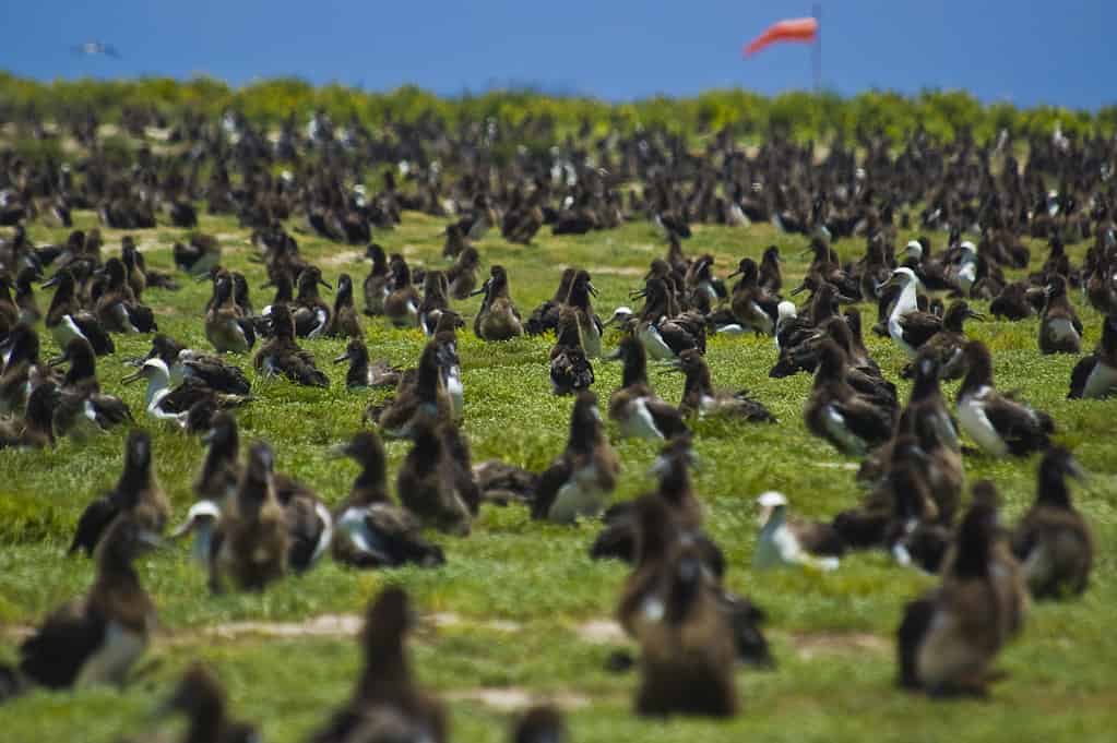
100602-N-7498L-021 PEARL HARBOR (June 2, 2010) More than a million Laysan Albatrosses, also known as Ògooney birdsÓ overwhelmingly occupy the entire Midway atoll. (U.S. Navy photo by Mass Communication Specialist 2nd Class Mark Logico/Released)
©U.S. Navy photo by Mass Communication Specialist 2nd Class Mark Logico / Public Domain – Original / License
Another wildlife refuge, Midway Islands or Midway Atoll is an area 1,300 miles northwest of Honolulu. It is a coral atoll with a circumference of 15 miles, and it is made up of two islands: Eastern and Sand Island. It has a relatively cool climate with wet winters and dry summers. The Midway Islands were claimed by the U.S. in 1859 and annexed by our country in 1867. It also served as a Navy base.
Wake Island
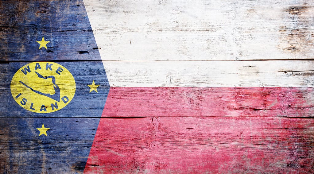
©grafvision/Shutterstock.com
Known as one of the most isolated islands in the world, Wake Island was formerly known as Halcyon Island, and it is made up of three coral inlets that are above an underwater volcano. Overall, it has a land area of 2.5 square miles. It has no inhabitants, and it receives very little rainfall.
It was formally claimed by the U.S. in 1899 and was intended for the installation of a cable station. In 1934, a hotel and seaplane base was added for overnight stops for transpacific flights. There is still an airfield that is used to this day. Also, the National Weather Service still uses wake island as a research station. Several hundred air force personnel currently call the island home.
Navassa Island
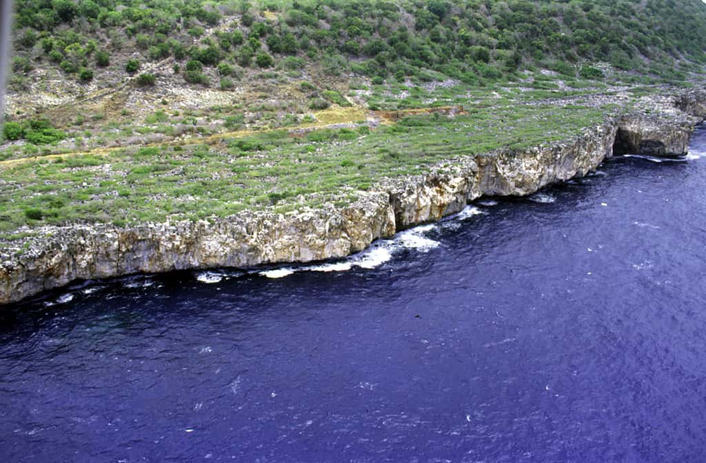
©USGS – http://coastal.er.usgs.gov/navassa/ Public Domain – Original / License
The island, often known only as “Navassa,” officially became an insular area when it was acquired via the Guano Act of 1856. Over time, the island was used by the Baltimore Fertilizer Company and the Navassa Phosphate Company until all operations ended in 1898. The island is three square miles, and it is located 100 miles from Guantanamo Bay, Cuba. In 1999, the area was designated as a wildlife refuge.
Freely Associated States
©USA federal government / Public Domain – Original / License
Although these next three areas have the word “state” in their name, they are only states in the international sense as independent countries. They are still considered U.S. locations that are not states. The only real involvement we have is that the U.S. is responsible for their defense.
Federated States of Micronesia
Micronesia
©Naima Niemand/Shutterstock.com
The area known as Micronesia is made up of more than 600 islands and islets located in the Caroline Islands archipelago. The area was acquired with the Commonwealth of the Northern Mariana Islands by the U.S. in 1947. The people of this area are classified as Micronesian and are very diverse. The economy is supported by fishing and farming, and the main foods are breadfruit, coconuts, and bananas.
The main source of revenue is the grand aid supplied by the U.S. government, which is part of the Compact of Free Association that was signed in 1982. The main source of income on the islands is paid positions from government employment. The Federated States of Micronesia is governed via executive, legislative, and judicial branches and a president and vice president. They also have a supreme court. There are elementary schools on every island and a community college.
Republic of the Marshall Islands
Marshal Islands
©KKKvintage/Shutterstock.com
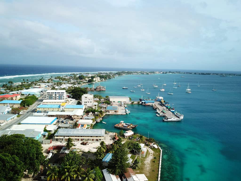
The Marshall Islands are located in the central Pacific Ocean, and they are composed of more than 1,200 islands and islets. These are all low-lying islands because none of them rise more than 20 feet above high tide. The climate is tropical and warm. The native people here are Micronesians, and many of the people there work at the U.S. missile testing range. The main sources of income are U.S. subsidies, and fishing and farming are the main economic activities. The Marshall Islands were made a part of the United Nations and came under the jurisdiction of the United States in 1947.
Republic of Palau
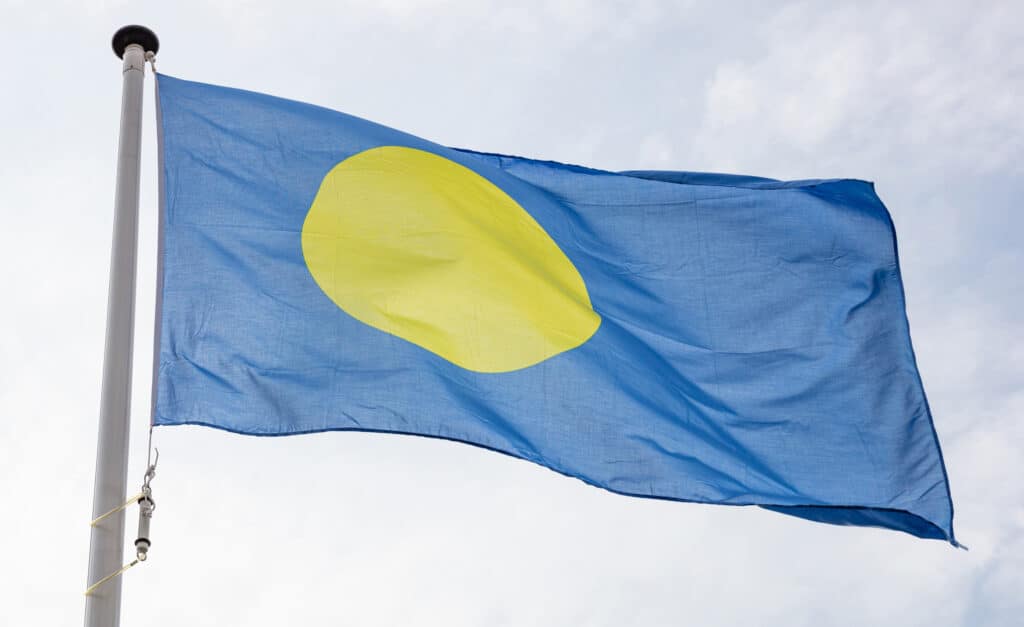
The flag of Palau features a softer blue and yellow.
©iStock.com/rawf8
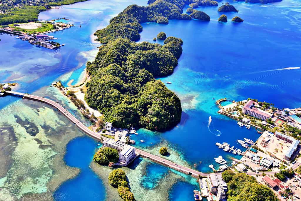
Finally, we have the Republic of Palau, which is composed of 340 coral and volcanic islands 830 miles from Guam. Most of the islands lie inside a barrier reef, and many of them are composed of forests and sandy beaches. This is a very tropical climate with up to 160 inches of rain every year. The area is occupied by a very diverse population that includes Americans, Europeans, and Japanese and they all occupied it at one time or another by the Japanese before they lost the area in World War II. The area came under U.S. administration in 1947.
Conclusion
That is your conclusive list of the U.S. locations that are not states, including the islands, territories, and commonwealths. These are all fascinating places and are worth a visit if you are ever looking for an exotic getaway. Only time will tell if America will add more territories to our great country.


How to Add Us to Google News


Thank you for reading! Have some feedback for us? Contact the AZ Animals editorial team.