
The Charles River was named by English explorer John Smith who explored and mapped parts of New England in 1614. The river was named in honor of Prince Charles (who would later become King Charles I). It is one of three major rivers in the Boston metro area. “The Charles” is the most prominent and busiest urban river in all of New England. It also has an infamous history of pollution dating as far back as the late 1800s. Thanks to a concerted cleanup effort, a new story for the river is now being written. Let’s take a look at this iconic Massachusetts waterway.

The Charles River is a hub of recreational activity in Boston today, but that wasn’t always the case.
©Michael Sean OLeary/Shutterstock.com
Charles River Depth and Length
Twenty dams control the flow of the Charles River. The numerous dams create varying depths along the river’s flow. The Charles River averages as much as fifteen feet deep in the lower section near the Esplanade to as shallow as two to three feet in the upper section between the Newton Yacht Club and Watertown Square.
The river is 80 miles long, flowing from Hopkinton, Massachusetts, to the Boston Harbor. It is the longest river that flows entirely within the borders of Massachusetts.
The river’s meander features many twists and turns, including a number of full switchbacks. In fact, some native people referred to the river as Quinobequin, which means “meandering.” The Charles River’s headwaters are only 350 feet above sea level. The river flows northeast through 23 Massachusetts cities and towns until it finally empties into Boston Harbor. The river’s watershed covers a 310-square-mile area.
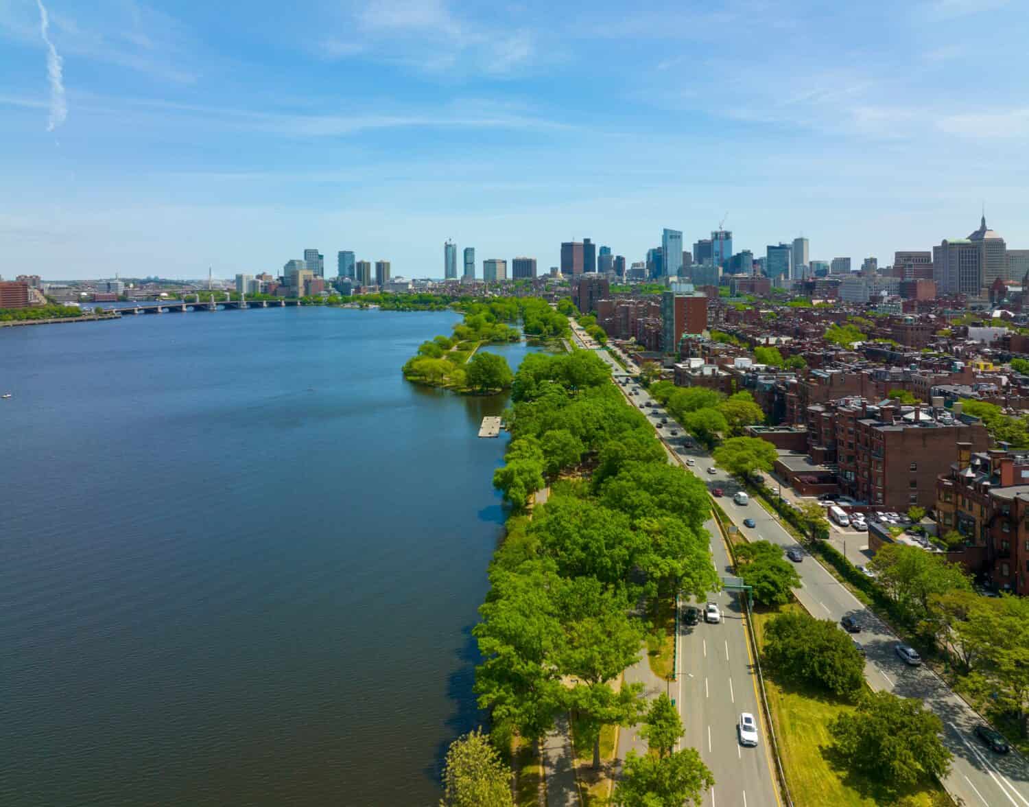
The Charles River meanders for 80 miles from Hopkinton to Boston Harbor.
©NewtonCourt / CC BY-SA 4.0 – Original
A Polluted History
The Charles River was famously one of the most polluted rivers in the United States by the mid-20th century. That pollution was created over a long period of time.
Dams and Mills
Native Americans inhabited the watershed as early as 4000 BC, long before the arrival of Europeans. In the 1620s-1630s, settlers made their homes here. They built the first weir (dam) on the Charles River and constructed the first grist mill along the river in the 1630s. Over time, they built forty-two more industrial mills on the Lower Charles.
In 1639, settlers dug a canal to divert water from the Charles River to a brook that drained to the Neponset River. The flow of this canal powered multiple mills, making it the first industrial canal in North America. People began to call the canal and brook “Mother Brook,” a name that sticks to this day as it still helps in flood control.
The river’s flow and ecosystem underwent many changes with the construction of dams and mills. For the first time ever, these structures limited fish migrations. The restricted water flow of the river led to the collection of sediments. Residents started using the newly formed ponds as garbage dumps, leading to their pollution.
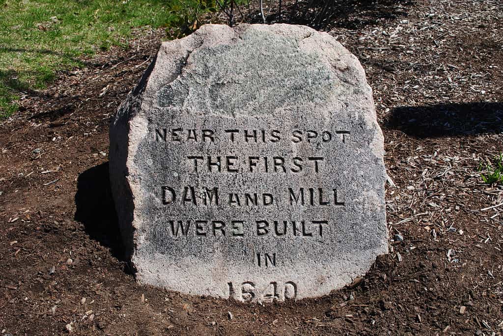
A stone marker is placed at the location of the first mill built on Mother Brook.
©Briancua / CC BY-SA 4.0 – Original
Urbanization
As Boston urbanized, workers paved the streets with cobblestone and built underground drainage systems in the 1700s. This impervious pavement lessened the water intake of aquifers and caused springs to start drying up. Meanwhile, sewage pollution was becoming a major issue.
In 1799, workers removed the hilltop of Mount Vernon and used the soil to fill in the marshland, paving the way for the construction of Charles Street. This action significantly diminished the river’s natural filtration system.
A Massively Industrialized Area
By the nineteenth century, the Charles River was one of the most industrialized areas in the United States. Mills and factories powered by the river abounded, which only increased the pollution of the waterway.
In the mid-1800s, the introduction of a municipal water supply led to indoor plumbing installation in many Boston buildings. The sewage outflow from this new indoor plumbing technology was directed into the Charles River.

Indoor plumbing created more outdoor pollution, especially in the Charles River.
©Dmitriy Prayzel/Shutterstock.com
The Charles River’s Polluted Reputation
In the 1850s, efforts to curb pollution in the river began but achieved only limited results. By the mid-twentieth century, people widely recognized the Charles River as a polluted waterway.
Noted conservationist Bernard DeVoto expressed his despair over the state of the Charles River in a 1955 Harper’s Magazine piece. He described the river as “foul and noisome, polluted by offal and industrious wastes, scummy with oil, unlikely to be mistaken for water.”
The Standells, in 1965, even found inspiration in the river’s polluted flow for their rock song “Dirty Water,” which you can hear in the video below.
The River’s Turnaround
Things slowly began to turn around for the Charles River in the second half of the twentieth century. The Charles River Watershed Association was founded in 1965. A new dam was constructed in 1978 to keep saltwater out of the basin.
In 1995, the Environmental Protection Agency (EPA) ordered municipalities to stop illicit discharges in city storm drains. The agency also published its goal to make the river swimmable again in ten years.
Public and private initiatives have had a remarkable impact on the water quality of the Charles River. The EPA issues an annual report card on the water quality of the river. Grades of A’s and B’s are common. An “A” means the river meets swimming and boating standards nearly all of the time. A grade of “B” indicates the river meets swimming and boating standards most of the time.
Water quality data is available on the EPA’s website.
The Charles River Today
The Charles River is central to the lives of Bay Staters who live along its path. The river, especially the “Lower Charles” from the Watertown Dam to Boston Harbor, is one of the busiest recreational rivers in the world.
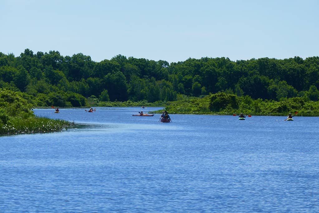
River Recreation
The river is lined with boat houses and walking/biking paths. Boating is a favorite pastime. Anglers cast their lines into the Charles River, targeting largemouth bass, yellow perch, striped bass, and many other fish species.
Canoes, kayaks, and paddleboards are common sights on the river during the summer. Parks such as Herter Park and Magazine Beach Park are great places to relax beside the river. The Charles River Esplanade is a grassy area perfect for a picnic or a jog along the river.
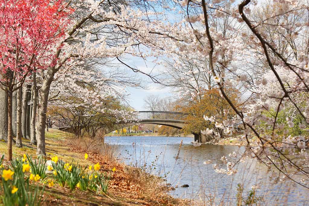
Spring on the Charles River Esplanade is spectacular!
©Jay Yuan/Shutterstock.com
Rowing
Competitive rowing is wildly popular on the Charles River. The Head of the Charles Regatta is held each October. It is the largest three-day regatta in the world, with 11,000 athletes competing in over 60 events. The regatta draws nearly 400,000 people and pumps tens of millions of dollars into the local economy.
Edward A. Hatch Memorial Shell
The world-famous Hatch Memorial Shell sits on the Esplanade in Back Bay. Concerts and movies are featured at this iconic venue most weekends and many weekdays during the summer. The most famous event at the Hatch Shell is the Boston Pops Orchestra’s annual performance at the city’s Fourth of July celebration. The Charles River quietly flows past the venue, creating an environment that is uniquely Bostonian.
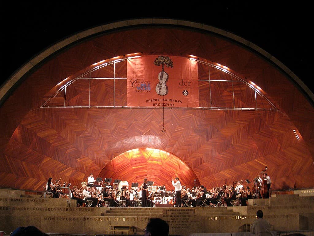
Concerts in the Hatch Shell are longstanding traditions along the Charles River.
©Daderot / Public domain – Original
The Future of the Charles River
This is not to say that the condition of the Charles River is perfect. Problems do persist. For example, toxic algae blooms can appear because of the discharge that warms the water temperature. But even though there are still challenges to overcome, the future of “The Charles” certainly looks brighter than it did several decades ago.
Where is the Charles River Located on a Map?
The Charles River, also known as the River Charles or simply the Charles, stretches across eastern Massachusetts, covering a length of 80 miles.
Here is Charles River on a map: