
The Charleston Harbor, situated in Charleston, South Carolina, covers around 8 square miles or 20.7 square kilometers of the Atlantic Ocean. It is a crucial part of the Intracoastal Waterway, created by the merging of the Ashley and Cooper rivers. Let’s quickly examine how the harbor’s appearance changed before and after the deepening project. Next, we’ll delve into the reasons for the deepening project.
The Saga of Charleston Harbor: A Vital Part of the City’s Economy and Culture
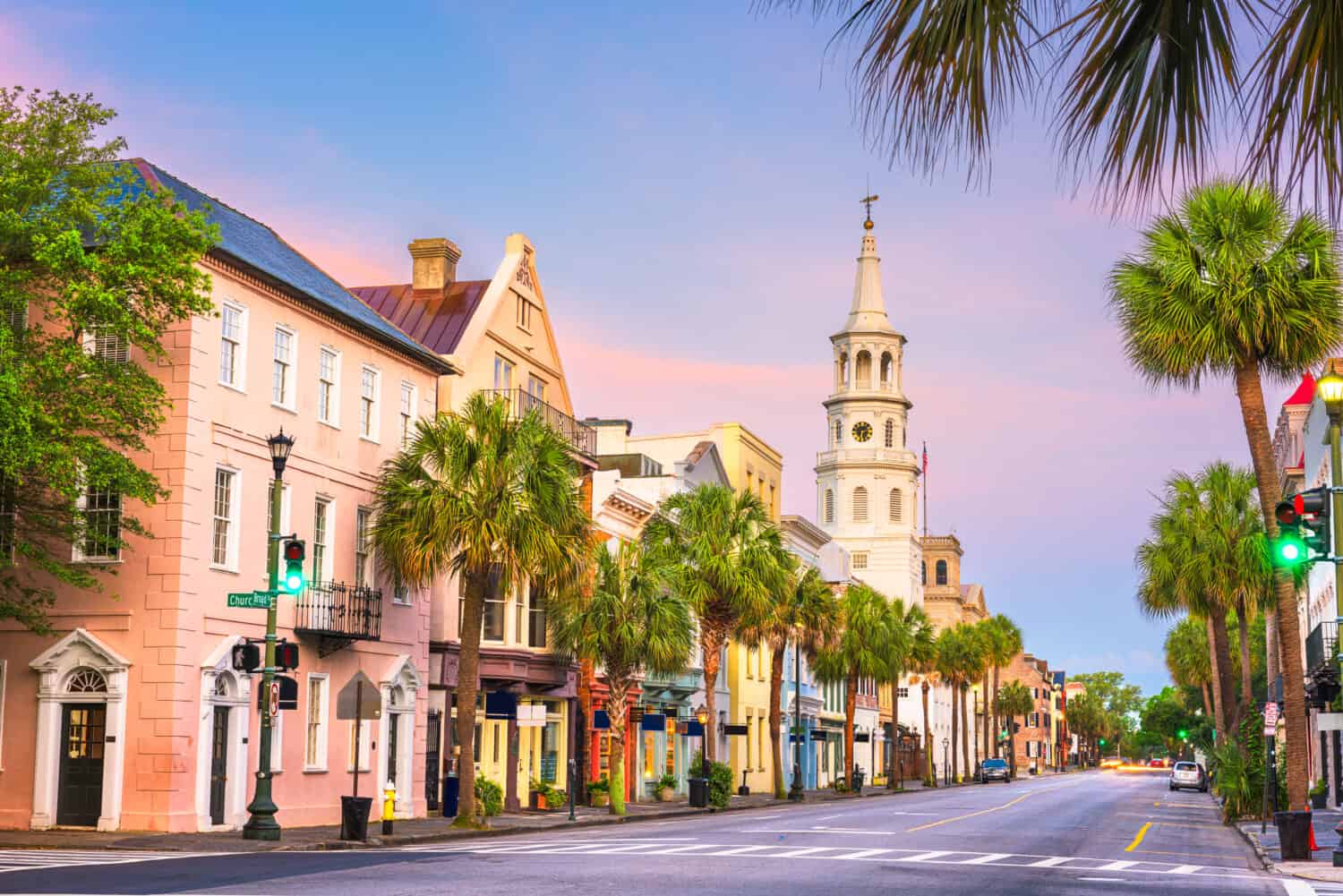
Origin of Charleston
In 1670, English settlers sailed and founded Charles Town, later Charleston, in present-day Charleston Harbor. They named the town after England’s King Charles II. Charleston developed into a hub exploiting and exporting natural resources, deer furs, and naval stores to England. Originally settled at Albemarle Point on the Ashley River’s west bank, Charleston relocated in 1680 to Charleston Neck. This peninsula forms where the Ashley and Cooper Rivers meet, creating Charleston Harbor with an Atlantic outlet.
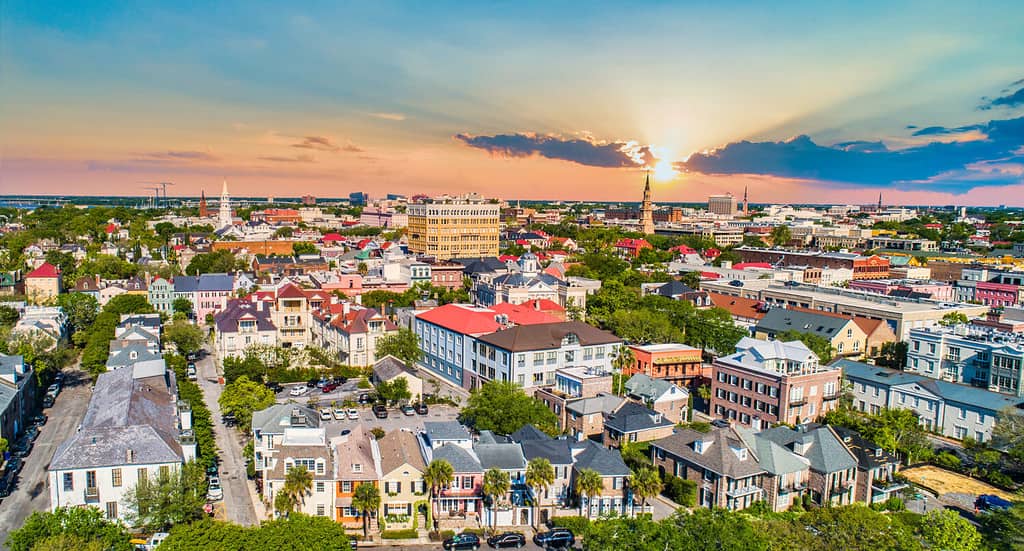
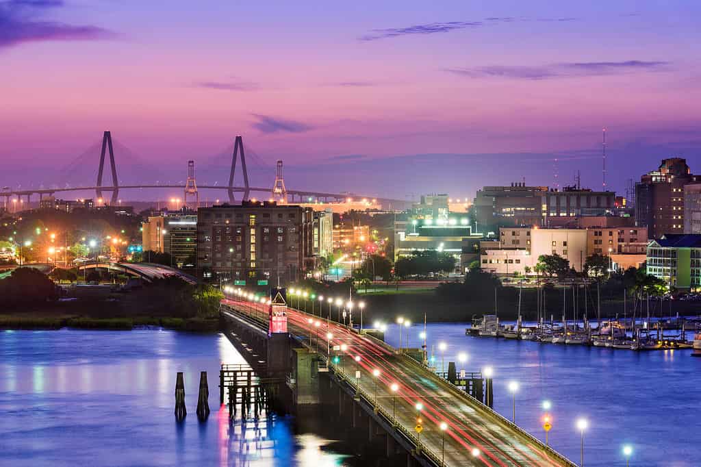
Downtown Charleston South Carolina Skyline Aerial View.
©Kevin Ruck/Shutterstock.com
Charleston Harbor’s Landmarks
Several sites surrounding Charleston Harbor, including national historic parks like Fort Sumter and Fort Moultrie, convey unique stories of the people and places that shaped the United States of America.
Patriots built a palmetto log fort at the entrance of Charleston Harbor during the American Revolution. This fort is now one of the two forts that stand at the entrance of the harbor. Patriots renamed the first Fort Moultrie, commemorating their victory over the Royal Navy in 1776. Simultaneously, Charleston was progressing toward secession to uphold slavery, and construction commenced on a new fort, Fort Sumter.
At 4:40 a.m. on April 12, 1861, Confederate forces initiated the Civil War by firing the first shots at federal troops in Fort Sumter. The United States’ development embedded the origins of this conflict. Fort Sumter maintained its role as a focal point in Charleston during the entire Civil War.
Sullivan’s Island
Captain Florence O’Sullivan settled on Sullivan’s Island in the late 17th Century while serving as a lookout. Its strong military history includes hosting the pivotal Revolutionary War battle, the Battle of Sullivan’s Island, and the initial shots of the American Civil War. Sullivan’s Island historically played a crucial role as the initial defense line for Charleston Harbor. Quarantine stations screened all arrivals, including enslaved Africans.
Sullivan’s Island, a two-and-a-half-mile-long barrier island at Charleston Harbor’s entrance, houses over 2,000 residents in half as many households. The Island boasts a small-town charm and a relaxed lifestyle, maintaining its character since 17th-century settlement. Pristine beaches, award-winning restaurants, and a close-knit community are its hallmarks.
On September 23, 1989, Hurricane Hugo struck as a Category 4 hurricane. Sullivan’s Island was directly affected as the eye passed over, causing widespread destruction. The Ben Sawyer Bridge, initially pointing down and mired in plow mud, became an international symbol of Hugo’s devastation. Today, a sturdy replacement bridge welcomes residents and visitors to this beloved island.
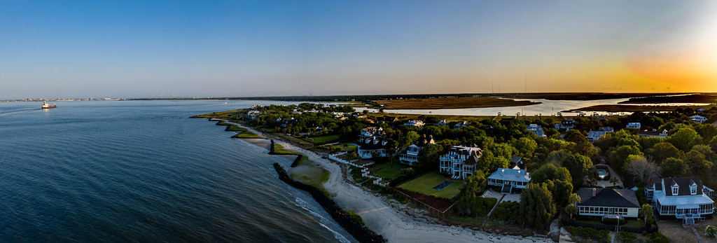
Sullivan’s Island is a barrier island close to Charleston Harbor.
©George A. Kenna/Shutterstock.com
Fort Moultrie
Colonel Moultrie and the second South Carolina infantry built the Palmetto log fort, which was attacked by Commodore Sir Peter Parker’s British fleet on June 28, 1776. After a nine-hour battle, the British ships retreated. The fort was named Fort Moultrie in honor of its commander. Finally, the British captured the Charleston, including Fort Moultrie. People evacuated the city as the Revolution entered its final year in December 1782.
The leaders and authorities modernized Fort Moultrie in the 1870s, installing larger cannons and building bombproofs. In 1885, President Cleveland appointed William Endicott to review coastal defenses. Also, They placed new batteries and weapons. World wars brought new threats and required new defenses at Fort Moultrie. Advanced technology, including nuclear weapons and guided missiles, rendered the old weapons obsolete. These outdated arms couldn’t compete.
Today, the Charleston district authorities have restored Fort Moultrie to depict its major historical periods from 1809 through 1947.
A picturesque view of Fort Moultrie on Sullivan’s Island at Sunrise bathed in the warm morning light.
©George A. Kenna/Shutterstock.com
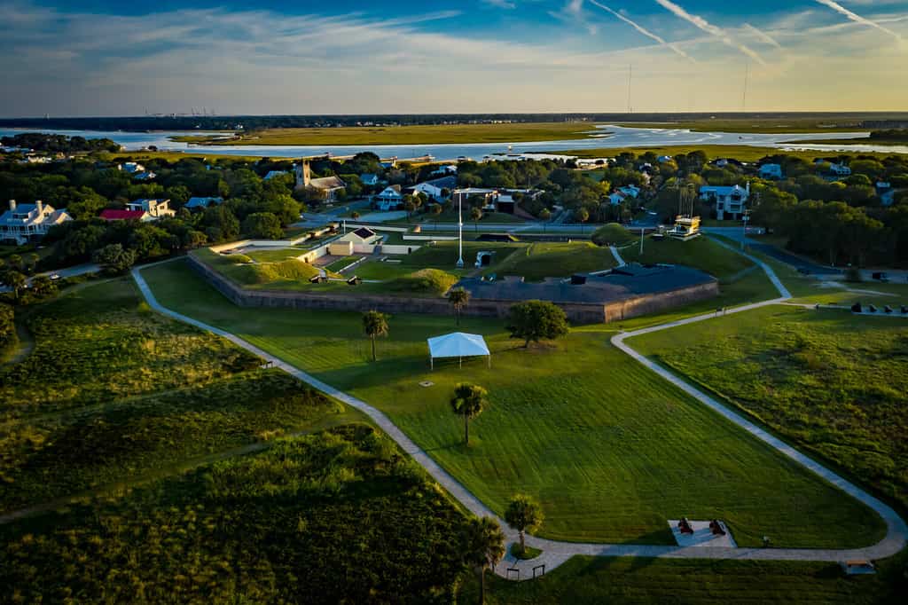
Fort Sumter
Fort Sumter is a sea fort located on an artificial island in Charleston Harbor, South Carolina. They built the fort to protect the region from naval attacks after the British captured Washington during the War of 1812. The battle took place on April 12 and 13, 1861, when Confederate forces launched an attack on the United States military garrison at Fort Sumter. The fort surrendered in less than two days without any casualties. This battle held historical significance as the first military action against the Union. It demonstrated the Confederacy’s determination to protect its sovereignty and the Union’s commitment to preserving national unity.
The Fort Sumter National Monument is open daily from 9 AM to 5 PM. The entrance and parking lot offer wheelchair accessibility. The ferry ride to Fort Sumter takes 30 minutes each way. Ferries usually operate multiple times daily from Downtown Charleston and at least once a day from Patriots Point.
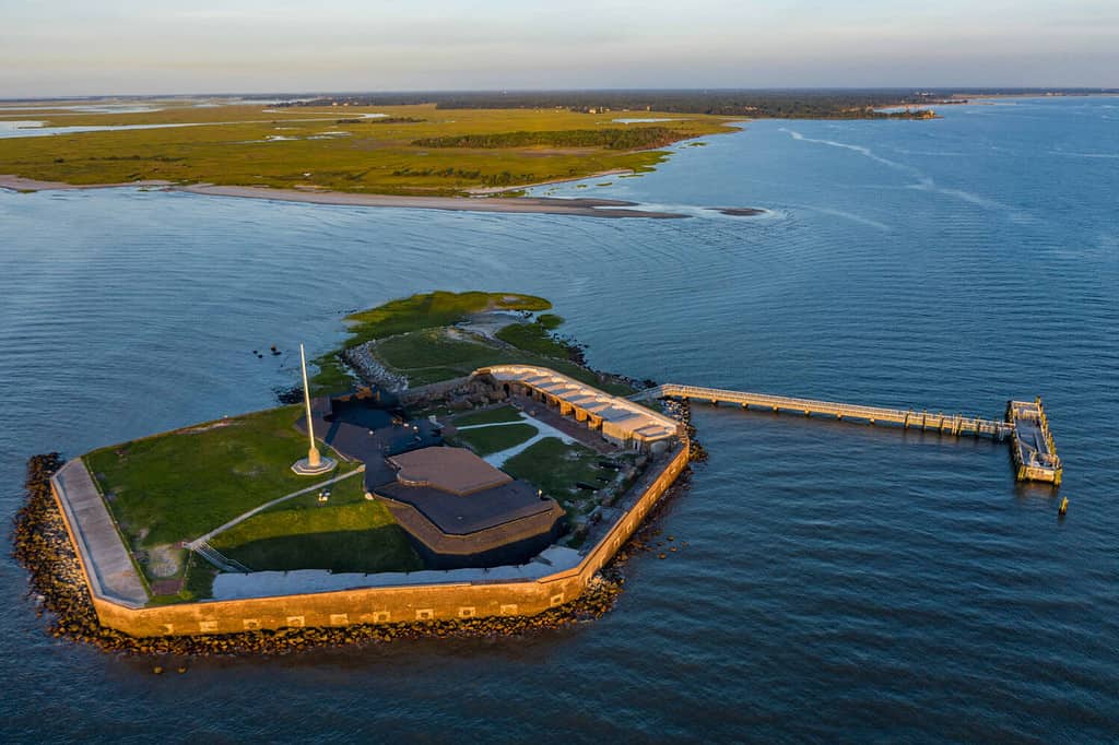
Aerial View of Fort Sumter at Sunrise.
©George A. Kenna/Shutterstock.com
Deepening of Charleston Harbor
Now that we have explored the culture and history behind the harbor let’s delve into what caused the deepening of Charleston Harbor. The inspiration for the Charleston Harbor Deepening Project came from the Panama Canal expansion. This endeavor aimed to accommodate larger ships from Panama, as well as to enhance transportation efficiency by widening the harbor for the growing shipping industry.
Lt. Col. Andrew Johannes, commander of the U.S. Army Corps of Engineers, Charleston District, stated,
“Many great things come from humble beginnings, and Charleston Harbor is no exception. In 1760, during the age of sail, the harbor averaged a depth of only 12 feet”
Charleston, South Carolina, USA skyline over the Ashley River.
©iStock.com/SeanPavonePhoto
Post-Panamax Ships
Panamax ships can pass through the original Panama Canal locks, with dimensions of 110 feet in width, 1,050 feet in length, and a 41.2-foot draft in tropical freshwater. In contrast, Post-Panamax vessels boast much greater cargo-carrying capabilities than Panamax ships. For instance, a Post-Panamax container ship with a capacity of 12,000 twenty-foot equivalent units (TEUs) can transport 2.5 times the cargo of the largest Panamax container vessel.
Post-Panamax ships posed infrastructure challenges for many ports. They required deeper drafts and more efficient and expensive ship-to-shore cranes with wider reaches. Ports had to dredge their waterways to accommodate these larger vessels.
The inspiration for the Charleston Harbor Deepening Project came from the Panama Canal expansion.
©iStock.com/ehrlif
Background
The harbor has undergone eight deepening projects in 250 years to accommodate the rapidly growing cargo vessels worldwide. The Charleston Harbor was only 12 feet deep in 1760, during the age of sail. Almost 100 years later, in 1851, the harbor was deepened to 17 feet to accommodate larger, steam-powered ships. The General Moultrie was used.
The General Moultrie was the world’s first hydraulic dredge. It was built in 1855 by William Colyer in New York. The General Moultrie had a hopper capacity of 118 cubic meters. It was used to deepen the Charleston Harbor to 17 feet in 1851.
Ashley and Cooper Rivers joined to form Charleston Harbor, providing an outlet to the Atlantic Ocean. This move was intended to expand and create shipping opportunities for the growing and prosperous colony.
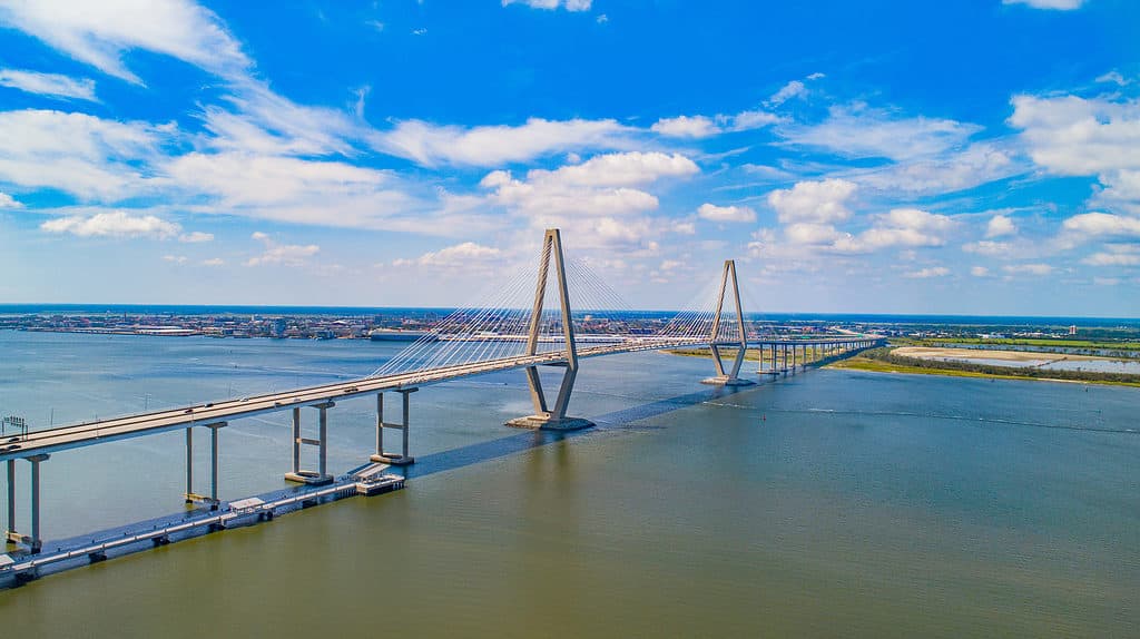
Cooper River Bridge in Charleston, South Carolina.
©Kevin Ruck/Shutterstock.com
The Historical Beginnings of Trade
In the years before the Revolutionary War, Charleston prospered as trade shifted from natural goods to agriculture, like indigo, sea island cotton, and rice. Plantations centered around cultivating these crops using African slave labor.
Due to the expansive rice plantations concentrated along the upper regions of the Ashley and Cooper Rivers, the Carolina colony, with Charleston at its core, thrived as one of the wealthiest British Empire colonies.
The move for independence from England in 1776 brought ruin and deprivation to the port. American troops and militia in the city capitulated to British arms in 1780 after repelling a naval and land assault in late June 1776. The British controlled the port until the war ended in 1783, during which time it languished as a trading backwater.

Charleston Harbor, looking toward Patriot’s Point, viewed from the Cooper River Bridge, in Charleston, South Carolina.
©Brian Stansberry, CC BY 3.0 <https://creativecommons.org/licenses/by/3.0>, via Wikimedia Commons – Original / License
The Motivation Behind Charleston Harbor Deepening
After the Civil War, Charleston declined as a port due to the collapse of its agricultural mainstay, rice. However, the discovery of phosphate in the late 1860s in nearby rivers and land deposits sparked the city’s economic revival. This increased port activity necessitated several harbor improvements. These included dredging ship channels, clearing navigational hazards (such as Civil War-era wrecks), and constructing two stone jetties at the entrance to Charleston Harbor.
Currently, the State Ports Authority operates five public terminals in Charleston Harbor, which is vital to South Carolina’s economy. It is one of the most productive ports in the country, and shipping remains one of South Carolina’s top industries. Beyond its economic significance, the harbor serves as a popular recreational hub. It hosts marinas, yacht clubs, cruise ships, and the annual Charleston Maritime Festival, offering a wide array of activities on the city’s waters.
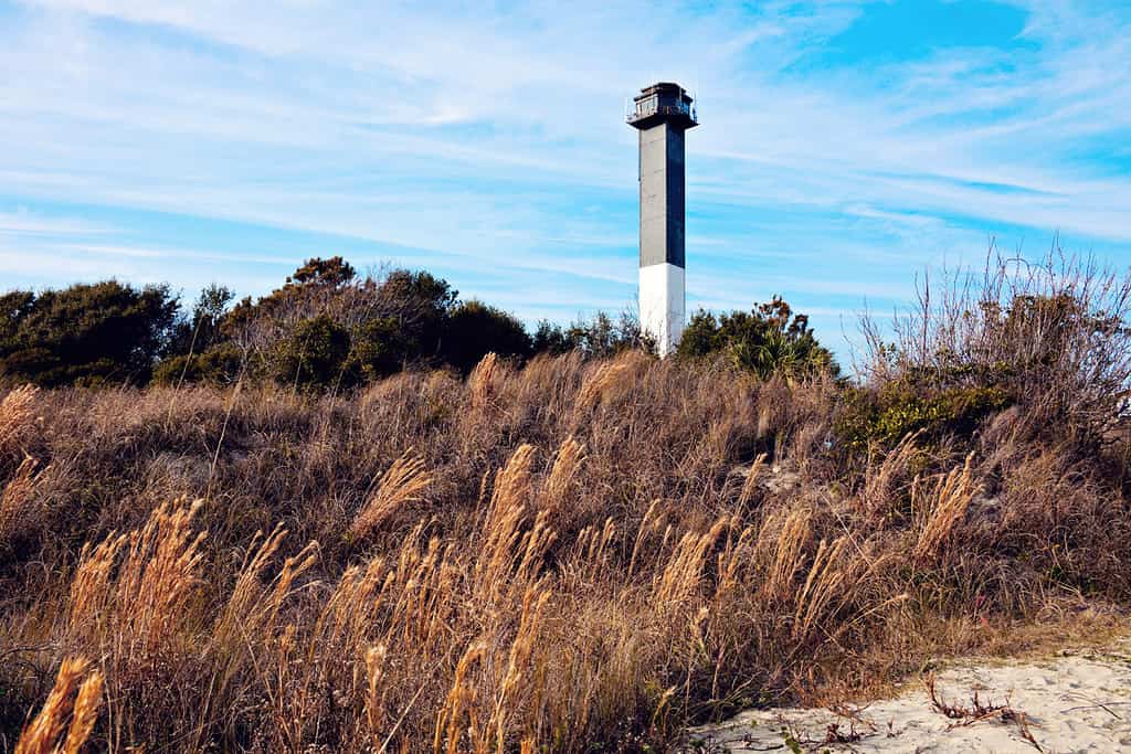
Charleston lighthouse is located on Sullivan’s Island in South Carolina.
©Henryk Sadura/Shutterstock.com
Significant Contributions of Remarkable Individuals
The S.C. Ports Authority is actively deepening Charleston Harbor from 45 to 52 feet, aiming for a competitive edge in accommodating larger vessels. Port CEO Jim Newsome emphasizes the project’s reliance on federal funding to meet its 2021 completion goal.
On December 5, 2022, Governor Henry McMaster, Senators Lindsey Graham and Tim Scott, Representative Nancy Mace, state leaders, representatives from the South Carolina Ports Authority, and other partner agencies, all of whom helped the U.S. Army Corps of Engineers, Charleston District, make the Charleston Harbor Deepening Project a reality, gathered to celebrate the dredging of the last scoop of sediment.
Senator: Lindsey Olin Graham
Senator Graham, who had pulled the lever to start deepening construction in 2018, returned to the stage, this time to commemorate its completion. He made history for South Carolina when he pulled the same lever again. After more than ten years of planning and years of construction, Charleston Harbor in South Carolina has become the deepest harbor on the U.S. East Coast, now at a depth of 52 feet.
Charleston Mayor: Joe Riley
Charleston Mayor Joe Riley played a significant role in the Charleston Harbor deepening project. In 2011, he engaged President Barack Obama, highlighting the project’s importance to jobs, exports, and the national economy. As one of the mayors who signed a letter to President Obama, he urged funding inclusion in the Administration’s budget for the U.S. Army Corps of Engineers to support the Charleston project. Mayor Riley’s continuous involvement has been invaluable as he consistently emphasizes Charleston Harbor’s merits in his interactions with the President.
The United States Army Corps of Engineers (USACE)
The USACE team diligently ensured the project’s on-time, on-budget completion, marking the nation’s first large navigation project under the Corps’ streamlined civil works planning process. This dedicated team consisted of engineers, navigation specialists, scientists, economists, planners, and project managers from across USACE, all distinguished in their respective fields. The deepening effort spanned the tenure of seven district commanders, commencing with Lt. Col. Jason Kirk and concluding with Lt. Col. Andrew Johannes.
The South Carolina Ports Authority (SCPA)
The South Carolina Ports Authority (SCPA) played a vital role in the strategic priority of deepening Charleston Harbor to 52 feet. It actively advocated for and oversaw the project, collaborating closely with the U.S. Army Corps of Engineers (USACE) to secure federal funding. Additionally, the SCPA has made substantial investments, initiating construction activities in February 2018 after the project received authorization from the US Congress in 2016.
South Carolina Governor: Henry McMaster
South Carolina Governor Henry McMaster played a pivotal role in deepening Charleston Harbor to 52 feet. This achievement resulted from a collaborative team effort that included federal delegation members, the General Assembly, and the Ports Authority leadership. At the milestone celebration, Governor McMaster, accompanied by US Senators Lindsey Graham and Tim Scott and other officials, commemorated Charleston Harbor’s status as the East Coast’s deepest port at 52 feet.
Chronological Events
2010: The United States Army Corps of Engineers (USACE) began working with the South Carolina Ports Authority (SCPA) to complete studies and move the project toward a 52-foot-deep federal channel.
2012: The state of South Carolina set aside $300 million for the project.
2016: The project received Congressional Authorization in December.
2018: On June 11, 2018, The United States Army Corps of Engineers (USACE) announced $49 million for the Charleston Harbor Deepening Project in the Fiscal Year 18 Work Plan.
2018: On November 21, 2018, the United States Army Corps of Engineers (USACE) announced $41.4 million for the project in the Fiscal Year 19 Work Plan, bringing the federal funding total to $108 million.
2021: In December 2021, Great Lakes Dredge & Dock (GLDD) completed three of the five phases of the project, deepening 24 miles of the federal channel, with 22 miles of the work taking place in the challenging offshore entrance channel.
2022: On December 5, 2022, A milestone celebration was held to commemorate the completion of the Charleston Harbor Post 45 Deepening Project, making Charleston Harbor the deepest port on the East Coast at 52 feet.
2023: On October 5, 2023, The project was officially completed. Thus, the Charleston Harbor Deepening and Widening Project was undertaken to address transportation inefficiencies and allow the port to accommodate the influx of post-Panamax ships.
The successful conclusion of the approximately $580 million Charleston Harbor Deepening Project enables the Port of Charleston to welcome the largest ships without any limitations, which greatly bolsters South Carolina’s economy and the efficiency of Southeast supply chains.
Contracts
As per the article from “South Carolina Department of Agriculture (SCDA), Market Bulletin Vol.97.Num.2, January 19, 2023, the Army Corps granted contracts for dredging to five different entities: three to Great Lakes Dredge and Dock Corp., one to Norfolk Dredging Co., and one to Marinex Construction Inc., who completed the work in four years.
Achieving Greater Depth: The Charleston Harbor Deepening Project’s Successful Completion
The SCPA, a major economic force with a $60 billion statewide impact, supports one in ten jobs directly. Record-breaking import numbers have been consistent for two years, including the new Hugh K. Leatherman terminal’s 2021 opening.
Elected leaders, such as Senator Graham and his staff and Melvin, regularly participated in meetings and updates with stakeholders. Their attendance reflected a shared understanding of the project’s importance and necessity.
Deepening completion means accommodating the world’s largest ships regardless of load, tide, or time. Records for the biggest ships visiting Charleston were already broken before full project completion. The CMA-CGM Marco Polo set the record in May 2021, followed by the COSCO Camellia in March 2022. In September of the same year, the MSC Rayshmi officially became the largest ship to visit with a draft of 48 feet, 11 inches.
It’s official: Charleston Harbor is now the deepest port on the East Coast at 52 feet, marking a significant milestone.
Conclusion
In conclusion, the deepening of Charleston Harbor is a source of pride and a vital resource for current and future generations. Once only 17 feet deep, the port has now been dredged to 52 feet. This achievement was made possible by the dedication and relentless efforts of countless individuals. The success of this project serves as a reminder of the power of collaboration, meticulous planning, unwavering commitment, and hard work. Today, we have the privilege of witnessing the fulfillment of their dreams.
The harbor deepening project serves as a shining testament, conveying that determination, learning from failures, and perseverance could achieve the impossible. Today, Charleston Harbor has expanded exports and created jobs and can handle the biggest and most modern ships independently of the tide, time, or other factors. It also provides significant job and livelihood opportunities to Charleston City and its surrounding villages.
The collective effort of various individuals and organizations, including Senator Graham, Lieutenant Colonel Andrew Johannes, the Charleston Mayor Joe Riley, the South Carolina Ports of Authority Team, and more, along with support from the Charleston community, President Barack Obama’s ‘We can’t wait’ initiative, and President Trump’s allocation of $138 million funding, brought this project to fruition. Key players such as Great Lakes Dredge and Dock Co., Norfolk Dredging Co., and Marinex Construction Inc., along with other unknown contributors, played crucial roles in making this project happen.


How to Add Us to Google News


Thank you for reading! Have some feedback for us? Contact the AZ Animals editorial team.