
Today we will dive into the depths of the fascinating Milwaukee River and explore its true extent. The Milwaukee River is a prominent waterway that flows through the heart of Wisconsin’s largest city. It provides both recreational opportunities and essential resources to the local community. Join us as we uncover the mysteries surrounding this iconic river. Including its depth, diverse ecosystem, historical significance, and how it has shaped the vibrant city of Milwaukee. Whether you are a curious local or an avid nature enthusiast, get ready to embark on an enlightening journey. We will delve into the depths of one of Milwaukee’s most treasured natural wonders: the Milwaukee River.

Overview of the Milwaukee River
The Milwaukee River, a prominent waterway in southeastern Wisconsin, holds great significance for the city it flows through. Spanning approximately 105 miles in length, this majestic river meanders its way across three counties: Ozaukee, Washington, and Milwaukee. Nestled within the eastern part of the state, this thriving river system brings life and vitality to numerous communities along its course.
Originating from Fond du Lac County near Malonedtville Marsh State Wildlife Area, the Milwaukee River begins as two separate branches—the East Branch and West Branch—before merging just north of Saukville. From thereon, it gracefully winds southward towards downtown Milwaukee where it empties into Lake Michigan at Lake Shore State Park.
Encompassing an impressive watershed area of approximately 882 square miles, the Milwaukee River plays a vital role in providing clean drinking water to nearly one million people. Furthermore, this remarkable body of water serves as an essential resource for recreational activities. A few favorites are fishing, boating, kayaking, and even paddleboarding.
Throughout its course, both urban landscapes and serene natural surroundings characterize the banks of the Milwaukee River. As it passes through various neighborhoods like Glendale and Shorewood on its journey toward downtown Milwaukee’s bustling cityscape. Diverse ecosystems coexist harmoniously alongside vibrant parks that offer tranquil escapes for residents and visitors alike.
While historically facing environmental challenges due to industrialization during the early years past, concerted efforts have been made over recent decades to restore and preserve the health of this significant body of water.
How Deep is the Milwaukee River?
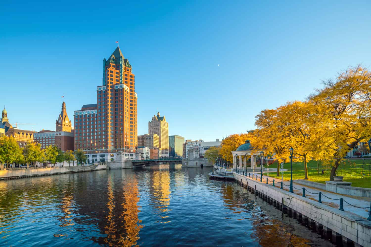
The Milwaukee River is 9.3 gage feet deep at its deepest point.
©f11photo/Shutterstock.com
According to snowflo.org, the Milwaukee River’s deepest point measures 9.3 gage feet. This area is near Jones Island Mouth. They have three different gauges stationed along the river. Read a fascinating discussion of gages here.
Where is the Milwaukee River Located on a Map?
The Milwaukee River is a prominent waterway that flows through the city of Milwaukee, Wisconsin. Situated in the southeastern part of the state, this river has its headwaters in Fond du Lac County. It gradually winds its way southward for approximately 105 miles before emptying into Lake Michigan. The river’s course traverses several counties, including Washington, Ozaukee, and Milwaukee.
On a map, you can find the Milwaukee River originating from its source near Astico Park in eastern Fond du Lac County. From there, it meanders southward through various landscapes and urban areas until it reaches downtown Milwaukee. As it approaches the city center, the river splits into three main branches. The east branch (which starts around Estabrook Park), the west branch (beginning near Hoyt Park), and finally converging to form what is commonly known as the main stem or main channel of the Milwaukee River.
Geography
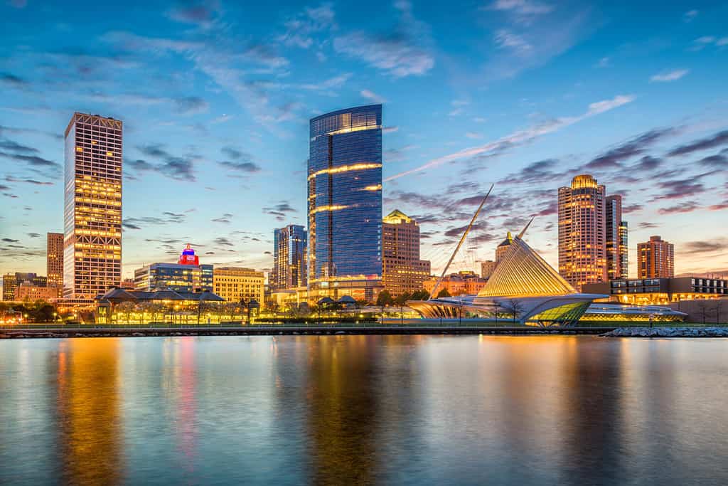
The Milwaukee River is an important part of the commerce and industrialization of Milwaukee.
©Sean Pavone/Shutterstock.com
The geography surrounding this water body is diverse and picturesque. Along its path, you will encounter lush forests with towering trees bordering much of its banks. There are also stretches where well-manicured parks provide serene green spaces for recreational activities such as biking or walking trails. Urban settings intermingle with natural beauty as neighborhoods like Shorewood or Glendale showcase their proximity to this majestic river.
Given its central location within metropolitan Milwaukee, numerous bridges span different sections of the river. These connect various parts of the town together while offering stunning views along these crossings.
The Formation of the Milwaukee River
Approximately 12,000 years ago, the Laurentide Ice Sheet started to move away from Wisconsin’s north and southeast. This sheet of ice had a large presence in both Canada and northern America. It left behind drumlins, moraines, kettles, and hills in Wisconsin’s geography. It also led to the formation of various ponds, rivers, lakes, and tributaries. The Milwaukee River system is the most prominent one.
History
The Milwaukee River was a sacred source of sustenance to many Native American tribes.
©Gokhan Eren/Shutterstock.com
For thousands of years, numerous Native American peoples, including the Sauk, Chippewa, Potawatomi, Winnebago, Menomonee, Ottawa, and Ojibwe, resided in the region and used the Milwaukee River as a source of sustenance. It supplied them with fish and game, such as deer and rabbits, for hunting. Additionally, it aided in their farming endeavors by providing irrigation for their crops of beans, maize, and squash. The river also served as a mode of transportation and facilitated trade and diplomacy among local tribes. In the seventeenth century, European explorers and missionaries came into contact with these Native American communities due to the Great Lakes and Wisconsin’s rivers. Fur traders saw them as commercial hubs with potential for economic growth. Jesuit missionaries viewed them as souls to be saved and aimed to convert them to Christianity.
Fur Trade
French fur traders drove demand for Indian pelts. This led to European empires clashing for control of the region in the 18th century. With the English victory in the Seven Years’ War, Native Americans faced a similar situation in the American Revolution. With little diplomatic leverage, they were pushed to sign haphazard agreements or face eviction. Government policy then dictated Indians live on reservations, separated from white settlers and under the supervision of the Bureau of Indian Affairs.
The national government’s policies regarding Native Americans often ousted them from their homes. But some Wisconsin tribes reached agreements to stay in the state, creating and evolving the city’s name, Milwaukee.
In an unusual twist of events, the Milwaukee River unified competing settlements- Juneautown and Kilbourntown- into one city. The 1840 territorial laws of Wisconsin ordered a bridge over the Milwaukee River. But anger between the two towns’ founders led to the “Bridge War” of 1845. Intermittent bouts of mob violence and bridge destruction followed, but no deaths. Appalled by the violence, both sides eventually agreed to build the bridge. They each wanted a greater sense of community and new economic opportunities. The bridge was completed a year later, connecting eastern and western Milwaukeeans.
Commerce
As Milwaukee grew into a center of trade on the Great Lakes in the 1800s, the river became very important for the city’s growing businesses.
Brewing

©Syda Productions/Shutterstock.com
As early as the 1840s, Milwaukee had a small brewing industry. But with the influx of German and Polish immigrants, the city quickly grew to become one of America’s leading beer producers. By the 1860s, there were over forty breweries in the area. Miller, Pabst, Schlitz, and Blatz were the most prominent. In the twentieth century, Milwaukee earned the title of America’s “brewing capital.” The Milwaukee River was a key component of this success. It provided a way to ship beer out and receive goods for local businesses. Frederick Pabst, the creator of Pabst Brewing Company, even bought a dock on the river to increase efficiency in his transactions.
Tanning
The tanning industry found Milwaukee to be an ideal location. German immigrants with experience in tanning techniques and the abundance of hemlock and oak tree bark made for the perfect situation. This, combined with lower operating costs, made Milwaukee a major hub for leather production, surpassing Chicago in the 1880s. Companies like Pfister and Vogel Leather Company took advantage of the Milwaukee River for chemical production and shipping purposes. By 1890, Milwaukee had become the largest producer of plain leather hides globally.
Wheat Production
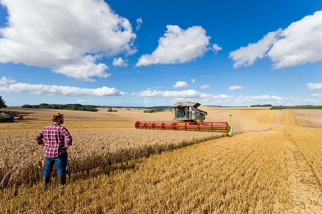
Wisconsin was once a large producer of wheat for the country.
©Juice Flair/Shutterstock.com
Before Wisconsin became known as the “dairy state,” it produced a sizeable portion of the nation’s wheat between 1840 and 1880. New settlers and European immigrants took advantage of the Milwaukee River. It gave them easy access to the city to process and package their wheat. Mills situated along the riverfront made use of waterpower to turn wheat into flour. This Wisconsin flour was then distributed throughout the Midwest, South, and East Coast. Unfortunately, overproduction caused soil degradation and other problems, leading to decreased profits for farmers. The added cost of transportation made Chicago a more attractive market than Milwaukee. Many producers shifted to other agricultural activities, such as dairy farming. This transition had a detrimental effect on the river. Pollutants from animal waste and fertilizers found their way into its tributaries.
Meatpacking
The Menomonee and Kinnickinnic Rivers in Milwaukee’s south side were home to many meatpacking plants owned by John Plankinton, Frederick Layton, and Thomas and Edward Roddis. These companies processed the majority of hogs and cattle in 1859. Because of its nearness to rural farms, pork was the main meat exported from Milwaukee, making it the fourth leading producer of pork in the United States in 1871. Patrick Cudahy bought Plankinton’s business when he retired and moved the plant out of Milwaukee due to possible future regulations. The rivers were used for transporting meat products while polluting the water with animal by-products.
Manufacturing
Manufacturing and foundries took up residence near the Milwaukee and Menomonee Rivers. Dodge County’s discovery of iron deposits spurred a growth in Milwaukee manufacturing from 558 in 1860. Thirty years later, there were up to 2,879 manufacturing facilities! The largest steel producer in Bay View, the Milwaukee Iron Company, opened in 1870 and focused on making rails for the railway networks that were being built to move people and goods to the western states. Steel was also used in bridges, buildings, and ships in the city.
Furthermore, Milwaukee’s steel industry and its location on the Great Lakes enabled the area to become a shipbuilding hub. Steamboats, schooners, tugboats, and other vessels were created for river and lake travel. After WWI, businesses such as the Manitowoc Shipbuilding Company began producing freighters, oil tankers, bulk carriers, and car ferries for more efficient transportation. During the war, they produced 33 cargo vessels called “Lakers” to transport material to American allies in Europe. All of these businesses depended on the Milwaukee River for production and transportation.
Environmental Impacts of Industrialization
In the late nineteenth century, Milwaukee underwent rapid industrialization and urbanization, causing pollution in the River. To fix this, a water tunnel between Lake Michigan and the North Avenue Dam was built in 1888, but this was only a short-term solution. In 1925, the Jones Island sewage treatment plant was built, and Milwaukee started to separate storm and sanitary sewers to prevent untreated waste from entering the River and Lake.
The North Avenue Dam
The North Avenue Dam, built around the start of the twentieth century, made the Milwaukee River a popular spot for people to swim and relax. Gordon Park, situated at Humboldt Avenue and Locust Street, was a well-known destination for locals to cool off during the hot summer months. It had a bathhouse, waterslides, diving boards, and dressing rooms. However, as wastewater management became inadequate, sewage from rainfall entered the river and tainted the Gordon Park beach. Health Commissioner J.P. Koehler eventually suggested closing it down for public health reasons in the mid-1930s. Milwaukee County closed the beach but used government money from the Works Progress Administration to build a swimming pool for locals. Although the river offered recreation opportunities in the early 1900s, ultimately, it became too polluted for swimmers.
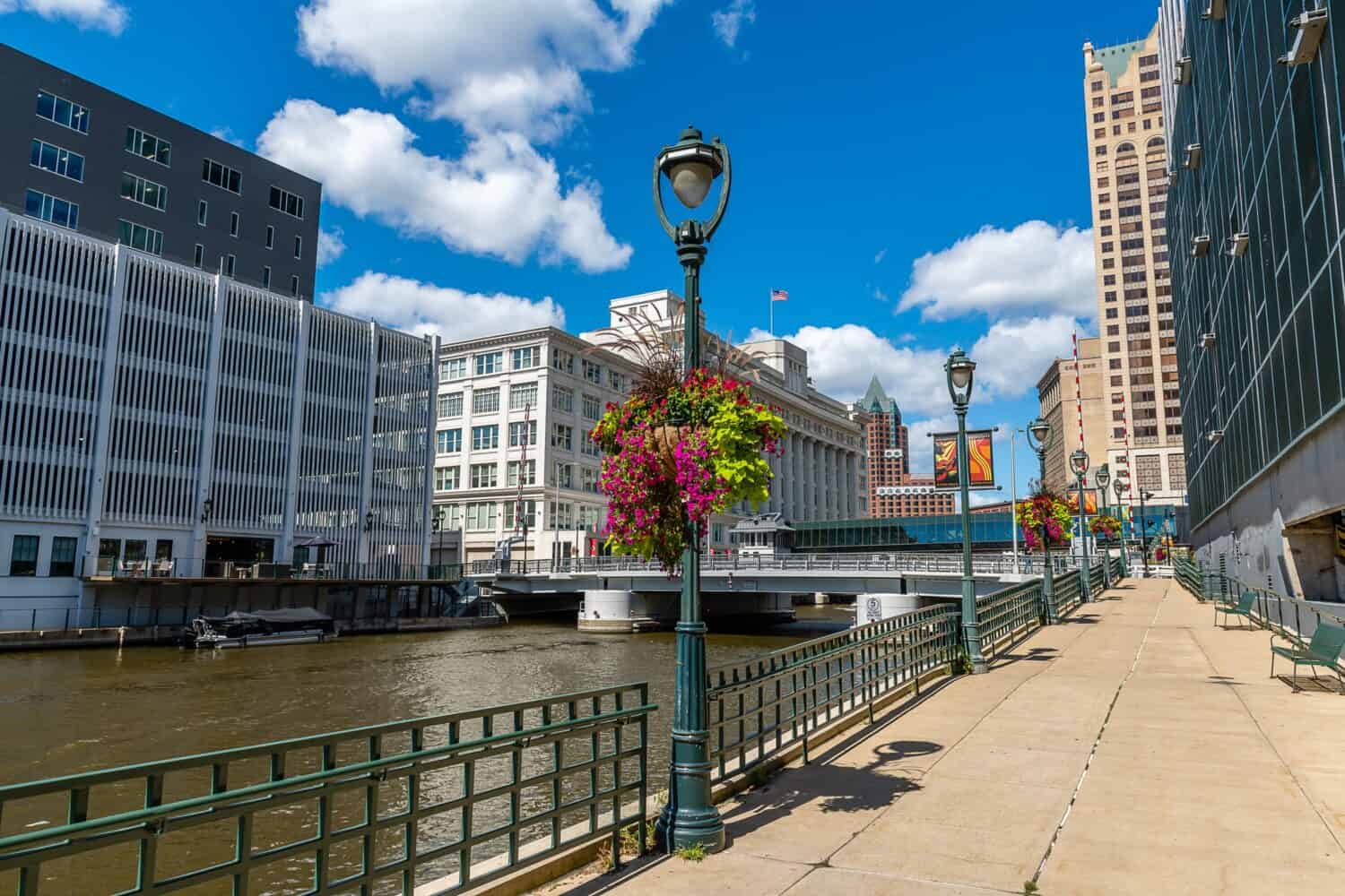
The Riverwalk
Mayor John Norquist launched the Riverwalk Initiative in 1988 to pretty up the river and stimulate economic and real estate development downtown. City officials reasoned that, by improving its condition and increasing access, the Milwaukee River could once again facilitate growth. Since the 1980s, the city has spent over $5B to rehabilitate and purify it.
Five years after Mayor Norquist’s suggestion, the city gave permission to create the RiverWalk, a network of bridges and pathways that extend along the Milwaukee River. Starting in the Historic Third Ward, it goes on for twenty blocks, concluding at Humboldt Avenue in the Beerline B area.
Landmarks like the Milwaukee Repertory Theater, Pabst Theater, and the Marcus Center for the Performing Arts are located near the path. You can also visit the Pere Marquette Park. At the intersection of Kilbourn Street is the “Bronze Fonz,” a statue of Arthur Fonzarelli from the popular TV show “Happy Days.” The show was based in 1950s Milwaukee and aired from 1974-1984. Nearby Water Street has many restaurants, bars, and clubs, which draw in both locals and tourists.
What to Do on the Milwaukee River
The Milwaukee Riverwalk is a source of much recreation for Wisconsin residents.
©Chris LaBasco/Shutterstock.com
When it comes to exploring the Milwaukee River, there is a wide range of activities and attractions that offer something for everyone. From leisurely riverboat rides and lively booze cruises to informative boat tours, there are plenty of options to choose from when it comes to experiencing the beauty of this iconic waterway.
For those seeking an active adventure on the river, kayak, canoe, and paddleboard rentals provide opportunities to navigate its currents at your own pace. Whether you prefer a peaceful solo excursion or a fun-filled group outing with friends or family, these watercraft allow you to immerse yourself in the serene surroundings while enjoying some exercise.
The Milwaukee River is also home to dedicated rowing teams who gracefully glide across its waters, showcasing their skill and teamwork. Their presence adds another layer of charm and athleticism to this already vibrant ecosystem.
If running is more your speed, the river offers scenic paths along its banks where joggers can enjoy invigorating workouts amidst stunning views. The tranquil ambiance created by the gentle flow of water provides a refreshing backdrop for runners seeking both physical activity and mental relaxation.
Additionally, 5K races and charity runs frequently take place near or alongside the river’s path. These events not only promote fitness but also serve as platforms for raising funds and awareness for important causes within the community.
The photo featured at the top of this post is © f11photo/Shutterstock.com
How to Add Us to Google News


Thank you for reading! Have some feedback for us? Contact the AZ Animals editorial team.