Guadalupe River New Braunfels, Texas
©JaDipity/Shutterstock.com
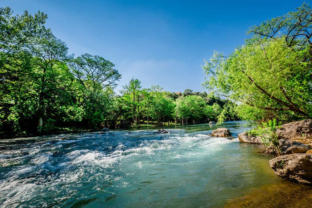
Guadalupe River is a Texas River that runs from Kerr County to San Antonio Bay and the Gulf of Mexico. The Guadalupe River is a popular destination for canoeing, fly fishing, and river rafting. It’s known as one of the most dangerous rivers in Texas. The landscape allows the water levels to rise to dangerous levels and can cause flooding. It has the highest number of reported deaths for a river in Texas. So, how deep is the Guadalupe River?
How Deep Is The Guadalupe River?

The Guadalupe River in Texas has an average depth of twelve feet. Guadalupe River begins in the Texas Hill Country at Kerr County. The elevation for the starting point of the river is 630 feet. The upper part of the Guadalupe River starts a smaller stream. It’s formed by two river forks and some limestone banks. The upper part makes for a fantastic tubing destination as the waters aren’t that deep compared to the other parts of the Guadalupe. One thing to note is that the river flows through the Guadalupe River State Park out in Spring Branch, Texas.
The lower park begins at Canyon Lake. The Canyon Dam moderates the river’s depth and flow. Whitewater rafters, canoeists, and water tubers love to visit Canyon Lake for their recreational activities. The Guadalupe River is joined by other rivers like the Comal River in New Braunfels and the San Marcos River just west of Gonzales, Texas. Then, the river slowly streams to conjoin the San Antonio River outside Tivoli, Texas. They form a delta and split off into two separate entities before hitting San Antonio Bay.
How Do Guadalupe’s Depths Compare To The Other Texas Rivers?
The hydrology of the Guadalupe River has mostly natural causes such as rainfall and evaporation. There are man-made influences such as water usage and dam management that also impact the river’s depth. Some of the significantly larger rivers in Texas are:
San Antonio River
The San Antonio River runs as shallow as two feet but goes as deep as twenty-four feet. It is only ten miles longer than the Guadalupe River as the Guadalupe is two hundred thirty miles long and the San Antonio River is two-hundred forty miles long.
Neches River
The Neches River is a forty feet deep river that starts in the eastern region of Texas. Neches is a 416 miles long river that flows through the Big Thicket National Preserve until meeting up with the Sabrine River. It’s a protected river for wildlife as it only has very minimal man-made reservoirs.
Sabine River
The Sabine River is one hundred ten feet deep and stretches for over 550 miles. It flows from the confluence of Cowleech and South Forks in northeastern Texas. Sabine River drains about 9,800 square miles between Louisiana and Texas. The upper part of the Sabine is controlled by the dam at Lake Tawakoni. The lower part of the Sabine is controlled by the releases of the Toledo Bend Reservoir. It’s a popular site for fishing and gator-watching.
Trinity River
The Trinity River is only thirty feet deep. It provides water to over forty percent of the state’s population. Whenever it rains, the water can rise above its usual river levels. It was actually a part of one of the worst floods in United States history. The Trinity River crested to 52 feet in 1908, destroying many properties and taking several lives. It’s home to many alligators, fishes, and snapping turtles.
Colorado River
The Colorado River has an average depth of fourteen feet. Yet, the deepest part of the river is eighty-seven feet at Lake Phantom Ranch. It’s the longest river that’s within the state of Texas as it is 862 miles long. It got the name Colorado River for its reddish water. The Colorado River is an important source of drinking water and power generation for cities and farms.
Pecos River
The Pecos River begins in New Mexico and ends as the Rio Grande River. Some depths of the river go as deep as twenty to thirty feet while other depths are as shallow as two to three feet. Massive forests surround the Pecos River and it’s a friendly spot to go fly-fishing, hiking, backpacking, camping, and hunting.
Summary
So, how deep is the Guadalupe River? Not that deep. The average depth is roughly twelve feet but it is a long river that goes all the way to San Antonio Bay and the Gulf of Mexico. It’s as deep as the Colorado River as the Colorado is only fourteen feet. Other rivers like the Pecos River and the Trinity River are respectively twenty and thirty feet deep. The Neches River is also forty feet deep, but compared to the Sabine, the Sabine is the deepest river discussed in the article being one hundred ten feet deep.