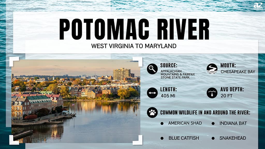
The Potomac River is referred to as ‘the Nation’s River – for its richness in American history and heritage. From being home to many Native American tribes to being an avenue for transport during the American Civil War, the vast river remains a cultural and historical attraction to millions of people who visit the region annually. All of the country’s capital city, Washington, D.C., also lies within the Potomac watershed. For a river draining a vast 14,700 square miles of land area from four states and Washington D.C, how deep is the Potomac River? Let’s find out!
Potomac River: Brief History
According to popular history, many battles of the American Civil War were fought in and around the Potomac River.
©iStock.com/BackyardProduction
The word “Potomac” is the European spelling of Patawomeck, the Algonquian name of a Native American tribe along the southern bank of the River. This name was first recorded by Captain John Smith, who discovered the River in 1608. However, before John Smith explored the Potomac River, the shores of the River were first inhabited by American Indians. This brings credence to the fact that the River dates back at least 3.5 million years, possibly extending to ten to twenty million years ago when the Atlantic Ocean lowered and exposed coastal sediments along the fall line.
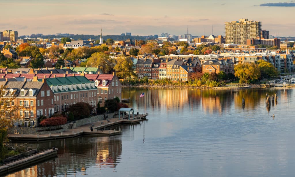
The Nation’s capital city, Washington, D.C., began using the Potomac as its principal source of drinking water in 1864, relying on water intake constructed at the Great Falls. The River has seen several pivotal incidents and progress in the USA from that time. According to popular history, many battles of the American Civil War were fought in and around the Potomac River and its tributaries.
The first President of the United States of America, George Washington, spent most of his life in Mount Vernon, within the Potomac basin. As an area rich in beauty and historical significance, Potomac was nicknamed “the Nation’s River.” Millions of people visit the vast river basin yearly to explore paddling, fishing, boating, hiking, boating, wildlife, riverside sightseeing, and more.
How Deep Is The Potomac River?

The Potomac River is 24 feet deep on average.
©iStock.com/Jon Bilous
Based on information from the U.S. Department of Interior, the Potomac watershed is 24 feet (7.3152 m) deep on average, with a navigable channel depth for about 108 miles of the river. However, the deepest point of the Potomac River is 107 feet (32.16m) deep, located near Morgantown in the tidal portion of the river just below Washington, D.C.
Where Does The Potomac River Start And End?
The Potomac River is a 405-mile-long river from its headwaters at North Branch to its mouth in the Chesapeake Bay. A river with a drainage area of 14,700 square miles, it flows from the Potomac Highlands and ends at the Chesapeake Bay. The Potomac River has two sources; the North and South Branches. The North Branch’s source is at the Fairfax Stone, West Virginia, and the source of the South Branch is near Hightown in northern Highland County, Virginia. The river’s two branches flow northeast, then converge just east of Green Spring in Hampshire County, West Virginia, to form the Potomac. From here, it flows past Maryland and turns southeast on its way to Washington, D.C.
About ten miles north of Washington, the river descends 90 feet in a series of rapids known as the Great Falls. The river flows at moderate depths along calm sloping banks just below the Great Falls and past Washington to Mount Vernon. From here, the river meets the tide and becomes an estuary. The Potomac River then enters the Chesapeake Bay, about 73 miles from the Atlantic Ocean.
Tributaries
The major tributaries draining into the Potomac river are:
- Conococheague Creek
- Antietam Creek
- South Branch
- Savage River
- Shenandoah River
- Monocacy River
- Rock Creek
- Anacostia River
- Goose Creek
- Wicomico River
How Wide Is The Potomac River?

The Potomac River provides water to about 90% of the Washington and District of Columbia metro region.
©iStock.com/SeanPavonePhoto
The Potomac River has an average width of approximately 1,300 feet upstream from Great Falls to Harpers Ferry. The river is at its widest at 11 miles wide between Point Lookout and Smith Point.
Where Is the Potomac River Located On A Map?
The Potomac River forms a portion of the borders between Maryland and Washington, D.C. on the left back and between Virginia and West Virginia on the banks of the river’s right side. The Potomac River is predominantly located in Maryland. The closest cities to the river are Bethesda and Brunswick, MD, Arlington and Alexandria VA, Falling Waters, and Campells, WVa.
Potomac River Facts
- Draining an area of approximately 14,700 square miles, the Potomac River Basin is the fourth largest along the Atlantic Coast and the 21st largest river in the United States.
- About 6.11 million people stay within the Potomac watershed. This population has increased by 5% since 2005.
- The Potomac River provides water to about 90% of the Washington and District of Columbia metro region.
- The Potomac River Basin stretches over four U.S. states: Virginia, West Virginia, Pennsylvania, and Maryland, as well as a District of Columbia, called the Potomac Watershed.
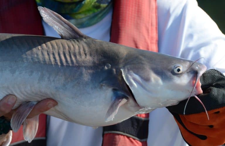
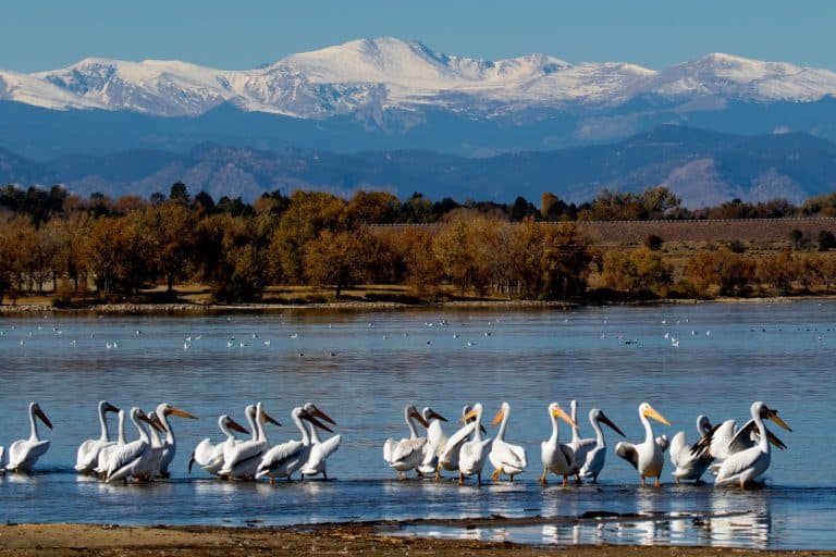
- The Potomac River is home to lots of wild vegetation and wildlife, including striped bass, dolphins, and bald eagles.
- Most of the basin’s land area is covered by 54.6 % of forests, 14.1 % of developed land, and 26% of agriculture. Water and wetlands comprise 5.9% of the basin’s land area.
- The Potomac Basin is the second-largest watershed in the Chesapeake Bay watershed.
- The average flow recorded on the Potomac at Washington is about 7 billion gallons per day. The largest ever recorded at this location was 275 billion gallons per day in March 1936.
- The Potomac Basin’s major industries include agriculture and forestry, fishing, coal mining, paper production, light, and high-tech.